Sparkman is a city in Dallas County, Arkansas, United States. The population was 427 at the 2010 census, down from 586 in 2000.
| Name: | Sparkman city |
|---|---|
| LSAD Code: | 25 |
| LSAD Description: | city (suffix) |
| State: | Arkansas |
| County: | Dallas County |
| Elevation: | 171 ft (52 m) |
| Total Area: | 1.29 sq mi (3.34 km²) |
| Land Area: | 1.29 sq mi (3.34 km²) |
| Water Area: | 0.00 sq mi (0.00 km²) |
| Total Population: | 355 |
| Population Density: | 274.98/sq mi (106.19/km²) |
| ZIP code: | 71763 |
| Area code: | 870 |
| FIPS code: | 0565900 |
| GNISfeature ID: | 0058666 |
Online Interactive Map
Click on ![]() to view map in "full screen" mode.
to view map in "full screen" mode.
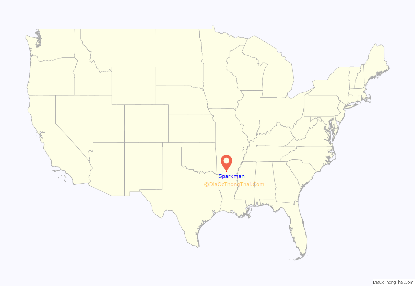
Sparkman location map. Where is Sparkman city?
History
Sparkman was established between 1911 and 1913 and was named after sawmill owner Lemuel “Pete” Sparkman. In 1915, the Sparkman News was established, Sparkman’s first election was held, and electricity was installed. The first school in Sparkman was a two-story building with an enrollment of 132. H.O. Theatt was the first principal, with Miss Ethel Fite and Miss Ella Adams being the first teachers.
A Baptist church was organized in 1914, with Methodist and A.M.E. churches organizing in 1916.
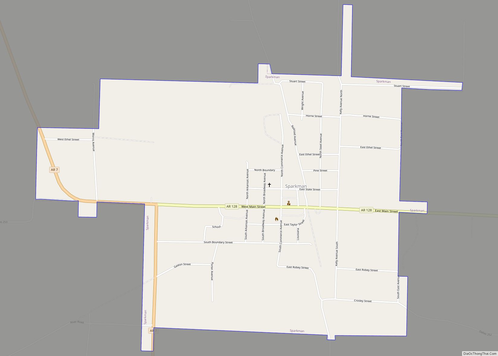
Sparkman Road Map
Sparkman city Satellite Map
Geography
Sparkman is located in western Dallas County at 33°55′2″N 92°50′56″W / 33.91722°N 92.84889°W / 33.91722; -92.84889 (33.917201, -92.848763). Arkansas Highway 128 passes through the center of town as Main Street and leads southeast 11 miles (18 km) to Highway 9 at Holly Springs. Arkansas Highway 7 passes through the west side of Sparkman, leading north (with Highway 128) 10 miles (16 km) to Highway 8 at Dalark and south 27 miles (43 km) to Camden.
According to the United States Census Bureau, Sparkman has a total area of 1.3 square miles (3.4 km), all land.
Climate
The climate in this area is characterized by hot, humid summers and generally mild to cool winters. According to the Köppen Climate Classification system, Sparkman has a humid subtropical climate, abbreviated “Cfa” on climate maps.
See also
Map of Arkansas State and its subdivision:- Arkansas
- Ashley
- Baxter
- Benton
- Boone
- Bradley
- Calhoun
- Carroll
- Chicot
- Clark
- Clay
- Cleburne
- Cleveland
- Columbia
- Conway
- Craighead
- Crawford
- Crittenden
- Cross
- Dallas
- Desha
- Drew
- Faulkner
- Franklin
- Fulton
- Garland
- Grant
- Greene
- Hempstead
- Hot Spring
- Howard
- Independence
- Izard
- Jackson
- Jefferson
- Johnson
- Lafayette
- Lawrence
- Lee
- Lincoln
- Little River
- Logan
- Lonoke
- Madison
- Marion
- Miller
- Mississippi
- Monroe
- Montgomery
- Nevada
- Newton
- Ouachita
- Perry
- Phillips
- Pike
- Poinsett
- Polk
- Pope
- Prairie
- Pulaski
- Randolph
- Saint Francis
- Saline
- Scott
- Searcy
- Sebastian
- Sevier
- Sharp
- Stone
- Union
- Van Buren
- Washington
- White
- Woodruff
- Yell
- Alabama
- Alaska
- Arizona
- Arkansas
- California
- Colorado
- Connecticut
- Delaware
- District of Columbia
- Florida
- Georgia
- Hawaii
- Idaho
- Illinois
- Indiana
- Iowa
- Kansas
- Kentucky
- Louisiana
- Maine
- Maryland
- Massachusetts
- Michigan
- Minnesota
- Mississippi
- Missouri
- Montana
- Nebraska
- Nevada
- New Hampshire
- New Jersey
- New Mexico
- New York
- North Carolina
- North Dakota
- Ohio
- Oklahoma
- Oregon
- Pennsylvania
- Rhode Island
- South Carolina
- South Dakota
- Tennessee
- Texas
- Utah
- Vermont
- Virginia
- Washington
- West Virginia
- Wisconsin
- Wyoming
