Waldo is a town in Columbia County, Arkansas, United States. The population was 1,372 at the 2010 census.
| Name: | Waldo city |
|---|---|
| LSAD Code: | 25 |
| LSAD Description: | city (suffix) |
| State: | Arkansas |
| County: | Columbia County |
| Elevation: | 361 ft (110 m) |
| Total Area: | 2.20 sq mi (5.69 km²) |
| Land Area: | 2.19 sq mi (5.68 km²) |
| Water Area: | 0.00 sq mi (0.00 km²) |
| Total Population: | 1,151 |
| Population Density: | 524.61/sq mi (202.59/km²) |
| ZIP code: | 71770 |
| Area code: | 870 |
| FIPS code: | 0572350 |
| GNISfeature ID: | 0058813 |
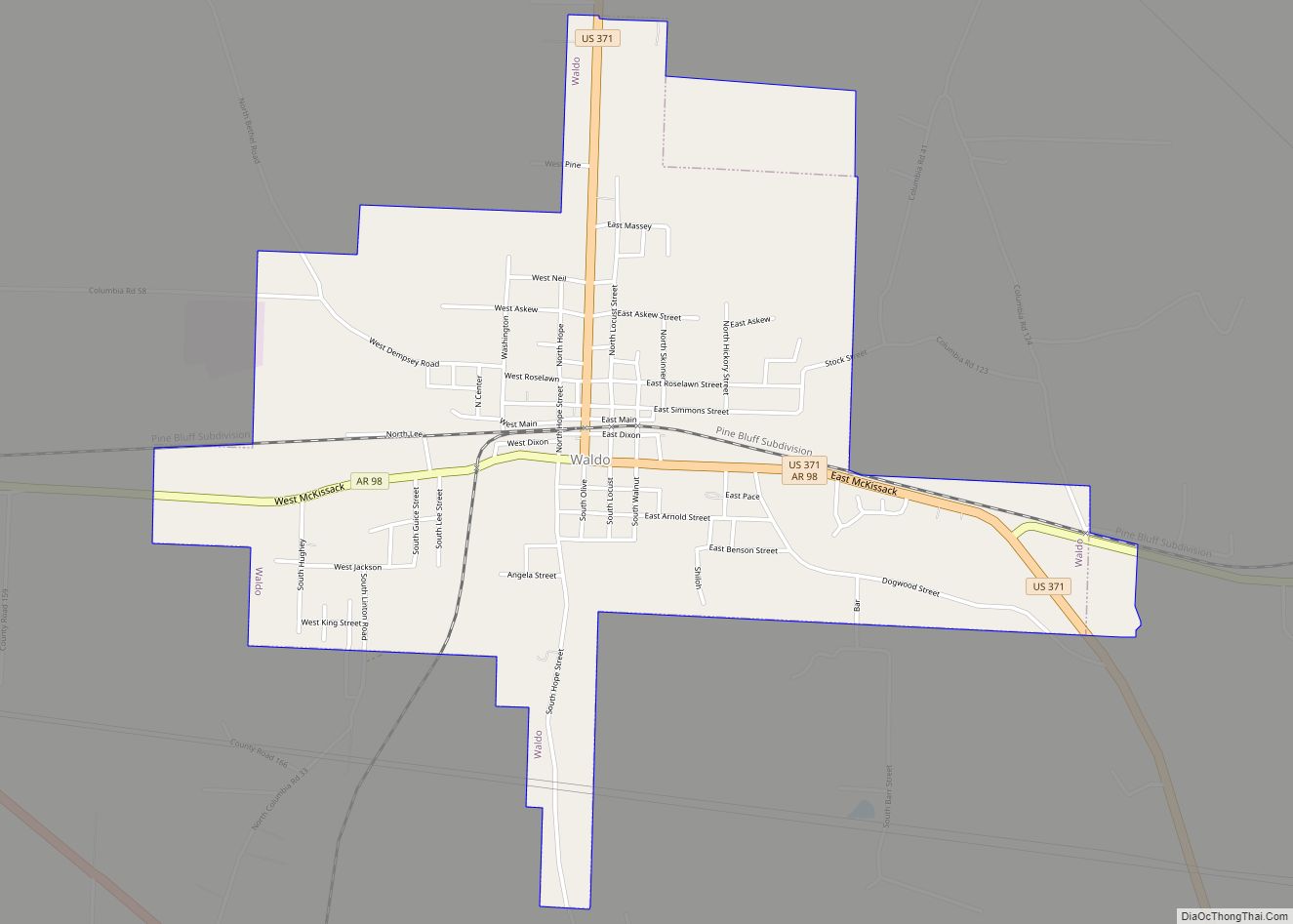
Online Interactive Map
Click on ![]() to view map in "full screen" mode.
to view map in "full screen" mode.
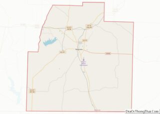
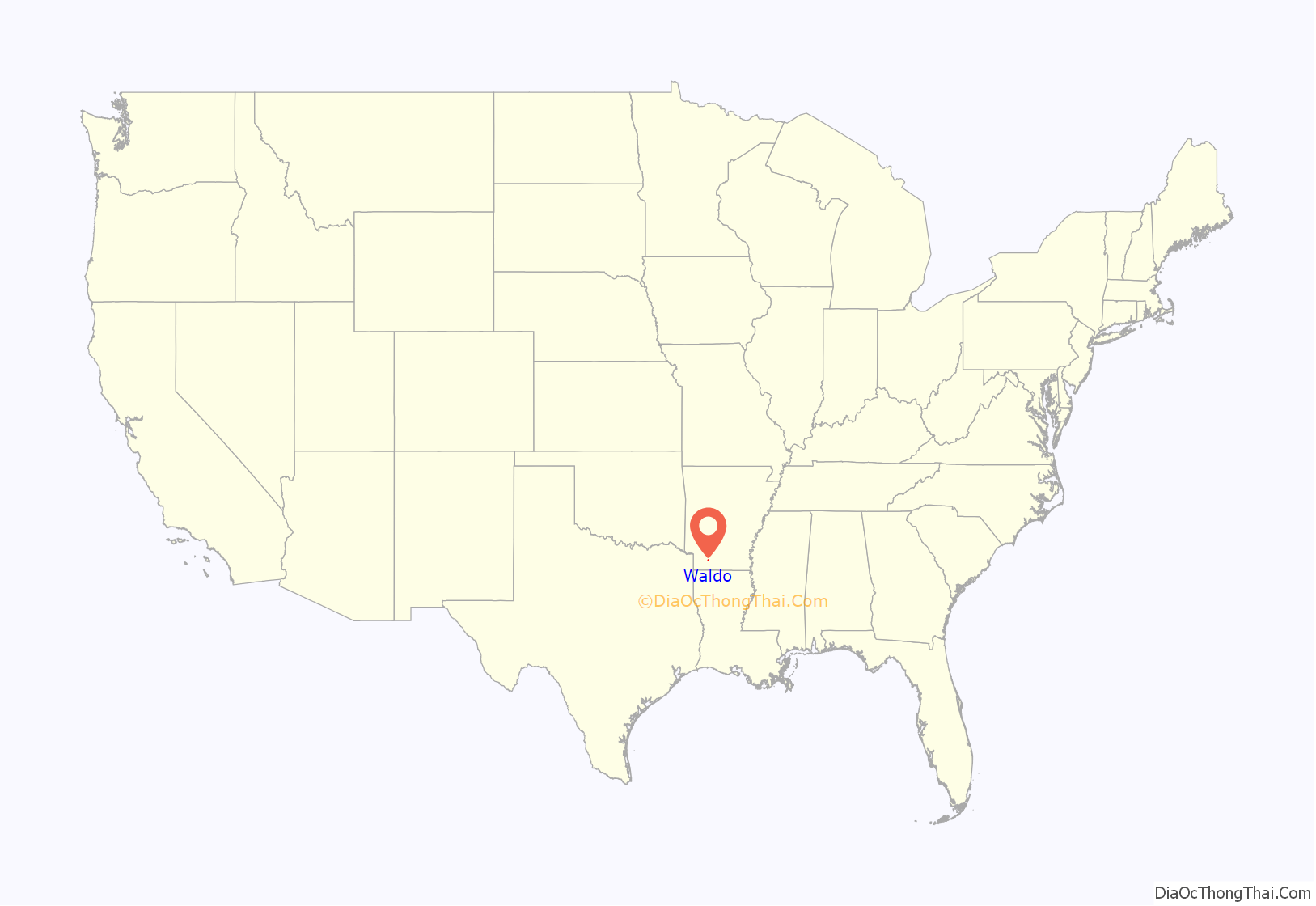
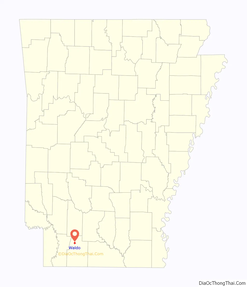
Waldo location map. Where is Waldo city?
History
Waldo celebrated its 120th year as a city in 2007. The small community was once a booming rail city on the Cotton Belt train route. The city has a rail museum with various displays showing its rail history.
The city began to wane in population in the 1950s when neighboring Magnolia began drawing industry.
Waldo was once home to the Waldo High School Bulldogs basketball teams. Consistently these teams made playoffs and on numerous occasions won the state championship. The legacy of Waldo School will carry on in the community despite its closing in 2005.
The Waldo Water Tower, completed in 1936 by the Pittsburgh-Des Moines Steel Co., is listed on the National Register of Historic Places.
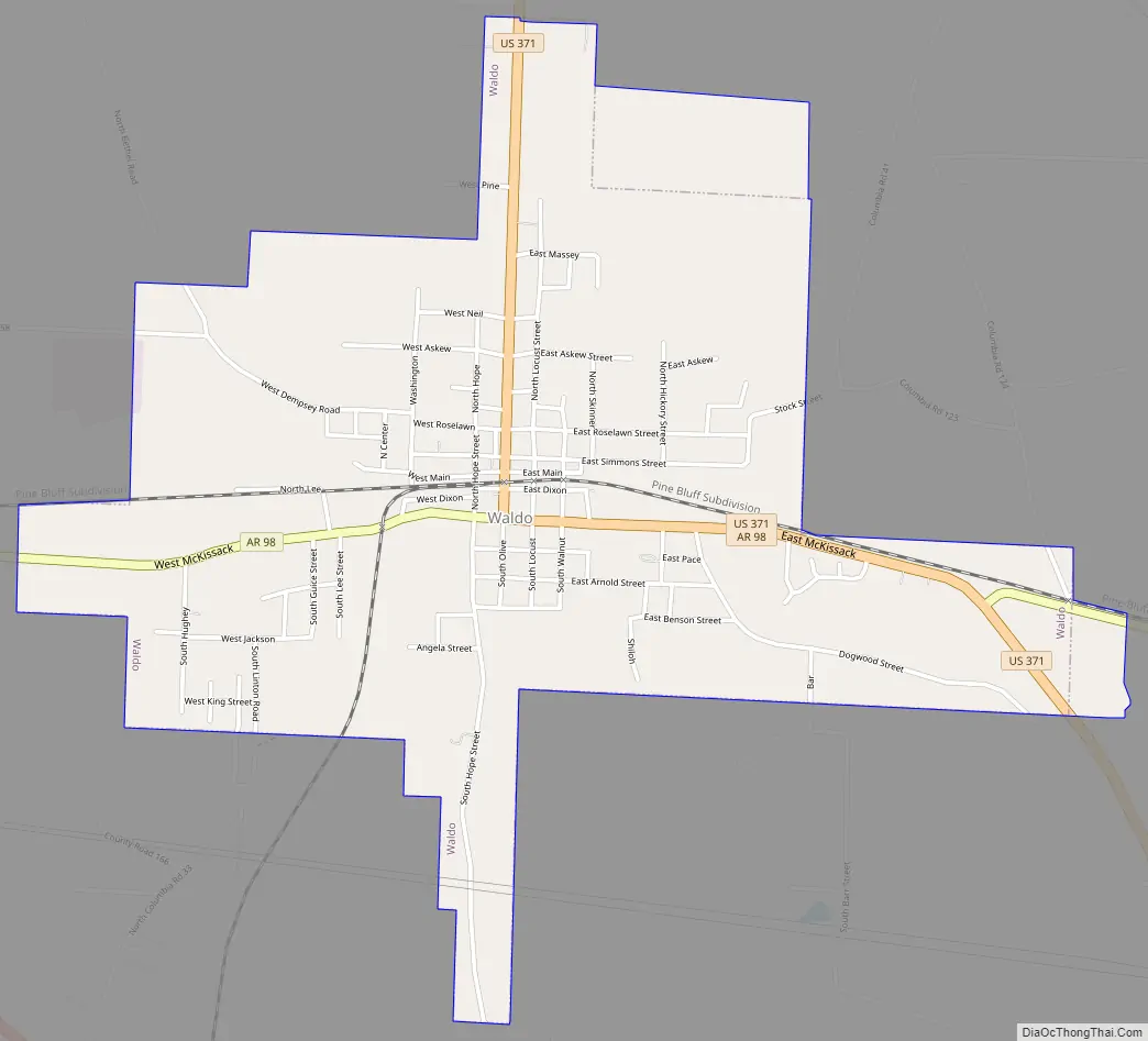
Waldo Road Map
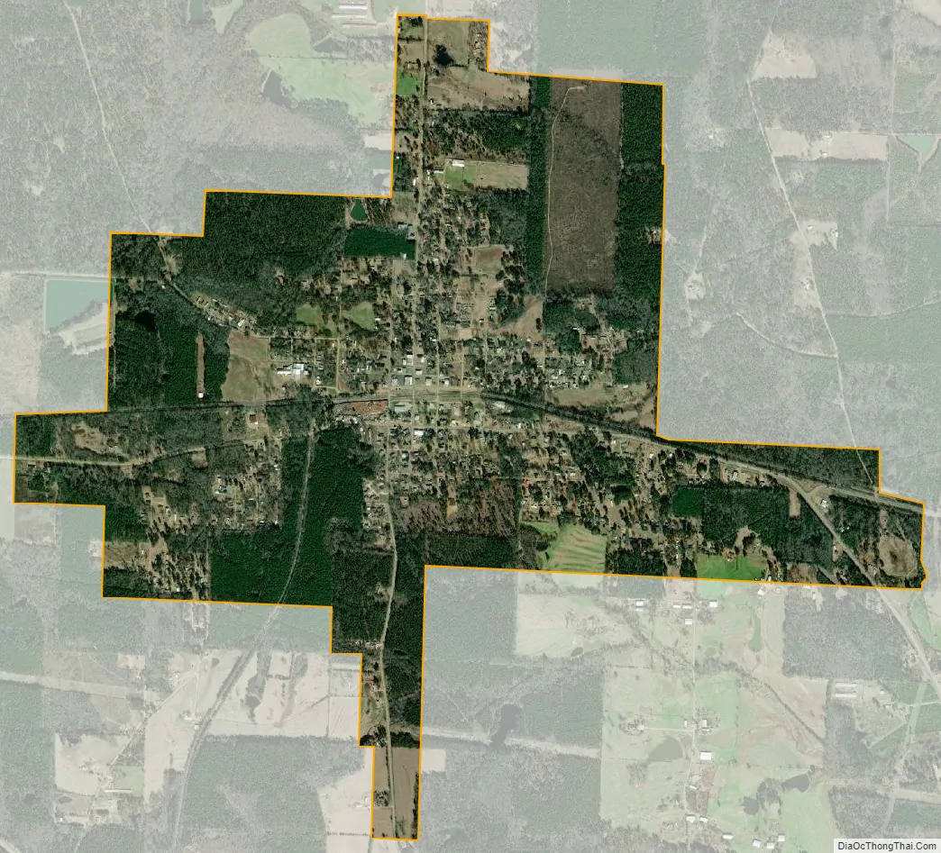
Waldo city Satellite Map
Geography
Waldo is located in northwestern Columbia County. By U.S. Route 371 it is 7 miles (11 km) northwest of Magnolia, the county seat.
According to the United States Census Bureau, the city has a total area of 2.3 square miles (5.9 km), all land.
Waldo, located in South Arkansas near the northern Louisiana border, has a subtropical climate like that of the Bayou State and similar terrain. The area is characterized by lowlands and swamps. Most of the area in and about the city is covered with pine or hardwood forests.
See also
Map of Arkansas State and its subdivision:- Arkansas
- Ashley
- Baxter
- Benton
- Boone
- Bradley
- Calhoun
- Carroll
- Chicot
- Clark
- Clay
- Cleburne
- Cleveland
- Columbia
- Conway
- Craighead
- Crawford
- Crittenden
- Cross
- Dallas
- Desha
- Drew
- Faulkner
- Franklin
- Fulton
- Garland
- Grant
- Greene
- Hempstead
- Hot Spring
- Howard
- Independence
- Izard
- Jackson
- Jefferson
- Johnson
- Lafayette
- Lawrence
- Lee
- Lincoln
- Little River
- Logan
- Lonoke
- Madison
- Marion
- Miller
- Mississippi
- Monroe
- Montgomery
- Nevada
- Newton
- Ouachita
- Perry
- Phillips
- Pike
- Poinsett
- Polk
- Pope
- Prairie
- Pulaski
- Randolph
- Saint Francis
- Saline
- Scott
- Searcy
- Sebastian
- Sevier
- Sharp
- Stone
- Union
- Van Buren
- Washington
- White
- Woodruff
- Yell
- Alabama
- Alaska
- Arizona
- Arkansas
- California
- Colorado
- Connecticut
- Delaware
- District of Columbia
- Florida
- Georgia
- Hawaii
- Idaho
- Illinois
- Indiana
- Iowa
- Kansas
- Kentucky
- Louisiana
- Maine
- Maryland
- Massachusetts
- Michigan
- Minnesota
- Mississippi
- Missouri
- Montana
- Nebraska
- Nevada
- New Hampshire
- New Jersey
- New Mexico
- New York
- North Carolina
- North Dakota
- Ohio
- Oklahoma
- Oregon
- Pennsylvania
- Rhode Island
- South Carolina
- South Dakota
- Tennessee
- Texas
- Utah
- Vermont
- Virginia
- Washington
- West Virginia
- Wisconsin
- Wyoming