Fallbrook is a CDP in northern San Diego County, California. Fallbrook had a population of 30,534 at the 2010 census, up from 29,100 at the 2000 census.
Fallbrook’s downtown is not on a major highway route. It is 5.5 miles (8.9 km) west of Interstate 15 or 6 miles (9.7 km) north of State Route 76. However, prior to 1949, Fallbrook was served by U.S. Route 395 until it was rerouted out of Fallbrook and onto an alignment near present-day I-15, which lasted until 1969. Fallbrook is immediately east of the U.S. Marine Corps’ Camp Pendleton.
Fallbrook is known for its avocado groves and claims, without any official recognition, the title “Avocado Capital of the World”.
| Name: | Fallbrook CDP |
|---|---|
| LSAD Code: | 57 |
| LSAD Description: | CDP (suffix) |
| State: | California |
| County: | San Diego County |
| Elevation: | 682 ft (208 m) |
| Total Area: | 17.561 sq mi (45.483 km²) |
| Land Area: | 17.528 sq mi (45.397 km²) |
| Water Area: | 0.033 sq mi (0.086 km²) 0.19% |
| Total Population: | 30,534 |
| Population Density: | 1,700/sq mi (670/km²) |
| ZIP code: | 92028, 92088 |
| FIPS code: | 0623462 |
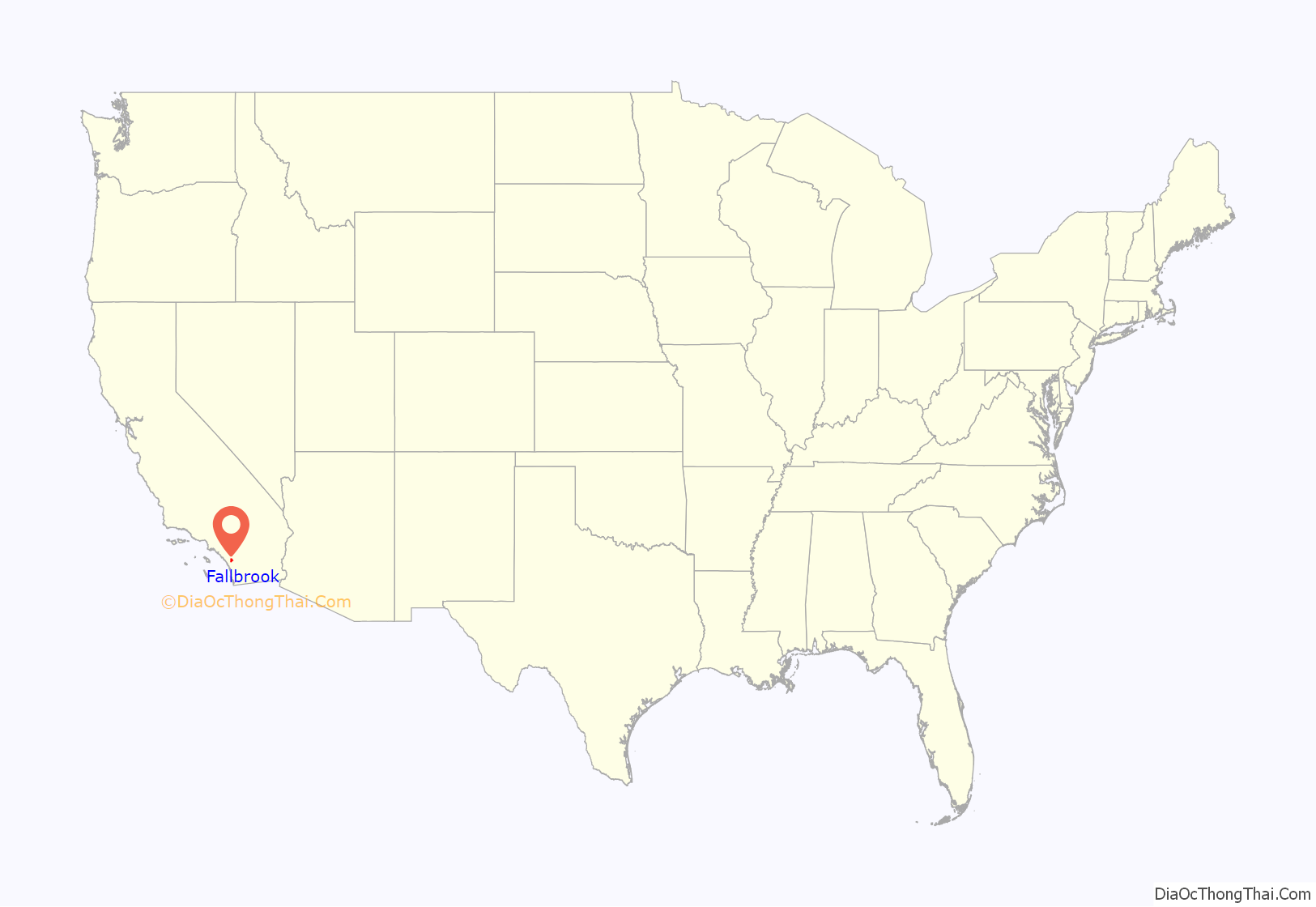
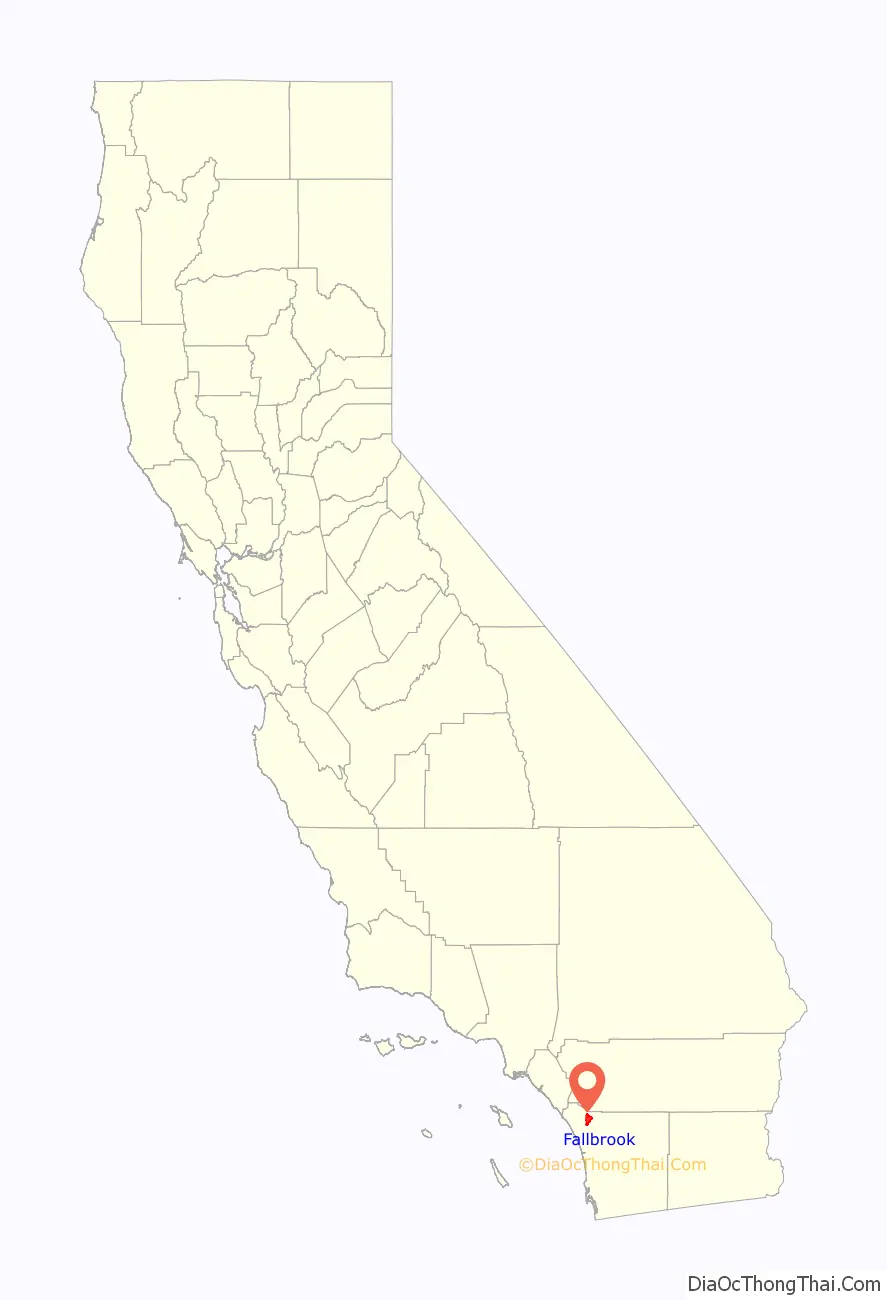
Online Interactive Map
Click on ![]() to view map in "full screen" mode.
to view map in "full screen" mode.
Fallbrook location map. Where is Fallbrook CDP?
History
The community of Fallbrook was first settled by the Payomkawichum people, later called Luiseños by the Spanish missionaries who were present in the area in the late 1700s. Large village sites and oak groves were established by the Luiseños. One site in particular became the area known today as Live Oak County Park.
The first permanent recorded settlement was during the Mexican period in 1846, when Ysidro Alvarado was granted Rancho Monserate by then governor of Mexican California, Pio Pico, who was residing to the west of Fallbrook where Camp Pendleton is currently located. Alvarado and Pico were second-generation Californians and San Diegans and were citizens of Mexico and the United States.
Rancho Monserate, a 13,323-acre grant stretched from the San Luis Rey River and Bonsall to the south to Stagecoach Lane and the Palomares house to the North to Mission Road to the west to Monserate Mountain to the east.
Pio’s nephew and local vaquero, Jose Maria Pico, had been residing in the area now known as the Fallbrook High School during the 1860 census and his family had registered to vote in October 1868, in time for the November presidential election, the first election after the Civil War ended.
The first known image of the area was an oil painting done by James Walker in 1870 called Roping the Bear at Santa Margarita Rancho, which depicts Mexican vaqueros capturing a grizzly bear.
Later, Canadian immigrant Vital Reche settled here with his family just north of Alvarado’s ranch at the site now known as Live Oak Park. They named the new community Fall Brook after their former homestead in Pennsylvania.
Oak trees were the original primary trees in Fallbrook. Furthermore, olives became a major crop by the 1920s and continued through World War II, but were eventually phased out in favor of the present avocado and floral industry.
Incorporation votes occurred in 1981 and 1987, but both votes failed.
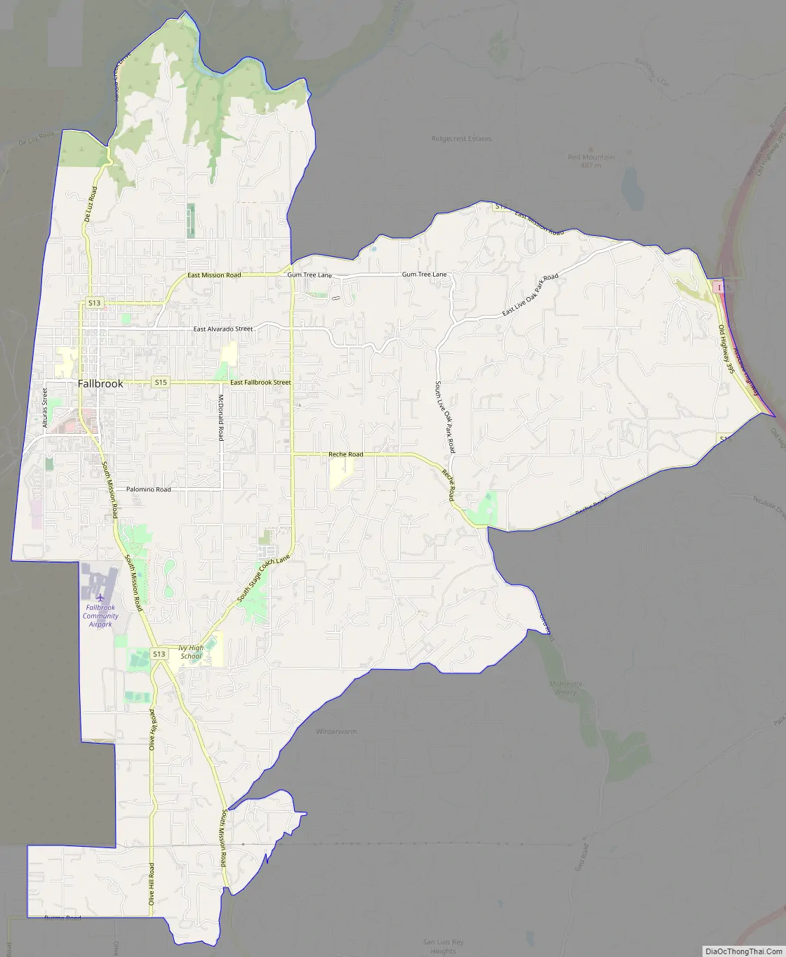
Fallbrook Road Map
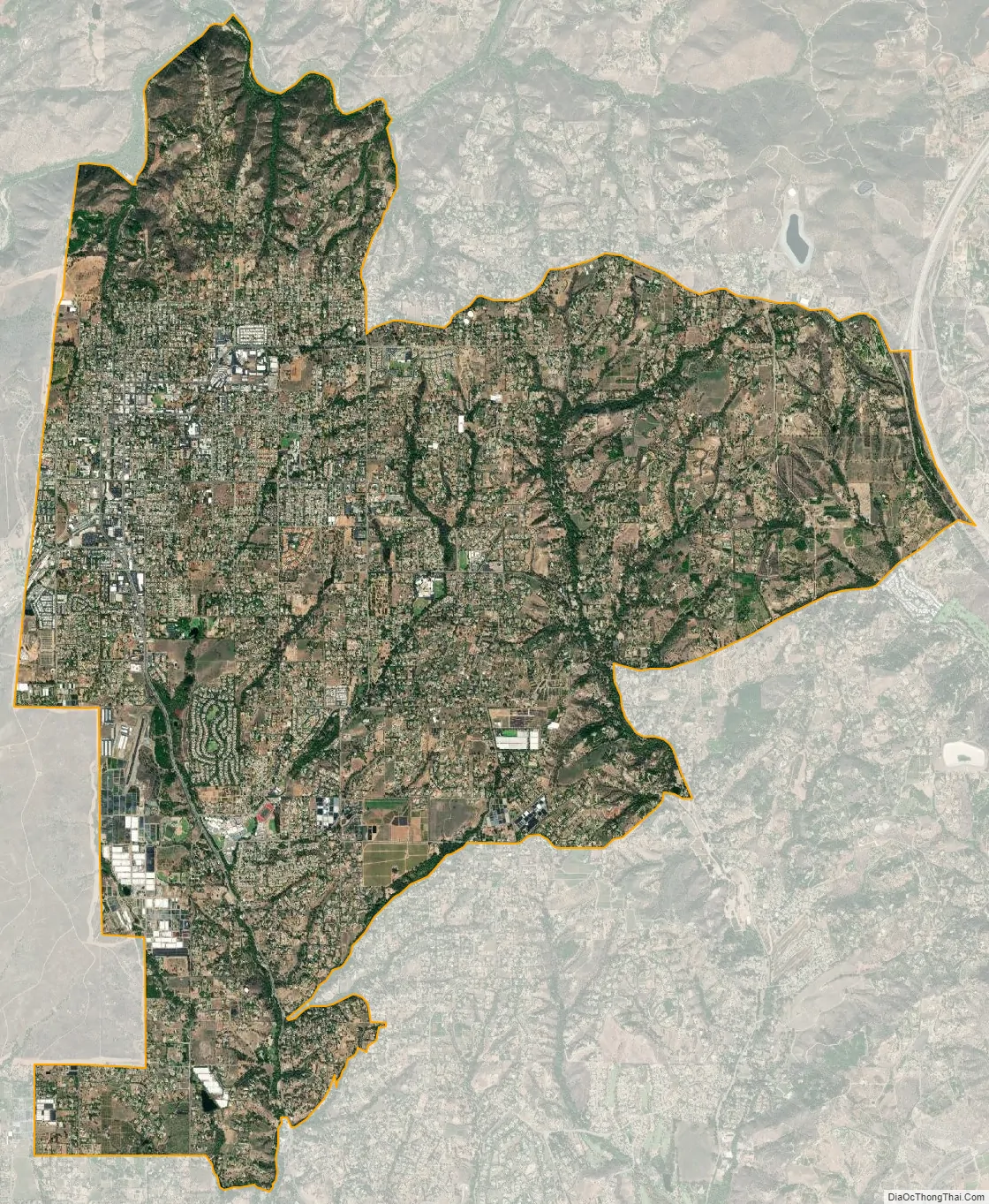
Fallbrook city Satellite Map
Geography
Fallbrook stands at elevations between 500 and 1500 feet, with an average around 685 feet.
Fallbrook is located at 33°22′18″N 117°14′10″W / 33.37167°N 117.23611°W / 33.37167; -117.23611.
The Fallbrook Community Planning Area is approximately 44 square miles (110 km). According to the United States Census Bureau, the CDP has a total area of 17.6 square miles (46 km). 17.5 square miles (45 km) of it is land and 0.03 square miles (0.078 km) of it (0.19%) is water.
See also
Map of California State and its subdivision:- Alameda
- Alpine
- Amador
- Butte
- Calaveras
- Colusa
- Contra Costa
- Del Norte
- El Dorado
- Fresno
- Glenn
- Humboldt
- Imperial
- Inyo
- Kern
- Kings
- Lake
- Lassen
- Los Angeles
- Madera
- Marin
- Mariposa
- Mendocino
- Merced
- Modoc
- Mono
- Monterey
- Napa
- Nevada
- Orange
- Placer
- Plumas
- Riverside
- Sacramento
- San Benito
- San Bernardino
- San Diego
- San Francisco
- San Joaquin
- San Luis Obispo
- San Mateo
- Santa Barbara
- Santa Clara
- Santa Cruz
- Shasta
- Sierra
- Siskiyou
- Solano
- Sonoma
- Stanislaus
- Sutter
- Tehama
- Trinity
- Tulare
- Tuolumne
- Ventura
- Yolo
- Yuba
- Alabama
- Alaska
- Arizona
- Arkansas
- California
- Colorado
- Connecticut
- Delaware
- District of Columbia
- Florida
- Georgia
- Hawaii
- Idaho
- Illinois
- Indiana
- Iowa
- Kansas
- Kentucky
- Louisiana
- Maine
- Maryland
- Massachusetts
- Michigan
- Minnesota
- Mississippi
- Missouri
- Montana
- Nebraska
- Nevada
- New Hampshire
- New Jersey
- New Mexico
- New York
- North Carolina
- North Dakota
- Ohio
- Oklahoma
- Oregon
- Pennsylvania
- Rhode Island
- South Carolina
- South Dakota
- Tennessee
- Texas
- Utah
- Vermont
- Virginia
- Washington
- West Virginia
- Wisconsin
- Wyoming


