Oceanside is a city on the South Coast of California, located in San Diego County. The city had a population of 174,068 at the 2020 United States census, up from 167,086 at the 2010 census. The city is a popular tourist destination, owing to its historic landmarks, beaches, and architecture.
Oceanside’s origins date to 1798, when the Spanish founded the village of San Luis Rey with the establishment of Mission San Luis Rey de Francia by Fermín de Lasuén. During the Spanish period, Mission San Luis Rey grew to be the largest of all the Californian missions, but following the Mexican secularization act of 1833 the mission and its community declined. Following the U.S. conquest of California, the former mission lands were developed into an oceanfront resort and the community’s name gradually changed to Oceanside.
| Name: | Oceanside city |
|---|---|
| LSAD Code: | 25 |
| LSAD Description: | city (suffix) |
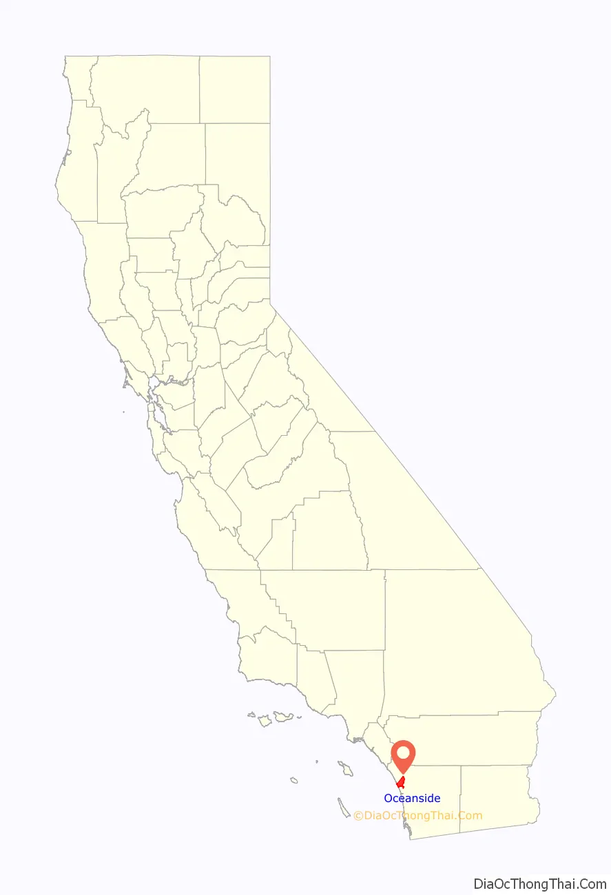
| State: | California |
| County: | San Diego County |
| Incorporated: | July 3, 1888 |
| Elevation: | 66 ft (20 m) |
| Total Area: | 42.16 sq mi (109.19 km²) |
| Land Area: | 41.26 sq mi (106.85 km²) |
| Water Area: | 0.90 sq mi (2.33 km²) 2.23% |
| Total Population: | 174,068 |
| Population Density: | 4,259.79/sq mi (1,644.73/km²) |
| FIPS code: | 0653322 |
| Website: | www.ci.oceanside.ca.us |
Online Interactive Map
Click on ![]() to view map in "full screen" mode.
to view map in "full screen" mode.
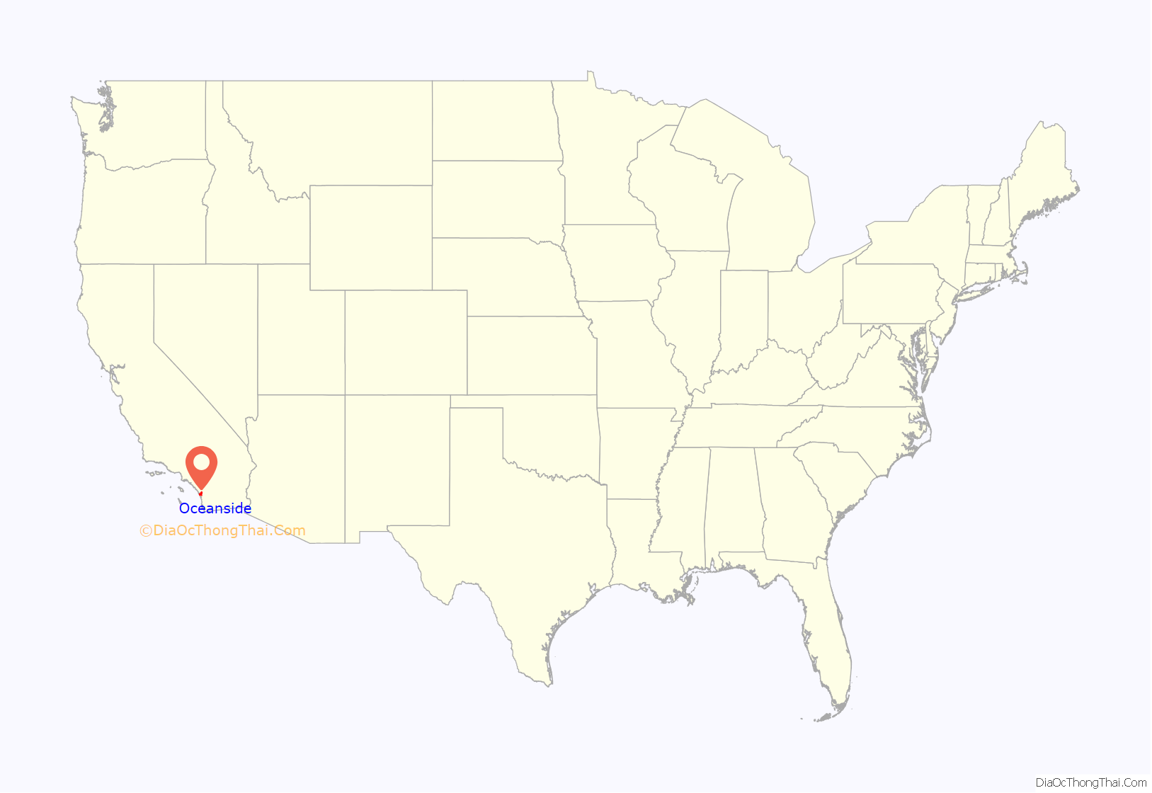
Oceanside location map. Where is Oceanside city?
History
Originally inhabited by Native Americans, Oceanside was first settled by the Luiseño peoples, or the Payomkawichum. The city of Oceanside sits on the locality on the San Luis Rey River that the Luiseno called Tacayme, which contained the villages of Qée’ish (Keish) and ‘ikáymay (Ikamal), in the San Luis Rey Mission area, Wiyóoya (Wiawio) at the mouth of the river, and Wi’áasamay (Wiasamai) and Waxáwmay (Wahaumai) at Guajome.
Spanish era
The first European explorers arrived in 1769. Spanish missionaries under Father Junípero Serra founded Mission San Luis Rey de Francia on a former site of a Luiseño Indian village on the banks of the San Luis Rey River called Keish according to the Portolà expedition who visited in the 1769.
In the early 19th century, the introduction of farming and grazing changed the landscape of what would become Oceanside.
Mexican era
Following the Mexican secularization act of 1833, the Californian missions were nationalized, transferring their ownership from the Franciscan Order of the Catholic Church to the Mexican Government. A mission administrator was appointed to each mission to oversee the process of secularization, the removal of the priests, and the selling or granting of the mission lands to private citizens.
At Mission San Luis Rey, Padre Antonio Peyrí had presided over the mission for 34 years when soldiers forced his removal in late 1833. Captain Pablo de la Portillà was appointed as administrator of San Luis Rey. Following the departure of Padre Peyrí, relations between the Luiseños and the new civilian administration hugely deteriorated, resulting in their famed refusal to work for Captain Portillà in 1835.
American era
In the late 1850s, Andrew Jackson Myers lived in San Joaquin County, but he returned in the late 1880s and lived in San Luis Rey. In 1882 Myers moved on the land that was the original town site for Oceanside. A patent for the land was issued in 1883 by the federal government. It was incorporated on July 3, 1888. The city hall as of the early 21st century stands on the former Myers homestead.
The town post office contains an oil-on-canvas mural, Air Mail, painted in 1937 by Elsie Seeds. Federally commissioned murals were produced from 1934 to 1943 in the United States through the Section of Painting and Sculpture, later called the Section of Fine Arts, of the Treasury Department.
In the 20th century, Oceanside was a beach town devoted to activities on a 6-mile (10 km) stretch of beaches. Residential areas like downtown (built in the 1890s), South Oceanside (built in the 1920s and 1930s), and developments east of Interstate 5 (built after World War II) are preserved and remodeled when these houses are considered to have historical value. Since the establishment of Marine Corps Base Camp Pendleton in 1942, Oceanside has been home to U.S. armed forces personnel, and the wartime industry of WWII and the 1950s had an ammunition manufacturing facility in the city.
After 1970, the main focus of Oceanside was suburban development. Oceanside continues to be known as a vacation home market.
In the 2010s, several mid-rise and high-rise housing and lodging projects were completed in the downtown area, with more to come. In 2021, two large Hyatt resorts were completed, bringing more tourists to the city.
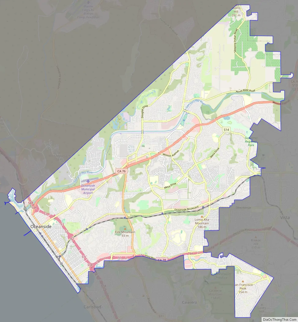
Oceanside Road Map
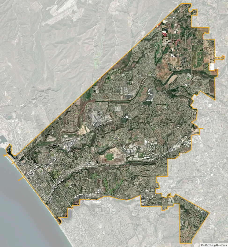
Oceanside city Satellite Map
Geography
Oceanside is at 33°12′42″N 117°19′33″W / 33.21167°N 117.32583°W / 33.21167; -117.32583 (33.211566, -117.325701).
According to the United States Census Bureau, the city has a total area of 42.2 square miles (109 km), of which 41.2 square miles (107 km) is land and 0.9 square miles (2.3 km) (2.23%) is water.
Traveling north on Interstate 5, Oceanside is the last city before Orange County. As the crow flies, it is roughly the same distance from Aliso Viejo as it is to downtown San Diego.
Together with Carlsbad and Vista, it forms a tri-city area.
Climate
Oceanside experiences a semi-arid climate (Köppen climate classification BSh) that is significantly tempered by maritime winds and the cool currents off the shoreline. The average high temperatures range from 64 to 77 °F (18 to 25 °C), while the average low temperatures range from 45 to 64 °F (7 to 18 °C).
See also
Map of California State and its subdivision:- Alameda
- Alpine
- Amador
- Butte
- Calaveras
- Colusa
- Contra Costa
- Del Norte
- El Dorado
- Fresno
- Glenn
- Humboldt
- Imperial
- Inyo
- Kern
- Kings
- Lake
- Lassen
- Los Angeles
- Madera
- Marin
- Mariposa
- Mendocino
- Merced
- Modoc
- Mono
- Monterey
- Napa
- Nevada
- Orange
- Placer
- Plumas
- Riverside
- Sacramento
- San Benito
- San Bernardino
- San Diego
- San Francisco
- San Joaquin
- San Luis Obispo
- San Mateo
- Santa Barbara
- Santa Clara
- Santa Cruz
- Shasta
- Sierra
- Siskiyou
- Solano
- Sonoma
- Stanislaus
- Sutter
- Tehama
- Trinity
- Tulare
- Tuolumne
- Ventura
- Yolo
- Yuba
- Alabama
- Alaska
- Arizona
- Arkansas
- California
- Colorado
- Connecticut
- Delaware
- District of Columbia
- Florida
- Georgia
- Hawaii
- Idaho
- Illinois
- Indiana
- Iowa
- Kansas
- Kentucky
- Louisiana
- Maine
- Maryland
- Massachusetts
- Michigan
- Minnesota
- Mississippi
- Missouri
- Montana
- Nebraska
- Nevada
- New Hampshire
- New Jersey
- New Mexico
- New York
- North Carolina
- North Dakota
- Ohio
- Oklahoma
- Oregon
- Pennsylvania
- Rhode Island
- South Carolina
- South Dakota
- Tennessee
- Texas
- Utah
- Vermont
- Virginia
- Washington
- West Virginia
- Wisconsin
- Wyoming


