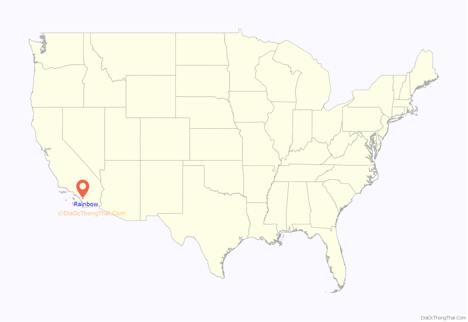
Rainbow is a census designated place (CDP) in northern San Diego County in the U.S. state of California. The population was 1,832 at the 2010 census, down from 2,026 at the 2000 census.
| Name: | Rainbow CDP |
|---|---|
| LSAD Code: | 57 |
| LSAD Description: | CDP (suffix) |
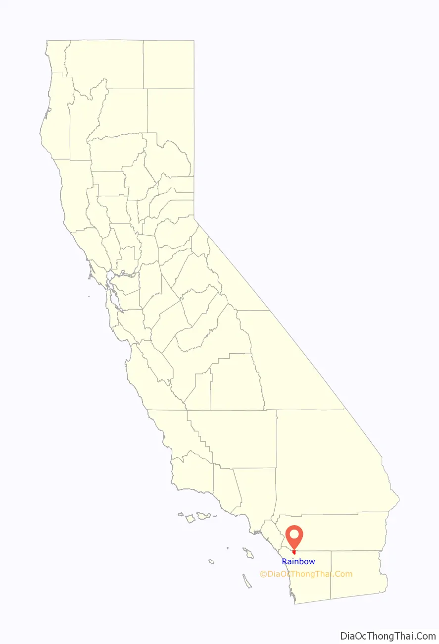
| State: | California |
| County: | San Diego County |
| Elevation: | 1,043 ft (318 m) |
| Total Area: | 11.042 sq mi (28.599 km²) |
| Land Area: | 11.042 sq mi (28.599 km²) |
| Water Area: | 0 sq mi (0 km²) 0% |
| Total Population: | 1,832 |
| Population Density: | 170/sq mi (64/km²) |
| ZIP code: | 92028 |
| FIPS code: | 0659248 |
Online Interactive Map
Click on ![]() to view map in "full screen" mode.
to view map in "full screen" mode.
Rainbow location map. Where is Rainbow CDP?
History
The area, previously known as “Vallecitos”, (little valley), was renamed “Rainbow Valley” in the late 1880s, after Mr. James Peebles Marshall Rainbow, who bought a homestead there.
In October 2007, the Santa Ana winds fueled a major wildfire in the area.
The town has many palm tree farms, and is a gateway to the city of Temecula.
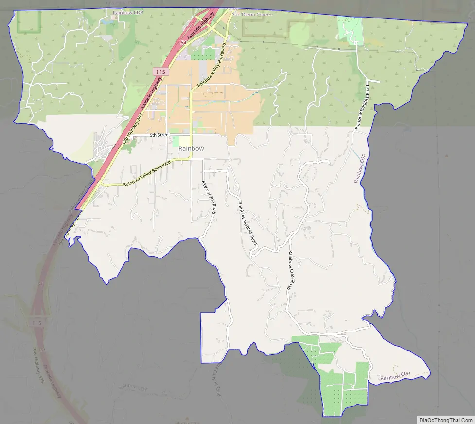
Rainbow Road Map
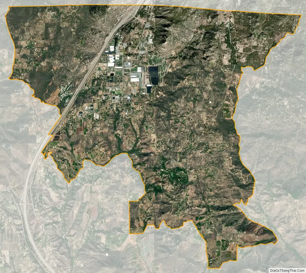
Rainbow city Satellite Map
Geography
Rainbow is located at 33°24′40″N 117°8′57″W / 33.41111°N 117.14917°W / 33.41111; -117.14917 (33.411213, -117.149209).
According to the United States Census Bureau, the CDP has a total area of 11.0 square miles (28 km), all land.
Climate
According to the Köppen Climate Classification system, Rainbow has a warm-summer Mediterranean climate, abbreviated “Csa” on climate maps.
See also
Map of California State and its subdivision:- Alameda
- Alpine
- Amador
- Butte
- Calaveras
- Colusa
- Contra Costa
- Del Norte
- El Dorado
- Fresno
- Glenn
- Humboldt
- Imperial
- Inyo
- Kern
- Kings
- Lake
- Lassen
- Los Angeles
- Madera
- Marin
- Mariposa
- Mendocino
- Merced
- Modoc
- Mono
- Monterey
- Napa
- Nevada
- Orange
- Placer
- Plumas
- Riverside
- Sacramento
- San Benito
- San Bernardino
- San Diego
- San Francisco
- San Joaquin
- San Luis Obispo
- San Mateo
- Santa Barbara
- Santa Clara
- Santa Cruz
- Shasta
- Sierra
- Siskiyou
- Solano
- Sonoma
- Stanislaus
- Sutter
- Tehama
- Trinity
- Tulare
- Tuolumne
- Ventura
- Yolo
- Yuba
- Alabama
- Alaska
- Arizona
- Arkansas
- California
- Colorado
- Connecticut
- Delaware
- District of Columbia
- Florida
- Georgia
- Hawaii
- Idaho
- Illinois
- Indiana
- Iowa
- Kansas
- Kentucky
- Louisiana
- Maine
- Maryland
- Massachusetts
- Michigan
- Minnesota
- Mississippi
- Missouri
- Montana
- Nebraska
- Nevada
- New Hampshire
- New Jersey
- New Mexico
- New York
- North Carolina
- North Dakota
- Ohio
- Oklahoma
- Oregon
- Pennsylvania
- Rhode Island
- South Carolina
- South Dakota
- Tennessee
- Texas
- Utah
- Vermont
- Virginia
- Washington
- West Virginia
- Wisconsin
- Wyoming


