Coral Terrace is a suburban unincorporated community and census-designated place (CDP) in Miami-Dade County, Florida, United States. The population was 23,142 at the 2020 census, down from 24,376 in 2010.
| Name: | Coral Terrace CDP |
|---|---|
| LSAD Code: | 57 |
| LSAD Description: | CDP (suffix) |
| State: | Florida |
| County: | Miami-Dade County |
| Elevation: | 7 ft (2 m) |
| Total Area: | 3.43 sq mi (8.89 km²) |
| Land Area: | 3.36 sq mi (8.70 km²) |
| Water Area: | 0.07 sq mi (0.19 km²) |
| Total Population: | 23,142 |
| Population Density: | 6,889.55/sq mi (2,660.05/km²) |
| FIPS code: | 1214412 |
| GNISfeature ID: | 1867127 |
Online Interactive Map
Click on ![]() to view map in "full screen" mode.
to view map in "full screen" mode.
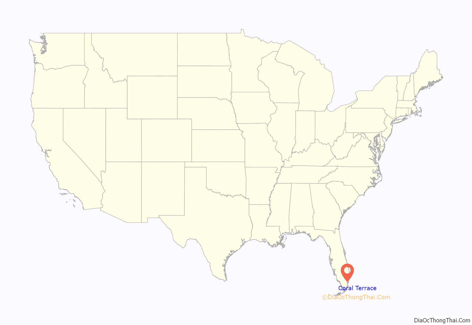
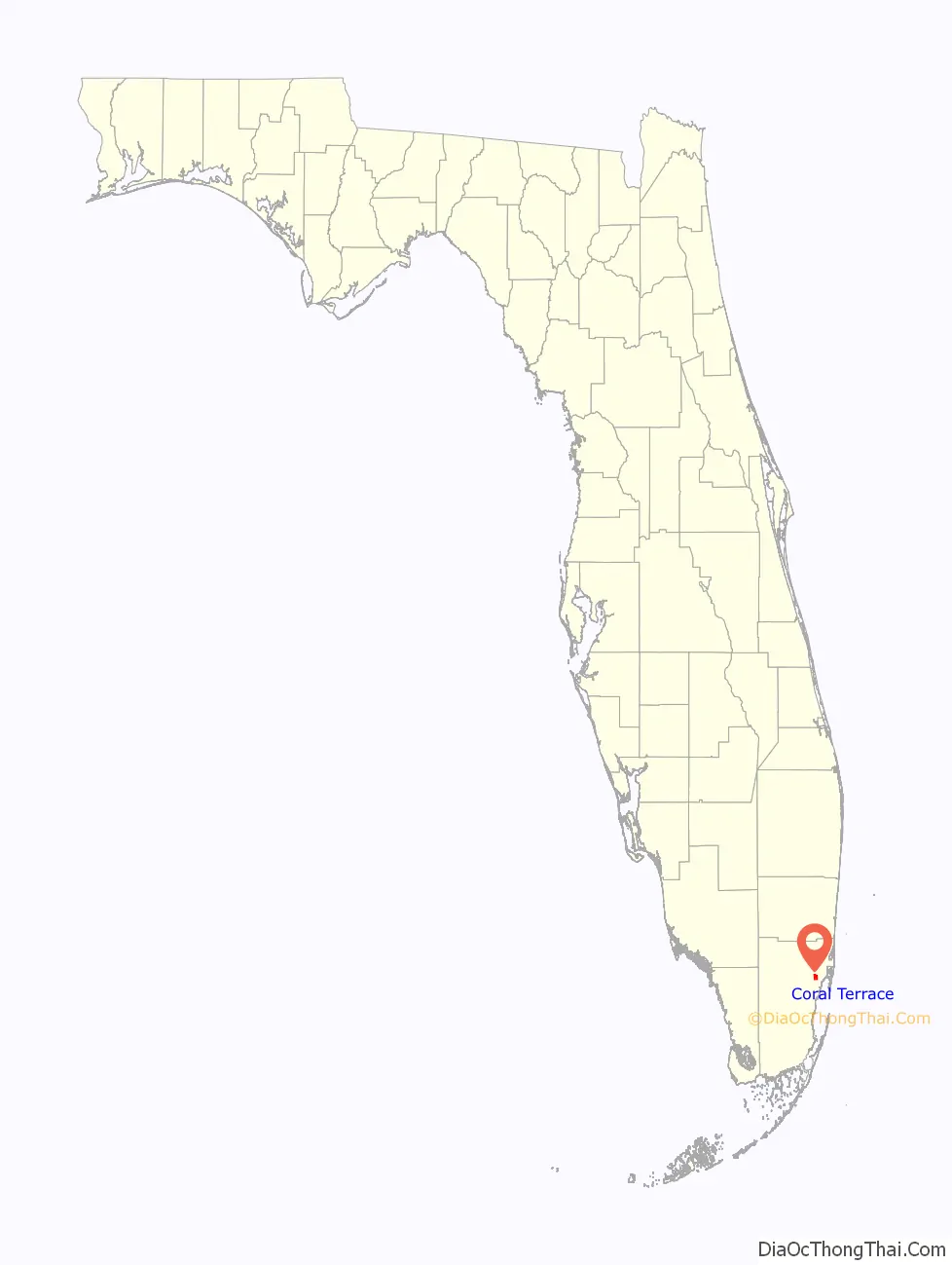
Coral Terrace location map. Where is Coral Terrace CDP?
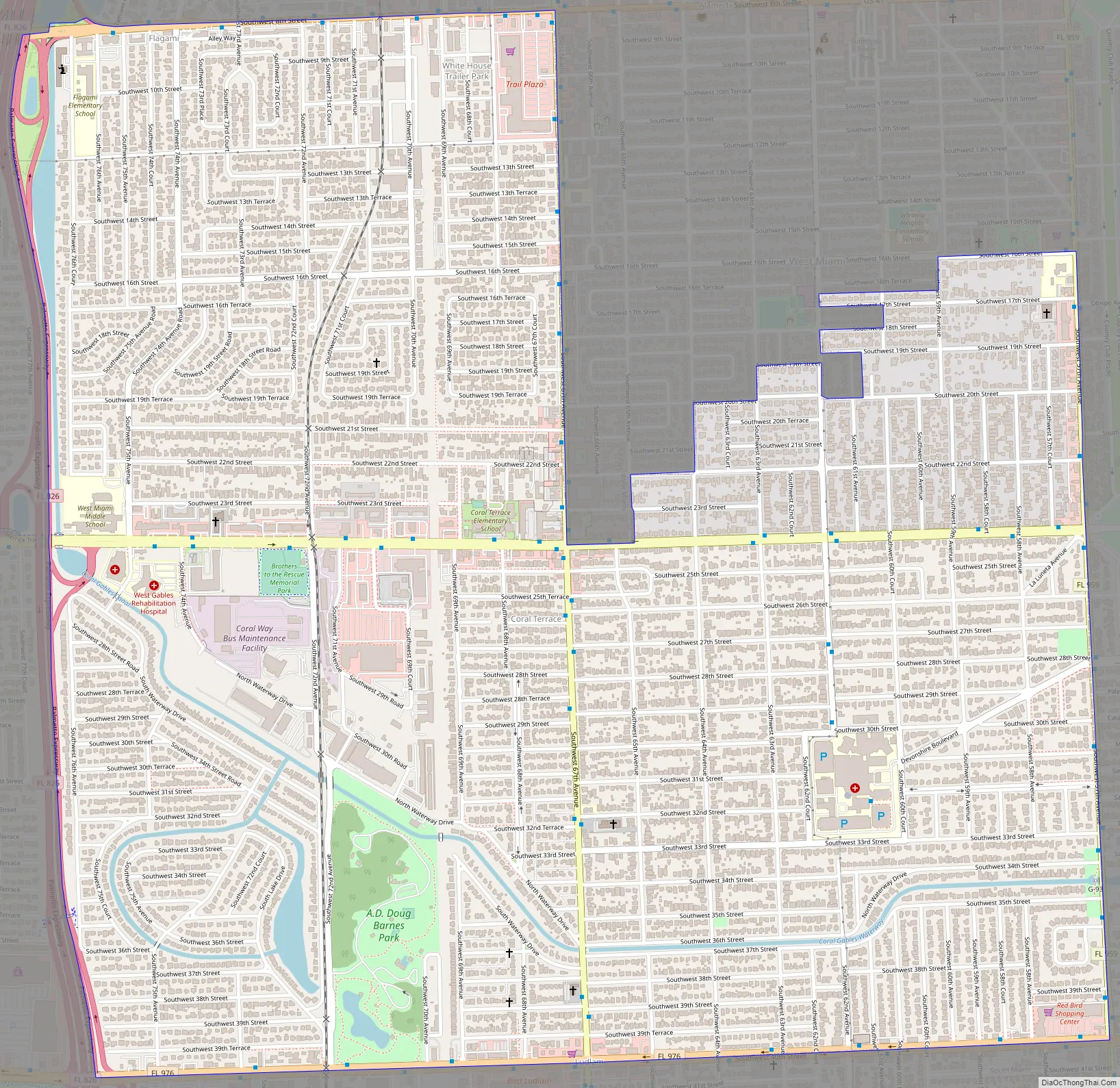
Coral Terrace Road Map
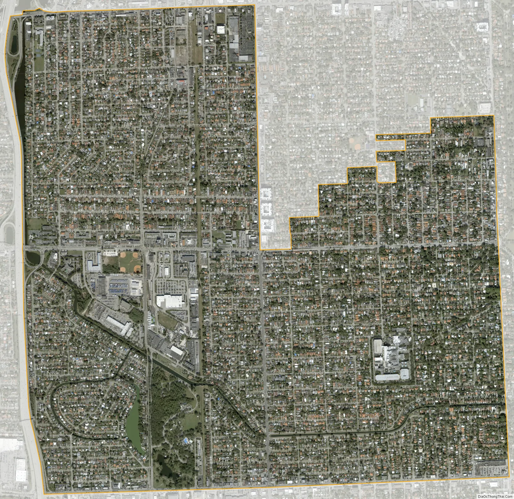
Coral Terrace city Satellite Map
Geography
Coral Terrace is located 7 miles (11 km) west of downtown Miami at 25°44′48″N 80°18′16″W / 25.74667°N 80.30444°W / 25.74667; -80.30444 (25.746778, -80.304551). It is bordered to the north by the Miami city limits, to the northeast by the city of West Miami, to the east by the city of Coral Gables, to the south by the city of South Miami and unincorporated Glenvar Heights, to the southwest by Olympia Heights, to the west by Westchester, and to the northwest by Fontainebleau, all unincorporated.
Florida State Road 826 (the Palmetto Expressway) forms the western border of Coral Terrace. U.S. Route 41 (SW 8th Street) forms the northern border with Miami, State Road 959 (S Red Road) forms the eastern border with Coral Gables, and State Road 976 (SW 40th Street) forms the southern border.
According to the United States Census Bureau, the Coral Terrace CDP has a total area of 3.43 square miles (8.9 km), of which 3.36 square miles (8.7 km) are land and 0.07 square miles (0.18 km) (2.10%) are water.
See also
Map of Florida State and its subdivision:- Alachua
- Baker
- Bay
- Bradford
- Brevard
- Broward
- Calhoun
- Charlotte
- Citrus
- Clay
- Collier
- Columbia
- Desoto
- Dixie
- Duval
- Escambia
- Flagler
- Franklin
- Gadsden
- Gilchrist
- Glades
- Gulf
- Hamilton
- Hardee
- Hendry
- Hernando
- Highlands
- Hillsborough
- Holmes
- Indian River
- Jackson
- Jefferson
- Lafayette
- Lake
- Lee
- Leon
- Levy
- Liberty
- Madison
- Manatee
- Marion
- Martin
- Miami-Dade
- Monroe
- Nassau
- Okaloosa
- Okeechobee
- Orange
- Osceola
- Palm Beach
- Pasco
- Pinellas
- Polk
- Putnam
- Saint Johns
- Saint Lucie
- Santa Rosa
- Sarasota
- Seminole
- Sumter
- Suwannee
- Taylor
- Union
- Volusia
- Wakulla
- Walton
- Washington
- Alabama
- Alaska
- Arizona
- Arkansas
- California
- Colorado
- Connecticut
- Delaware
- District of Columbia
- Florida
- Georgia
- Hawaii
- Idaho
- Illinois
- Indiana
- Iowa
- Kansas
- Kentucky
- Louisiana
- Maine
- Maryland
- Massachusetts
- Michigan
- Minnesota
- Mississippi
- Missouri
- Montana
- Nebraska
- Nevada
- New Hampshire
- New Jersey
- New Mexico
- New York
- North Carolina
- North Dakota
- Ohio
- Oklahoma
- Oregon
- Pennsylvania
- Rhode Island
- South Carolina
- South Dakota
- Tennessee
- Texas
- Utah
- Vermont
- Virginia
- Washington
- West Virginia
- Wisconsin
- Wyoming


