Miami (/maɪˈæmi/ my-AM-ee), officially the City of Miami, is a coastal metropolis and the seat of Miami-Dade County in South Florida. With a population of 442,241 as of the 2020 census, it is the second-most populous city in the state of Florida after Jacksonville. It is the core of the much larger Miami metropolitan area, which, with a population of 6.138 million, is the third-largest metro in the Southeast and ninth-largest in the United States. The city has the third-largest skyline in the U.S. with over 300 high-rises, 58 of which exceed 491 ft (150 m).
Miami is a major center and leader in finance, commerce, culture, arts, and international trade. Miami’s metropolitan area is by far the largest urban economy in Florida, with a gross domestic product of $344.9 billion as of 2017. According to a 2018 UBS study of 77 world cities, Miami is the third-richest city in the U.S. and the third richest globally in purchasing power. Miami is a majority-minority city with a Hispanic and Latino population of 310,472, or 70.2 percent of the city’s population, as of 2020.
Downtown Miami has one of the largest concentrations of international banks in the U.S. and is home to several large national and international companies. The Health District is home to several major University of Miami-affiliated hospital and health facilities, including Jackson Memorial Hospital, the nation’s largest hospital with 1,547 beds, and the Leonard M. Miller School of Medicine, the University of Miami’s academic medical center and teaching hospital, and others engaged in health-related care and research. PortMiami, the city’s seaport, is the busiest cruise port in the world in both passenger traffic and cruise lines. Miami is the second-largest tourism hub for international visitors after New York City. Miami has sometimes been called the “Gateway to Latin America” because of the magnitude of its commercial and cultural ties to the region.
In 2022, Miami ranked seventh in the U.S. in business activity, human capital, information exchange, cultural experience, and political engagement.
| Name: | Miami city |
|---|---|
| LSAD Code: | 25 |
| LSAD Description: | city (suffix) |
| State: | Florida |
| County: | Miami-Dade County |
| Incorporated: | July 28, 1896 |
| Elevation: | 6 ft (1.8 m) |
| Total Area: | 56.07 sq mi (145.23 km²) |
| Land Area: | 36.00 sq mi (93.23 km²) |
| Water Area: | 20.08 sq mi (52.00 km²) |
| Total Population: | 442,241 |
| Population Density: | 12,284.47/sq mi (4,743.55/km²) |
| Area code: | 305, 645, and 786 |
| FIPS code: | 1245000 |
| GNISfeature ID: | 277593 |
| Website: | miamigov.com |
Explore the Miami map to discover the city’s highways, roads, places, and a list of things to do. From the world-famous Art Deco District to the iconic South Beach, you won’t want to miss out on all the fun and excitement Miami has to offer. Plus, take a look at our interactive map of Florida to see why Miami attracts over 23 million visitors per year.
Online Interactive Map
Click on ![]() to view map in "full screen" mode.
to view map in "full screen" mode.
From museums and cultural institutions to unique cafes and unique boutiques, Miami is home to some of the best cultural experiences in the country. It’s also home to many of the most beautiful outdoor spaces in the country, from Biscayne Bay to the Everglades. With this interactive map, discover all the hidden gems that Miami has to offer.
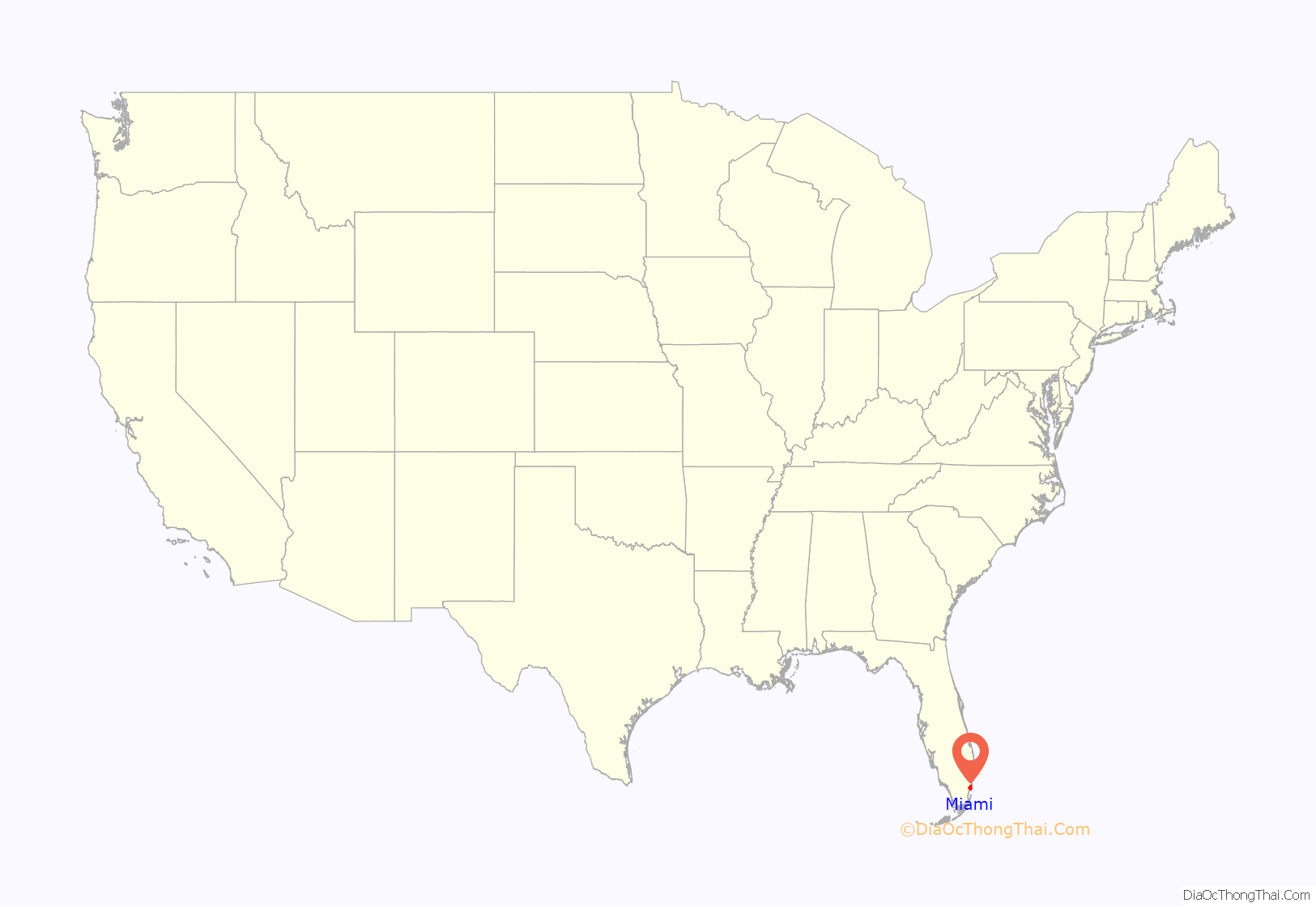
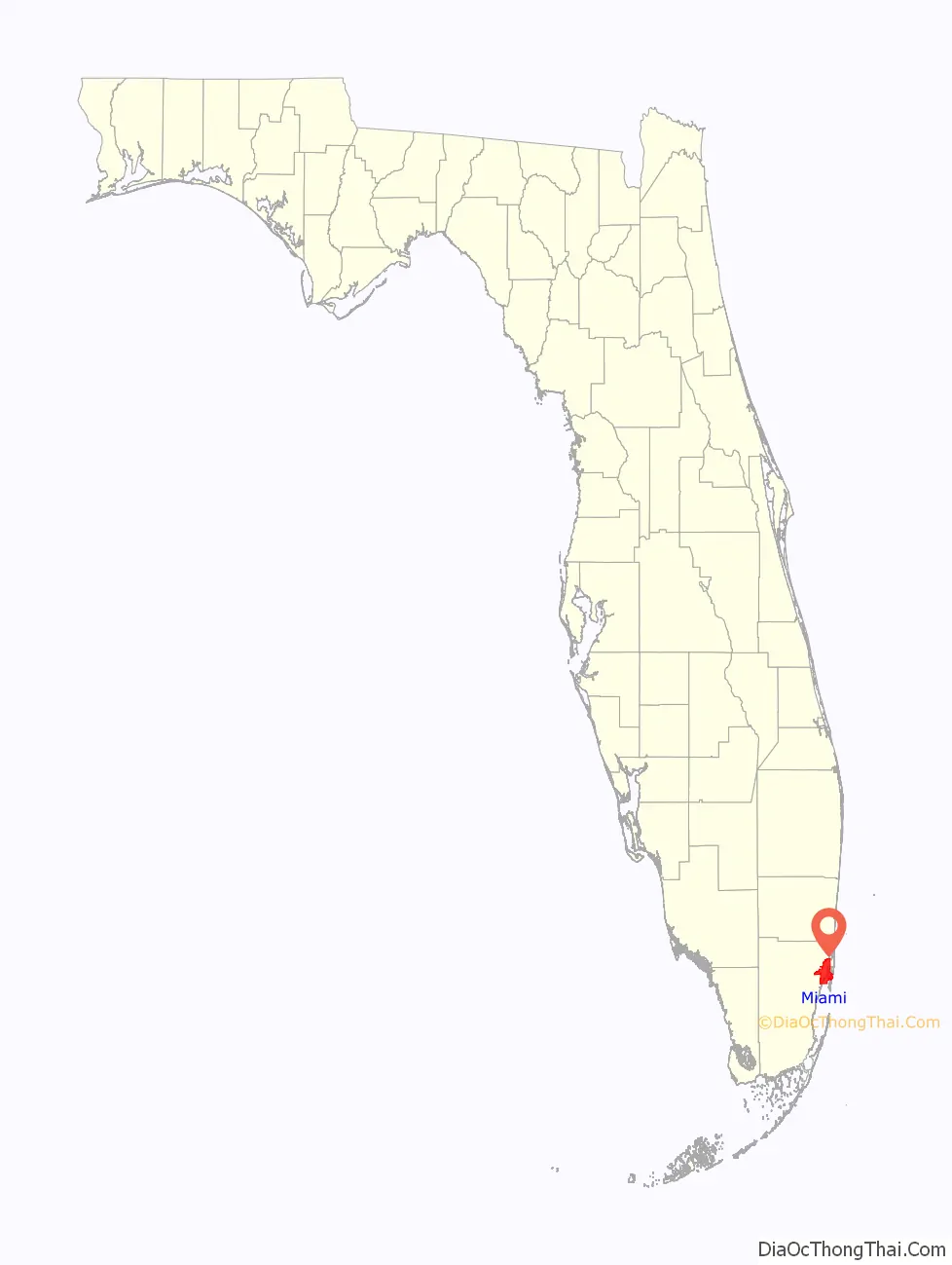
Miami location map. Where is Miami city?
History
The Tequesta tribe occupied the Miami area for around 2,000 years before contact with Europeans. A village of hundreds of people, dating to 500–600 BCE, was located at the mouth of the Miami River. It is believed that the entire tribe migrated to Cuba by the mid-1700s.
Settlement
In 1566, admiral Pedro Menéndez de Avilés, Florida’s first governor, claimed the area for Spain. A Spanish mission was constructed one year later. Spain and Britain successively ruled Florida until Spain ceded it to the United States in 1821. In 1836, the U.S. built Fort Dallas on the banks of the Miami River as part of their development of the Florida Territory and their attempt to suppress and remove the Seminoles. As a result, the Miami area became a site of fighting in the Second Seminole War.
Founding
Miami is noted as the only major city in the United States founded by a woman. Julia Tuttle, a local citrus grower and a wealthy Cleveland native, was the original owner of the land upon which the city was built. In the late 19th century, the area was known as “Biscayne Bay Country”, and reports described it as a promising wilderness and “one of the finest building sites in Florida”. The Great Freeze of 1894–1895 hastened Miami’s growth, as the crops there were the only ones in Florida that survived. Julia Tuttle subsequently convinced railroad tycoon Henry Flagler to extend his Florida East Coast Railway to the region, for which she became known as “the mother of Miami”. Miami was officially incorporated as a city on July 28, 1896, with a population of just over 300. African American labor played a crucial role in Miami’s early development.
20th century
During the early 20th century, migrants from the Bahamas and African-Americans constituted 40 percent of the city’s population. Despite their role in the city’s growth, their community was limited to a small space. When landlords began to rent homes to African-Americans around Avenue J (what would later become NW Fifth Avenue), a gang of white men with torches marched through the neighborhood and warned the residents to move or be bombed.
Miami prospered during the 1920s with an increase in population and development in infrastructure as northerners moved to the city. The legacy of Jim Crow was embedded in these developments. Miami’s chief of police at the time, H. Leslie Quigg, did not hide the fact that he, like many other white Miami police officers, was a member of the Ku Klux Klan. Unsurprisingly, these officers enforced social codes far beyond the written law. Quigg, for example, “personally and publicly beat a colored bellboy to death for speaking directly to a white woman”.
The collapse of the Florida land boom of the 1920s, the 1926 Miami Hurricane, and the Great Depression in the 1930s slowed development. When World War II began, Miami became a base for U.S. defense against German submarines due to its prime location on the southern coast of Florida. This brought an increase in Miami’s population; 172,172 people lived in the city by 1940. The city’s nickname, The Magic City, came from its rapid growth, which was noticed by winter visitors who remarked that the city grew so much from one year to the next that it was like magic.
After Fidel Castro rose to power in Cuba following the Revolution in 1959, many wealthy Cubans sought refuge in Miami, further increasing the city’s population. The city’s national profile expanded dramatically in the 1970s, particularly in 1972. The region hosted both the Democratic and Republican National Conventions in the 1972 Presidential election. The Miami Dolphins also made history with their undefeated “perfect” season. The area’s educational and cultural institutions had also developed significantly in this period, positioning the city to service a larger and increasingly international populace. Miami also developed new businesses and cultural amenities as part of the New South in the 1980s and 1990s. At the same time, South Florida weathered social problems related to drug wars, immigration from Haiti and Latin America, and the widespread destruction of Hurricane Andrew. Racial and cultural tensions sometimes sparked, but the city developed in the latter half of the 20th century as a major international, financial, and cultural center. It is the second-largest U.S. city with a Spanish-speaking majority (after El Paso, Texas), and the largest city with a Cuban-American plurality.
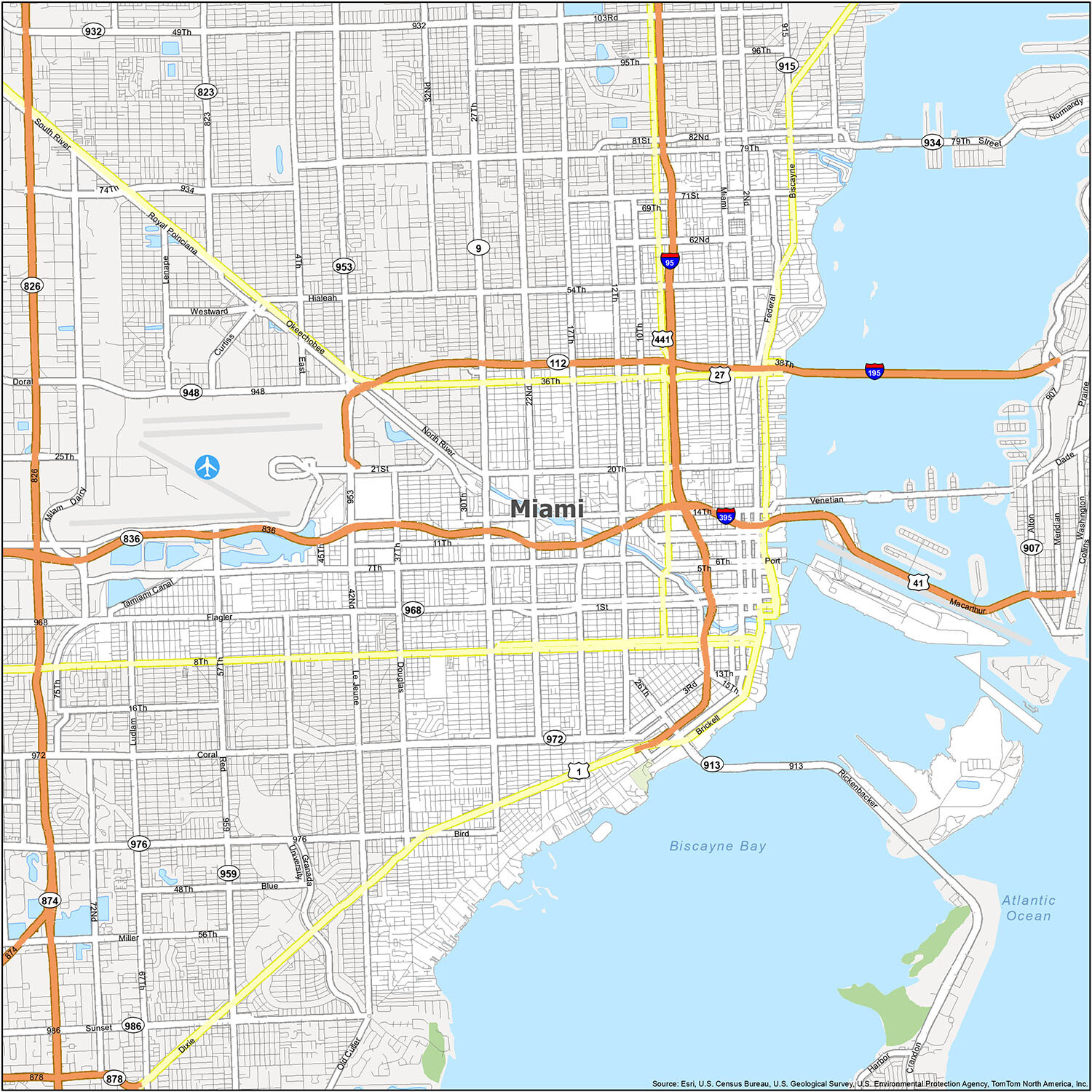
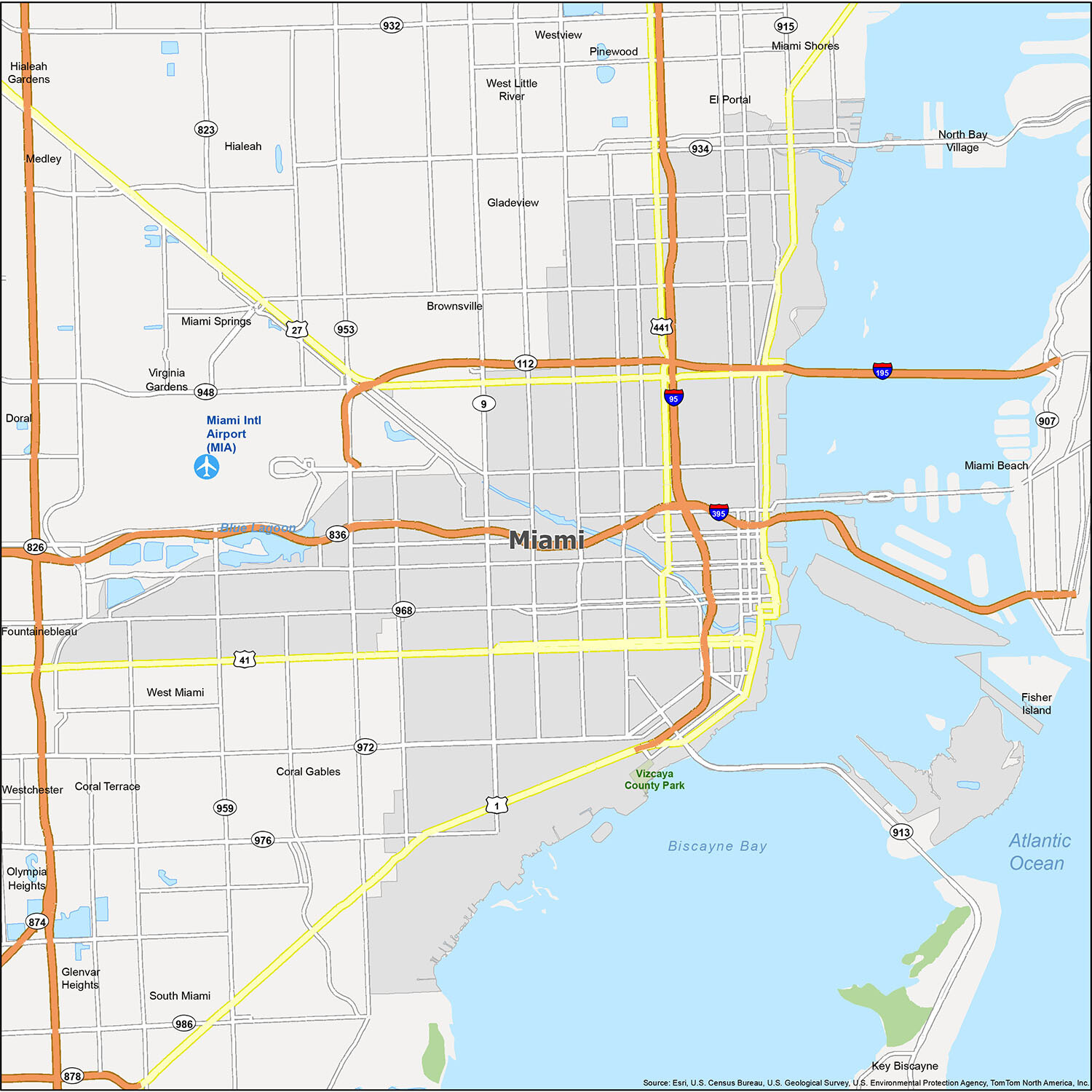
Miami Road Map
Miami is one of the most beautiful cities in the world, known for its colorful buildings, beautiful people, and beautiful weather. It’s also an international hub for sport, fashion, art, music, and culture. Don’t worry about getting lost. Because whether you’re a local or a visitor, this detailed road map is perfect for navigating the city. For traveling outside the city, take a look at our Florida road map for detailed interstates and highway information.
Interstate Highways: I-95, I-195, I-395,
US Highways: 1, 9, 27, 41, 112, 441, 836, 934, 953, 968, 972, Dolphin Expy, Dixie Hwy, Federal Hwy
Causeway/Parkways: Little River Pky, Delaware Pky, Venetian Cswy
Major Roads: 1st St, 2nd St, 3rd Ave, 4th Ave, 7th St, 8th St, 12th St, 13th St, 15th Rd, 20th St, 22nd St, 27th Ave, 36th St, 38th St, 42nd Ave, 79th St, 82nd St, Bayshore Dr, Beacom Blvd, Bird Rd, Biscayne Blvd, Brickell Ave, Coral Way, Design Blvd, Douglas Rd, Flagler St, Granada Blvd, Le Jeune Rd, North River Dr, Martin Luther King Blvd, Miami Ave, Port Blvd, Rickenbacker Cswy, South River Dr, Tamiami Canal Rd, Venetian Way
Discover Miami with this reference map! Take a tour of the city’s many neighborhoods, and explore the lakes, rivers, state parks, and populated areas. From the Gulf Coast’s sandy beaches and beautiful mangroves to vibrant little towns right on the water, Miami is a magical place. Plus, you can easily access the city via Miami International Airport (MIA). Whether you’re visiting Coral Gables, Doral, Hialeah, Hialeah Gardens, Miami, Miami Beach, Miami Springs, North Bay Village, South Miami, West Miami, Medley, El Portal, Key Biscayne, Miami Shores, Virginia Gardens, Brownsville, Coral Terrace, Fisher Island, Fountainebleau, Gladeview, Glenvar Heights, Olympia Heights, Pinewood, West Little River, Westchester, or Westview, you’re sure to find something special!
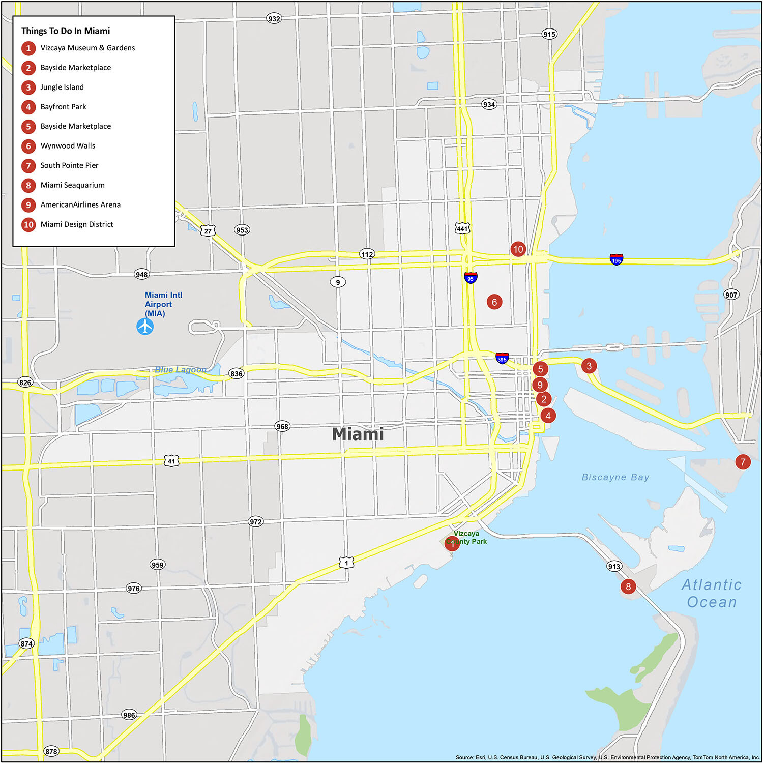
10 things to do in Miami city
From museums and cultural institutions to unique cafes and unique boutiques, Miami is home to some of the best cultural experiences in the country. It’s also home to many of the most beautiful outdoor spaces in the country, from Biscayne Bay to the Everglades. With this interactive map, discover all the hidden gems that Miami has to offer.
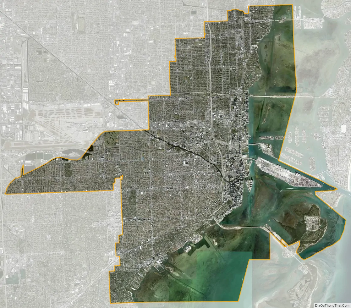
Miami city Satellite Map
Geography
Miami and its suburbs are located on a broad plain between the Everglades to the west and Biscayne Bay to the east, which extends from Lake Okeechobee southward to Florida Bay. The elevation of the area averages at around 6 ft (1.8 m) above sea level in most neighborhoods, especially near the coast. The highest points are found along the Miami Rock Ridge, which lies under most of the eastern Miami metro. The main portion of the city is on the shores of Biscayne Bay, which contains several hundred natural and artificial barrier islands, the largest of which contains Miami Beach and South Beach. The Gulf Stream, a warm ocean current, runs northward just 15 miles (24 km) off the coast, allowing the city’s climate to stay warm and mild all year.
Geology
The surface bedrock under the Miami area is called Miami oolite or Miami limestone. This bedrock is covered by a thin layer of soil, and is no more than 50 feet (15 m) thick. Miami limestone formed as the result of the drastic changes in sea level associated with recent glacial periods, or ice ages. Beginning some 130,000 years ago, the Sangamonian Stage raised sea levels to approximately 25 feet (8 m) above the current level. All of southern Florida was covered by a shallow sea. Several parallel lines of reef formed along the edge of the submerged Florida plateau, stretching from the present Miami area to what is now the Dry Tortugas. The area behind this reef line was, in fact, a large lagoon, and the Miami limestone formed throughout the area from the deposition of oolites and the shells of bryozoans. Starting about 100,000 years ago, the Wisconsin glaciation began lowering sea levels, exposing the floor of the lagoon. By 15,000 years ago, the sea level had dropped 300 to 350 feet (90 to 110 m) below the current level. The sea level rose quickly after that, stabilizing at the current level about 4,000 years ago, leaving the mainland of South Florida just above sea level.
Beneath the plain lies the Biscayne Aquifer, a natural underground source of fresh water that extends from southern Palm Beach County to Florida Bay. It comes closest to the surface around the cities of Miami Springs and Hialeah. Most of the Miami metropolitan area obtains its drinking water from the Biscayne Aquifer. As a result of the aquifer, it is not possible to dig more than 15 to 20 ft (5 to 6 m) beneath the city without hitting water, which impedes underground construction, though some underground parking garages exist. For this reason, the mass transit systems in and around Miami are elevated or at-grade.
Most of the western fringes of the city border the Everglades, a tropical marshland covering most of the southern portion of Florida. Alligators that live in the marshes have ventured into Miami communities and onto major highways.
Cityscape
Miami is split roughly into north, south, west, and Downtown areas. The heart of the city is Downtown Miami, which is on the eastern side and includes the neighborhoods of Brickell, Virginia Key, Watson Island, as well as PortMiami. Downtown Miami is Florida’s largest and most influential central business district, with many major banks, courthouses, financial headquarters, cultural and tourist attractions, schools, parks, and a large residential population. Brickell Avenue has the largest concentration of international banks in the United States. Just northwest of Downtown is the Health District, which is Miami’s center for hospitals, research institutes and biotechnology, with hospitals such as Jackson Memorial Hospital, Bascom Palmer Eye Institute, and the University of Miami’s Leonard M. Miller School of Medicine.
The southern side of Miami includes the neighborhoods of Coral Way, The Roads, and Coconut Grove. Coral Way is a historic residential neighborhood built in 1922 between Downtown and Coral Gables, and is home to many old homes and tree-lined streets. Coconut Grove, established in 1825, is a historic neighborhood with narrow, winding roads and a heavy tree canopy. It is the location of Miami’s City Hall at Dinner Key, the former Coconut Grove Playhouse, CocoWalk, and the Coconut Grove Convention Center. It is also home to many nightclubs, bars, restaurants, and bohemian shops, which makes it very popular with local college students. Coconut Grove is known for its many parks and gardens, such as Vizcaya Museum, The Kampong, The Barnacle Historic State Park, and numerous other historic homes and estates.
The western side of Miami includes the neighborhoods of Little Havana, West Flagler, and Flagami. Although at one time a mostly Jewish neighborhood, today western Miami is home to immigrants from mostly Central America and Cuba, while the west central neighborhood of Allapattah is a multicultural community of many ethnicities.
The northern side of Miami includes Midtown, a district with a great mix of diversity ranging from West Indians to Hispanics to European Americans. The Edgewater neighborhood of Midtown is mostly composed of high-rise residential towers and is home to the Adrienne Arsht Center for the Performing Arts. Wynwood is an art district with ten galleries in former warehouses, as well as a large outdoor mural project. The wealthier residents of Miami usually live in the Design District and the Upper Eastside, which has many 1920s homes as well as examples of Miami Modern architecture in the MiMo Historic District. The northern side of Miami also has notable African-American and Caribbean immigrant communities, including Little Haiti, Overtown (home of the Lyric Theater), and Liberty City.
Climate
Miami has a tropical monsoon climate (Köppen climate classification Am) with hot and wet summers and warm and dry winters.
The city’s sea-level elevation, coastal location, position just above the Tropic of Cancer, and proximity to the Gulf Stream shape its climate. Average winter high temperatures, from December to March, range from 76.4–80.3 °F (24.7–26.8 °C). January is the coolest month with an average daily temperature of 68.2 °F (20.1 °C). Low temperatures fall below 50 °F (10 °C) about 3 to 4 nights during the winter season, after the passage of cold fronts that produce what little rainfall that falls in the winter.
There are two basic seasons in Miami, a hot and wet season from May through October, and a warm and dry season from November through April. During the hot and wet season, daily thundershowers occur in the humid unstable air masses. The wet season in Miami is defined as the period during which the average daily dew point temperature is above 70 °F (21 °C). The rainy season typically begins on the first day that occurs, or within a few days later. Similarly, daily rainfall in Miami decreases sharply when the average daily dew point falls to 70 °F (21 °C) or below, although in some years, a stalled front to the south of the Florida peninsula may cause rains to continue for a few more days. During the years 1956 to 1997, the date summer began ranged from April 16 to June 3, with a median date of May 21. During those same years, the date summer ended ranged from September 24 to November 1, with a median date of October 17. During the summer, temperatures range from the mid-80s to low 90s °F (29–35 °C) and are accompanied by high humidity, though the heat is often relieved in the afternoon by thunderstorms or a sea breeze that develops off the Atlantic Ocean. Much of the year’s 61.9 inches (1,572 mm) of rainfall occurs during this period. Dew points in the warm months range from 71.9 °F (22.2 °C) in June to 73.7 °F (23.2 °C) in August.
Extremes range from 27 °F (−2.8 °C) on February 3, 1917, to 100 °F (38 °C) on July 21, 1942. While Miami has never recorded snowfall at any official weather station since records have been kept, snow flurries fell in some parts of the city on January 19, 1977. The coldest daytime maximum temperature on record is 45 °F (7 °C) in December 1989 during the December 1989 United States cold wave, while the coldest maximum temperature average between 1991 and 2020 stood at 59 °F (15 °C). The warmest overnight low measured is 84 °F (29 °C) on several occasions. The stability of summer overnight lows is underlined by the mean maximum annual overnight low is just one degree lower.
Hurricane season officially runs from June 1 through November 30, although hurricanes can develop beyond those dates. The most likely time for Miami to be hit is during the peak of the Cape Verde season, which is mid-August through the end of September. Although tornadoes are uncommon in the area, one struck in 1925 and another in 1997. Around 40% of homes in Miami are built upon floodplains and are considered as flood-risk zones.
Miami falls under the Department of Agriculture’s 10b/11a plant hardiness zone.
Miami is one of the major coastal cities and major cities in the United States that will be most affected by climate change. Globally, it is one of the most at-risk cities as well, according to a 2020 report by Resources for the Future. Global sea level rise, which in Miami is projected to be 21 inches (53 cm) to 40 inches (100 cm) by 2070, will lead to an increase in storm damage, more intense flooding, and will threaten the city’s water supply. Other potential impacts of climate change include higher hurricane wind speeds and severe thunderstorms, which can bring about hail or tornadoes. Some protective efforts are in place, including nourishing beaches and adding protective barriers, raising buildings and roads that are vulnerable, and restoring natural habitats such as wetlands. Miami Beach has invested $500 million to protect roads, buildings, and water systems. Real estate prices in Miami already reflect the increase in prices for real estate at a higher elevation within the city compared to real estate at a lower elevation.
See also
Map of Florida State and its subdivision:- Alachua
- Baker
- Bay
- Bradford
- Brevard
- Broward
- Calhoun
- Charlotte
- Citrus
- Clay
- Collier
- Columbia
- Desoto
- Dixie
- Duval
- Escambia
- Flagler
- Franklin
- Gadsden
- Gilchrist
- Glades
- Gulf
- Hamilton
- Hardee
- Hendry
- Hernando
- Highlands
- Hillsborough
- Holmes
- Indian River
- Jackson
- Jefferson
- Lafayette
- Lake
- Lee
- Leon
- Levy
- Liberty
- Madison
- Manatee
- Marion
- Martin
- Miami-Dade
- Monroe
- Nassau
- Okaloosa
- Okeechobee
- Orange
- Osceola
- Palm Beach
- Pasco
- Pinellas
- Polk
- Putnam
- Saint Johns
- Saint Lucie
- Santa Rosa
- Sarasota
- Seminole
- Sumter
- Suwannee
- Taylor
- Union
- Volusia
- Wakulla
- Walton
- Washington
- Alabama
- Alaska
- Arizona
- Arkansas
- California
- Colorado
- Connecticut
- Delaware
- District of Columbia
- Florida
- Georgia
- Hawaii
- Idaho
- Illinois
- Indiana
- Iowa
- Kansas
- Kentucky
- Louisiana
- Maine
- Maryland
- Massachusetts
- Michigan
- Minnesota
- Mississippi
- Missouri
- Montana
- Nebraska
- Nevada
- New Hampshire
- New Jersey
- New Mexico
- New York
- North Carolina
- North Dakota
- Ohio
- Oklahoma
- Oregon
- Pennsylvania
- Rhode Island
- South Carolina
- South Dakota
- Tennessee
- Texas
- Utah
- Vermont
- Virginia
- Washington
- West Virginia
- Wisconsin
- Wyoming


