Davenport is a city in Polk County, Florida, United States. The population was 9,040 at the 2020 census. While the city of Davenport itself is very small, the area north of the city close to Interstate 4 and US 27 is experiencing explosive growth. It is part of the Lakeland–Winter Haven Metropolitan Statistical Area. The current mayor is H.B. “Rob” Robinson, who was appointed in February 2018. Per the City Charter, Mayor Robinson beat former Mayor Darlene Bradley capturing 69.8% of the vote in the municipal election in April 2019.
| Name: | Davenport city |
|---|---|
| LSAD Code: | 25 |
| LSAD Description: | city (suffix) |
| State: | Florida |
| County: | Polk County |
| Incorporated: | 1915 |
| Elevation: | 125 ft (38 m) |
| Total Area: | 4.21 sq mi (10.89 km²) |
| Land Area: | 4.07 sq mi (10.53 km²) |
| Water Area: | 0.14 sq mi (0.36 km²) |
| Population Density: | 2,224.05/sq mi (858.79/km²) |
| ZIP code: | 33837, 33897, 33896 |
| Area code: | Area code 863 |
| FIPS code: | 1216450 |
| GNISfeature ID: | 2404190 |
| Website: | www.mydavenport.org |
Online Interactive Map
Click on ![]() to view map in "full screen" mode.
to view map in "full screen" mode.
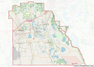
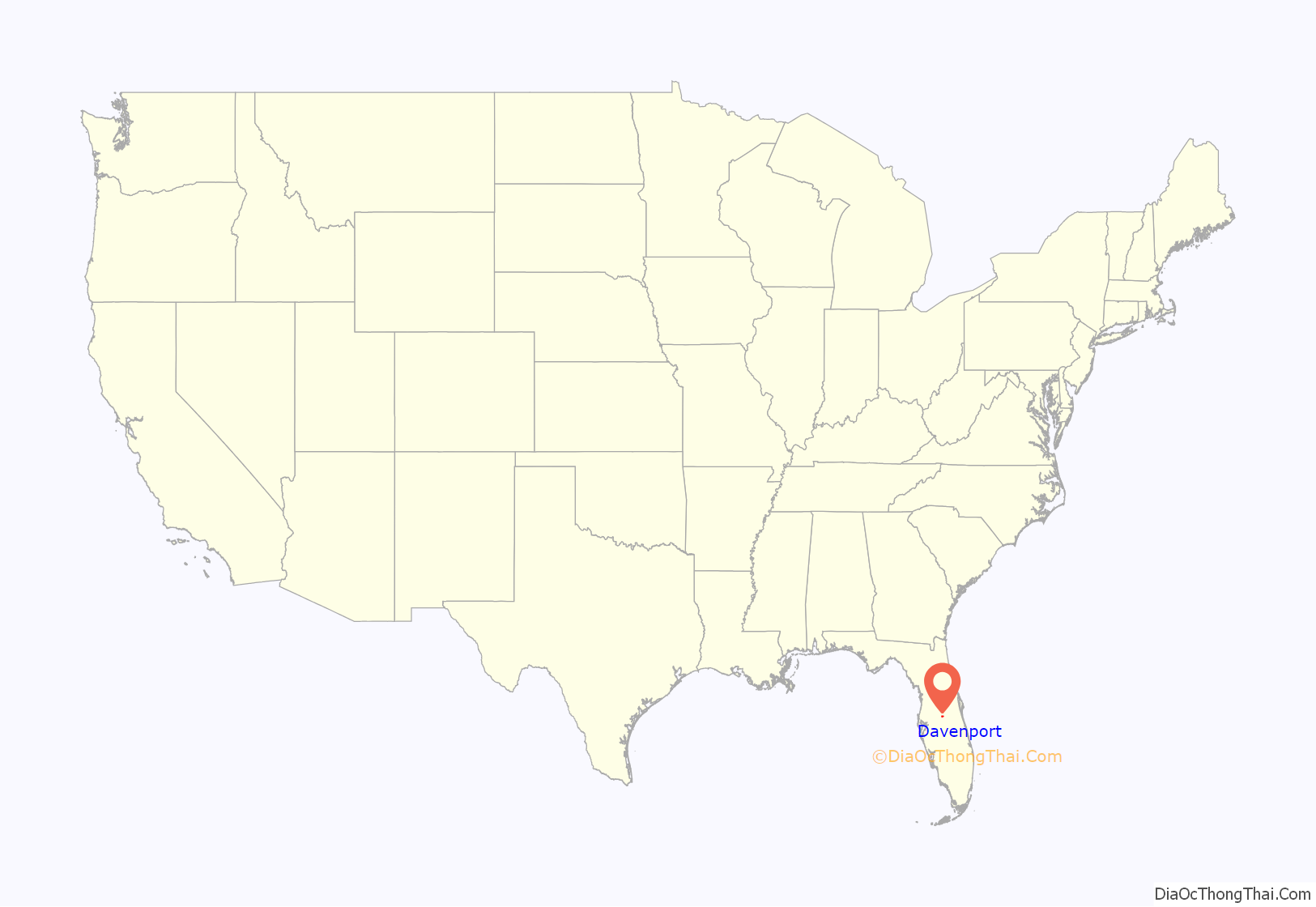
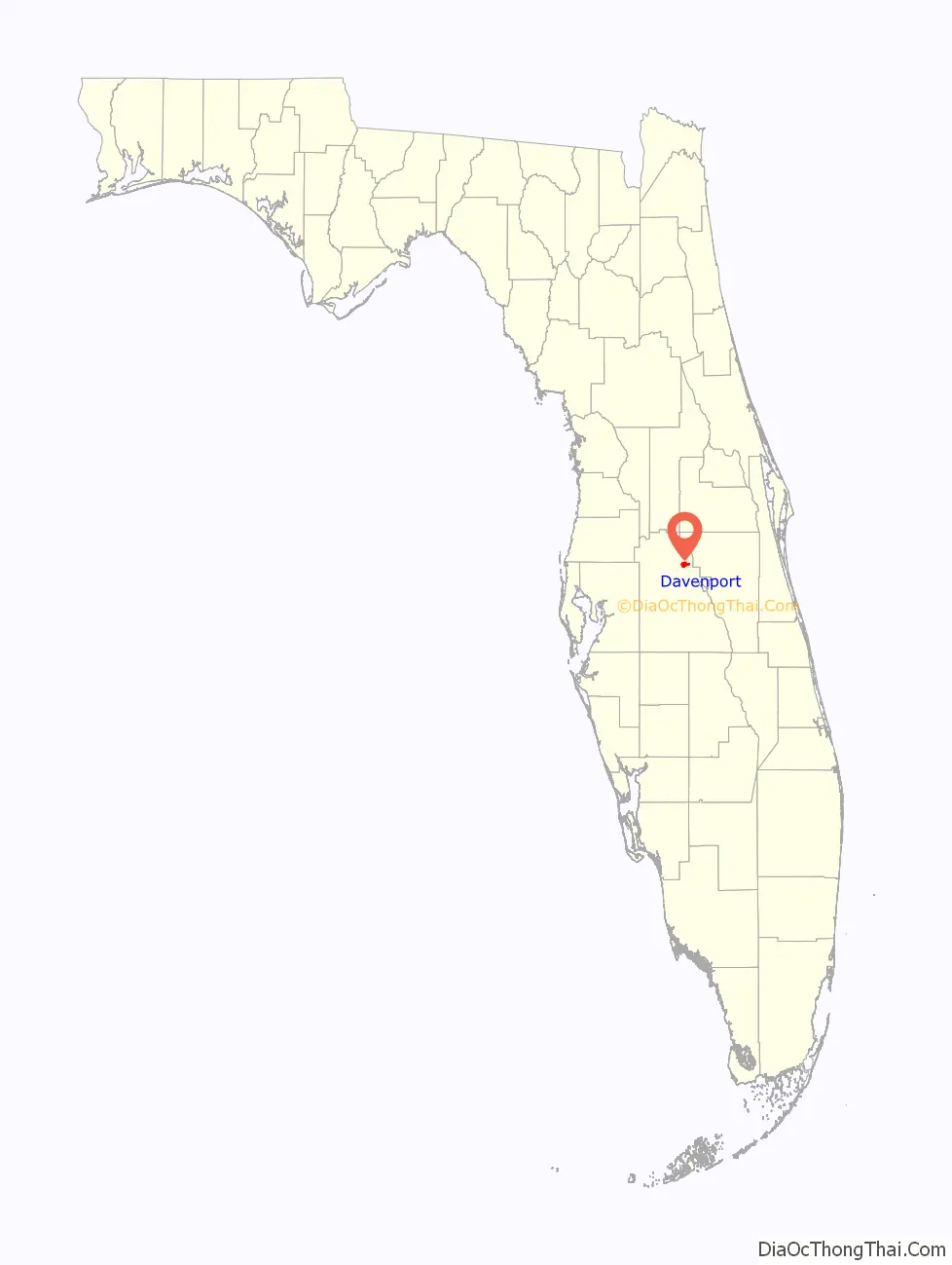
Davenport location map. Where is Davenport city?
History
The settlement in the area now known as Davenport was established in 1838 when the US military set up Fort Davenport during the Second Seminole War, about 12 miles north of the present site of Davenport. The fort was one of a number built at 20 mile intervals along a trail from Fort Brooke to Fort Mellon. The fort only lasted a few years. The fort was named for Colonel William Davenport, who served as the local U.S. commander in the war. There is no known documentary evidence to support an alternative claim that the city was named for a railroad conductor.
The modern city of Davenport had its start in the 1880s when the South Florida Railroad was extended to that point. The settlement was first known as Horse Creek, for the creek first recorded on a US Army survey of 1849 which flows past the site to enter Snell Creek and eventually Lake Hatchineha in the Kissimmee River system. A post office was established at Horse Creek in 1884, and the name of the post office was changed to Davenport in 1886. Davenport was incorporated in 1915.
The South Florida Railroad opened a station half a mile north of the present site of the city. The railroad line was acquired by the Plant System in 1893, and the Atlantic Coast Line Railroad in 1902. In 1926, it was replaced by a new station in the downtown area. It was later closed in the 1970s. From 1958 to 1986 there was a second station, the Vertagreen Railroad Station, opened only for the transportation of fertilizer and not for public use.
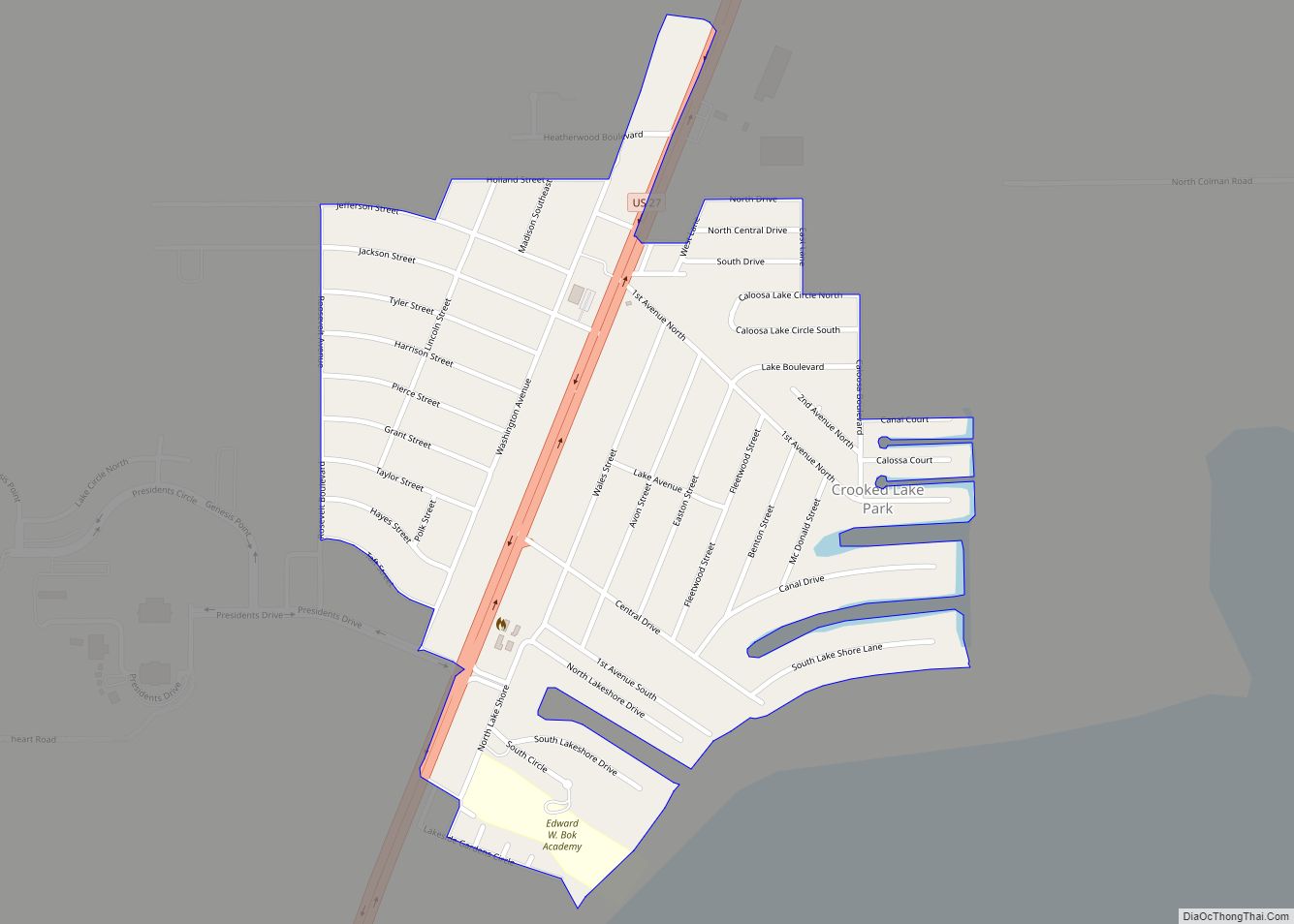
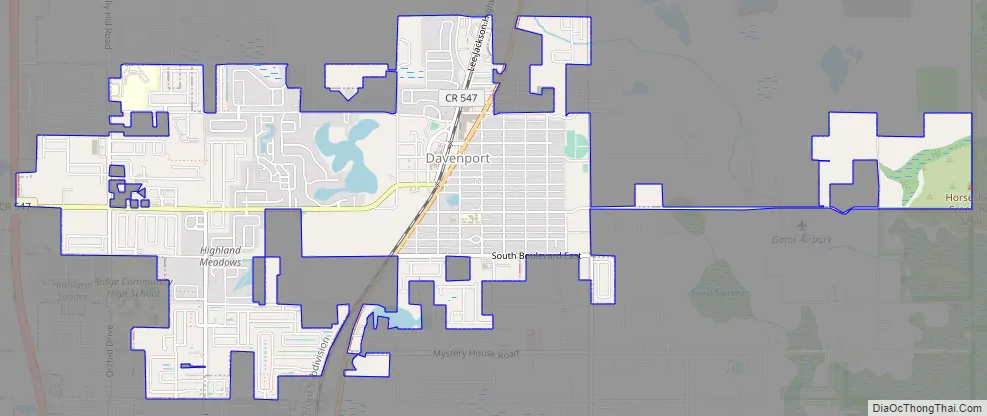
Davenport Road Map
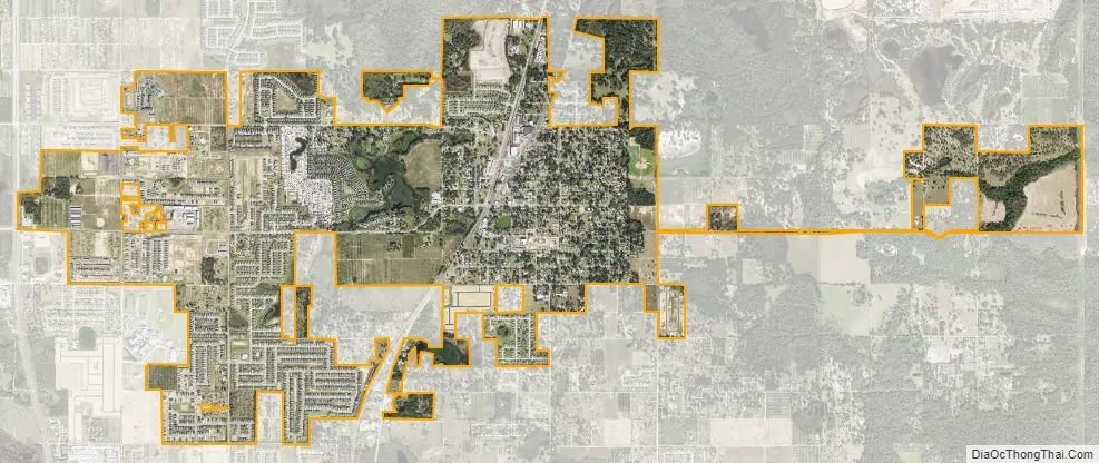
Davenport city Satellite Map
Geography
Davenport is located within the Central Florida Highlands area of the Atlantic coastal plain with a terrain consisting of flatland interspersed with gently rolling hills.
According to the United States Census Bureau, the city has a total area of 1.6 square miles (4.1 km), of which 1.6 square miles (4.1 km) is land and 0.1 square miles (0.26 km) (3.68%) is water.
Davenport is located in the humid subtropical zone, as designated by (Köppen climate classification: Cfa).
See also
Map of Florida State and its subdivision:- Alachua
- Baker
- Bay
- Bradford
- Brevard
- Broward
- Calhoun
- Charlotte
- Citrus
- Clay
- Collier
- Columbia
- Desoto
- Dixie
- Duval
- Escambia
- Flagler
- Franklin
- Gadsden
- Gilchrist
- Glades
- Gulf
- Hamilton
- Hardee
- Hendry
- Hernando
- Highlands
- Hillsborough
- Holmes
- Indian River
- Jackson
- Jefferson
- Lafayette
- Lake
- Lee
- Leon
- Levy
- Liberty
- Madison
- Manatee
- Marion
- Martin
- Miami-Dade
- Monroe
- Nassau
- Okaloosa
- Okeechobee
- Orange
- Osceola
- Palm Beach
- Pasco
- Pinellas
- Polk
- Putnam
- Saint Johns
- Saint Lucie
- Santa Rosa
- Sarasota
- Seminole
- Sumter
- Suwannee
- Taylor
- Union
- Volusia
- Wakulla
- Walton
- Washington
- Alabama
- Alaska
- Arizona
- Arkansas
- California
- Colorado
- Connecticut
- Delaware
- District of Columbia
- Florida
- Georgia
- Hawaii
- Idaho
- Illinois
- Indiana
- Iowa
- Kansas
- Kentucky
- Louisiana
- Maine
- Maryland
- Massachusetts
- Michigan
- Minnesota
- Mississippi
- Missouri
- Montana
- Nebraska
- Nevada
- New Hampshire
- New Jersey
- New Mexico
- New York
- North Carolina
- North Dakota
- Ohio
- Oklahoma
- Oregon
- Pennsylvania
- Rhode Island
- South Carolina
- South Dakota
- Tennessee
- Texas
- Utah
- Vermont
- Virginia
- Washington
- West Virginia
- Wisconsin
- Wyoming