East Lake-Orient Park is an unincorporated census-designated place in Hillsborough County, Florida, United States. The population was 22,753 at the 2010 census, up from 5,703 at the 2000 census following an expansion of its borders. The area is the home of the Florida State Fairgrounds, which hosts the Florida State Fair in mid-February of each year. It was previously home to East Lake Square Mall. The ZIP code for East Lake-Orient Park is 33610 (East Lake) and 33619 (Orient Park).
| Name: | East Lake-Orient Park CDP |
|---|---|
| LSAD Code: | 57 |
| LSAD Description: | CDP (suffix) |
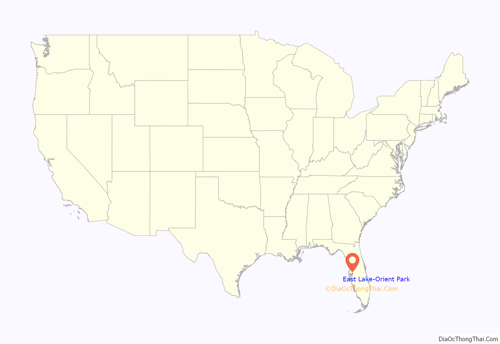
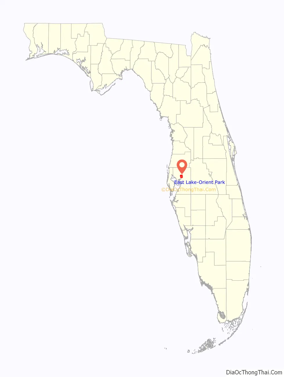
| State: | Florida |
| County: | Hillsborough County |
| Elevation: | 37 ft (11 m) |
| Total Area: | 16.92 sq mi (43.83 km²) |
| Land Area: | 15.81 sq mi (40.96 km²) |
| Water Area: | 1.11 sq mi (2.87 km²) |
| Total Population: | 28,050 |
| Population Density: | 1,773.74/sq mi (684.85/km²) |
| Area code: | 813 |
| FIPS code: | 1219212 |
| GNISfeature ID: | 2402431 |
Online Interactive Map
Click on ![]() to view map in "full screen" mode.
to view map in "full screen" mode.
East Lake-Orient Park location map. Where is East Lake-Orient Park CDP?
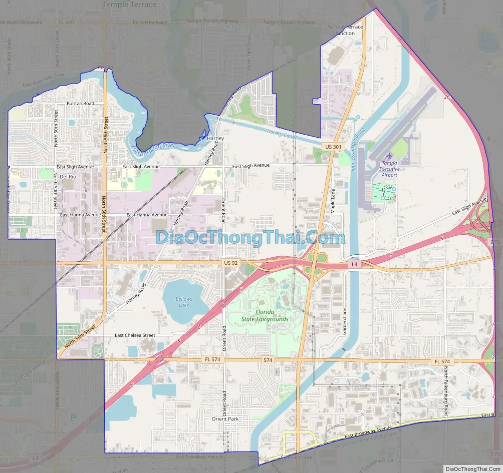
East Lake-Orient Park Road Map
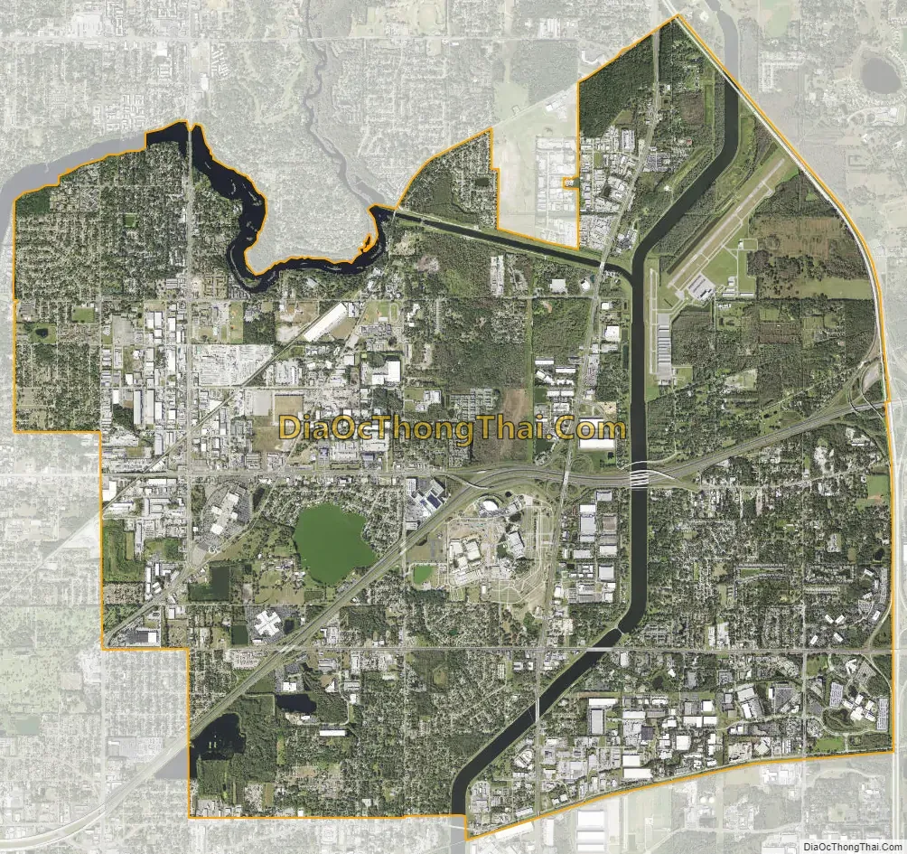
East Lake-Orient Park city Satellite Map
Geography
East Lake-Orient Park is located in north-central Hillsborough County at 27°58′42″N 82°22′26″W / 27.97833°N 82.37389°W / 27.97833; -82.37389 (27.978399, -82.374017). The CDP includes the communities of East Lake, Orient Park, and Del Rio. It is bordered by the city of Tampa to the south and west, Temple Terrace to the north, Thonotosassa and Mango to the east, and Brandon to the southeast. U.S. Route 301 and Interstate 4 run through the community, crossing near the center of the CDP. US 301 leads northeast 21 miles (34 km) to Zephyrhills and south 9 miles (14 km) to Riverview, while I-4 leads east 27 miles (43 km) to Lakeland and west 8 miles (13 km) to downtown Tampa. Interstate 75 forms the eastern edge of the East Lake-Orient Park CDP, leading north 93 miles (150 km) to Ocala and south 42 miles (68 km) to Bradenton.
According to the United States Census Bureau, the CDP has a total area of 17.4 square miles (45.0 km), of which 16.3 square miles (42.3 km) are land and 1.0 square mile (2.7 km), or 6.06%, are water. The Tampa Bypass Canal crosses the CDP from north to south.
See also
Map of Florida State and its subdivision:- Alachua
- Baker
- Bay
- Bradford
- Brevard
- Broward
- Calhoun
- Charlotte
- Citrus
- Clay
- Collier
- Columbia
- Desoto
- Dixie
- Duval
- Escambia
- Flagler
- Franklin
- Gadsden
- Gilchrist
- Glades
- Gulf
- Hamilton
- Hardee
- Hendry
- Hernando
- Highlands
- Hillsborough
- Holmes
- Indian River
- Jackson
- Jefferson
- Lafayette
- Lake
- Lee
- Leon
- Levy
- Liberty
- Madison
- Manatee
- Marion
- Martin
- Miami-Dade
- Monroe
- Nassau
- Okaloosa
- Okeechobee
- Orange
- Osceola
- Palm Beach
- Pasco
- Pinellas
- Polk
- Putnam
- Saint Johns
- Saint Lucie
- Santa Rosa
- Sarasota
- Seminole
- Sumter
- Suwannee
- Taylor
- Union
- Volusia
- Wakulla
- Walton
- Washington
- Alabama
- Alaska
- Arizona
- Arkansas
- California
- Colorado
- Connecticut
- Delaware
- District of Columbia
- Florida
- Georgia
- Hawaii
- Idaho
- Illinois
- Indiana
- Iowa
- Kansas
- Kentucky
- Louisiana
- Maine
- Maryland
- Massachusetts
- Michigan
- Minnesota
- Mississippi
- Missouri
- Montana
- Nebraska
- Nevada
- New Hampshire
- New Jersey
- New Mexico
- New York
- North Carolina
- North Dakota
- Ohio
- Oklahoma
- Oregon
- Pennsylvania
- Rhode Island
- South Carolina
- South Dakota
- Tennessee
- Texas
- Utah
- Vermont
- Virginia
- Washington
- West Virginia
- Wisconsin
- Wyoming


