Eustis is a city in Lake County, Florida, United States. The population was 23,189 at the 2020 census. It is part of the Orlando–Kissimmee–Sanford Metropolitan Statistical Area. Eustis High School is the town’s local public high school.
The City of Eustis holds a festival every year which begins on the last Friday of February and runs through Sunday and has been held since 1902. This festival, referred to simply as GeorgeFest, is recognized today as the longest ongoing annual event held in honor of George Washington, first President of the United States.
| Name: | Eustis city |
|---|---|
| LSAD Code: | 25 |
| LSAD Description: | city (suffix) |
| State: | Florida |
| County: | Lake County |
| Elevation: | 79 ft (24 m) |
| Total Area: | 13.03 sq mi (33.75 km²) |
| Land Area: | 11.10 sq mi (28.75 km²) |
| Water Area: | 1.93 sq mi (5.00 km²) |
| Total Population: | 23,189 |
| Population Density: | 2,088.72/sq mi (806.50/km²) |
| ZIP code: | 32726, 32727, 32736 |
| Area code: | 352 |
| FIPS code: | 1221350 |
| GNISfeature ID: | 2403580 |
Online Interactive Map
Click on ![]() to view map in "full screen" mode.
to view map in "full screen" mode.
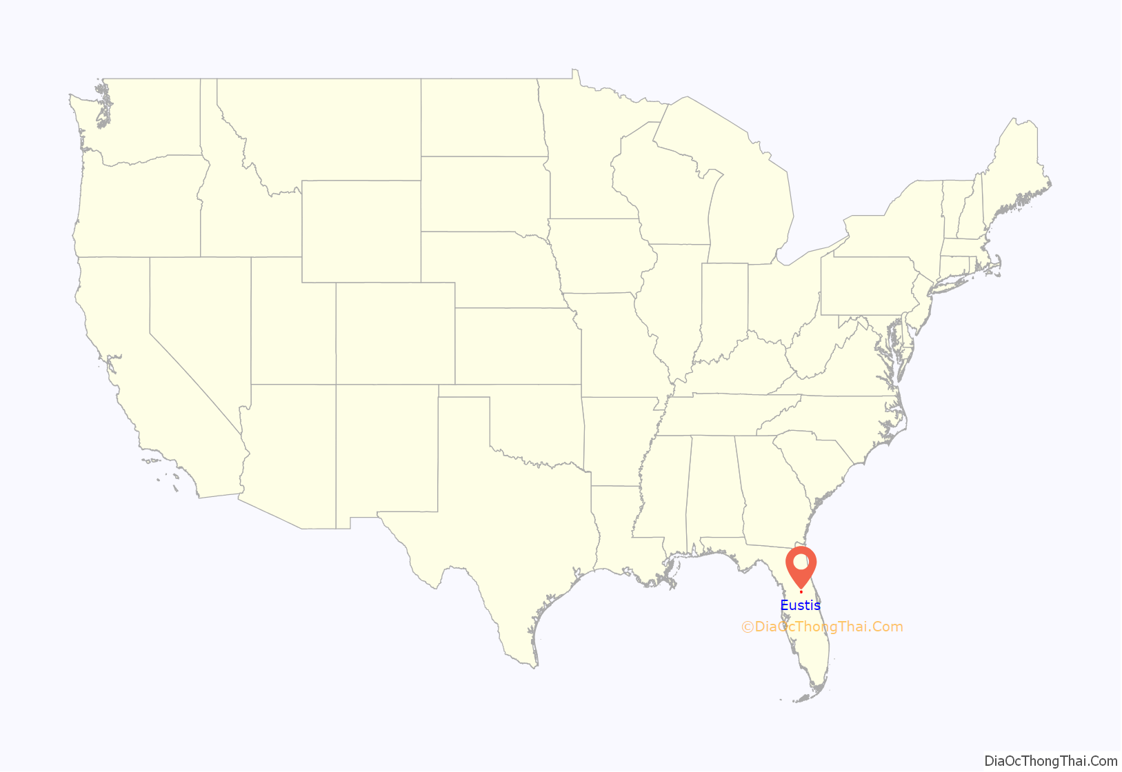
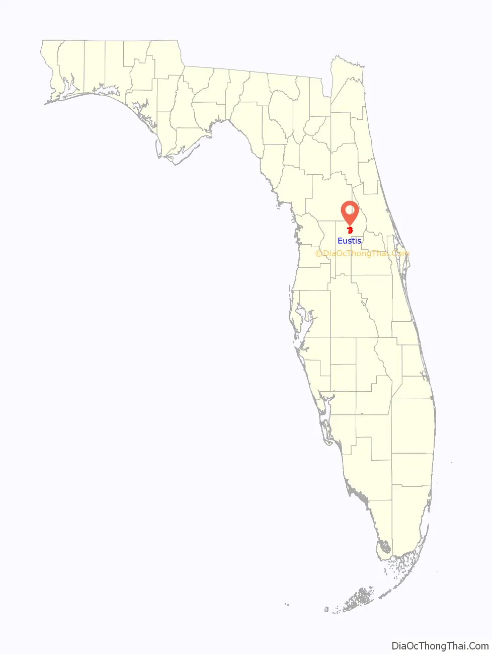
Eustis location map. Where is Eustis city?
History
The people of Eustis, on the east shore of Lake Eustis, took their time deciding on a name. First it was Highlands, then Pendryville, and finally Lake Eustis, itself named about 1825 for General Abraham Eustis. General Eustis, prominent in the Seminole Wars, had skirmished with the Indians on the south shore, near present-day Tavares, Florida. In 1876, A.S. Pendry homesteaded and set out a citrus grove. In 1877 he opened the Ocklawaha Hotel. The post office in the lobby carried the sign “Pendryville”.
Before railroads came in the 1880s, Eustis was a busy port for steamers plying Lakes Harris, Eustis, Dora, and Griffin. In 1883 the “Lake” was dropped and the town became just Eustis. Although the U.S. opened up the area for homesteading in the 1850s, settlement was delayed by the Civil War. Surveying was finally completed in 1875 and settlement began in earnest. Among the earliest settlers was Guilford David “G.D.” Clifford, who established a store and began the first mail service for the new settlement. It was in the Clifford General Store second floor meeting hall that the town’s first churches were formed. Episcopal, Methodist, and Presbyterian groups all organized and held services there before they had their own buildings.
The first homes were those of D.W. Herrick, A.D. Herrick, and Henry Key. In 1881 Clifford and Smith built the first general store in the building later occupied by A.D. and C.D. Miller. A big year was 1878 when the town’s first telegraph line connected Eustis, Leesburg, and Sanford. The railroad arrived in 1880, the first train coming from Astor to Fort Mason, where passengers and freight made lake steamer connections to Leesburg, Helena, Yalaha, Bloomfield, Lane Park, and Tavares. Bertie Clifford was the first baby born before Eustis was incorporated in 1883, and Edith Hutchins the first baby of the newly incorporated town. D.W. Herrick was the first mayor. G.D. Clifford’s dream home in Eustis was designed in 1894 but the Big Freeze of 1894–1895 postponed its completion until 1911. Says Eustis historian Louise Carter, “Even though the freeze brought the town’s economy to a standstill, Mr. Clifford kept his lakefront general store open and extended credit until people could recover.”
According to an 1887 business directory, the Clifford Store on Lake Eustis sold groceries, hardware, building material, fertilizers, stoves, crockery, glassware, hay, and grain. The opera house, on the second floor, was a cultural center of Eustis and a wide swath of Central Florida. The eighteen-room house at the corner of Bay Street and Bates Avenue today houses the Eustis Historical Museum and Preservation Society, and takes visitors back to the gracious Lake County lifestyle of one hundred-odd years ago.
Dr. J. H. Potter, the founding pastor of the First Presbyterian Church, encouraged the development of Eustis Seminary in 1886, under the direction of Professor Byron F. Marsh (for whom Marsh Memorial Park is named). The seminary served students from first through twelfth grades. Its buildings were located near the present site of Eustis High School on Washington Avenue. Struggling financially, the school closed around 1895. By the early 1900s, Eustis was already a winter vacation spot for many. The Ocklawaha Hotel catered to the wealthy. Eustis continues to be a popular winter destination.
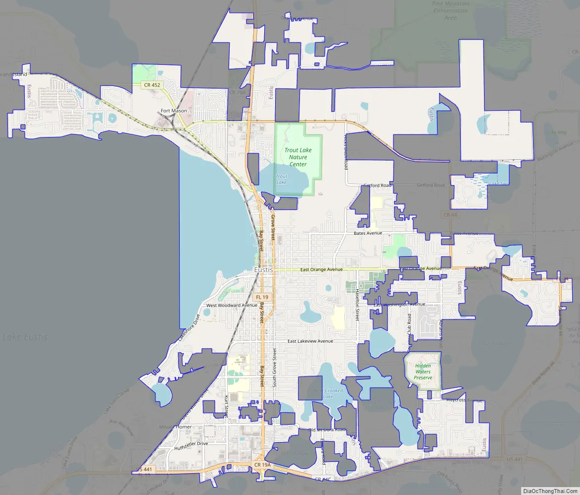
Eustis Road Map
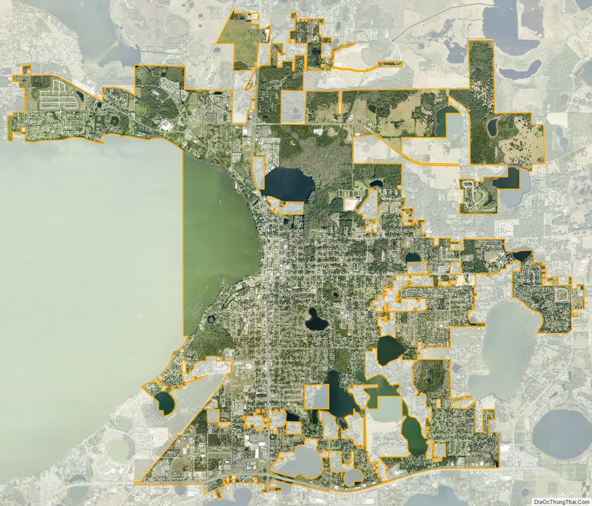
Eustis city Satellite Map
Geography
According to the United States Census Bureau, the city has a total area of 9.6 square miles (25 km), of which 8.4 square miles (22 km) is land and 1.3 square miles (3.4 km) (13.28%) is water. The city limits are defined by Eudora, Abrams, and CR 44 (bypass) on the east, CR44 to the north, US Hwy 441 to the south and Lake Eustis and Florida Hospital Waterman to the west.
See also
Map of Florida State and its subdivision:- Alachua
- Baker
- Bay
- Bradford
- Brevard
- Broward
- Calhoun
- Charlotte
- Citrus
- Clay
- Collier
- Columbia
- Desoto
- Dixie
- Duval
- Escambia
- Flagler
- Franklin
- Gadsden
- Gilchrist
- Glades
- Gulf
- Hamilton
- Hardee
- Hendry
- Hernando
- Highlands
- Hillsborough
- Holmes
- Indian River
- Jackson
- Jefferson
- Lafayette
- Lake
- Lee
- Leon
- Levy
- Liberty
- Madison
- Manatee
- Marion
- Martin
- Miami-Dade
- Monroe
- Nassau
- Okaloosa
- Okeechobee
- Orange
- Osceola
- Palm Beach
- Pasco
- Pinellas
- Polk
- Putnam
- Saint Johns
- Saint Lucie
- Santa Rosa
- Sarasota
- Seminole
- Sumter
- Suwannee
- Taylor
- Union
- Volusia
- Wakulla
- Walton
- Washington
- Alabama
- Alaska
- Arizona
- Arkansas
- California
- Colorado
- Connecticut
- Delaware
- District of Columbia
- Florida
- Georgia
- Hawaii
- Idaho
- Illinois
- Indiana
- Iowa
- Kansas
- Kentucky
- Louisiana
- Maine
- Maryland
- Massachusetts
- Michigan
- Minnesota
- Mississippi
- Missouri
- Montana
- Nebraska
- Nevada
- New Hampshire
- New Jersey
- New Mexico
- New York
- North Carolina
- North Dakota
- Ohio
- Oklahoma
- Oregon
- Pennsylvania
- Rhode Island
- South Carolina
- South Dakota
- Tennessee
- Texas
- Utah
- Vermont
- Virginia
- Washington
- West Virginia
- Wisconsin
- Wyoming


