Fort Myers Beach is a town located on the North end of Estero Island in Lee County, Florida, United States. The town is on the Gulf of Mexico and is accessed from the mainland by a bridge over Estero Bay. The population was 5,582 at the 2020 census. It is part of the Cape Coral-Fort Myers, Florida Metropolitan Statistical Area. It was officially incorporated on December 31, 1995.
| Name: | Fort Myers Beach town |
|---|---|
| LSAD Code: | 43 |
| LSAD Description: | town (suffix) |
| State: | Florida |
| County: | Lee County |
| Incorporated: | December 31, 1995 |
| Elevation: | 3 ft (1 m) |
| Total Area: | 6.17 sq mi (15.98 km²) |
| Land Area: | 2.78 sq mi (7.20 km²) |
| Water Area: | 3.39 sq mi (8.78 km²) |
| Total Population: | 5,582 |
| Population Density: | 2,006.47/sq mi (774.84/km²) |
| ZIP code: | 33931-33932 |
| Area code: | 239 |
| FIPS code: | 1224150 |
| GNISfeature ID: | 0282701 |
| Website: | www.fortmyersbeachfl.gov |
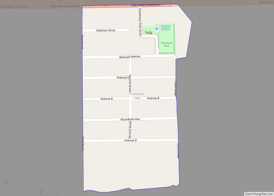
Online Interactive Map
Click on ![]() to view map in "full screen" mode.
to view map in "full screen" mode.
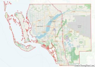
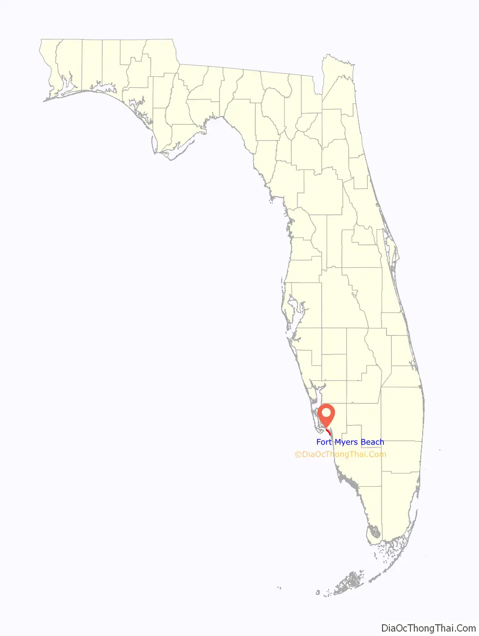
Fort Myers Beach location map. Where is Fort Myers Beach town?

History
Early history
The Calusa Indians first inhabited Estero Island, the island that Fort Myers Beach occupies, 2,000 years ago. The Calusa Indians resisted Spanish colonization attempts successfully including those by Ponce de León in 1513 and 1521. The Calusa met their demise 150 years later due to disease, hostilities, and political and economic upheaval. In the mid to late 1700s, Cuban fishermen then began to settle a small fishing village known as a Ranchero. This effectively displaced the remaining Calusa. In 1845, Florida became the 27th state.
American settlement
The Homestead Act of 1862 initiated American settlements on Estero Island. In 1862, Robert Gilbert received a homestead grant at the end of Connecticut Street, the highest point on Fort Myers Beach. In 1911, William Case developed the first subdivision and cottage rental industry. By 1914, all the property on the island was homesteaded with little industry beyond a hotel, fishing, gardening, and a sawmill operated by the Koreshan Unity (a communal society based on mainland Estero). At this point, Estero Island was named Crescent Beach.
Development on Crescent Beach was slow until the 1920s when Florida gained national attention as a vacation destination. In 1921, a toll bridge was opened connecting the beach to the mainland, followed closely by the construction of two casinos, hotels, a pier and the island’s first canal. The land boom ended with the hurricanes of 1921 and 1926 that challenged the paradise appeal of southwest Florida. Despite entering a depression, Crescent Beach continued to gain small businesses, restaurants, subdivisions, and a school. In the 1950s, Crescent Beach continued to modernize. Many hotels were built including the Rancho del Mar, which boasted the first swimming pool. Additionally, the swing bridge was electrified to facilitate traffic. During this time, “pink gold” or pink shrimp were discovered igniting the shrimping industry and ancillary businesses to support it as the population increased by 50 percent. During this second land boom, numerous civic organizations, churches, local newspapers, weather and US Coast Guard stations, and the Beach Library were added to the island. The library became the first free public library in Lee County and opened in 1955 in a one-room cottage with a single librarian.
Incorporation
Fort Myers Beach has continued to develop to the present day. The island has a mix of year-round and seasonal residents, as well as a vibrant tourism industry. On December 31, 1995, legislation was passed to incorporate the town of Fort Myers Beach.
Hurricane Ian
On September 28, 2022, Hurricane Ian made landfall just north of the town as a high-end Category 4 hurricane, causing catastrophic damage and substantial loss of life in the city from high winds and destructive storm surge, which decimated the majority of homes and businesses along the coastline, including the popular Times Square.
Fort Myers Beach Road Map

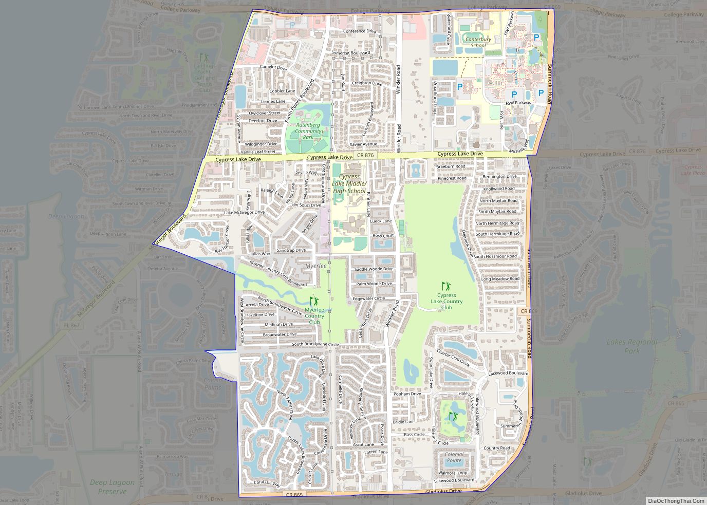
Fort Myers Beach city Satellite Map

Geography
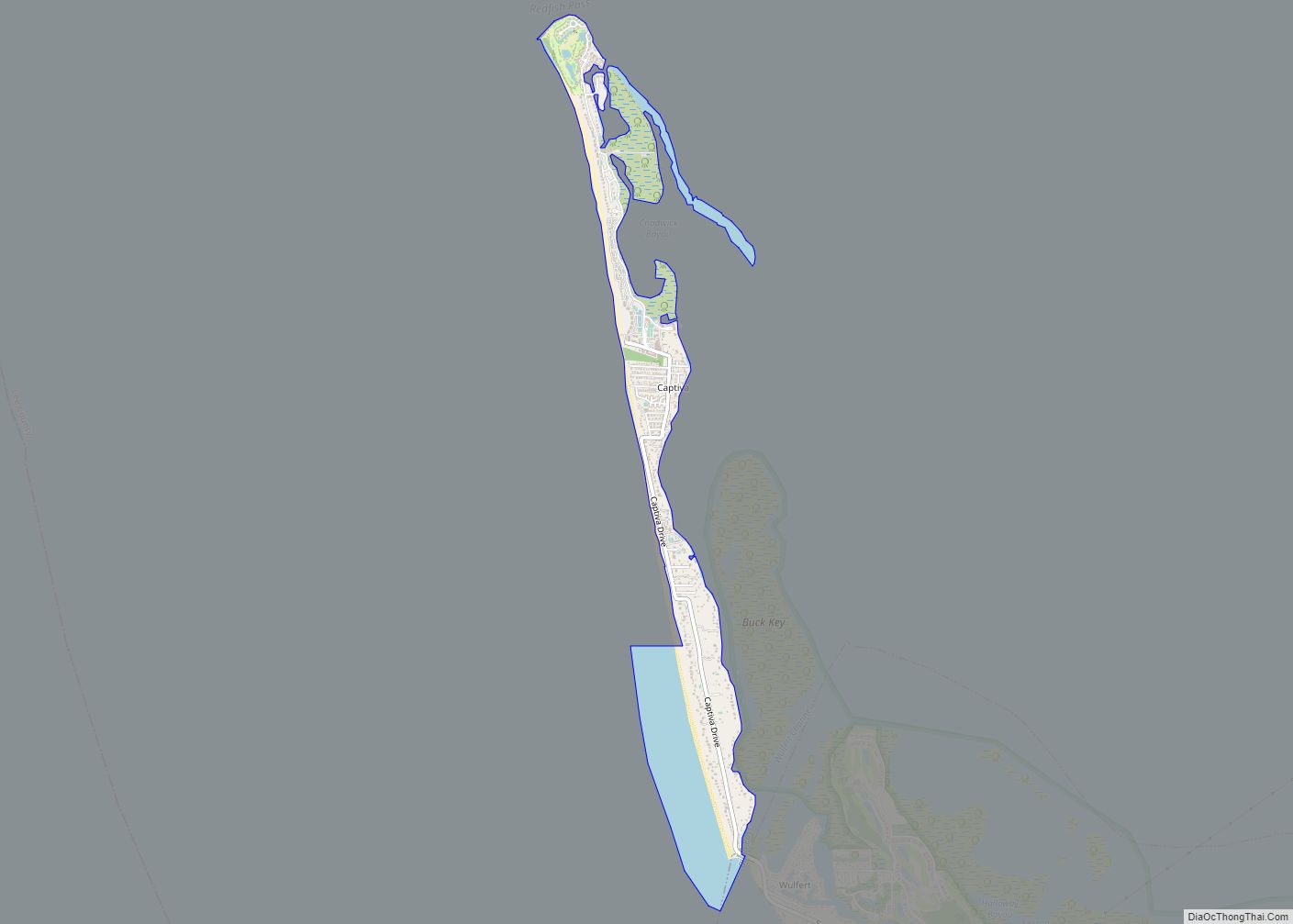
Fort Myers Beach is located at 26°26′19″N 81°55′32″W / 26.43861°N 81.92556°W / 26.43861; -81.92556 (26.438676, –81.925620).
The town is situated on the North end of Estero Island, one of the barrier islands in the Gulf of Mexico off the coast of Fort Myers, Florida.
According to the United States Census Bureau, the town has a total area of 6.2 square miles (16 km), of which 2.9 square miles (7.5 km) is land and 3.3 square miles (8.5 km) (53.41%) is water.
See also
Map of Florida State and its subdivision:- Alachua
- Baker
- Bay
- Bradford
- Brevard
- Broward
- Calhoun
- Charlotte
- Citrus
- Clay
- Collier
- Columbia
- Desoto
- Dixie
- Duval
- Escambia
- Flagler
- Franklin
- Gadsden
- Gilchrist
- Glades
- Gulf
- Hamilton
- Hardee
- Hendry
- Hernando
- Highlands
- Hillsborough
- Holmes
- Indian River
- Jackson
- Jefferson
- Lafayette
- Lake
- Lee
- Leon
- Levy
- Liberty
- Madison
- Manatee
- Marion
- Martin
- Miami-Dade
- Monroe
- Nassau
- Okaloosa
- Okeechobee
- Orange
- Osceola
- Palm Beach
- Pasco
- Pinellas
- Polk
- Putnam
- Saint Johns
- Saint Lucie
- Santa Rosa
- Sarasota
- Seminole
- Sumter
- Suwannee
- Taylor
- Union
- Volusia
- Wakulla
- Walton
- Washington
- Alabama
- Alaska
- Arizona
- Arkansas
- California
- Colorado
- Connecticut
- Delaware
- District of Columbia
- Florida
- Georgia
- Hawaii
- Idaho
- Illinois
- Indiana
- Iowa
- Kansas
- Kentucky
- Louisiana
- Maine
- Maryland
- Massachusetts
- Michigan
- Minnesota
- Mississippi
- Missouri
- Montana
- Nebraska
- Nevada
- New Hampshire
- New Jersey
- New Mexico
- New York
- North Carolina
- North Dakota
- Ohio
- Oklahoma
- Oregon
- Pennsylvania
- Rhode Island
- South Carolina
- South Dakota
- Tennessee
- Texas
- Utah
- Vermont
- Virginia
- Washington
- West Virginia
- Wisconsin
- Wyoming