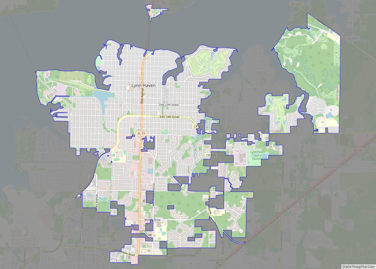
Lynn Haven is a city in Bay County, Florida, United States, north of Panama City. The population was 18,493 at the 2010 census. Like many communities in Bay County, the city was severely damaged by Category 5 Hurricane Michael on October 10, 2018.
| Name: | Lynn Haven city |
|---|---|
| LSAD Code: | 25 |
| LSAD Description: | city (suffix) |
| State: | Florida |
| County: | Bay County |
| Elevation: | 13 ft (4 m) |
| Total Area: | 10.53 sq mi (27.27 km²) |
| Land Area: | 10.45 sq mi (27.07 km²) |
| Water Area: | 0.07 sq mi (0.19 km²) |
| Total Population: | 18,695 |
| Population Density: | 1,788.48/sq mi (690.57/km²) |
| ZIP code: | 32444 |
| Area code: | 850 |
| FIPS code: | 1241825 |
| GNISfeature ID: | 0286227 |
| Website: | www.cityoflynnhaven.com |
Online Interactive Map
Click on ![]() to view map in "full screen" mode.
to view map in "full screen" mode.
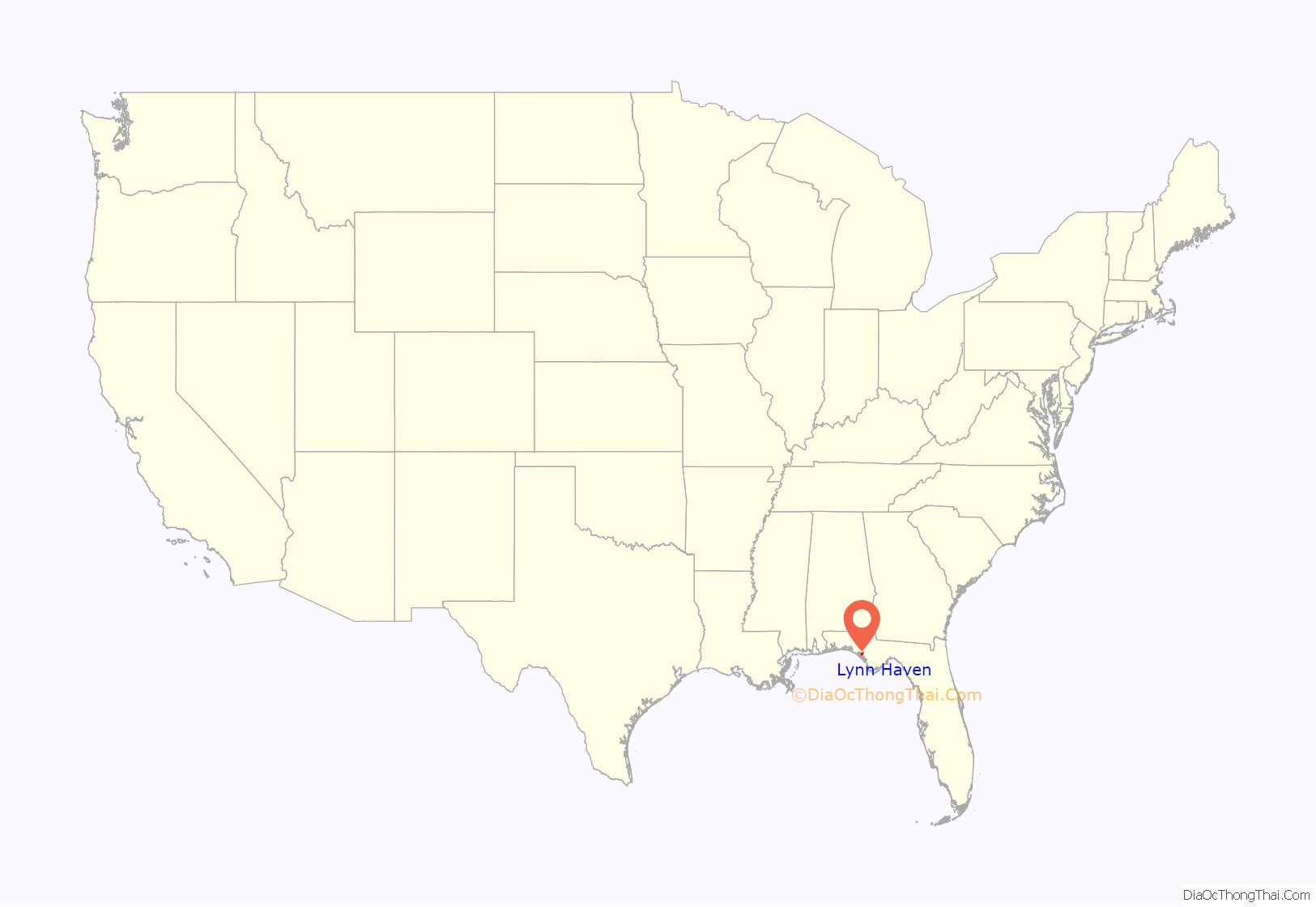
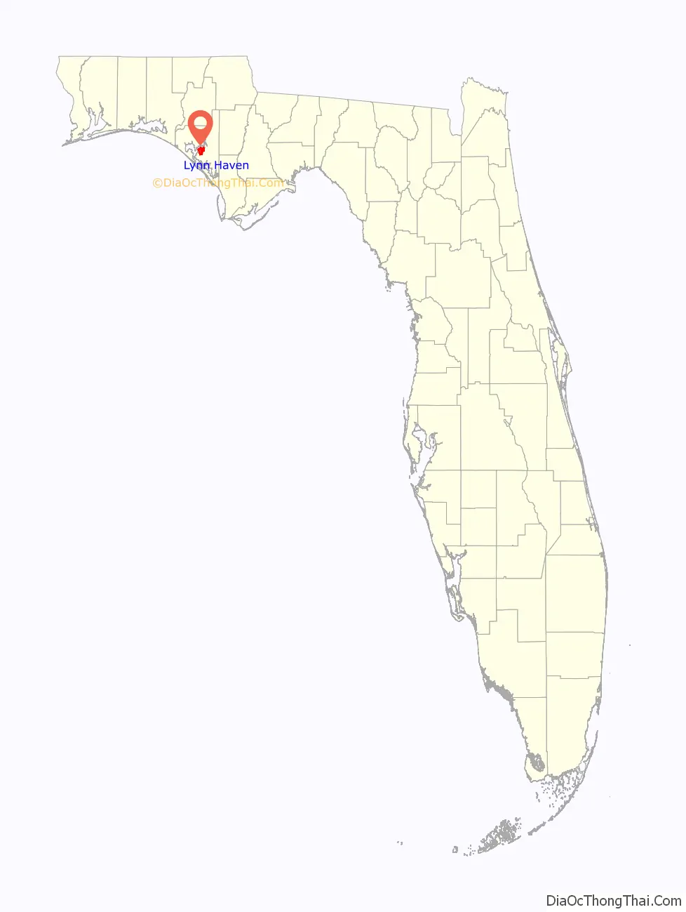
Lynn Haven location map. Where is Lynn Haven city?
History
Lynn Haven was founded in 1911 by Union veterans from the American Civil War. The town was named after W. H. Lynn, a primary stockholder of the St. Andrews Bay Development Company, the corporation that owned and developed the land on which Lynn Haven grew.
On October 10, 2018, Hurricane Michael made landfall near Lynn Haven. The 3rd strongest hurricane to ever make landfall in the contiguous United States was the first category 5 hurricane to strike the United States since Hurricane Andrew in 1992. Hurricane Michael displaced thousands of Lynn Haven residents.
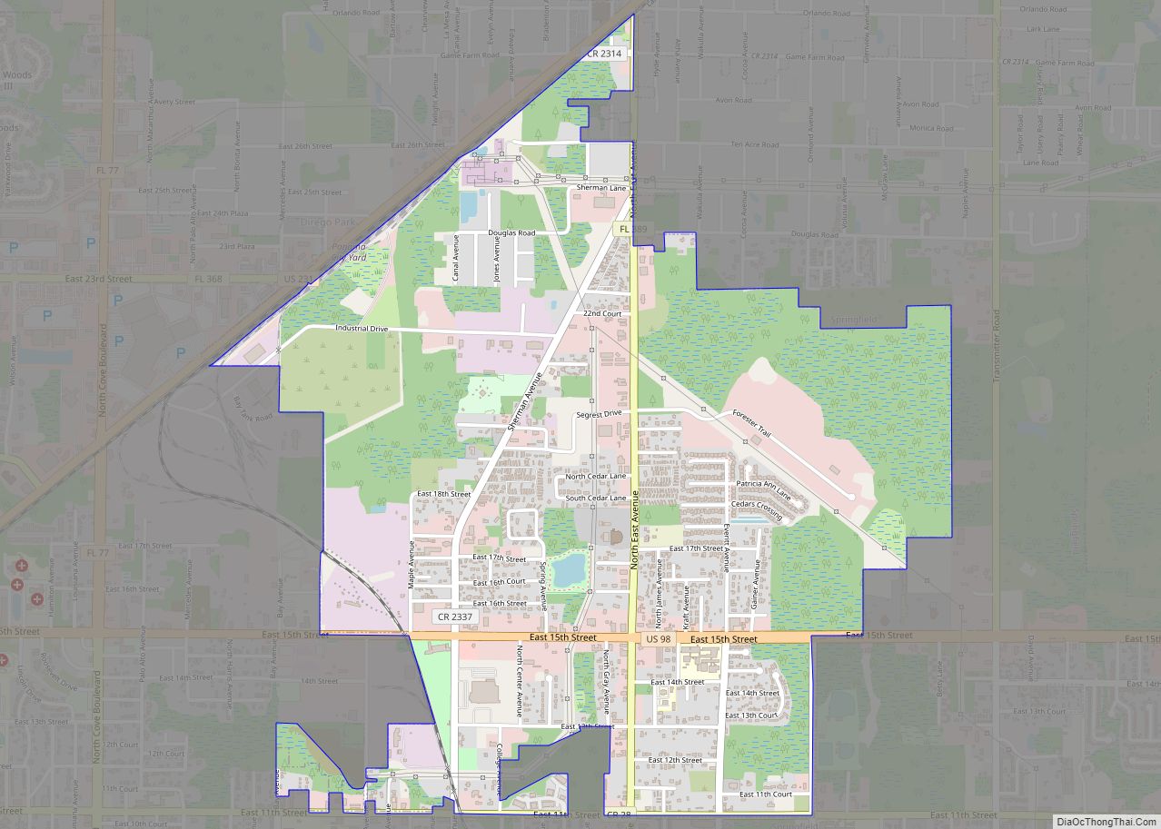
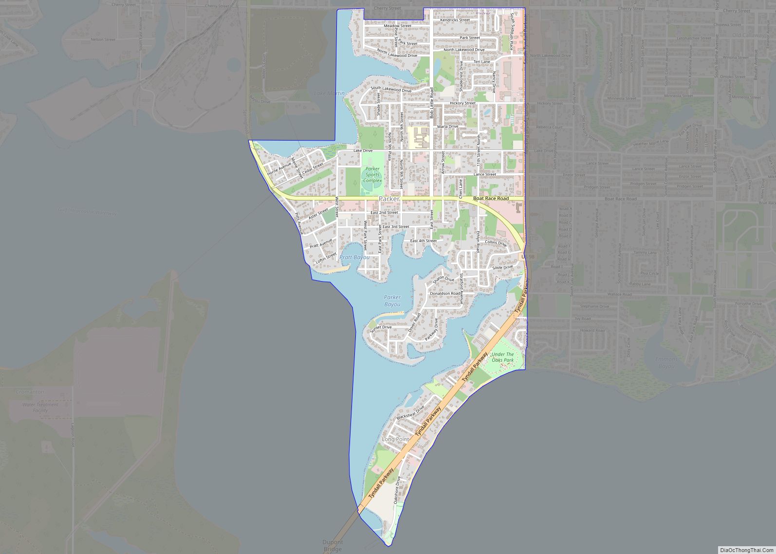
Lynn Haven Road Map
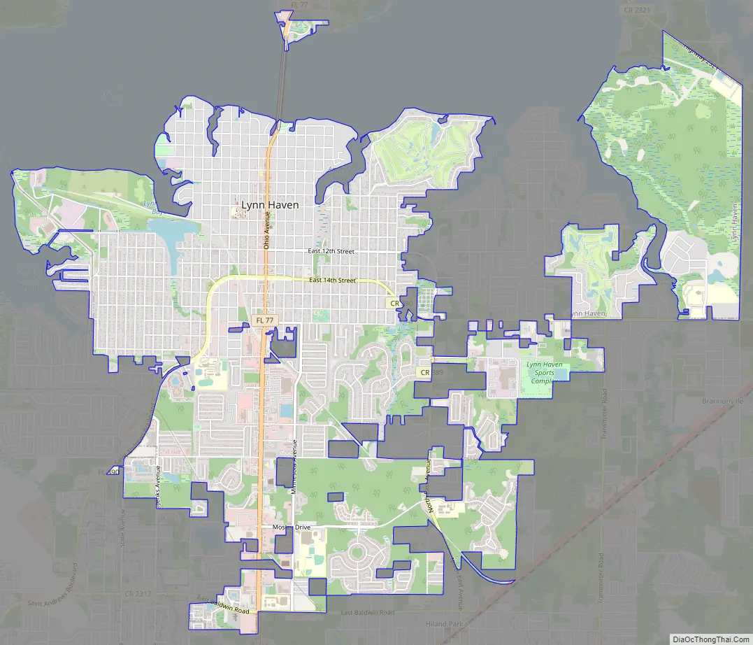
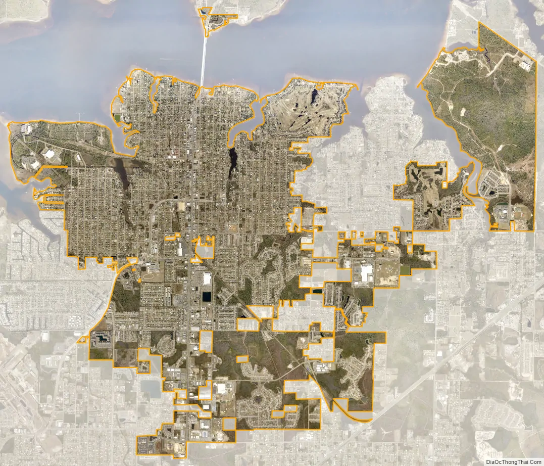
Lynn Haven city Satellite Map
Geography
Lynn Haven is located at 30°14′23″N 85°38′53″W / 30.239849°N 85.648126°W / 30.239849; -85.648126.
The city is located north of Panama City along Florida State Road 77, which is the main route through the city. FL-77 leads north 41 mi (66 km) to Chipley along Interstate 10 and south 6 mi (10 km) to the center of Panama City.
According to the United States Census Bureau, the city has a total area of 11.8 square miles (30.5 km), of which 10.4 square miles (26.9 km) is land, and 1.4 square miles (3.6 km) (11.90%) is water.
See also
Map of Florida State and its subdivision:- Alachua
- Baker
- Bay
- Bradford
- Brevard
- Broward
- Calhoun
- Charlotte
- Citrus
- Clay
- Collier
- Columbia
- Desoto
- Dixie
- Duval
- Escambia
- Flagler
- Franklin
- Gadsden
- Gilchrist
- Glades
- Gulf
- Hamilton
- Hardee
- Hendry
- Hernando
- Highlands
- Hillsborough
- Holmes
- Indian River
- Jackson
- Jefferson
- Lafayette
- Lake
- Lee
- Leon
- Levy
- Liberty
- Madison
- Manatee
- Marion
- Martin
- Miami-Dade
- Monroe
- Nassau
- Okaloosa
- Okeechobee
- Orange
- Osceola
- Palm Beach
- Pasco
- Pinellas
- Polk
- Putnam
- Saint Johns
- Saint Lucie
- Santa Rosa
- Sarasota
- Seminole
- Sumter
- Suwannee
- Taylor
- Union
- Volusia
- Wakulla
- Walton
- Washington
- Alabama
- Alaska
- Arizona
- Arkansas
- California
- Colorado
- Connecticut
- Delaware
- District of Columbia
- Florida
- Georgia
- Hawaii
- Idaho
- Illinois
- Indiana
- Iowa
- Kansas
- Kentucky
- Louisiana
- Maine
- Maryland
- Massachusetts
- Michigan
- Minnesota
- Mississippi
- Missouri
- Montana
- Nebraska
- Nevada
- New Hampshire
- New Jersey
- New Mexico
- New York
- North Carolina
- North Dakota
- Ohio
- Oklahoma
- Oregon
- Pennsylvania
- Rhode Island
- South Carolina
- South Dakota
- Tennessee
- Texas
- Utah
- Vermont
- Virginia
- Washington
- West Virginia
- Wisconsin
- Wyoming