Mexico Beach is a city in Bay County, Florida, United States. It is located 25 miles (40 km) southeast of Panama City. The population was 1,060 at the 2020 census. The community was extensively damaged by Hurricane Michael on October 10, 2018. The Federal Emergency Management Agency (FEMA) declared the community “wiped out” in the aftermath of the hurricane’s devastating impact.
| Name: | Mexico Beach city |
|---|---|
| LSAD Code: | 25 |
| LSAD Description: | city (suffix) |
| State: | Florida |
| County: | Bay County |
| Elevation: | 13 ft (4 m) |
| Total Area: | 2.34 sq mi (6.06 km²) |
| Land Area: | 2.28 sq mi (5.89 km²) |
| Water Area: | 0.06 sq mi (0.16 km²) |
| Total Population: | 1,060 |
| Population Density: | 402.46/sq mi (155.39/km²) |
| ZIP code: | 32410 |
| Area code: | 850 |
| FIPS code: | 1244300 |
| Website: | mexicobeachgov.com |
Online Interactive Map
Click on ![]() to view map in "full screen" mode.
to view map in "full screen" mode.
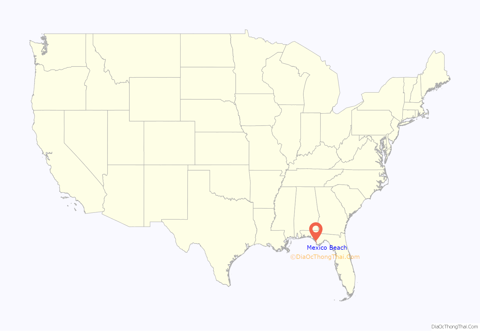
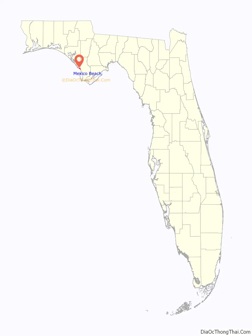
Mexico Beach location map. Where is Mexico Beach city?
History
Mexico Beach was incorporated in 1966. Before Hurricane Michael, “the town was “old Florida,” … a collection of 50-year-old bungalows and newer vacation homes on stilts,” where tourists walked on white sand beaches.
On November 22, 1985, Hurricane Kate’s eye passed over Mexico Beach. Category 2 winds and tides destroyed beachfront homes and businesses.
Hurricane Michael
Hurricane Michael made landfall near Mexico Beach on October 10, 2018, just before 1 p.m. local time with maximum sustained winds of 160 miles per hour (260 km/h), the first Category 5 hurricane to make landfall in the United States since Hurricane Andrew in 1992. Michael made history as the third strongest (by pressure) and fourth strongest (by wind speed) landfalling storm in the continental United States. The storm caused extensive damage to the community, and to the nearby Tyndall Air Force Base. Nearly all homes were totally destroyed. Brock Long, the FEMA administrator, told CNN that Mexico Beach was “wiped out” and referred to the community as “ground zero”. The elementary school and city hall were among the buildings devastated; the pier washed away, and the water tower was knocked down.
A report by the State indicated that roughly 285 people in Mexico Beach had declined to evacuate the area, although some of those may have left before the peak of the storm. Three people from Mexico Beach were listed among the deaths due to the hurricane. At that time, Mayor Al Cathey told residents it might be months before electricity, water, and plumbing were restored.
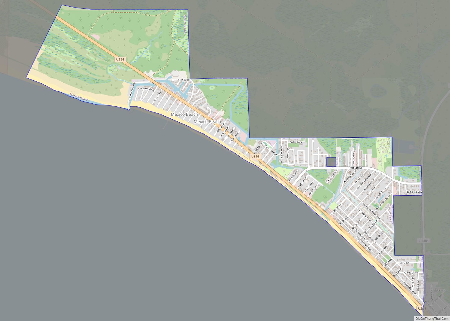
Mexico Beach Road Map
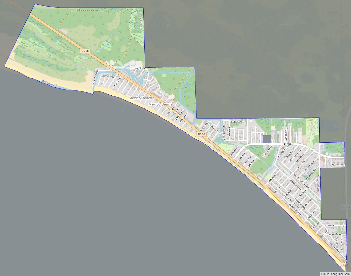
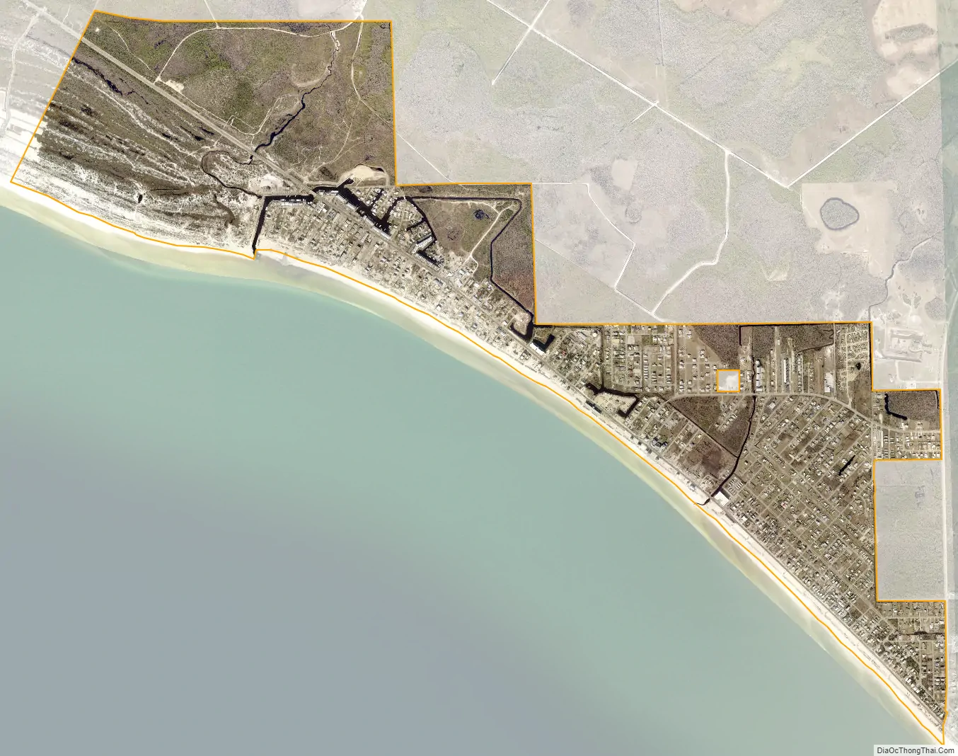
Mexico Beach city Satellite Map
Geography
Mexico Beach is located at 29°56′29″N 85°24′23″W / 29.941336°N 85.406361°W / 29.941336; -85.406361. According to the United States Census Bureau, the city has a total area of 1.8 square miles (4.7 km), of which 1.8 square miles (4.6 km) is land, and 0.04 square miles (0.1 km), or 2.84%, is water.
Mexico Beach is located in the Florida Panhandle.
See also
Map of Florida State and its subdivision:- Alachua
- Baker
- Bay
- Bradford
- Brevard
- Broward
- Calhoun
- Charlotte
- Citrus
- Clay
- Collier
- Columbia
- Desoto
- Dixie
- Duval
- Escambia
- Flagler
- Franklin
- Gadsden
- Gilchrist
- Glades
- Gulf
- Hamilton
- Hardee
- Hendry
- Hernando
- Highlands
- Hillsborough
- Holmes
- Indian River
- Jackson
- Jefferson
- Lafayette
- Lake
- Lee
- Leon
- Levy
- Liberty
- Madison
- Manatee
- Marion
- Martin
- Miami-Dade
- Monroe
- Nassau
- Okaloosa
- Okeechobee
- Orange
- Osceola
- Palm Beach
- Pasco
- Pinellas
- Polk
- Putnam
- Saint Johns
- Saint Lucie
- Santa Rosa
- Sarasota
- Seminole
- Sumter
- Suwannee
- Taylor
- Union
- Volusia
- Wakulla
- Walton
- Washington
- Alabama
- Alaska
- Arizona
- Arkansas
- California
- Colorado
- Connecticut
- Delaware
- District of Columbia
- Florida
- Georgia
- Hawaii
- Idaho
- Illinois
- Indiana
- Iowa
- Kansas
- Kentucky
- Louisiana
- Maine
- Maryland
- Massachusetts
- Michigan
- Minnesota
- Mississippi
- Missouri
- Montana
- Nebraska
- Nevada
- New Hampshire
- New Jersey
- New Mexico
- New York
- North Carolina
- North Dakota
- Ohio
- Oklahoma
- Oregon
- Pennsylvania
- Rhode Island
- South Carolina
- South Dakota
- Tennessee
- Texas
- Utah
- Vermont
- Virginia
- Washington
- West Virginia
- Wisconsin
- Wyoming