Memphis is an unincorporated community and census-designated place (CDP) in Manatee County, Florida, United States. The population was 9,024 as of the 2020 census, up from 7,848 in 2010. It is part of the Bradenton–Sarasota–Venice Metropolitan Statistical Area.
| Name: | Memphis CDP |
|---|---|
| LSAD Code: | 57 |
| LSAD Description: | CDP (suffix) |
| State: | Florida |
| County: | Manatee County |
| Elevation: | 20 ft (6 m) |
| Total Area: | 3.67 sq mi (9.52 km²) |
| Land Area: | 3.26 sq mi (8.44 km²) |
| Water Area: | 0.41 sq mi (1.08 km²) |
| Total Population: | 9,024 |
| Population Density: | 2,768.10/sq mi (1,068.88/km²) |
| ZIP code: | 34221 (Palmetto) |
| Area code: | 941 |
| FIPS code: | 1244175 |
| GNISfeature ID: | 0286711 |
Online Interactive Map
Click on ![]() to view map in "full screen" mode.
to view map in "full screen" mode.
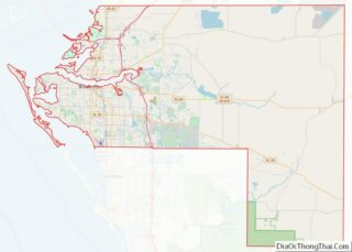
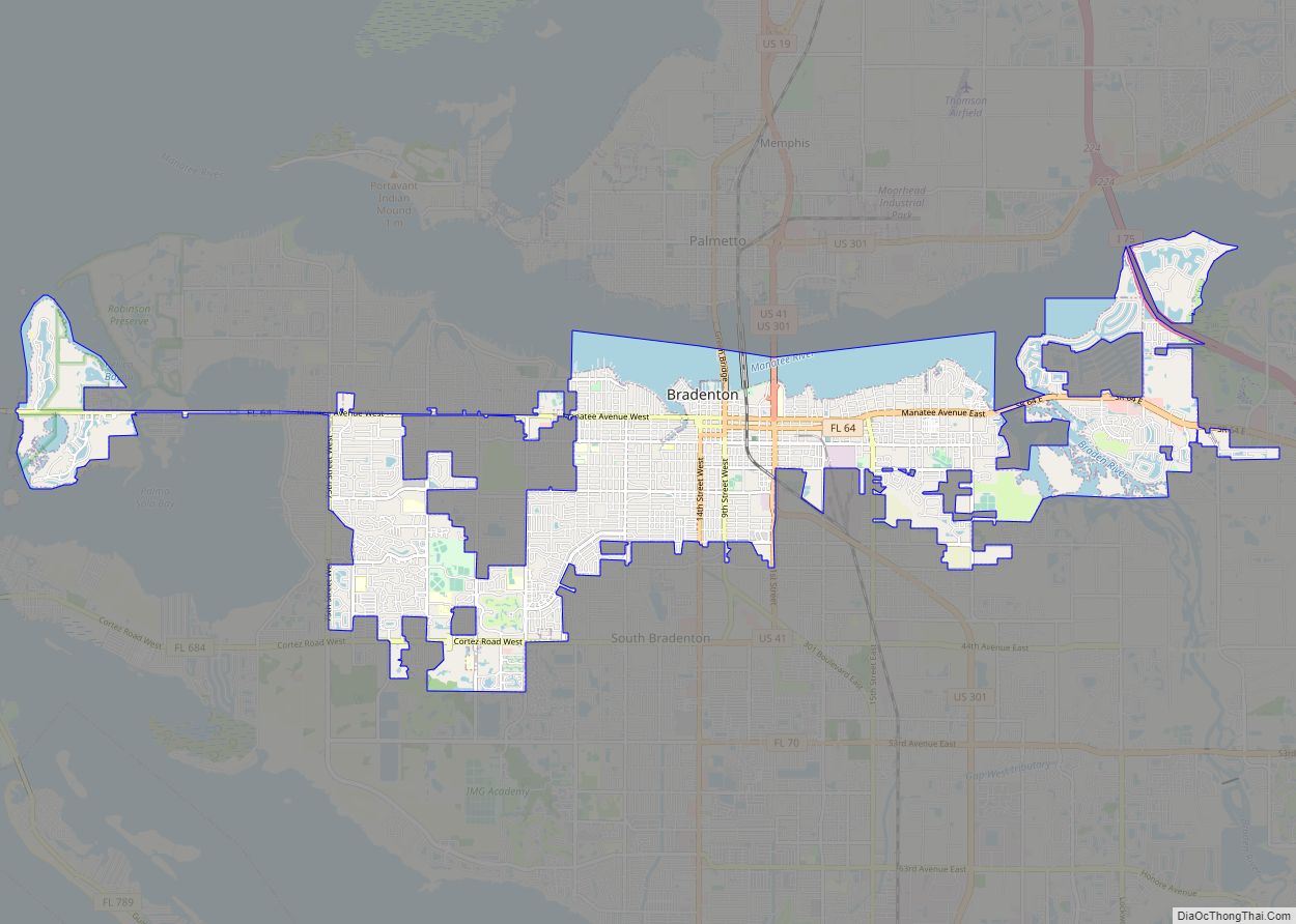
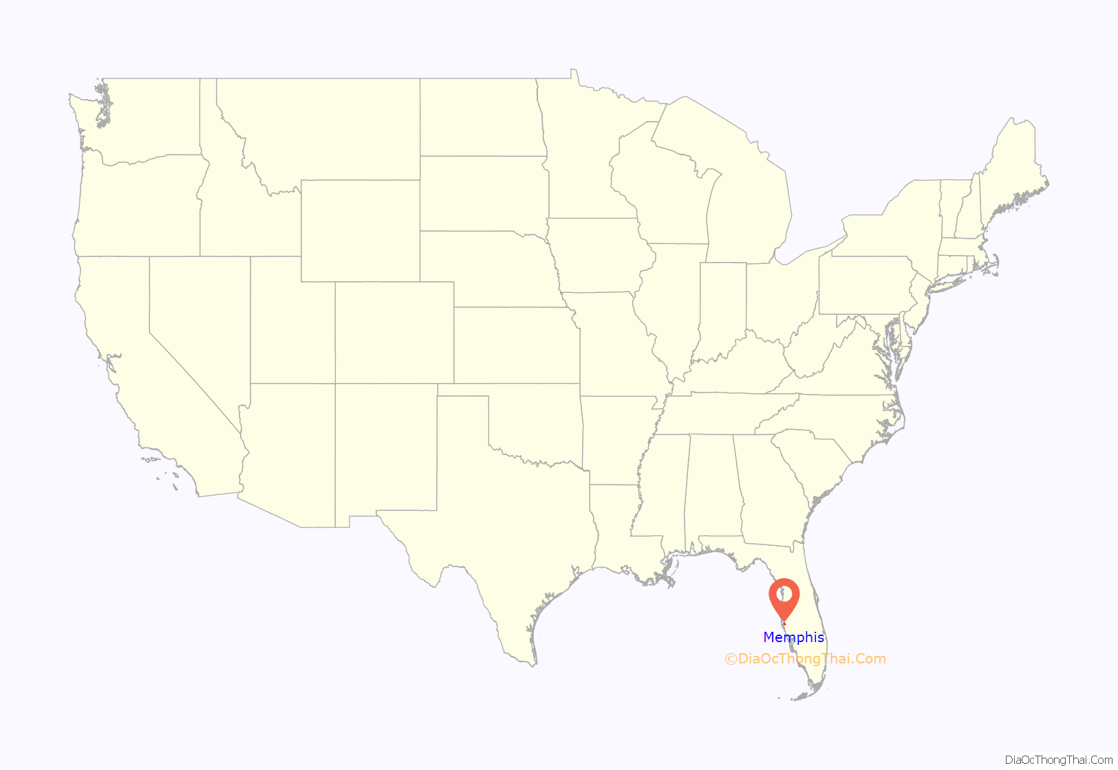
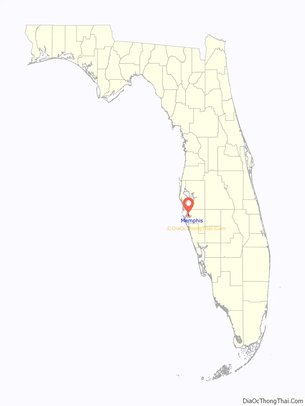
Memphis location map. Where is Memphis CDP?
History
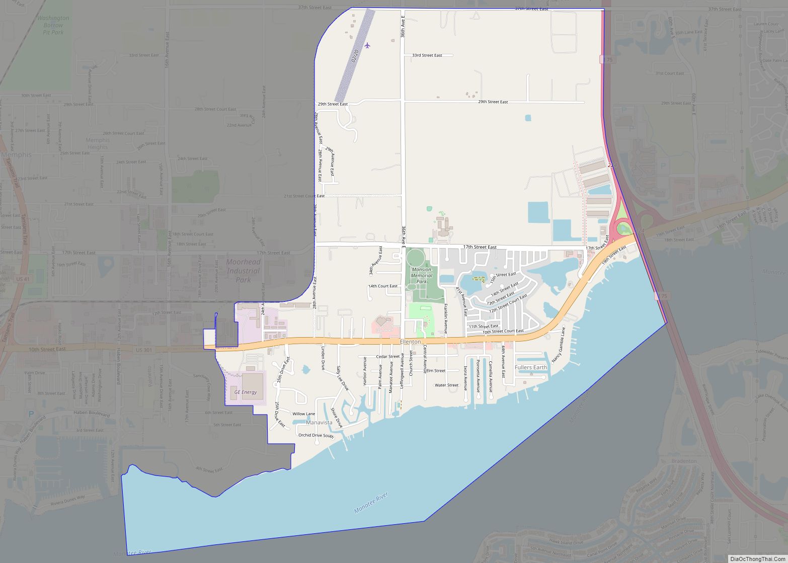
The community can trace its roots back to the 1880s, when it was planned as an 80-acre subdivision, adjacent to the city of Palmetto. Tennessee-born Robert Willis (1855-1933) originally owned the land, but eventually it was sold to I.E. Barwick (1854-1924) who subdivided it. The community’s traditional borders roughly lie on the west side of 16th Avenue East and just on the west side of U.S. 41, and between 17th and 25th Streets East. An 1897 Manatee County directory mentions a handful of establishments, from a clothing store to a crate mill and a bakery then under construction.
Over time, the area eventually became a predominantly African American community in the segregation era. The Old Memphis cemetery is the resting place of over 600 individuals. Many of the graves are of these early African American settlers, some of whom were freed slaves. The cemetery lies north of the community and was closed by the 1970s. Early residents included the Reverend Daniel and Isabel Baity. Reverend Baity became the first minister of the first African American church in Sarasota. The identity of the close-knit community was interrupted with the construction of U.S. 41 in the 1960s. In more recent years, the old cemetery fell into disrepair and was cleaned up on several occasions. An historical marker was erected in 2013 at the entrance of the Old Memphis cemetery.
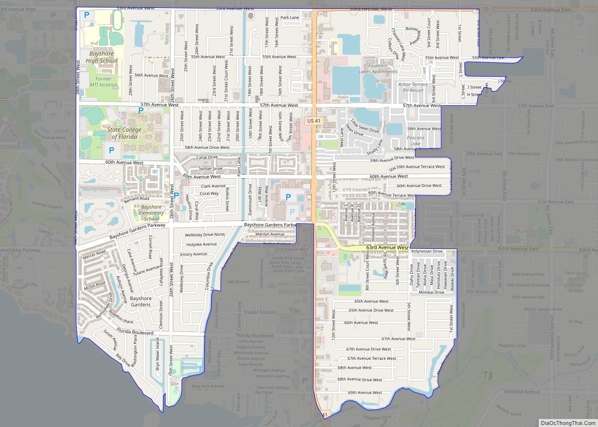
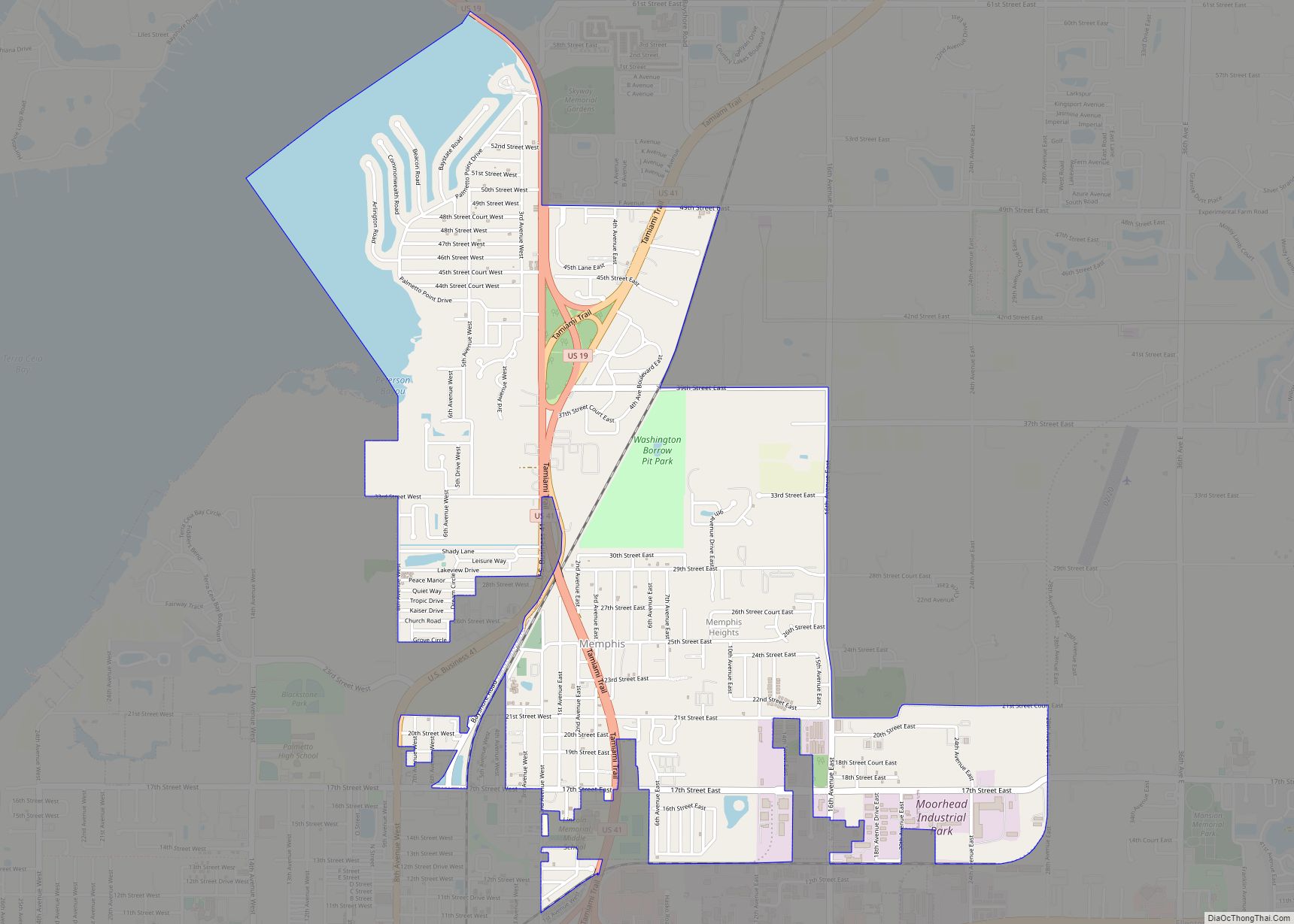
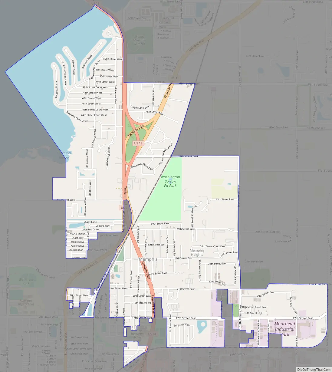
Memphis Road Map
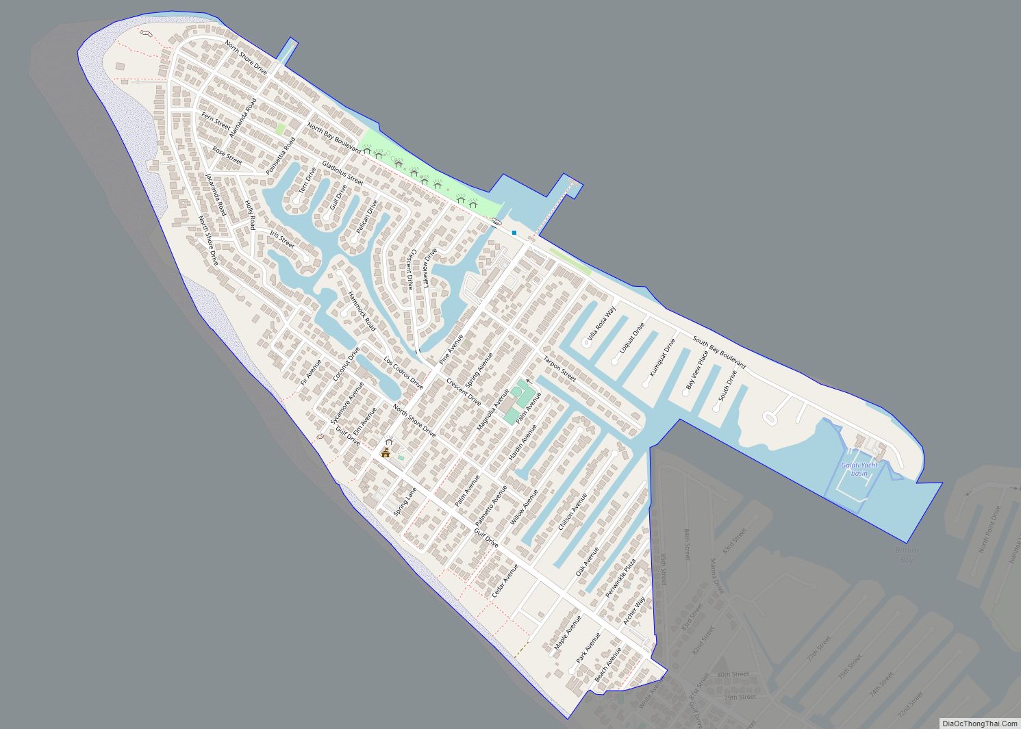
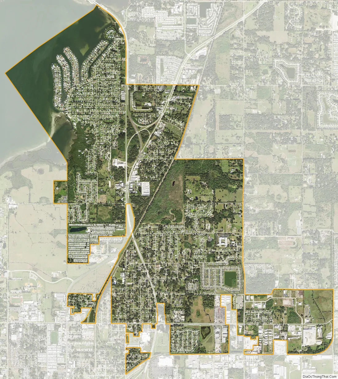
Memphis city Satellite Map
Geography
Memphis is located in northern Manatee County at 27°32′23″N 82°33′47″W / 27.53972°N 82.56306°W / 27.53972; -82.56306 (27.539798, -82.562966). It is bordered to the south and west by the city of Palmetto and to the northwest by Terra Ceia Bay, an arm of Tampa Bay.
According to the United States Census Bureau, the CDP has a total area of 3.7 square miles (9.6 km), of which 3.3 square miles (8.5 km) are land and 0.4 square miles (1.0 km), or 11.29%, are water. The main road through the community is US Route 41, also known as the Tamiami Trail, which leads south 4 miles (6 km) to Bradenton, the county seat, and north 38 miles (61 km) to Tampa. US Route 19 has its southern terminus at US 41 in Memphis. US 19 leads northwest via the Sunshine Skyway Bridge over Tampa Bay to St. Petersburg, 21 miles (34 km) away.
See also
Map of Florida State and its subdivision:- Alachua
- Baker
- Bay
- Bradford
- Brevard
- Broward
- Calhoun
- Charlotte
- Citrus
- Clay
- Collier
- Columbia
- Desoto
- Dixie
- Duval
- Escambia
- Flagler
- Franklin
- Gadsden
- Gilchrist
- Glades
- Gulf
- Hamilton
- Hardee
- Hendry
- Hernando
- Highlands
- Hillsborough
- Holmes
- Indian River
- Jackson
- Jefferson
- Lafayette
- Lake
- Lee
- Leon
- Levy
- Liberty
- Madison
- Manatee
- Marion
- Martin
- Miami-Dade
- Monroe
- Nassau
- Okaloosa
- Okeechobee
- Orange
- Osceola
- Palm Beach
- Pasco
- Pinellas
- Polk
- Putnam
- Saint Johns
- Saint Lucie
- Santa Rosa
- Sarasota
- Seminole
- Sumter
- Suwannee
- Taylor
- Union
- Volusia
- Wakulla
- Walton
- Washington
- Alabama
- Alaska
- Arizona
- Arkansas
- California
- Colorado
- Connecticut
- Delaware
- District of Columbia
- Florida
- Georgia
- Hawaii
- Idaho
- Illinois
- Indiana
- Iowa
- Kansas
- Kentucky
- Louisiana
- Maine
- Maryland
- Massachusetts
- Michigan
- Minnesota
- Mississippi
- Missouri
- Montana
- Nebraska
- Nevada
- New Hampshire
- New Jersey
- New Mexico
- New York
- North Carolina
- North Dakota
- Ohio
- Oklahoma
- Oregon
- Pennsylvania
- Rhode Island
- South Carolina
- South Dakota
- Tennessee
- Texas
- Utah
- Vermont
- Virginia
- Washington
- West Virginia
- Wisconsin
- Wyoming