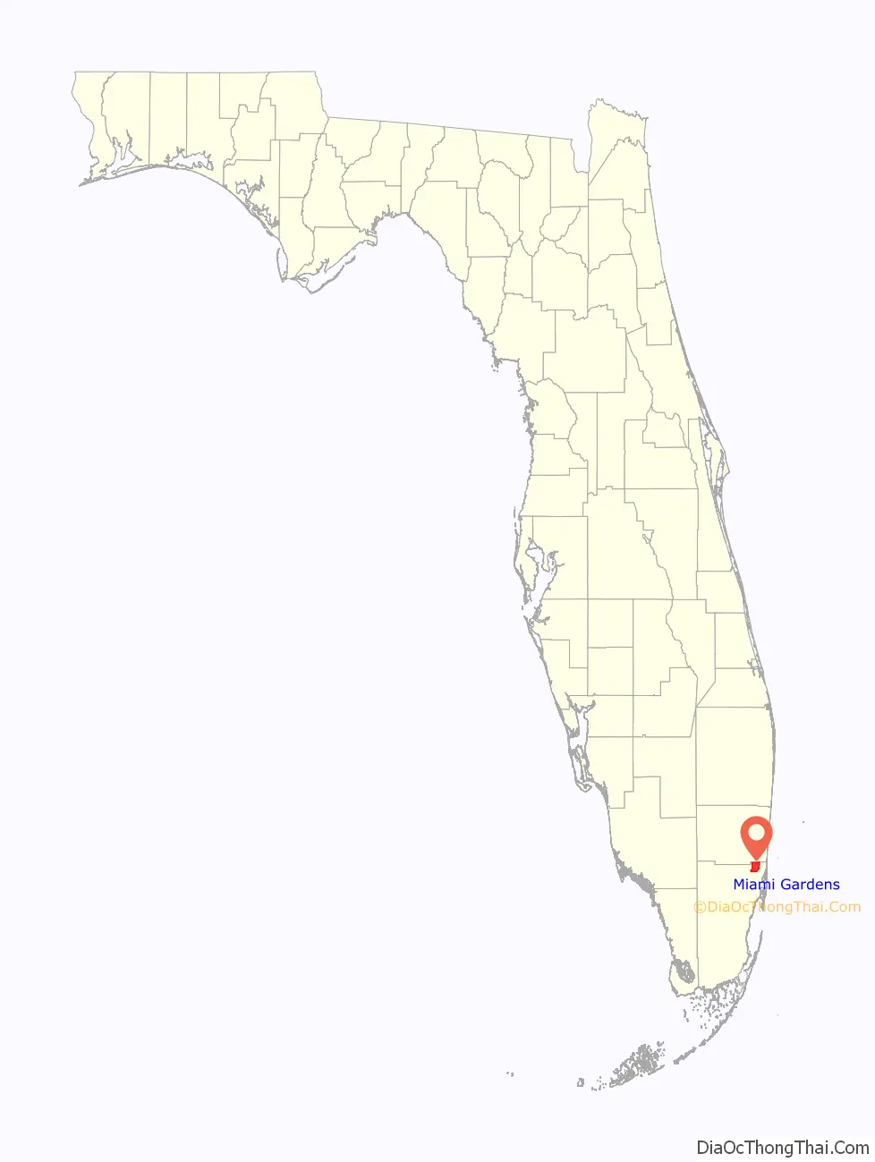
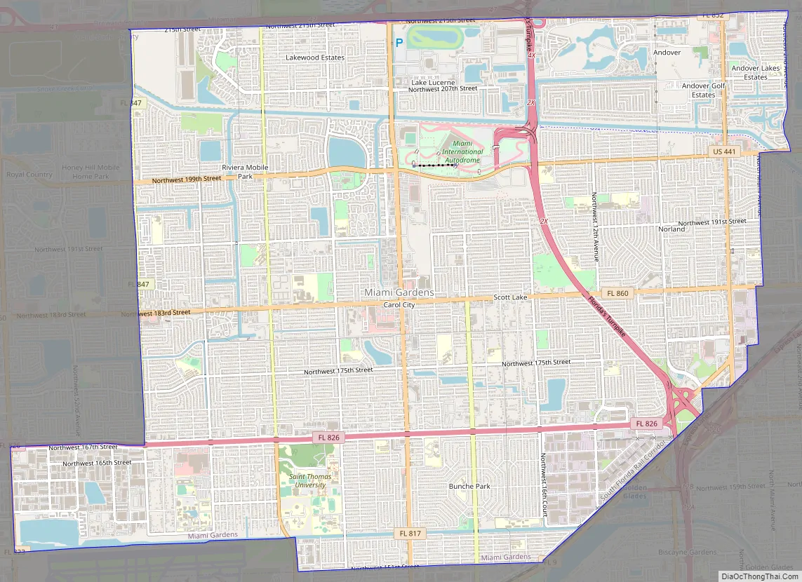
Miami Gardens is a city in north-central Miami-Dade County, Florida, United States. It is located 16 miles (26 km) north of Downtown Miami with city boundaries that stretch from I-95 and Northeast 2nd Avenue to its east to Northwest 47th and Northwest 57th Avenues to its west, and from the Broward County line to its north to 151st Street to its south. The city’s name originated from Florida State Road 860, a major roadway through the area also known as Miami Gardens Drive.
Miami Gardens had a population of 111,640 as of 2020. It is Florida’s most populous city with a majority African American population and also home to the largest percentage of African Americans (66.97 percent) of any city in Florida, according to the U.S. Census Bureau. It is a principal city within the Miami metropolitan area, the nation’s ninth largest and world’s 65th largest metropolitan area with a population of 6.158 million people as of 2020.
Miami Gardens is the home of Hard Rock Stadium, a 64,767 capacity multi-purpose stadium that serves as the home field for both the Miami Dolphins of the National Football League and the Miami Hurricanes, the University of Miami’s NCAA Division I college football team, which has won five national championships since 1983.
| Name: | Miami Gardens city |
|---|---|
| LSAD Code: | 25 |
| LSAD Description: | city (suffix) |
| State: | Florida |
| County: | Miami-Dade County |
| Incorporated: | May 13, 2003 |
| Elevation: | 7 ft (2 m) |
| Land Area: | 18.23 sq mi (47.21 km²) |
| Water Area: | 0.77 sq mi (2.00 km²) |
| Population Density: | 5,900/sq mi (2,300/km²) |
| Area code: | 305, 786 |
| FIPS code: | 1245060 |
| GNISfeature ID: | 1989951 |
| Website: | miamigardens-fl.gov |
Online Interactive Map
Click on ![]() to view map in "full screen" mode.
to view map in "full screen" mode.
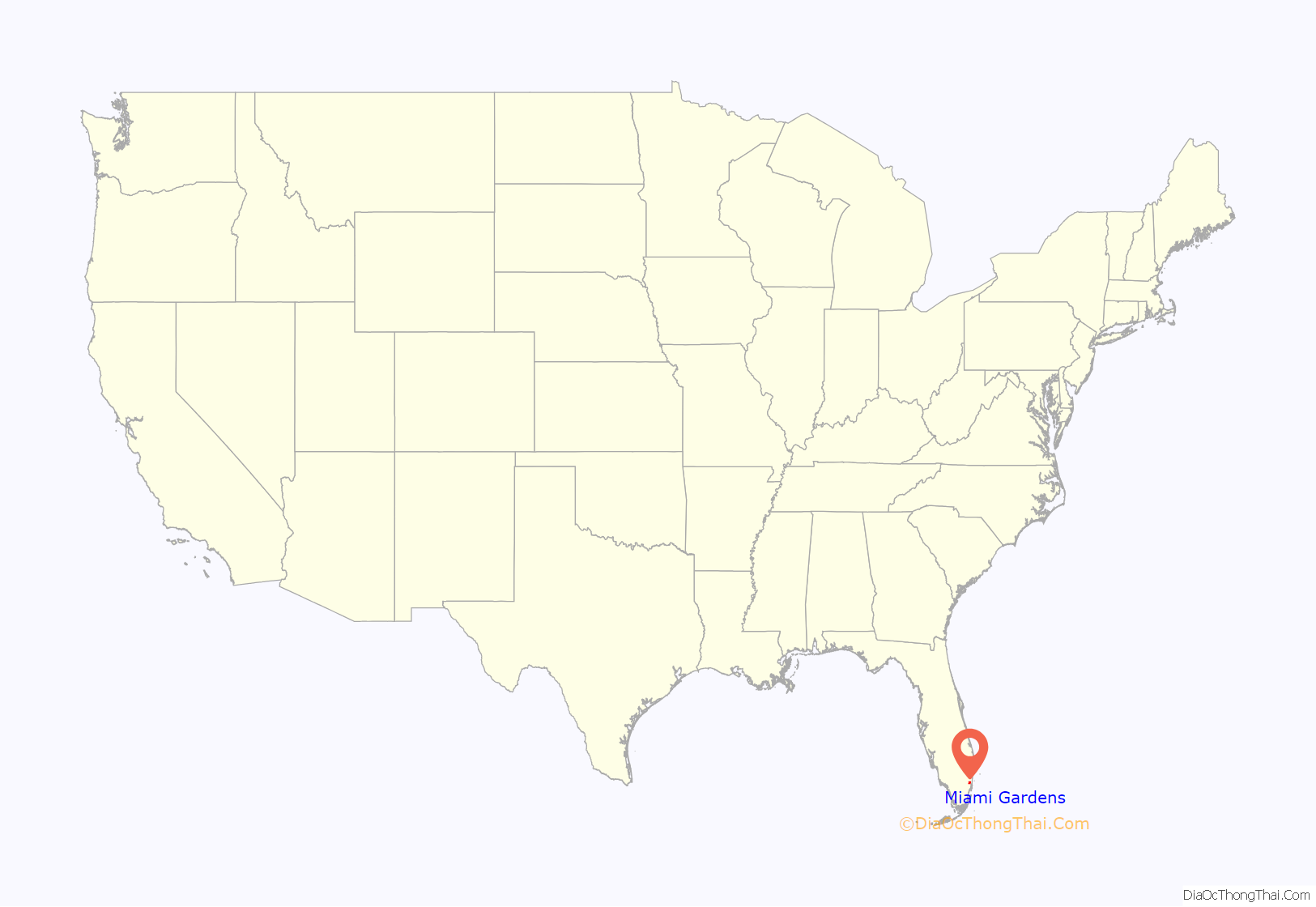
Miami Gardens location map. Where is Miami Gardens city?
History
In the wake of the construction of I-95 in the late 1960s, many middle- and upper-income African American and West Indian American families migrated from Miami neighborhoods like Liberty City to what became Miami Gardens (also called Carol City, Norland or Norwood) as race-based covenants were outlawed with the Fair Housing Act, and mostly lower income blacks moved into the Liberty City and Little Haiti neighborhoods surrounding Liberty Square and Edison Courts.
Miami Gardens was incorporated on May 13, 2003. The city’s neighborhoods of Andover, Bunche Park, Carol City, Lake Lucerne, Norland, Opa-locka North, and Scott Lake were previously unincorporated areas within Miami-Dade County.
In 2007, Mayor Shirley Gibson said that the city would no longer allow any low-income housing developments; many residents blamed the developments for spreading crime and recreational drugs throughout the city. Around that time, the city’s tax revenues dropped to the third-lowest in Miami-Dade County.
In 2012, Oliver Gilbert, only the second mayor the city has had, proposed forming a community redevelopment agency (CRA). CRAs are formed to remove “slum and blight”, to improve the physical environment of the city and to combat the social and economic problems typical of slum areas. CRAs are funded with property tax increases, which funds are used, in part, to stimulate private investment in the rehabilitation of the community.
During the 2026 FIFA World Cup, Hard Rock Stadium will host multiple matches during the tournament.
Miami Gardens Road Map
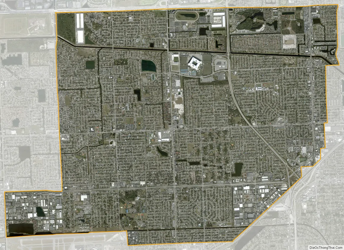
Miami Gardens city Satellite Map
See also
Map of Florida State and its subdivision:- Alachua
- Baker
- Bay
- Bradford
- Brevard
- Broward
- Calhoun
- Charlotte
- Citrus
- Clay
- Collier
- Columbia
- Desoto
- Dixie
- Duval
- Escambia
- Flagler
- Franklin
- Gadsden
- Gilchrist
- Glades
- Gulf
- Hamilton
- Hardee
- Hendry
- Hernando
- Highlands
- Hillsborough
- Holmes
- Indian River
- Jackson
- Jefferson
- Lafayette
- Lake
- Lee
- Leon
- Levy
- Liberty
- Madison
- Manatee
- Marion
- Martin
- Miami-Dade
- Monroe
- Nassau
- Okaloosa
- Okeechobee
- Orange
- Osceola
- Palm Beach
- Pasco
- Pinellas
- Polk
- Putnam
- Saint Johns
- Saint Lucie
- Santa Rosa
- Sarasota
- Seminole
- Sumter
- Suwannee
- Taylor
- Union
- Volusia
- Wakulla
- Walton
- Washington
- Alabama
- Alaska
- Arizona
- Arkansas
- California
- Colorado
- Connecticut
- Delaware
- District of Columbia
- Florida
- Georgia
- Hawaii
- Idaho
- Illinois
- Indiana
- Iowa
- Kansas
- Kentucky
- Louisiana
- Maine
- Maryland
- Massachusetts
- Michigan
- Minnesota
- Mississippi
- Missouri
- Montana
- Nebraska
- Nevada
- New Hampshire
- New Jersey
- New Mexico
- New York
- North Carolina
- North Dakota
- Ohio
- Oklahoma
- Oregon
- Pennsylvania
- Rhode Island
- South Carolina
- South Dakota
- Tennessee
- Texas
- Utah
- Vermont
- Virginia
- Washington
- West Virginia
- Wisconsin
- Wyoming


