Pinellas Park is a city located in central Pinellas County, Florida, United States. The population was 53,093 at the 2020 census. Originally home to northern transplants and vacationers, the hundred year old city has grown into the fourth largest city in Pinellas County, the most densely-populated county in Florida. The city and surrounding areas are almost completely urbanized. Pinellas Park contains a substantial portion of the Gateway area of the county, targeted for future infrastructure, residential, and commercial development as it sits roughly in the middle of the Tampa Bay area’s over two million people. Though land-locked, its borders lie only a few miles from Tampa Bay to the east, and Boca Ciega Bay and the Gulf of Mexico to the west. The city is known for its popular equestrian facilities and events, and many residents also participate in fishing and water activities in nearby venues.
| Name: | Pinellas Park city |
|---|---|
| LSAD Code: | 25 |
| LSAD Description: | city (suffix) |
| State: | Florida |
| County: | Pinellas County |
| Incorporated: | October 14, 1914 (1914-10-14) |
| Elevation: | 13 ft (4 m) |
| Total Area: | 16.80 sq mi (43.51 km²) |
| Land Area: | 16.13 sq mi (41.76 km²) |
| Water Area: | 0.68 sq mi (1.75 km²) |
| Total Population: | 53,093 |
| Population Density: | 3,292.59/sq mi (1,271.27/km²) |
| ZIP code: | 33780–33782 |
| Area code: | 727 |
| FIPS code: | 1256975 |
| GNISfeature ID: | 0288936 |
| Website: | www.pinellas-park.com |
Online Interactive Map
Click on ![]() to view map in "full screen" mode.
to view map in "full screen" mode.
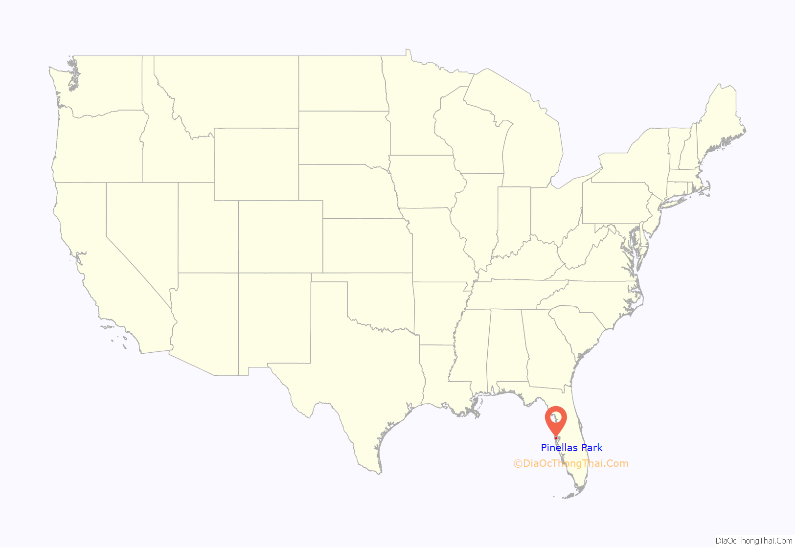
Pinellas Park location map. Where is Pinellas Park city?

History
The city was founded by Philadelphia publisher F. A. Davis, who purchased 12,800 acres (52 km) of Hamilton Disston’s land around 1911. Davies used promotional brochures to lure northerners, especially Pennsylvanians, to the town, noting the pleasant climate in the winter and the agreeable agricultural conditions. The Florida Association, a corporation, set up model farms and offered a free lot in the city with the purchase of ten acres of nearby farm land. A two-story building called the Colony House was established to house perspective purchasers of the available farm plots. The primary crop that the founders intended to grow on the farms they established was sugar cane. By 1912, lots in the city were being sold separately. The City of Pinellas Park was formally incorporated on October 14, 1914.
Though not on the original Orange Belt Railway, Pinellas Park did have a train depot, razed in 1970, on the line between Clearwater and St. Petersburg. The city lay on the vehicle road from St. Petersburg to Tampa. Growth was moderate until after World War II, when the city’s population more than tripled.
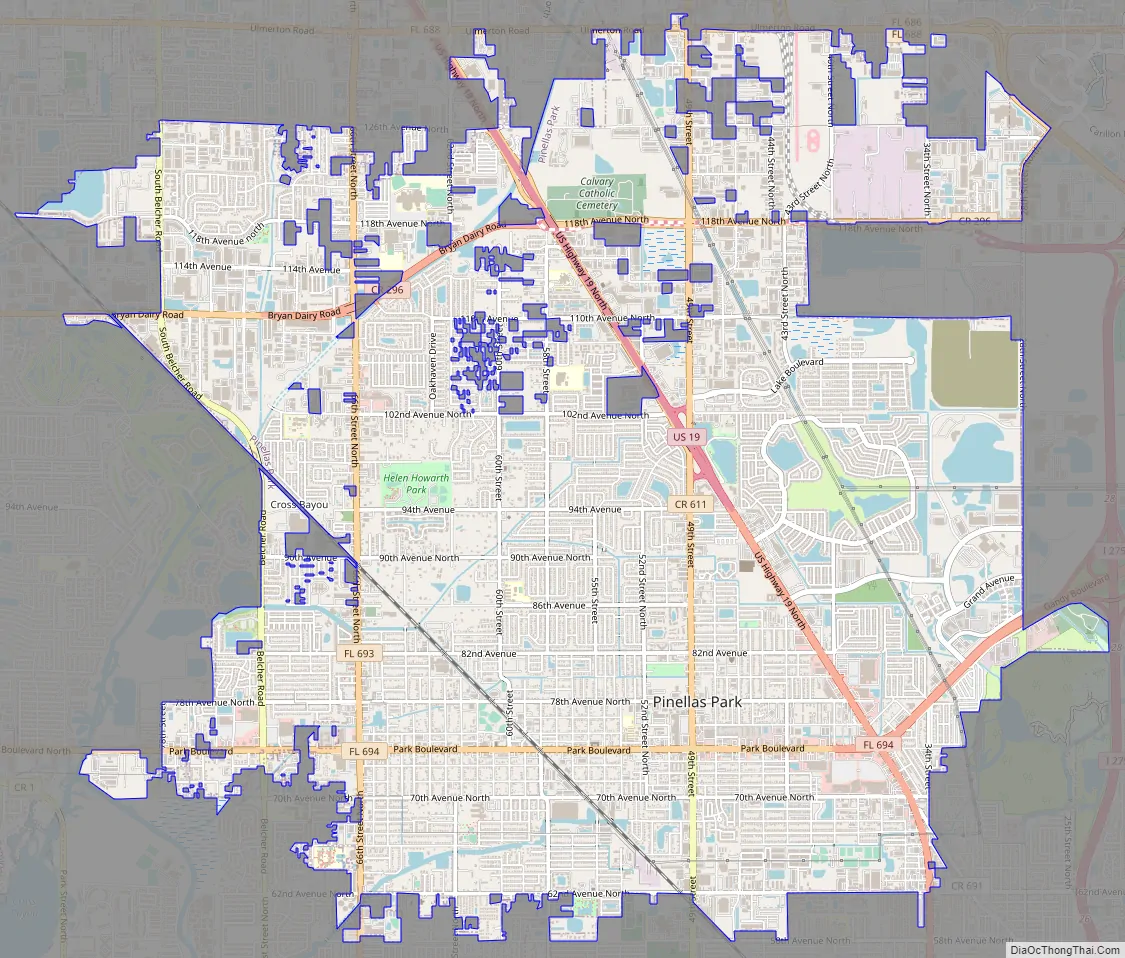
Pinellas Park Road Map
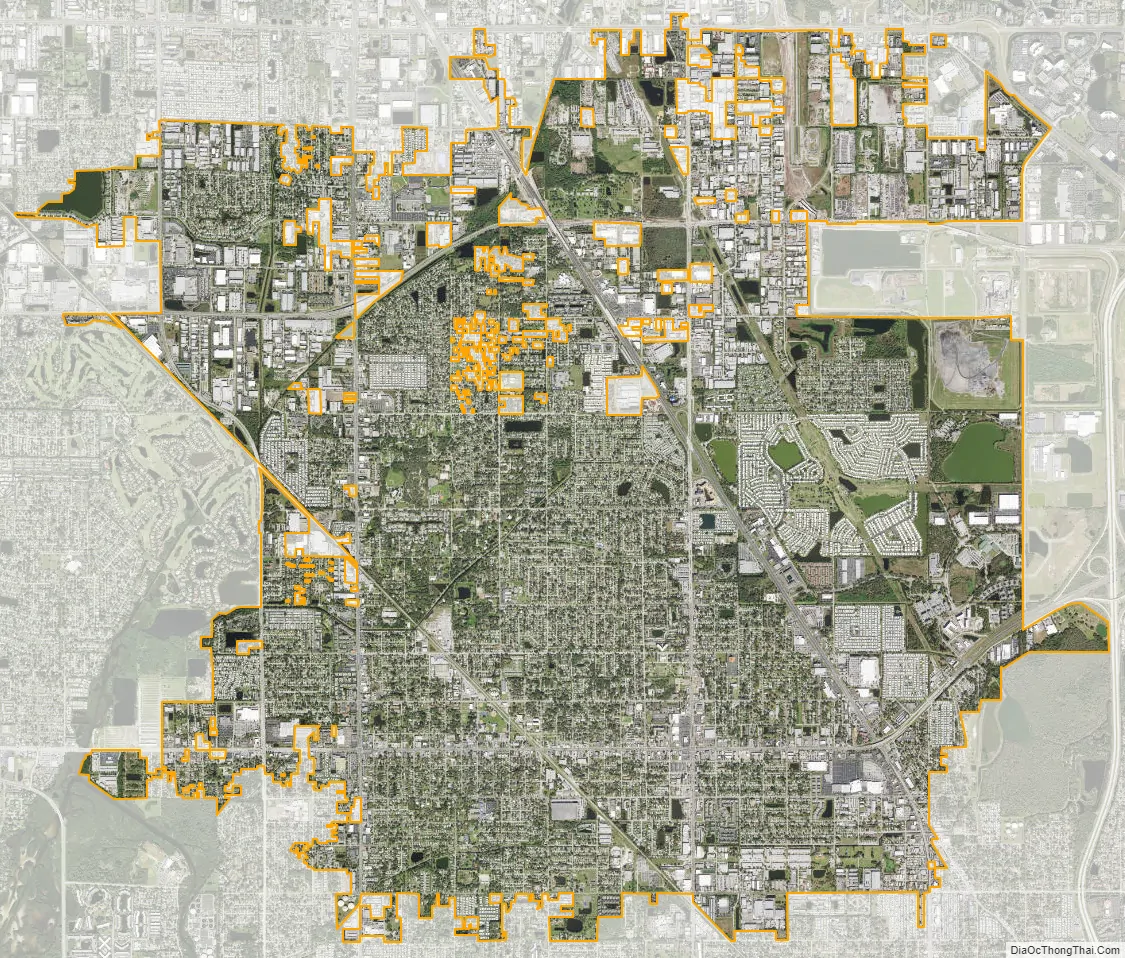
Pinellas Park city Satellite Map
Geography
According to the United States Census Bureau, the city has a total area of 16.2 square miles (41.9 km), of which 15.5 square miles (40.2 km) is land and 0.66 square miles (1.7 km) (4.14%) is water.
Pinellas Park city limits are contiguous with those of St. Petersburg, Clearwater, Largo, Seminole, Kenneth City, and unincorporated areas of Pinellas County. Annexation into the city is voluntary by both the property owner and the City Council.
Because of the city’s relatively low elevation between major bodies of water, and its generally flat topography, it has historically been subject to flooding. Through construction of a network of drainage canals and other measures by the Pinellas Park Water Management District, flooding in the city has been greatly mitigated.
See also
Map of Florida State and its subdivision:- Alachua
- Baker
- Bay
- Bradford
- Brevard
- Broward
- Calhoun
- Charlotte
- Citrus
- Clay
- Collier
- Columbia
- Desoto
- Dixie
- Duval
- Escambia
- Flagler
- Franklin
- Gadsden
- Gilchrist
- Glades
- Gulf
- Hamilton
- Hardee
- Hendry
- Hernando
- Highlands
- Hillsborough
- Holmes
- Indian River
- Jackson
- Jefferson
- Lafayette
- Lake
- Lee
- Leon
- Levy
- Liberty
- Madison
- Manatee
- Marion
- Martin
- Miami-Dade
- Monroe
- Nassau
- Okaloosa
- Okeechobee
- Orange
- Osceola
- Palm Beach
- Pasco
- Pinellas
- Polk
- Putnam
- Saint Johns
- Saint Lucie
- Santa Rosa
- Sarasota
- Seminole
- Sumter
- Suwannee
- Taylor
- Union
- Volusia
- Wakulla
- Walton
- Washington
- Alabama
- Alaska
- Arizona
- Arkansas
- California
- Colorado
- Connecticut
- Delaware
- District of Columbia
- Florida
- Georgia
- Hawaii
- Idaho
- Illinois
- Indiana
- Iowa
- Kansas
- Kentucky
- Louisiana
- Maine
- Maryland
- Massachusetts
- Michigan
- Minnesota
- Mississippi
- Missouri
- Montana
- Nebraska
- Nevada
- New Hampshire
- New Jersey
- New Mexico
- New York
- North Carolina
- North Dakota
- Ohio
- Oklahoma
- Oregon
- Pennsylvania
- Rhode Island
- South Carolina
- South Dakota
- Tennessee
- Texas
- Utah
- Vermont
- Virginia
- Washington
- West Virginia
- Wisconsin
- Wyoming