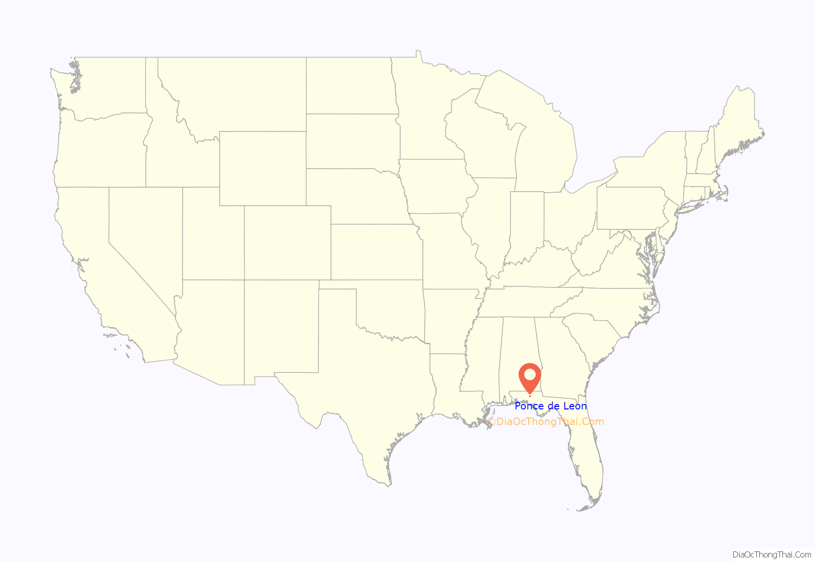
Ponce de Leon (/ˌpɒns də ˈliːən/ PONSS də LEE-ən) is a town in Holmes County, Florida, United States. The population was 598 at the 2010 census, up from 457 at the 2000 census. From 2000 to 2010, the Ponce de Leon town population growth percentage was 30.9%.
| Name: | Ponce de Leon town |
|---|---|
| LSAD Code: | 43 |
| LSAD Description: | town (suffix) |
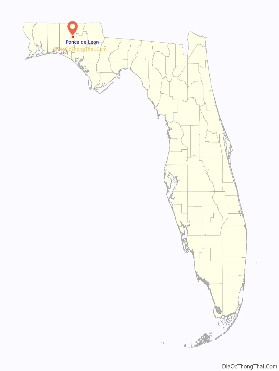
| State: | Florida |
| County: | Holmes County |
| Elevation: | 62 ft (19 m) |
| Total Area: | 5.00 sq mi (12.95 km²) |
| Land Area: | 4.96 sq mi (12.85 km²) |
| Water Area: | 0.04 sq mi (0.10 km²) |
| Total Population: | 504 |
| Population Density: | 101.59/sq mi (39.23/km²) |
| ZIP code: | 32455 |
| Area code: | 850 |
| FIPS code: | 1258175 |
| GNISfeature ID: | 0289171 |
| Website: | www.poncedeleonfl.com |
Online Interactive Map
Click on ![]() to view map in "full screen" mode.
to view map in "full screen" mode.
Ponce de Leon location map. Where is Ponce de Leon town?
Ponce de Leon Road Map
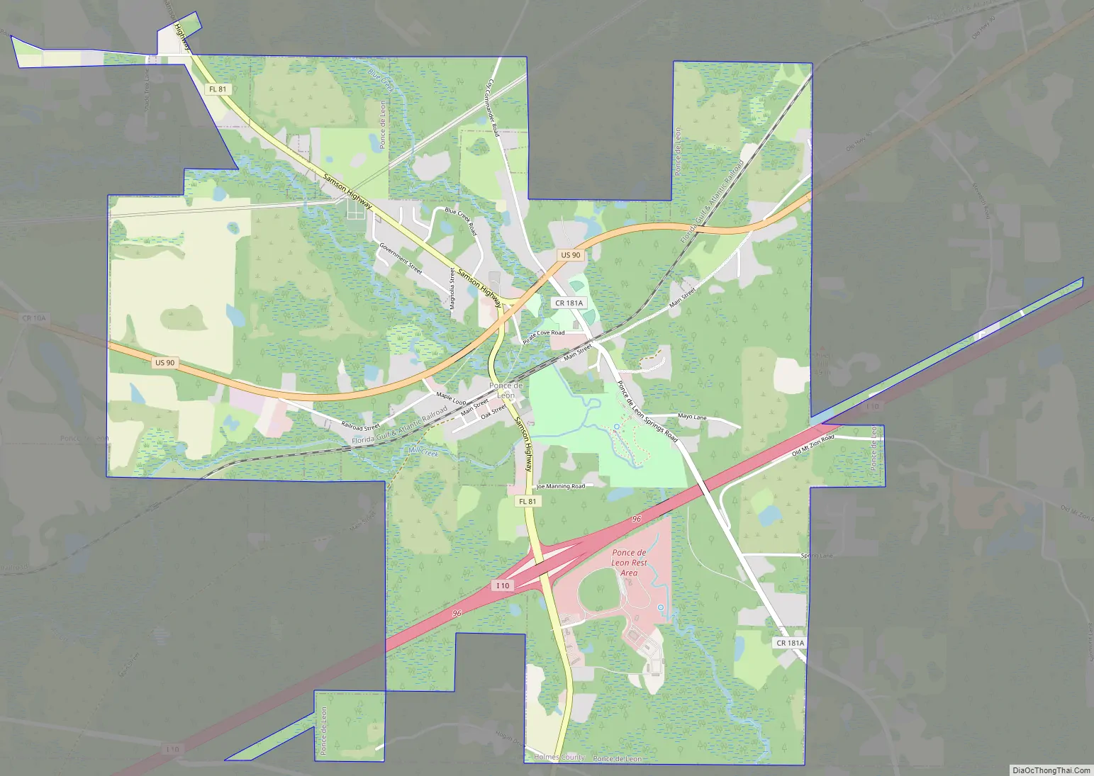
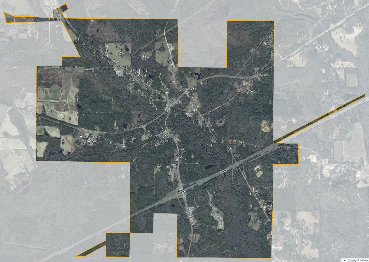
Ponce de Leon city Satellite Map
Geography
Ponce de Leon is located in southwestern Holmes County at 30°43′33″N 85°56′16″W / 30.72583°N 85.93778°W / 30.72583; -85.93778 (30.725783, –85.937783). U.S. Route 90 runs through the center of town, leading northeast 17 miles (27 km) to Bonifay, the Holmes County seat, and west 11 miles (18 km) to DeFuniak Springs. Florida State Road 81 crosses US 90 near the center of town, leading north 20 miles (32 km) to the Alabama border and south 19 miles (31 km) to Florida State Road 20 at Bruce. Interstate 10 passes through the southern part of Ponce de Leon, with access from Exit 96 (SR 81). I-10 leads east 107 miles (172 km) to Tallahassee and west 88 miles (142 km) to Pensacola.
According to the United States Census Bureau, the town has a total area of 5.0 square miles (12.9 km), of which 4.9 square miles (12.8 km) are land and 0.26 square kilometres (0.1 sq mi), or 0.78%, are water. The town is in the valley of Sandy Creek, a south-flowing tributary of the Choctawhatchee River. Ponce de Leon Springs State Park is in the southern part of the town, north of I-10, along both sides of Sandy Creek. The entrance is on the eastern side of the park off Ponce de Leon Springs Road.
See also
Map of Florida State and its subdivision:- Alachua
- Baker
- Bay
- Bradford
- Brevard
- Broward
- Calhoun
- Charlotte
- Citrus
- Clay
- Collier
- Columbia
- Desoto
- Dixie
- Duval
- Escambia
- Flagler
- Franklin
- Gadsden
- Gilchrist
- Glades
- Gulf
- Hamilton
- Hardee
- Hendry
- Hernando
- Highlands
- Hillsborough
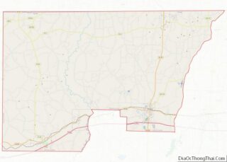
- Holmes
- Indian River
- Jackson
- Jefferson
- Lafayette
- Lake
- Lee
- Leon
- Levy
- Liberty
- Madison
- Manatee
- Marion
- Martin
- Miami-Dade
- Monroe
- Nassau
- Okaloosa
- Okeechobee
- Orange
- Osceola
- Palm Beach
- Pasco
- Pinellas
- Polk
- Putnam
- Saint Johns
- Saint Lucie
- Santa Rosa
- Sarasota
- Seminole
- Sumter
- Suwannee
- Taylor
- Union
- Volusia
- Wakulla
- Walton
- Washington
- Alabama
- Alaska
- Arizona
- Arkansas
- California
- Colorado
- Connecticut
- Delaware
- District of Columbia
- Florida
- Georgia
- Hawaii
- Idaho
- Illinois
- Indiana
- Iowa
- Kansas
- Kentucky
- Louisiana
- Maine
- Maryland
- Massachusetts
- Michigan
- Minnesota
- Mississippi
- Missouri
- Montana
- Nebraska
- Nevada
- New Hampshire
- New Jersey
- New Mexico
- New York
- North Carolina
- North Dakota
- Ohio
- Oklahoma
- Oregon
- Pennsylvania
- Rhode Island
- South Carolina
- South Dakota
- Tennessee
- Texas
- Utah
- Vermont
- Virginia
- Washington
- West Virginia
- Wisconsin
- Wyoming