DeFuniak Springs is a city and the county seat of Walton County, Florida, United States. The population was 6,968 as of the 2020 Census. DeFuniak Springs also serves as a hub for many residents in surrounding communities. In 2019, MSN’s Insider Online named the city as the “best small town in Florida”.
DeFuniak Springs is home to Lake DeFuniak, one of two spring-fed lakes in the world that is nearly perfectly round.
| Name: | DeFuniak Springs city |
|---|---|
| LSAD Code: | 25 |
| LSAD Description: | city (suffix) |
| State: | Florida |
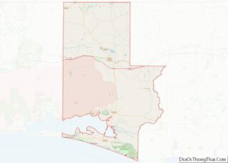
| County: | Walton County |
| Elevation: | 259 ft (79 m) |
| Total Area: | 14.30 sq mi (37.03 km²) |
| Land Area: | 13.95 sq mi (36.13 km²) |
| Water Area: | 0.35 sq mi (0.90 km²) |
| Total Population: | 5,919 |
| Population Density: | 424.30/sq mi (163.82/km²) |
| ZIP code: | 32433, 32435 |
| Area code: | 850 |
| FIPS code: | 1216800 |
| GNISfeature ID: | 0294592 |
| Website: | http://www.defuniaksprings.net |
Online Interactive Map
Click on ![]() to view map in "full screen" mode.
to view map in "full screen" mode.
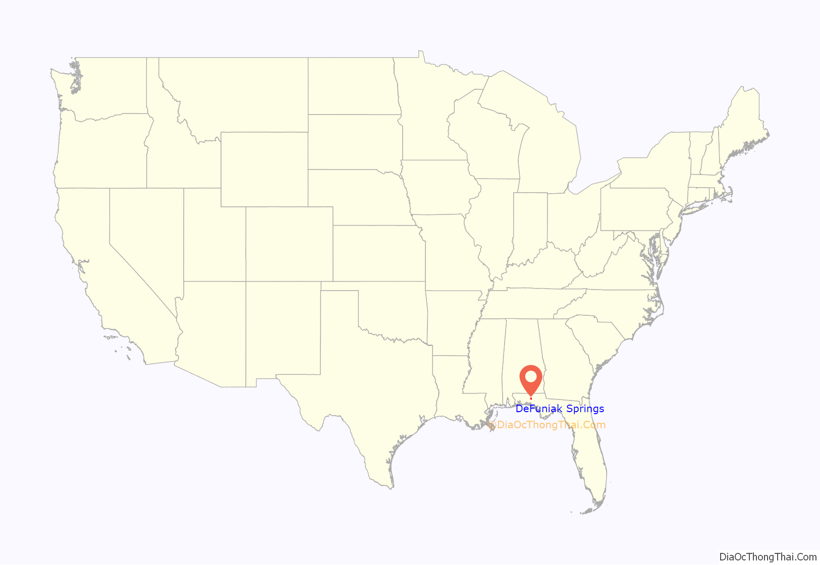
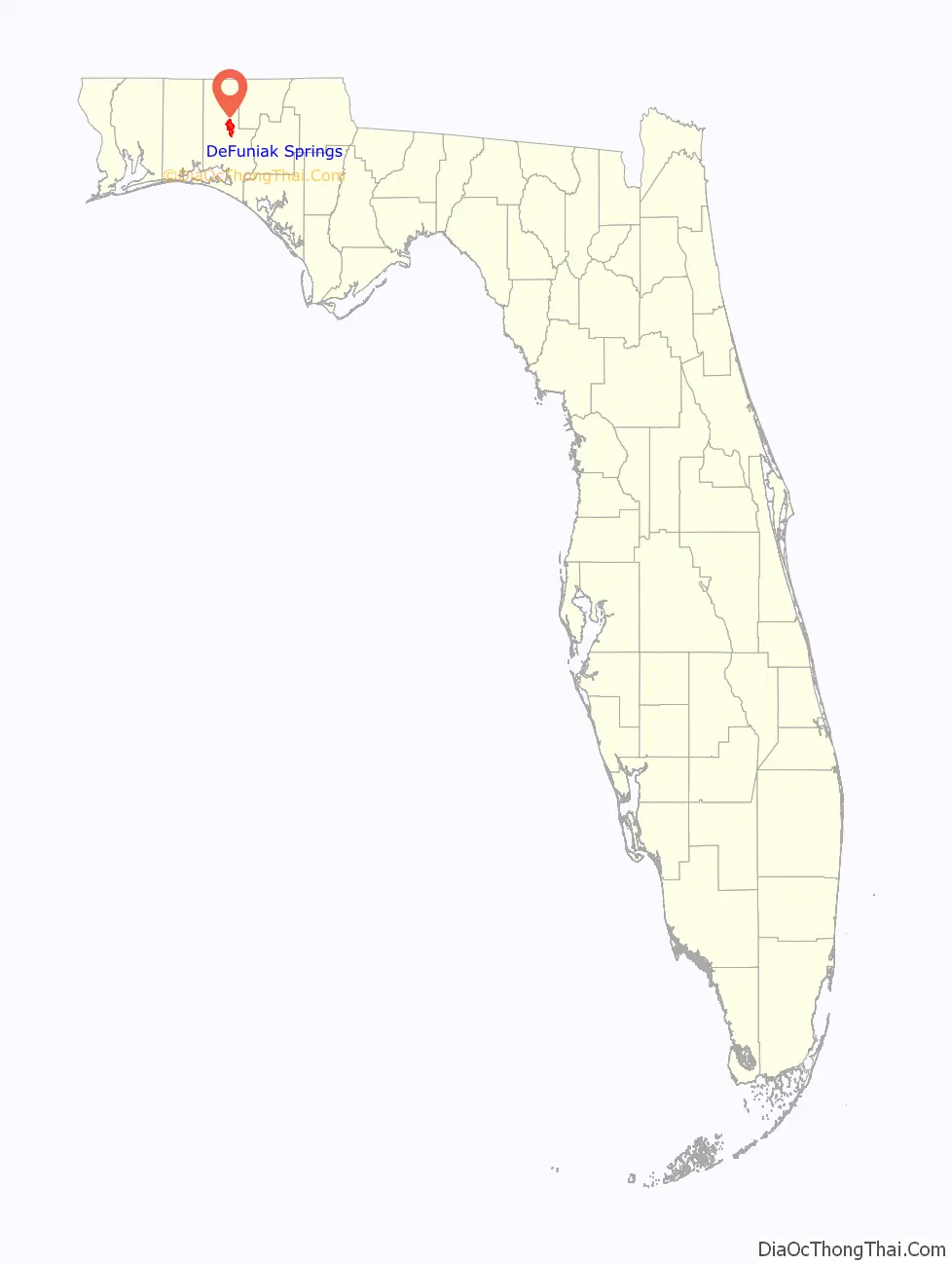
DeFuniak Springs location map. Where is DeFuniak Springs city?
History
The town was founded during the late 19th century as a resort development by the officers of the Pensacola and Atlantic Railroad, a subsidiary of the Louisville and Nashville Railroad. The P&A was organized to connect the terminus of the L&N at Pensacola to the western terminus of a predecessor of the Seaboard Air Line Railroad at River Junction—now Chattahoochee—in the 1880s. The town was named after Frederick R. De Funiak, a vice-president of the L&N. Like much of Northwest Florida, DeFuniak Springs was settled mainly by Scots from Virginia and the Carolinas.
DeFuniak Springs was established as a final-destination resort. The developers enlisted the cooperation and aid of the Chautauqua Movement. The Chautauqua Hall of Brotherhood, an auditorium seating 4,000, was constructed on Lake DeFuniak in the center of town. Seminars, classes, and the like were held in the Hall of Brotherhood building for people on vacation.
The auditorium of the building was severely damaged by Hurricane Eloise in 1975 and razed. In 2003, the Chautauqua Hall of Brotherhood Foundation, Inc., a charitable foundation, started a capital campaign to restore the historic building. The westerly portion of the building facing Circle Drive was still in use at that time.
As part of the intellectual atmosphere of the town, a college and a private high school (named Palmer College and Palmer Academy, respectively), as well as a technical school (Thomas Industrial Institute) and a teacher training school (Florida Normal College) were established in the late 19th century. Florida Normal College was later incorporated into Florida State University. The other schools closed during the Great Depression, which created financial strains. There remains a College Avenue that once led to Palmer College.
In 1886, the town held an important meeting that changed the course of public education in Florida. At this meeting, teachers from around the state formed the Florida Education Association. This teachers’ union remains the state’s predominant voice for educators and is affiliated with the National Education Association and the American Federation of Teachers.
The town contains other historically significant landmarks. The Walton County Library is located on Circle Drive, the oldest extant library in the state of Florida. The library contains antiquities, including an impressive medieval weapon collection, in addition to many first-edition books. Also situated on Circle Drive are the Walton County Heritage Museum, housed in the former L&N railroad depot, and St. Agatha’s Episcopal Church, built in 1895–1896.
First Presbyterian Church is the only private structure in the Lake Yard, the park surrounding the lake. Although Walton County was opposed to secession, the first monument to the Confederate war dead constructed in Florida is located on the lawn of the Walton County Courthouse.
A chicken processing plant operated by Perdue Farms at DeFuniak Springs was closed in April 2004.
Traditions
The surrounding landscape of Lake DeFuniak is decorated for the holidays between Thanksgiving and New Year’s Day to celebrate the holiday season. This is known to locals as the “Christmas Reflections”.
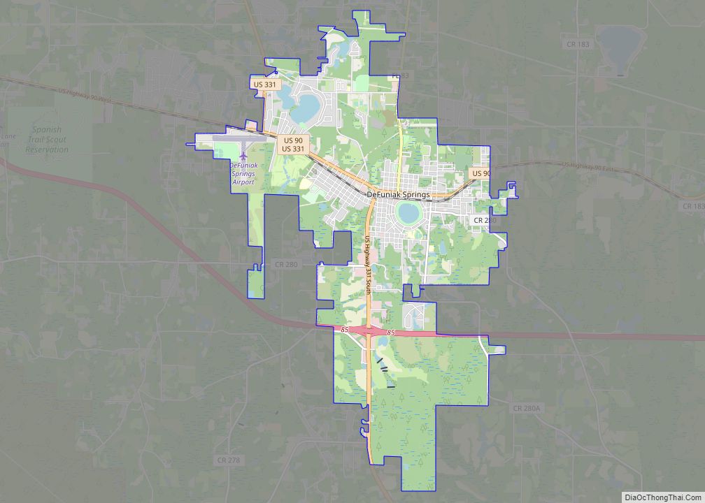
DeFuniak Springs Road Map
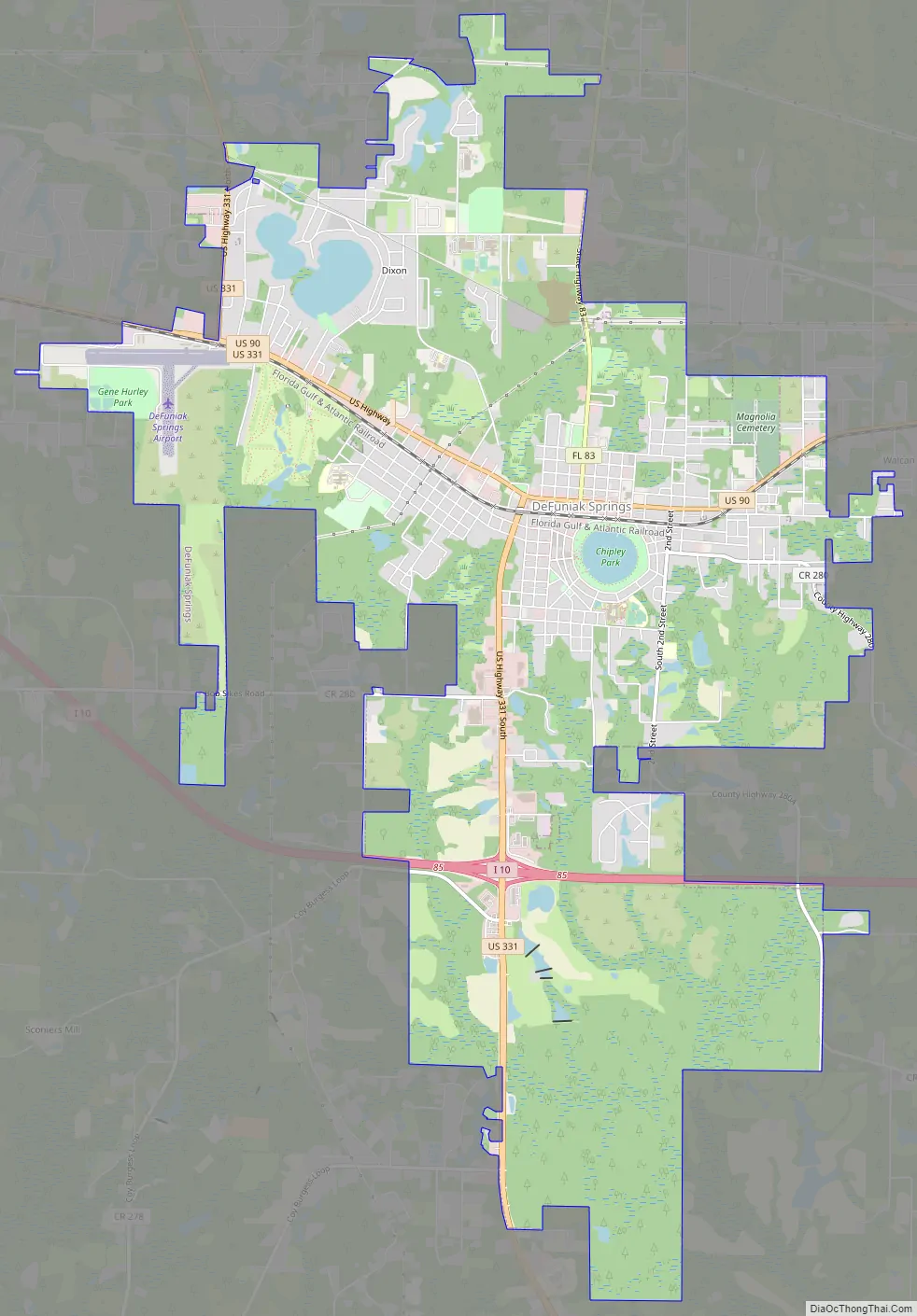
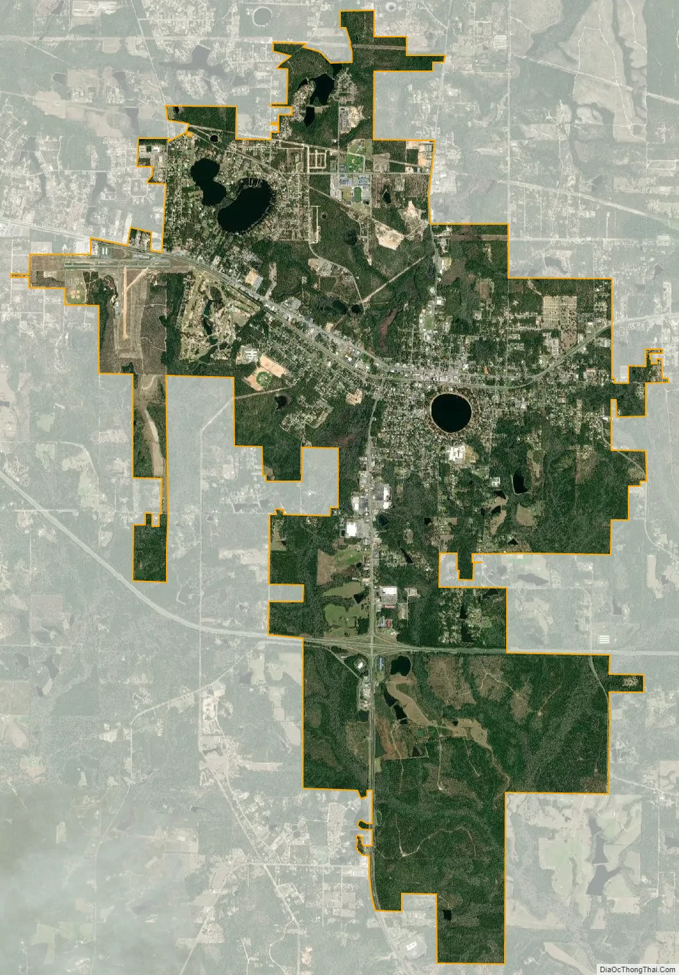
DeFuniak Springs city Satellite Map
Geography
DeFuniak Springs is located at 30°43’N 86°7’W (30.721, –86.119).
The city is located in the Florida Panhandle along Interstate 10 and U.S. Routes 90 and 331. I-10 runs south of the city from west to east, providing access from exit 85 (U.S. Route 331). I-10 leads east 119 mi (192 km) to Tallahassee, the state capital, and west 80 mi (130 km) to Pensacola. U.S. Route 90 runs through the city from west to east as Nelson Avenue, and leads east 12 mi (19 km) to Ponce de Leon and west 29 mi (47 km) to Crestview. U.S. Route 331 is the main north–south route in the city and its main connection to the Gulf coast. U.S. 331 leads northwest 25 mi (40 km) to Florala, Alabama and south 26 mi (42 km) to U.S. Route 98 near Santa Rosa Beach. Florida State Road 83 also runs through the city as well, leading south to Santa Rosa Beach (with U.S. 331) and north 19 mi (31 km) to the Florida-Alabama state line.
According to the United States Census Bureau, the city has a total area of 11.2 square miles (29 km), of which 11.0 square miles (28 km) is land, and 0.3 square miles (0.78 km) (2.49%) is water.
Climate
DeFuniak Springs has a humid subtropical climate (Cfa).
See also
Map of Florida State and its subdivision:- Alachua
- Baker
- Bay
- Bradford
- Brevard
- Broward
- Calhoun
- Charlotte
- Citrus
- Clay
- Collier
- Columbia
- Desoto
- Dixie
- Duval
- Escambia
- Flagler
- Franklin
- Gadsden
- Gilchrist
- Glades
- Gulf
- Hamilton
- Hardee
- Hendry
- Hernando
- Highlands
- Hillsborough
- Holmes
- Indian River
- Jackson
- Jefferson
- Lafayette
- Lake
- Lee
- Leon
- Levy
- Liberty
- Madison
- Manatee
- Marion
- Martin
- Miami-Dade
- Monroe
- Nassau
- Okaloosa
- Okeechobee
- Orange
- Osceola
- Palm Beach
- Pasco
- Pinellas
- Polk
- Putnam
- Saint Johns
- Saint Lucie
- Santa Rosa
- Sarasota
- Seminole
- Sumter
- Suwannee
- Taylor
- Union
- Volusia
- Wakulla
- Walton
- Washington
- Alabama
- Alaska
- Arizona
- Arkansas
- California
- Colorado
- Connecticut
- Delaware
- District of Columbia
- Florida
- Georgia
- Hawaii
- Idaho
- Illinois
- Indiana
- Iowa
- Kansas
- Kentucky
- Louisiana
- Maine
- Maryland
- Massachusetts
- Michigan
- Minnesota
- Mississippi
- Missouri
- Montana
- Nebraska
- Nevada
- New Hampshire
- New Jersey
- New Mexico
- New York
- North Carolina
- North Dakota
- Ohio
- Oklahoma
- Oregon
- Pennsylvania
- Rhode Island
- South Carolina
- South Dakota
- Tennessee
- Texas
- Utah
- Vermont
- Virginia
- Washington
- West Virginia
- Wisconsin
- Wyoming