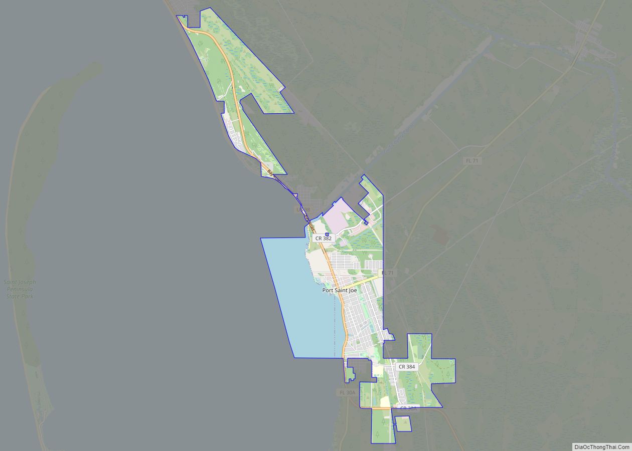
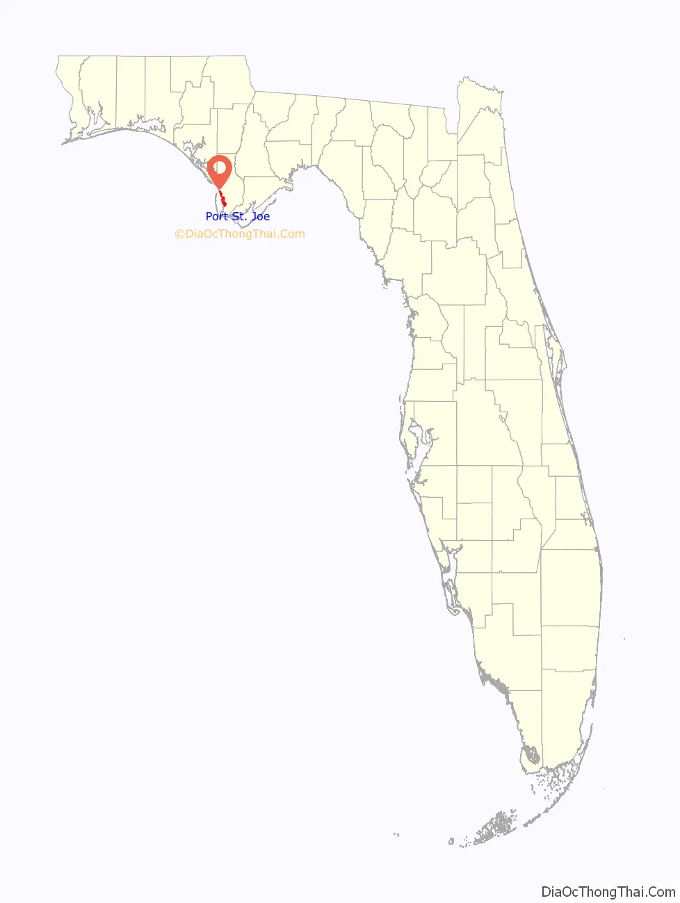
Port St. Joe is a city and the county seat of Gulf County, Florida. It is located at the intersection of U.S. Highway 98 and State Road 71 As of the 2020 census,the population was 3,357, a decline from 3,644 as of the 2000 census.
| Name: | Port St. Joe city |
|---|---|
| LSAD Code: | 25 |
| LSAD Description: | city (suffix) |
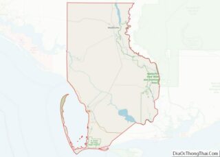
| State: | Florida |
| County: | Gulf County |
| Elevation: | 2 ft (0.6 m) |
| Total Area: | 11.97 sq mi (30.99 km²) |
| Land Area: | 9.37 sq mi (24.26 km²) |
| Water Area: | 2.60 sq mi (6.73 km²) |
| Total Population: | 3,357 |
| Population Density: | 358.39/sq mi (138.38/km²) |
| ZIP code: | 32456, 32457 |
| Area code: | 850 |
| FIPS code: | 1258675 |
| GNISfeature ID: | 2404557 |
| Website: | www.cityofportstjoe.com |
Online Interactive Map
Click on ![]() to view map in "full screen" mode.
to view map in "full screen" mode.
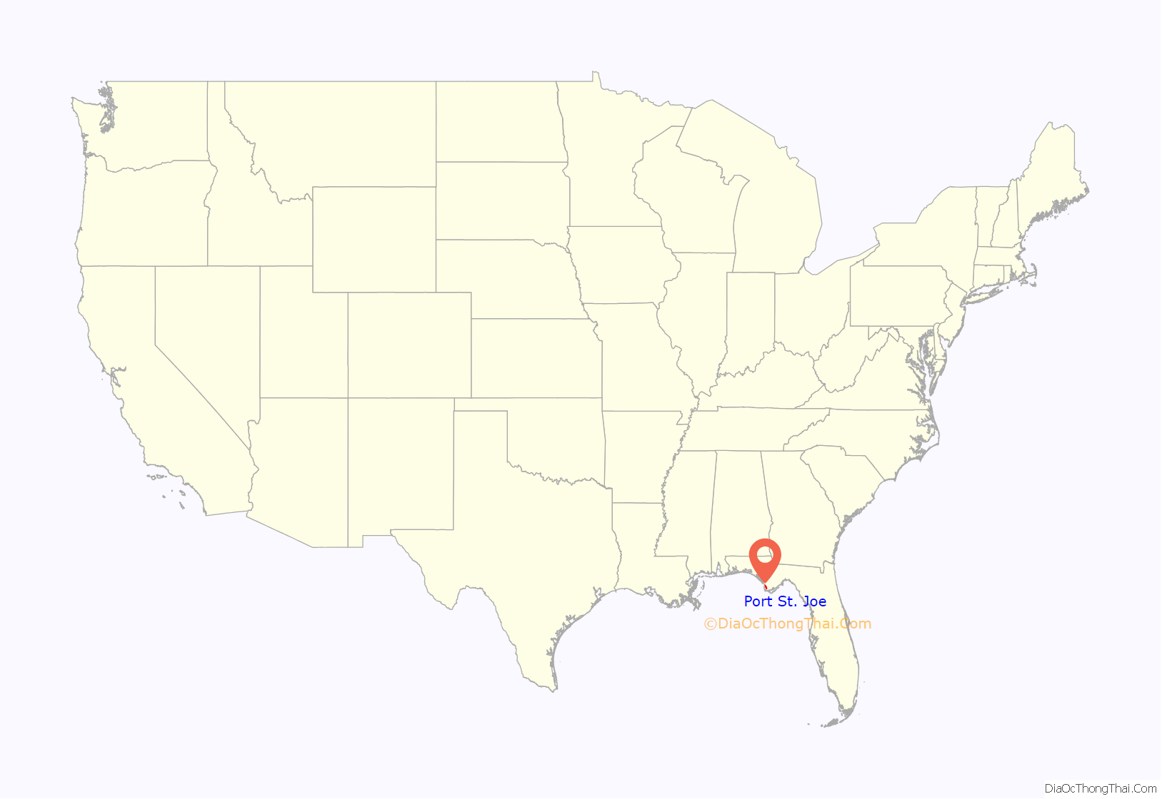
Port St. Joe location map. Where is Port St. Joe city?
History
St. Joseph was founded in 1835 by businessmen from nearby Apalachicola, which was troubled by legal conflict over land titles. It was mostly abandoned in 1841 after a yellow fever epidemic; a storm surge produced by a hurricane in 1844 destroyed what structures remained.
During the Civil War, Florida was a leading producer of salt for the Confederate army. On September 15, 1862, a Union officer on board the USS Kingfisher wrote that he an his men had sent a demand to the extensive salt works at Saint Joseph that they cease production. When the work was not halted, the Kingfisher went into Saint Joseph bay, sent at least 50 men in land, and destroyed the salt works.
In the early 20th century a new settlement was founded close to the original after the arrival of the Apalachicola Northern Railroad in 1909. It appears that the more informal “Port St. Joe” was adopted for official use around this time.
The community was extensively damaged by Hurricane Michael on October 10, 2018.
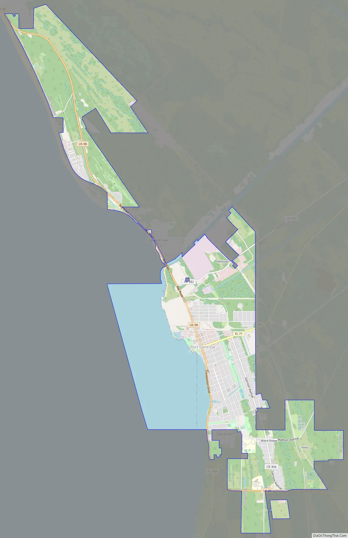
Port St. Joe Road Map
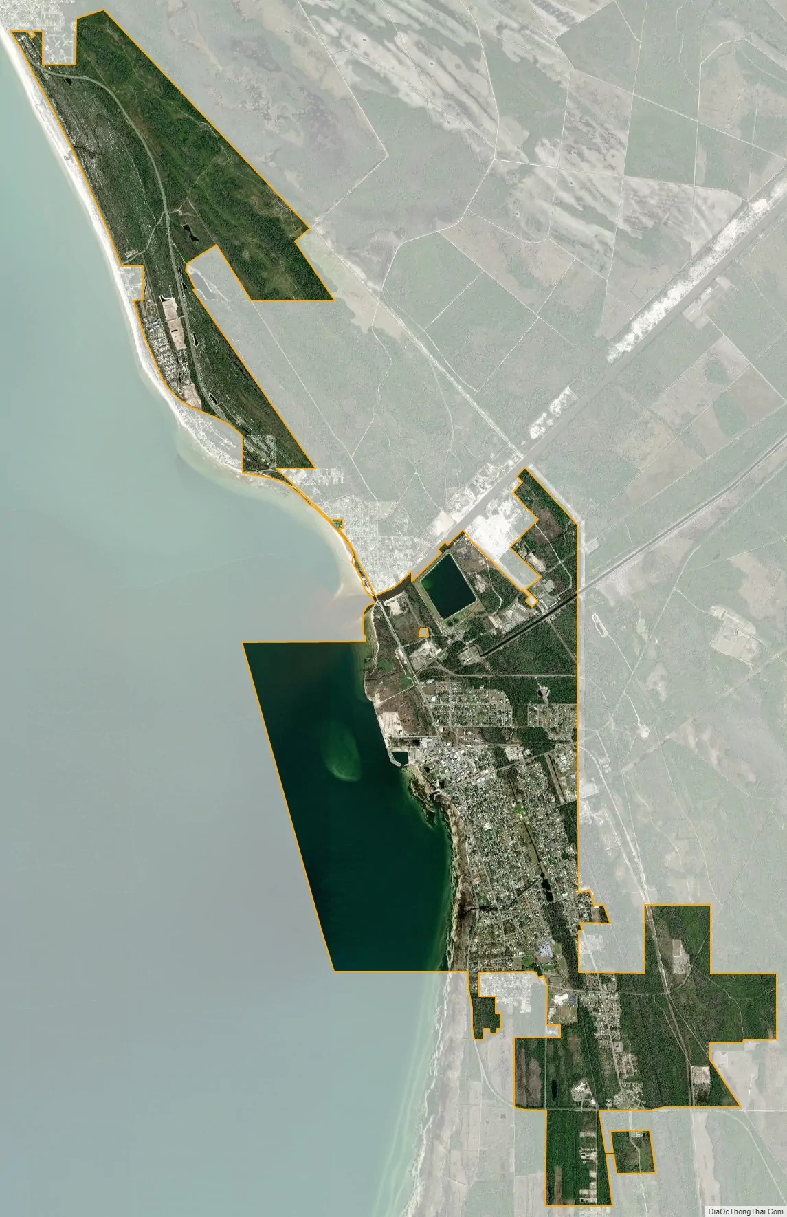
Port St. Joe city Satellite Map
Geography
Port St. Joe is located in southern Gulf County at 29°48′29″N 85°17′52″W / 29.80806°N 85.29778°W / 29.80806; -85.29778 (29.807968, –85.297684), within the Florida Panhandle and along the Emerald Coast. According to the United States Census Bureau, the city has a total area of 12.1 square miles (31.3 km), of which 9.5 square miles (24.5 km) is land and 2.6 square miles (6.8 km), or 21.86%, is water. The city limits extend into St. Joseph Bay, an arm of the Gulf of Mexico.
U.S. Route 98 passes through Port St. Joe as Monument Drive in the north and Constitution Drive in the south. US 98 leads northwest along the Gulf shore 36 miles (58 km) to Panama City and southeast 23 miles (37 km) to Apalachicola. Florida State Road 71 (Cecil G. Costin Sr. Boulevard) leads northeast 24 miles (39 km) to Wewahitchka.
Port St. Joe averages only 3 feet (0.91 m) above sea level. At its highest point it is only 8 feet (2.4 m) above sea level. This portion of the town has been dubbed “Highland View”.
See also
Map of Florida State and its subdivision:- Alachua
- Baker
- Bay
- Bradford
- Brevard
- Broward
- Calhoun
- Charlotte
- Citrus
- Clay
- Collier
- Columbia
- Desoto
- Dixie
- Duval
- Escambia
- Flagler
- Franklin
- Gadsden
- Gilchrist
- Glades
- Gulf
- Hamilton
- Hardee
- Hendry
- Hernando
- Highlands
- Hillsborough
- Holmes
- Indian River
- Jackson
- Jefferson
- Lafayette
- Lake
- Lee
- Leon
- Levy
- Liberty
- Madison
- Manatee
- Marion
- Martin
- Miami-Dade
- Monroe
- Nassau
- Okaloosa
- Okeechobee
- Orange
- Osceola
- Palm Beach
- Pasco
- Pinellas
- Polk
- Putnam
- Saint Johns
- Saint Lucie
- Santa Rosa
- Sarasota
- Seminole
- Sumter
- Suwannee
- Taylor
- Union
- Volusia
- Wakulla
- Walton
- Washington
- Alabama
- Alaska
- Arizona
- Arkansas
- California
- Colorado
- Connecticut
- Delaware
- District of Columbia
- Florida
- Georgia
- Hawaii
- Idaho
- Illinois
- Indiana
- Iowa
- Kansas
- Kentucky
- Louisiana
- Maine
- Maryland
- Massachusetts
- Michigan
- Minnesota
- Mississippi
- Missouri
- Montana
- Nebraska
- Nevada
- New Hampshire
- New Jersey
- New Mexico
- New York
- North Carolina
- North Dakota
- Ohio
- Oklahoma
- Oregon
- Pennsylvania
- Rhode Island
- South Carolina
- South Dakota
- Tennessee
- Texas
- Utah
- Vermont
- Virginia
- Washington
- West Virginia
- Wisconsin
- Wyoming