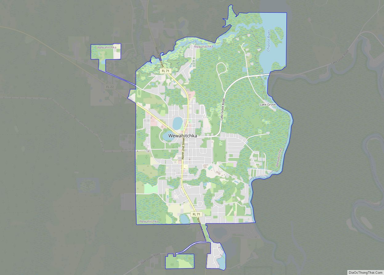
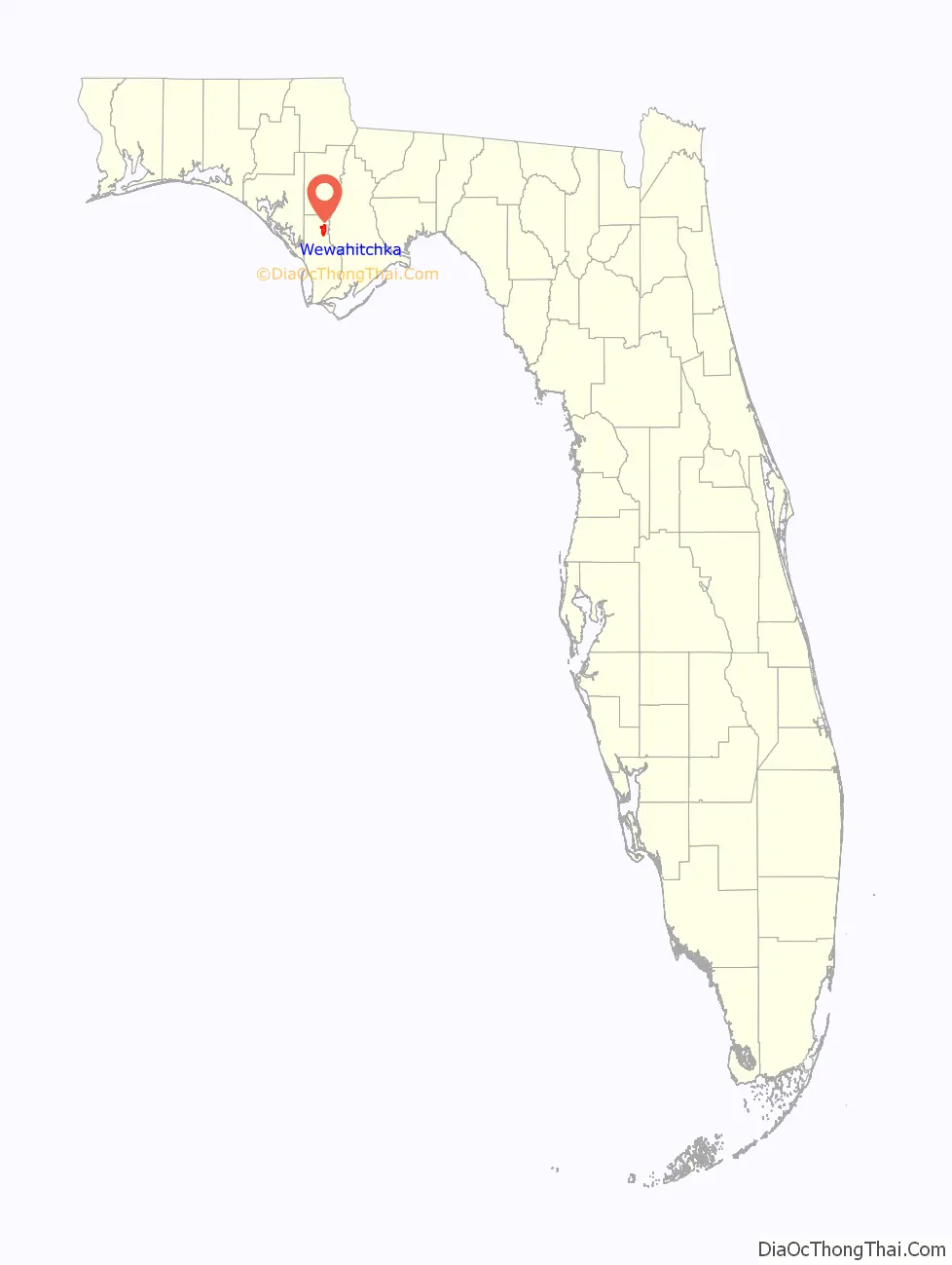
Wewahitchka is a city in Gulf County, Florida, United States. The population was 2,074 as of the 2020 census. This was up from 1,722 as of the 2000 census. From the creation of Gulf County in 1925 until 1965, it served as the county seat before the county seat was moved to Port St. Joe. The city took its name from an American Indian word meaning “water eyes”. Two lakes along the edge of town look like a perfect pair of eyes.
| Name: | Wewahitchka city |
|---|---|
| LSAD Code: | 25 |
| LSAD Description: | city (suffix) |
| State: | Florida |
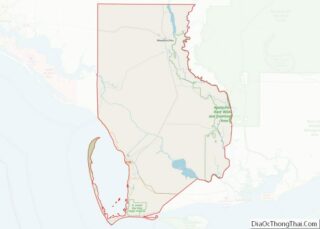
| County: | Gulf County |
| Elevation: | 46 ft (14 m) |
| Total Area: | 7.80 sq mi (20.20 km²) |
| Land Area: | 6.69 sq mi (17.34 km²) |
| Water Area: | 1.11 sq mi (2.87 km²) |
| Total Population: | 2,074 |
| Population Density: | 309.88/sq mi (119.64/km²) |
| ZIP code: | 32465 |
| Area code: | 850 |
| FIPS code: | 1277100 |
| GNISfeature ID: | 0294641 |
| Website: | cityofwewahitchka.com |
Online Interactive Map
Click on ![]() to view map in "full screen" mode.
to view map in "full screen" mode.
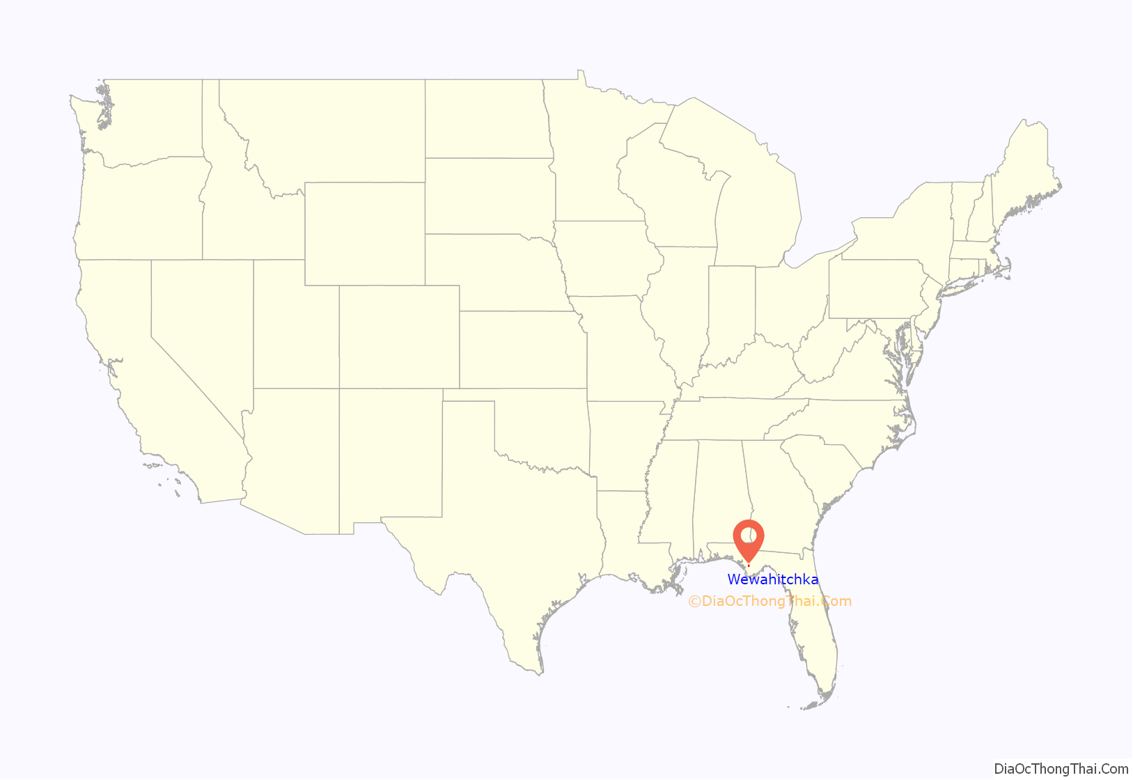
Wewahitchka location map. Where is Wewahitchka city?
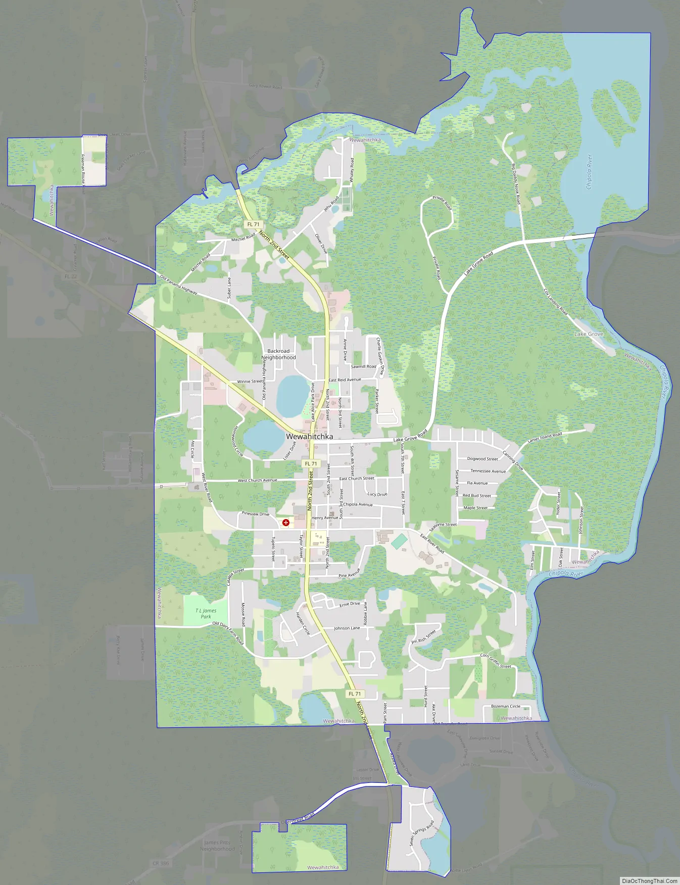
Wewahitchka Road Map
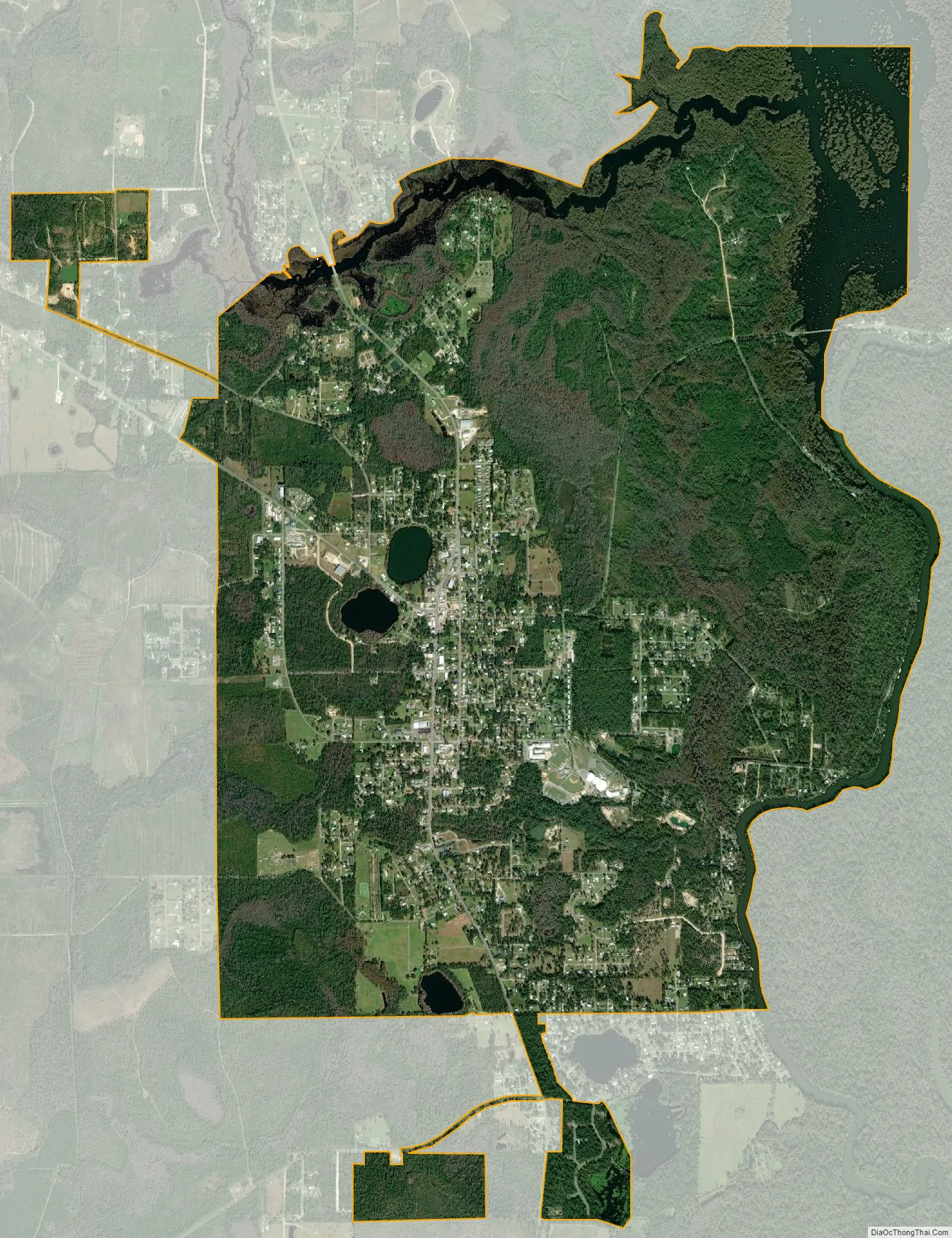
Wewahitchka city Satellite Map
Geography
Wewahitchka is located in northeastern Gulf County at the junction of Florida State Roads 71 and 22. SR 71 leads north 27 miles (43 km) to Blountstown and south 24 miles (39 km) to Port St. Joe, while SR 22 leads west 28 miles (45 km) to Panama City. According to the United States Census Bureau, Wewahitchka has a total area of 7.7 square miles (20.0 km), of which 6.5 square miles (16.8 km) is land and 1.2 square miles (3.2 km), or 15.80%, is water. It is located west of the Chipola River, a tributary of the Apalachicola River, and southwest of Dead Lake.
See also
Map of Florida State and its subdivision:- Alachua
- Baker
- Bay
- Bradford
- Brevard
- Broward
- Calhoun
- Charlotte
- Citrus
- Clay
- Collier
- Columbia
- Desoto
- Dixie
- Duval
- Escambia
- Flagler
- Franklin
- Gadsden
- Gilchrist
- Glades
- Gulf
- Hamilton
- Hardee
- Hendry
- Hernando
- Highlands
- Hillsborough
- Holmes
- Indian River
- Jackson
- Jefferson
- Lafayette
- Lake
- Lee
- Leon
- Levy
- Liberty
- Madison
- Manatee
- Marion
- Martin
- Miami-Dade
- Monroe
- Nassau
- Okaloosa
- Okeechobee
- Orange
- Osceola
- Palm Beach
- Pasco
- Pinellas
- Polk
- Putnam
- Saint Johns
- Saint Lucie
- Santa Rosa
- Sarasota
- Seminole
- Sumter
- Suwannee
- Taylor
- Union
- Volusia
- Wakulla
- Walton
- Washington
- Alabama
- Alaska
- Arizona
- Arkansas
- California
- Colorado
- Connecticut
- Delaware
- District of Columbia
- Florida
- Georgia
- Hawaii
- Idaho
- Illinois
- Indiana
- Iowa
- Kansas
- Kentucky
- Louisiana
- Maine
- Maryland
- Massachusetts
- Michigan
- Minnesota
- Mississippi
- Missouri
- Montana
- Nebraska
- Nevada
- New Hampshire
- New Jersey
- New Mexico
- New York
- North Carolina
- North Dakota
- Ohio
- Oklahoma
- Oregon
- Pennsylvania
- Rhode Island
- South Carolina
- South Dakota
- Tennessee
- Texas
- Utah
- Vermont
- Virginia
- Washington
- West Virginia
- Wisconsin
- Wyoming