Rotonda West is an unincorporated, deed-restricted community situated in Charlotte County, Florida, United States. The 2020 U.S. Census Bureau lists it as the Rotonda census-designated place, with a population of 10,114. It is part of the Sarasota-Bradenton-Punta Gorda Combined Statistical Area. It was developed and named Rotonda West by Cavanagh Communities Corporation, which purchased the land in 1969.
That developer also bought land for a projected but never developed community named Rotonda East in southern Martin County and northern Palm Beach County. The land selected for that development was swamp land and it was not considered wise to drain those wetlands due to changing views on the ecological value of wetlands, and the Army Corps of Engineers refused a permit, so the Rotonda East project was abandoned.
The area was part of ranch lands prior to development for housing in the 1970s. Although the community’s layout mimics that of temporary World War II airfields, there was no airfield at this location prior to the construction of the development; the land was instead part of a large cattle ranch.
| Name: | Rotonda CDP |
|---|---|
| LSAD Code: | 57 |
| LSAD Description: | CDP (suffix) |
| State: | Florida |
| County: | Charlotte County |
| Land Area: | 10.66 sq mi (27.60 km²) |
| Water Area: | 0.88 sq mi (2.27 km²) |
| Population Density: | 949.05/sq mi (366.42/km²) |
| ZIP code: | 33947 |
| Area code: | 941 |
| FIPS code: | 1261937 |
| Website: | https://www.rotondawest.org |
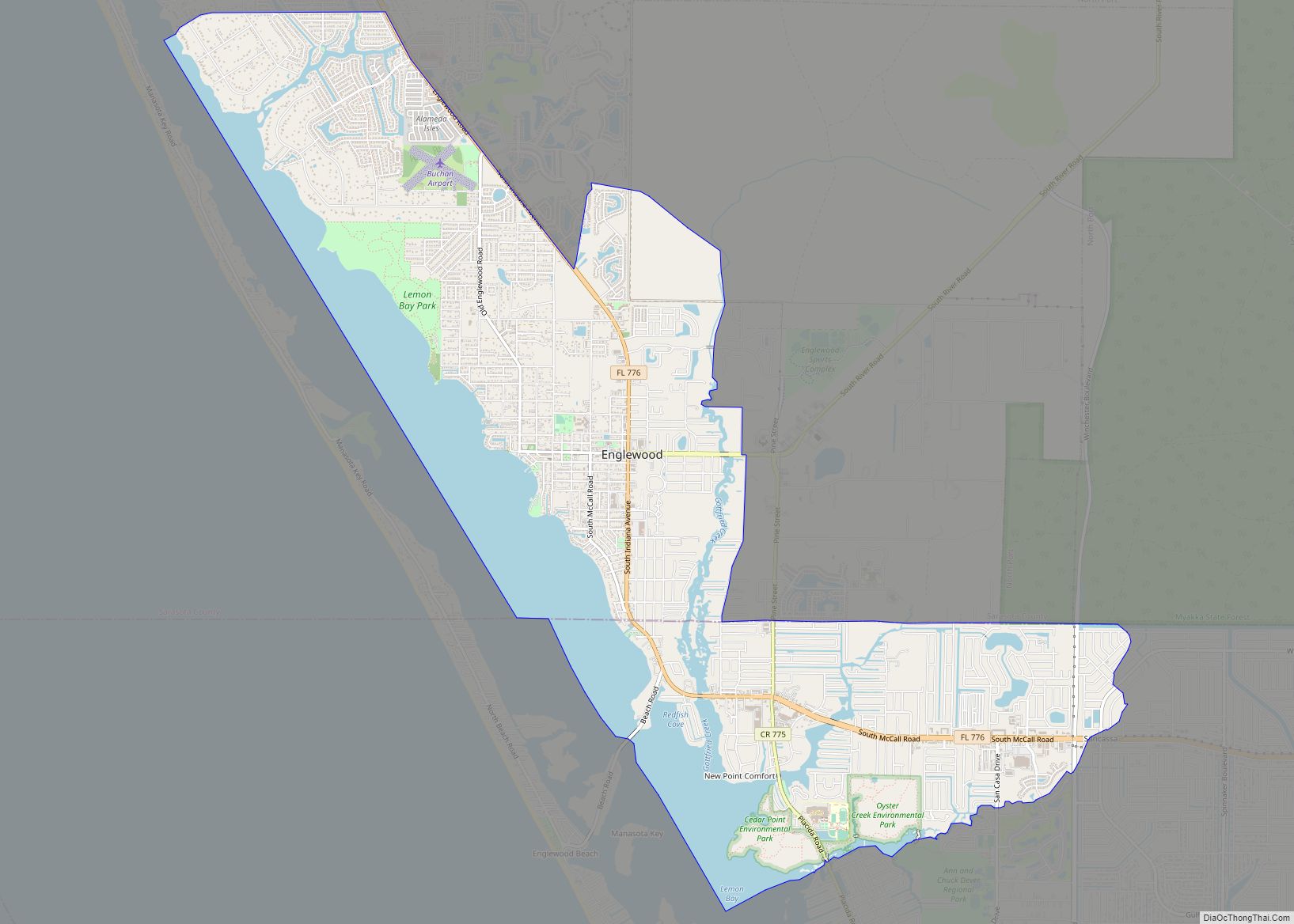
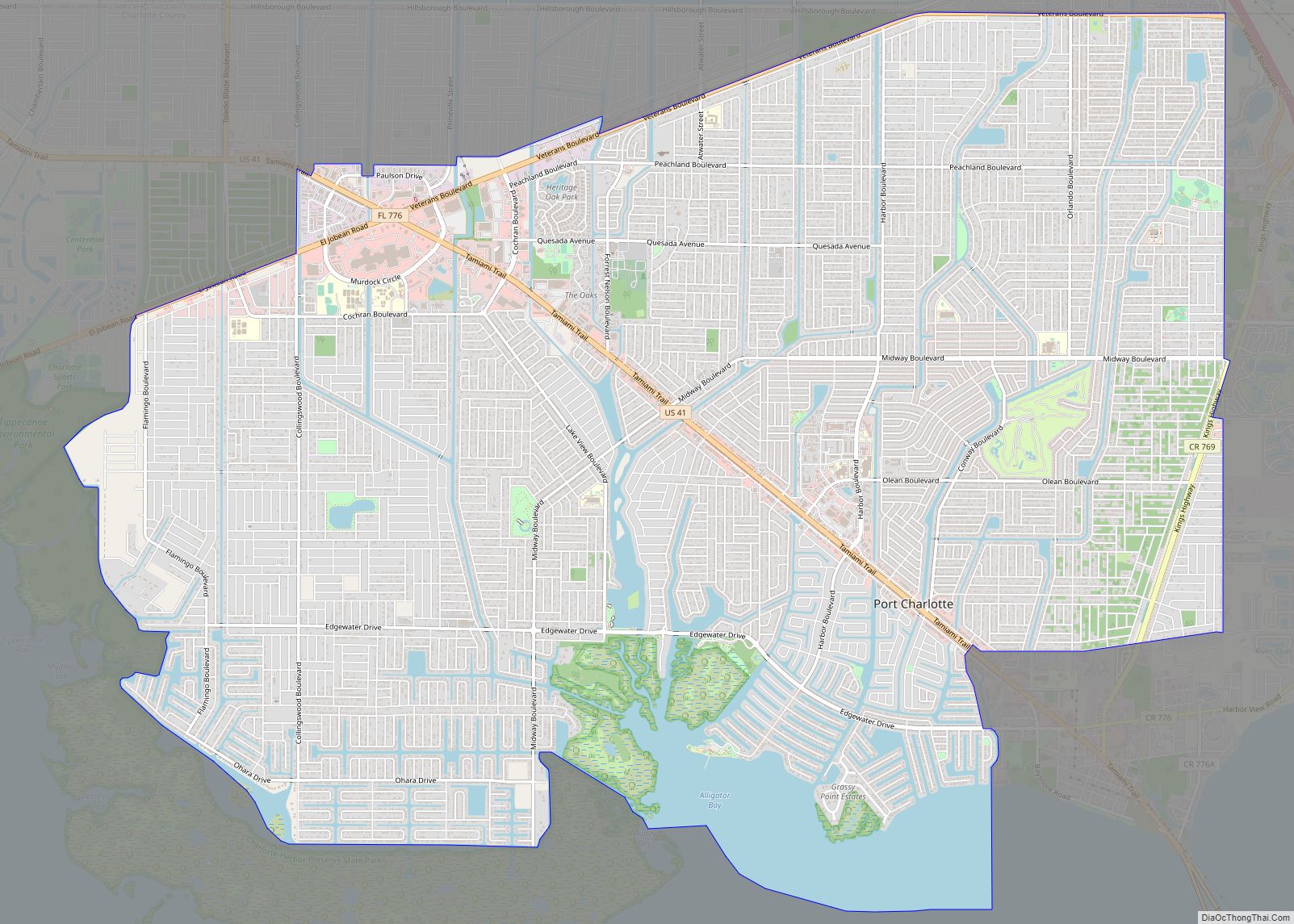
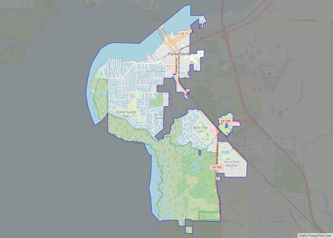
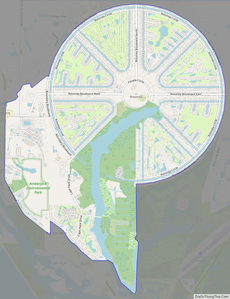
Online Interactive Map
Click on ![]() to view map in "full screen" mode.
to view map in "full screen" mode.
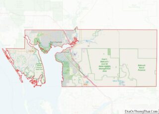
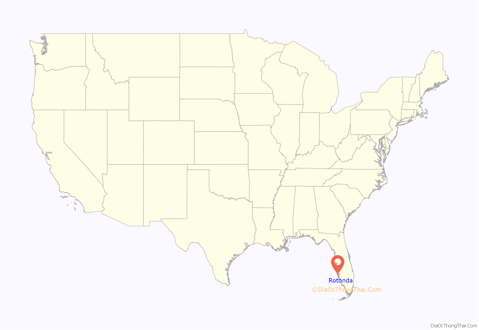
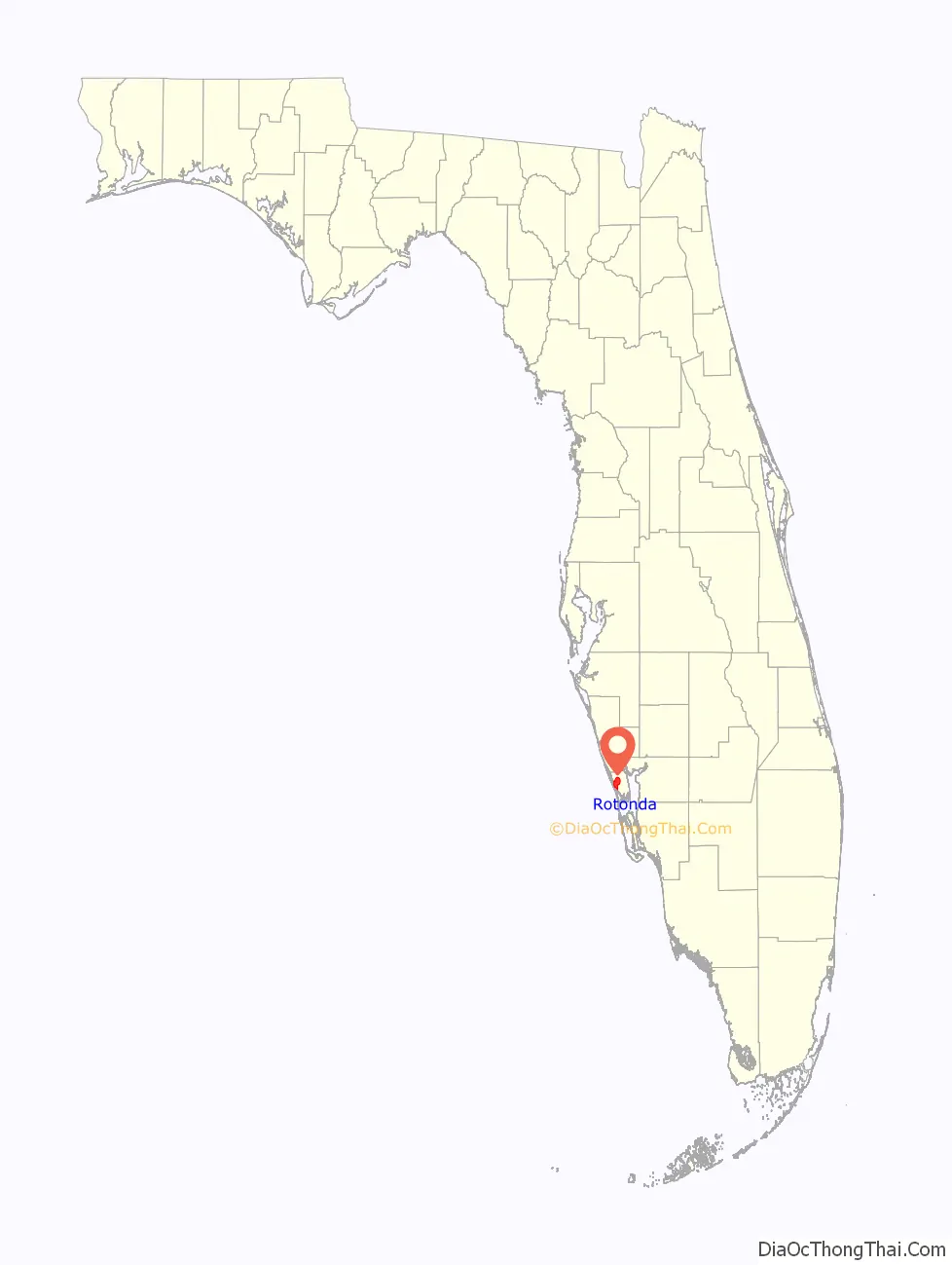
Rotonda location map. Where is Rotonda CDP?
History
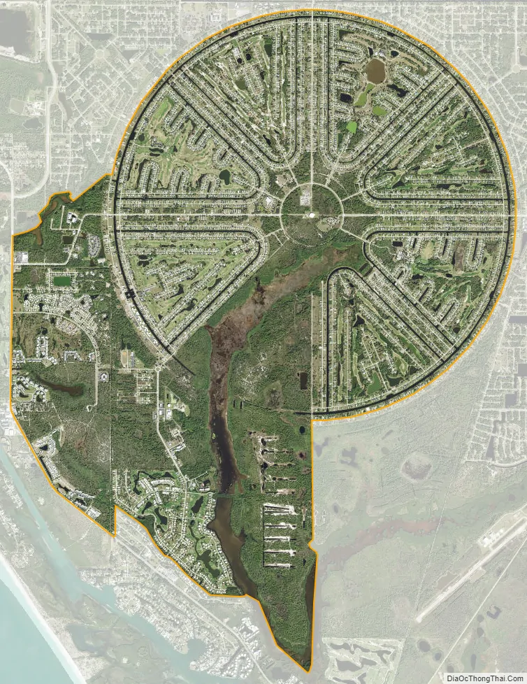
The land was first part of a large cattle ranch owned by brothers William and Alfred Vanderbilt, direct descendants of Cornelius Vanderbilt. They purchased the land in 1952 and sold a portion in 1969 that became Rotonda West. The development of Rotonda West began in 1970. The layout of Rotonda West precisely mimics temporary World War II airfields in Florida, laid out like a wagon wheel. There are canals as well as streets in this development; the canals are generally parallel to the streets. Shallow craft can maneuver on the canals.
The choice of the airfield layout as the pattern for Rotonda West gives it a flavor of Florida history, however there was no airfield at this location prior to development.
This area was one of many in Florida hit by Hurricane Ian in September 2022.
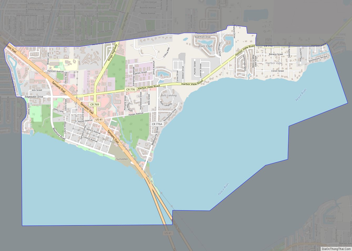
Rotonda Road Map
Rotonda city Satellite Map
Geography
Rotonda West is located at 26°53′16″N 82°16′17″W / 26.887875°N 82.271262°W / 26.887875; -82.271262Coordinates: 26°53′16″N 82°16′17″W / 26.887875°N 82.271262°W / 26.887875; -82.271262.
According to the United States Census Bureau, the Rotonda CDP has a total area of 11.5 square miles (29.9 km), of which 10.7 square miles (27.6 km) is land and 0.89 square miles (2.3 km), or 7.74%, is water.
See also
Map of Florida State and its subdivision:- Alachua
- Baker
- Bay
- Bradford
- Brevard
- Broward
- Calhoun
- Charlotte
- Citrus
- Clay
- Collier
- Columbia
- Desoto
- Dixie
- Duval
- Escambia
- Flagler
- Franklin
- Gadsden
- Gilchrist
- Glades
- Gulf
- Hamilton
- Hardee
- Hendry
- Hernando
- Highlands
- Hillsborough
- Holmes
- Indian River
- Jackson
- Jefferson
- Lafayette
- Lake
- Lee
- Leon
- Levy
- Liberty
- Madison
- Manatee
- Marion
- Martin
- Miami-Dade
- Monroe
- Nassau
- Okaloosa
- Okeechobee
- Orange
- Osceola
- Palm Beach
- Pasco
- Pinellas
- Polk
- Putnam
- Saint Johns
- Saint Lucie
- Santa Rosa
- Sarasota
- Seminole
- Sumter
- Suwannee
- Taylor
- Union
- Volusia
- Wakulla
- Walton
- Washington
- Alabama
- Alaska
- Arizona
- Arkansas
- California
- Colorado
- Connecticut
- Delaware
- District of Columbia
- Florida
- Georgia
- Hawaii
- Idaho
- Illinois
- Indiana
- Iowa
- Kansas
- Kentucky
- Louisiana
- Maine
- Maryland
- Massachusetts
- Michigan
- Minnesota
- Mississippi
- Missouri
- Montana
- Nebraska
- Nevada
- New Hampshire
- New Jersey
- New Mexico
- New York
- North Carolina
- North Dakota
- Ohio
- Oklahoma
- Oregon
- Pennsylvania
- Rhode Island
- South Carolina
- South Dakota
- Tennessee
- Texas
- Utah
- Vermont
- Virginia
- Washington
- West Virginia
- Wisconsin
- Wyoming