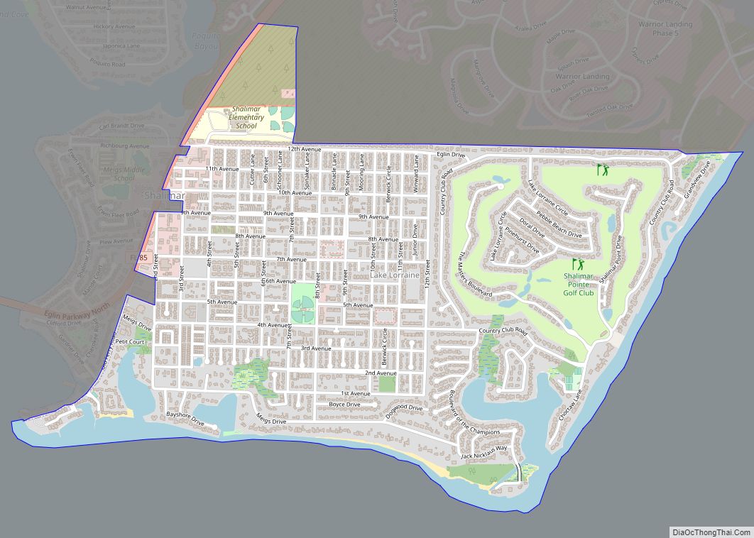
Shalimar is a town in Okaloosa County, Florida, United States. The population was 717 at the 2010 census. It is part of the Fort Walton Beach–Crestview–Destin Metropolitan Statistical Area.
| Name: | Shalimar town |
|---|---|
| LSAD Code: | 43 |
| LSAD Description: | town (suffix) |
| State: | Florida |
| County: | Okaloosa County |
| Elevation: | 13 ft (4 m) |
| Total Area: | 0.29 sq mi (0.75 km²) |
| Land Area: | 0.29 sq mi (0.75 km²) |
| Water Area: | 0.00 sq mi (0.00 km²) |
| Total Population: | 737 |
| Population Density: | 2,541.38/sq mi (981.05/km²) |
| ZIP code: | 32579 |
| Area code: | 850 |
| FIPS code: | 1265425 |
| Website: | www.shalimarflorida.org |
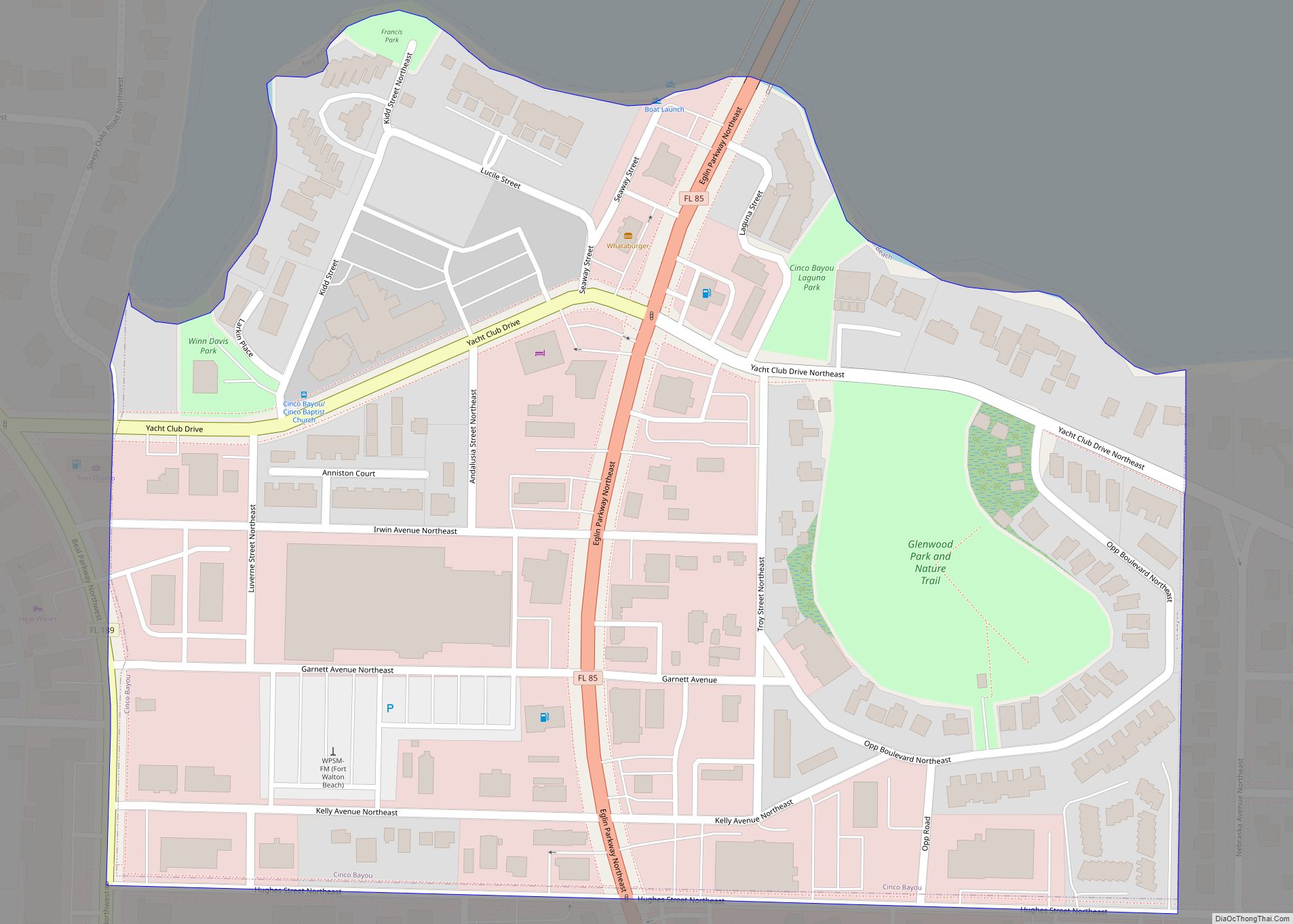
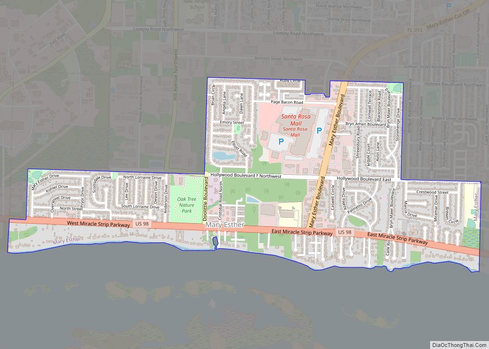
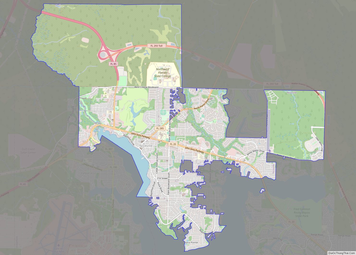
Online Interactive Map
Click on ![]() to view map in "full screen" mode.
to view map in "full screen" mode.
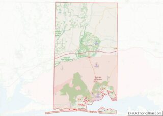
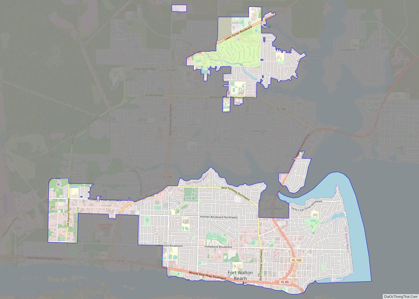
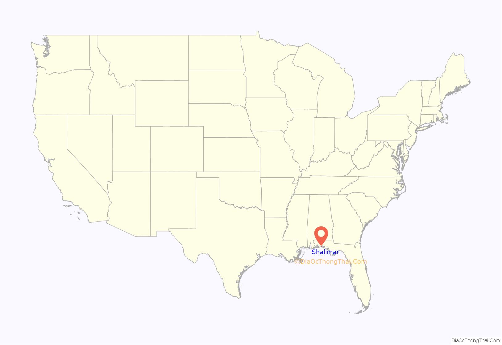
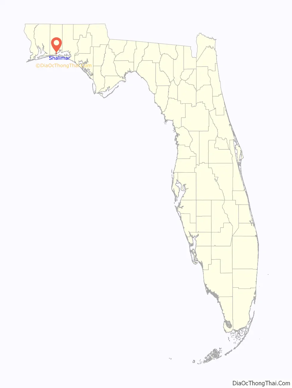
Shalimar location map. Where is Shalimar town?
History
Originally an area called Port Dixie, the town “sprang up out of the woods” in 1943–1944 as a community of 160 houses to be used as housing for military officers by developer Clifford H. Meigs.
During the Civil War [sic- First World War], 130 Germans operated a “dye” plant at Port Dixie, “actually an explosives factory and probably a submarine base as well.” Costly machinery was smashed when they fled and the records were thrown into Garnier’s Bayou.
“In February 1927 the Choctawhatchee and Northern Railroad was chartered ‘To construct, acquire, maintain, lease, or operate a line of railroad or railroads from a point between Galliver and Crestview on the Louisville and Nashville Railroad in Okaloosa County, to a point in said county on Choctawhatchee Bay, a distance of approximately twenty-eight miles.’ On Garnier’s Bayou near the present Eglin (Air Force Base) housing development of Shalimar, a $29,000,000 Port Dixie Harbor and Terminal Company was chartered to build wharves for liners, a rail line north, and a city of one square mile, with streets 100 feet wide.” These ambitious plans would not see fruition.
Badly needed new homes were constructed beginning in 1942 by Clifford Meigs and his associates to provide adequate facilities for commissioned officers assigned at the rapidly expanding Eglin Field, immediately north of what was initially referred to as “Shalimar Park”. This land was acquired from James E. Plew. The first 50 homes were almost complete by May, with another 25 underway, with the entire project costing approximately $350,000. The Plew Heights housing project near Valparaiso, Florida had been erected in 1941 to take care of civil service employees and enlisted personnel, but the government made no provision for commissioned officers.
A new post office opened in Shalimar on July 1, 1943, with Clifford H. Meigs serving as the first postmaster. Previously, mail for the new community was handled through Valparaiso, Florida.
Incorporated in June 1947, Clifford Meigs served as its first mayor. The incorporation was directly related to state law that prohibited clubs in unincorporated areas from staying open from midnight Saturday until Monday morning, which would negatively impact the gambling operations at the casino of the Shalimar Club, the opening of which “was the social event of 1947.” “The Fort Walton Beach [sic – Fort Walton did not become Fort Walton Beach until June 1953] places were doing a booming business on the weekends while there were rumors that the sheriff might enforce the law in Shalimar and close the place there,” Meigs told the Playground News in 1959. “The owner came to me and suggested incorporation, and while I didn’t think I had much to gain then, I agreed. With only about three other freeholders in the area, it was a simple matter to get incorporated.” The reprieve on gambling would be temporary, however. “The collapse of Okaloosa gambling was brought about by the glare of outside publicity, reform zeal from within and the direct intervention of Gov. Fuller Warren. The first wind of adversity was blown by the Tampa Tribune’s exposé of gambling in Fort Walton.” The 1949 article led to the governor suspending Okaloosa County Sheriff Isle Enzor and two constables in 1950 for failure to enforce the state gambling laws. The popular Enzor was reelected in 1952 but gambling was on the way out. “Back on the job and converted to the cause, Sheriff Enzor began cracking down, and soon even the Shalimar Club was turning to more ‘legitimate’ forms of entertainment. But without gambling, it was just another nightspot. The Shalimar closed for good in 1956.”
In 1948, the town features included the Shalimar Store, the Shalimar Service Station, and lumberman and Shalimar resident Roger Clary’s Shalimar Club. The 160 residences were rented through Shalimar Homes and Meigs Homes corporations.
In 1950, the 280-car capacity Florida Drive-In Theatre, erected at a cost of ~$40,000, at the junction of Ferry Road and State Road 85, later Eglin Parkway, the main road between the air force base and Fort Walton, Florida, opened on Thursday, June 15, with an Esther Williams picture, “On an Island with You“. Operated by the James K. Tringas family, that also built the Tringas Theatre in Fort Walton in 1940 (which is, ironically, still in business and being refurbished to its former glory in 2019), the drive-in would close in the fall of 1973. This property is now occupied by the Shalimar United Methodist Church family life center and a furniture store, which property is also owned by the church.
The Louis Woodham Concrete Company, which would provide construction materials for the growing Shalimar area, was established at Dixie Point at the end of Ferry Road by 1956, and would survive into the late 1970s before being replaced by condominiums. It was regularly supplied by towboats with barges of raw materials which transited across the Choctawhatchee Bay from the Intracoastal Waterway on the south edge of the bay. A Coast Guard tripod navigation marker in the bay just offshore of Meig’s Beach, Port Dixie, was removed after merchant commerce ceased to Ferry Point. The end of water deliveries to Ferry Point marked the last gasp of “Port Dixie” as once envisioned.
Clifford Meigs served as mayor until his death in 1960, and was succeeded by his brother Clyde Meigs in November, who had served as a councilman. The first elected mayor was James P. Tras, in 1965, followed by Sarah Tras for a two to three-year term. She had been married to Clifford Meigs at the time of his death, and is the wife of Jim Tras, as of 2009. Residential Meigs Drive, parallelling the Choctawhatchee Bay, Clifford Drive and Sara Drive are all named for the town’s founding family. Carl Brandt Drive and Gardner Drive are named for former Eglin AFB commanders.
During World War II, Eglin water range 60 was located in the bay immediately south of Port Dixie, with a battleship-size target float anchored off of Black’s Point.
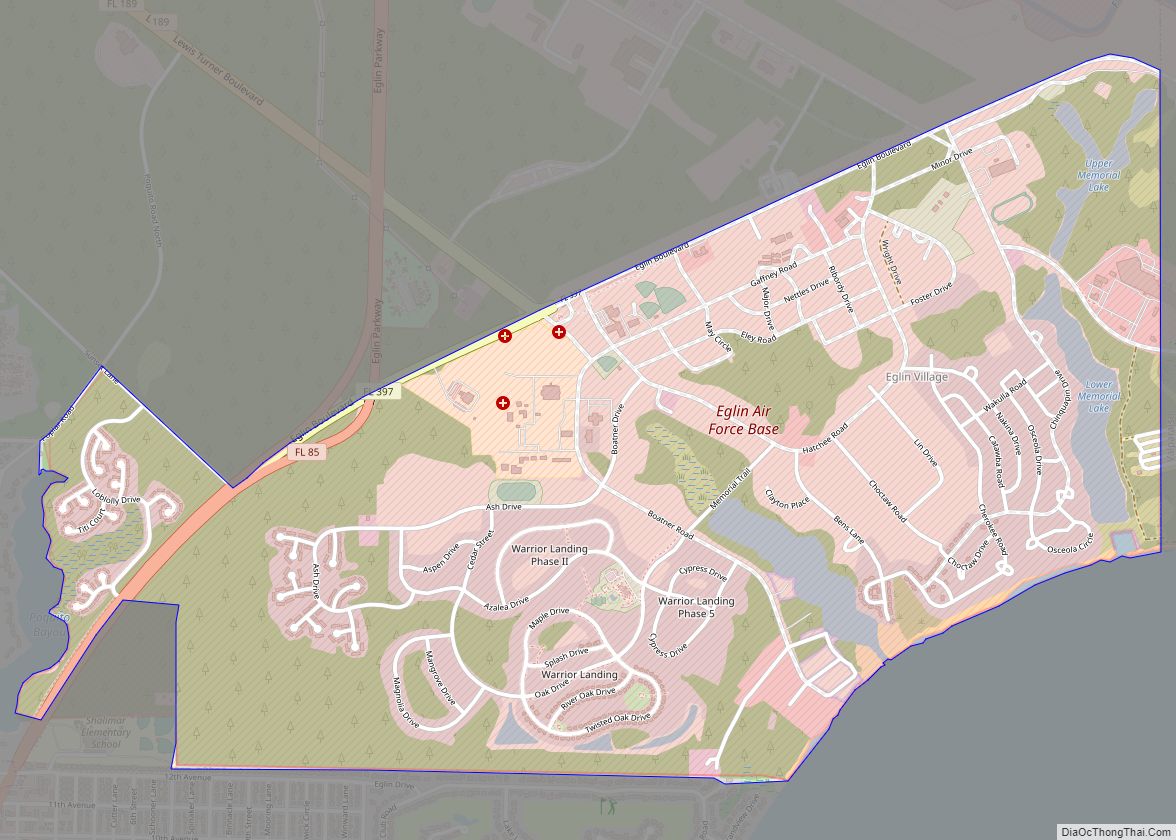
The Lake Lorraine area at Black’s Point to the east of the incorporated Shalimar community was developed in the 1970s, but carries a Shalimar postal address.
The Poquito Bayou area north of the incorporated Shalimar also carries a Shalimar postal address.
The mostly residential area of Okaloosa County between Shalimar and Lake Lorraine continues to be referred to as Port Dixie.
Shalimar Road Map
Shalimar city Satellite Map
Geography
Shalimar is located at 30°26′40″N 86°34′55″W / 30.44444°N 86.58194°W / 30.44444; -86.58194 (30.444398, –86.581904).
According to the United States Census Bureau, the town has a total area of 0.3 square miles (0.78 km), all land.
See also
Map of Florida State and its subdivision:- Alachua
- Baker
- Bay
- Bradford
- Brevard
- Broward
- Calhoun
- Charlotte
- Citrus
- Clay
- Collier
- Columbia
- Desoto
- Dixie
- Duval
- Escambia
- Flagler
- Franklin
- Gadsden
- Gilchrist
- Glades
- Gulf
- Hamilton
- Hardee
- Hendry
- Hernando
- Highlands
- Hillsborough
- Holmes
- Indian River
- Jackson
- Jefferson
- Lafayette
- Lake
- Lee
- Leon
- Levy
- Liberty
- Madison
- Manatee
- Marion
- Martin
- Miami-Dade
- Monroe
- Nassau
- Okaloosa
- Okeechobee
- Orange
- Osceola
- Palm Beach
- Pasco
- Pinellas
- Polk
- Putnam
- Saint Johns
- Saint Lucie
- Santa Rosa
- Sarasota
- Seminole
- Sumter
- Suwannee
- Taylor
- Union
- Volusia
- Wakulla
- Walton
- Washington
- Alabama
- Alaska
- Arizona
- Arkansas
- California
- Colorado
- Connecticut
- Delaware
- District of Columbia
- Florida
- Georgia
- Hawaii
- Idaho
- Illinois
- Indiana
- Iowa
- Kansas
- Kentucky
- Louisiana
- Maine
- Maryland
- Massachusetts
- Michigan
- Minnesota
- Mississippi
- Missouri
- Montana
- Nebraska
- Nevada
- New Hampshire
- New Jersey
- New Mexico
- New York
- North Carolina
- North Dakota
- Ohio
- Oklahoma
- Oregon
- Pennsylvania
- Rhode Island
- South Carolina
- South Dakota
- Tennessee
- Texas
- Utah
- Vermont
- Virginia
- Washington
- West Virginia
- Wisconsin
- Wyoming