Sweetwater is a city in Miami-Dade County, Florida, United States. As of the 2020 census, the population was 19,363, up from 13,499 in 2010.
| Name: | Sweetwater city |
|---|---|
| LSAD Code: | 25 |
| LSAD Description: | city (suffix) |
| State: | Florida |
| County: | Miami-Dade County |
| Incorporated: | October 10, 1941 |
| Total Area: | 2.30 sq mi (10.96 km²) |
| Land Area: | 2.19 sq mi (5.68 km²) |
| Water Area: | 0.11 sq mi (0.28 km²) |
| Total Population: | 19,363 |
| Population Density: | 8,833.49/sq mi (3,410.48/km²) |
| Area code: | 305, 786 |
| FIPS code: | 1270345 |
| GNISfeature ID: | 2405554 |
| Website: | www.cityofsweetwater.fl.gov |
Online Interactive Map
Click on ![]() to view map in "full screen" mode.
to view map in "full screen" mode.
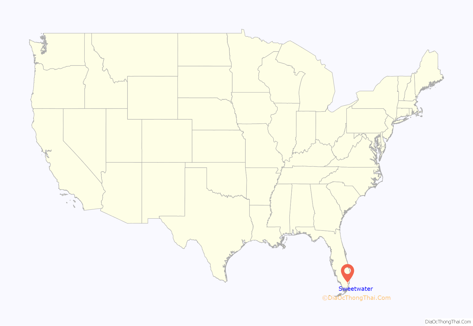
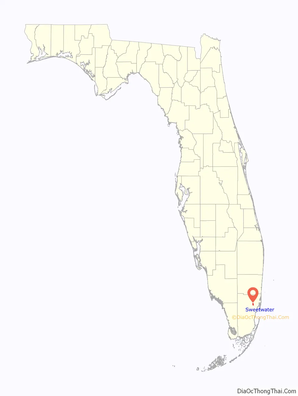
Sweetwater location map. Where is Sweetwater city?
History
The history of Sweetwater began during the Florida land boom of the 1920s when the Miami-Pittsburgh Land Company purchased land and laid out the original plat of “Sweetwater Groves”. However, the 1926 Miami Hurricane and subsequent South Florida real estate “bust” put an abrupt end to the development venture.
In 1938, Clyde Andrews acquired most of the “Sweetwater Groves” tract and began to market lots. Among his buyers was a troupe of Russian dwarves seeking a place to retire after a career with the circus. They built several mini-scaled homes suited to their needs. For years, Sweetwater was known as the “midget” community.
In 1941, Sweetwater held a successful election for incorporation. The new town’s first mayor was Joe Sanderlin, the midgets’ guardian and manager. By 1959, Sweetwater had attracted 500 residents and contained a town hall, church, grocery store, service station and 183 homes. It also had a two-man police force and a volunteer fire department. In 1970, Sweetwater was still a relatively small community of about 3,000 residents.
During the 1970s, several events dramatically changed the “sleepy little country town” of Sweetwater forever. These events included the establishment of Florida International University to the south of the city, the construction of the two major expressways to the north and west, and the discovery of Sweetwater by Dade County’s Hispanic community. The growth and development which was precipitated by these occurrences caused Sweetwater to more than double in population and lead all other Dade cities in growth during the 1970s.
In March 1996, Sweetwater made national news as 69 animals were found dead on two properties in the city. Dade County police and the local zoologist blamed a large dog, while some residents blamed the killings on the chupacabra.
In the 2010s, there are only a few vacant lots left to develop. By 2010, the city’s population had burgeoned to 13,499 persons, of which 95.5% were of Hispanic origin. The city now has a full-service police department, four parks, an elementary school, a county fire station, 4,353 residential housing units, 14 shopping centers, over 600 businesses, several churches and a bank. There are three 24-hour diners in Sweetwater, which are Rey’s Pizza (Cuban Style Pizza) and La Esquinita Havanera (Cuban Cuisine) and Latin Restaurant (Cuban Cuisine). All three are located a short distance from each other off 107th Avenue. Sweetwater is also located near Miami International Mall. After a December 2010 vote, Dolphin Mall is now part of the city.
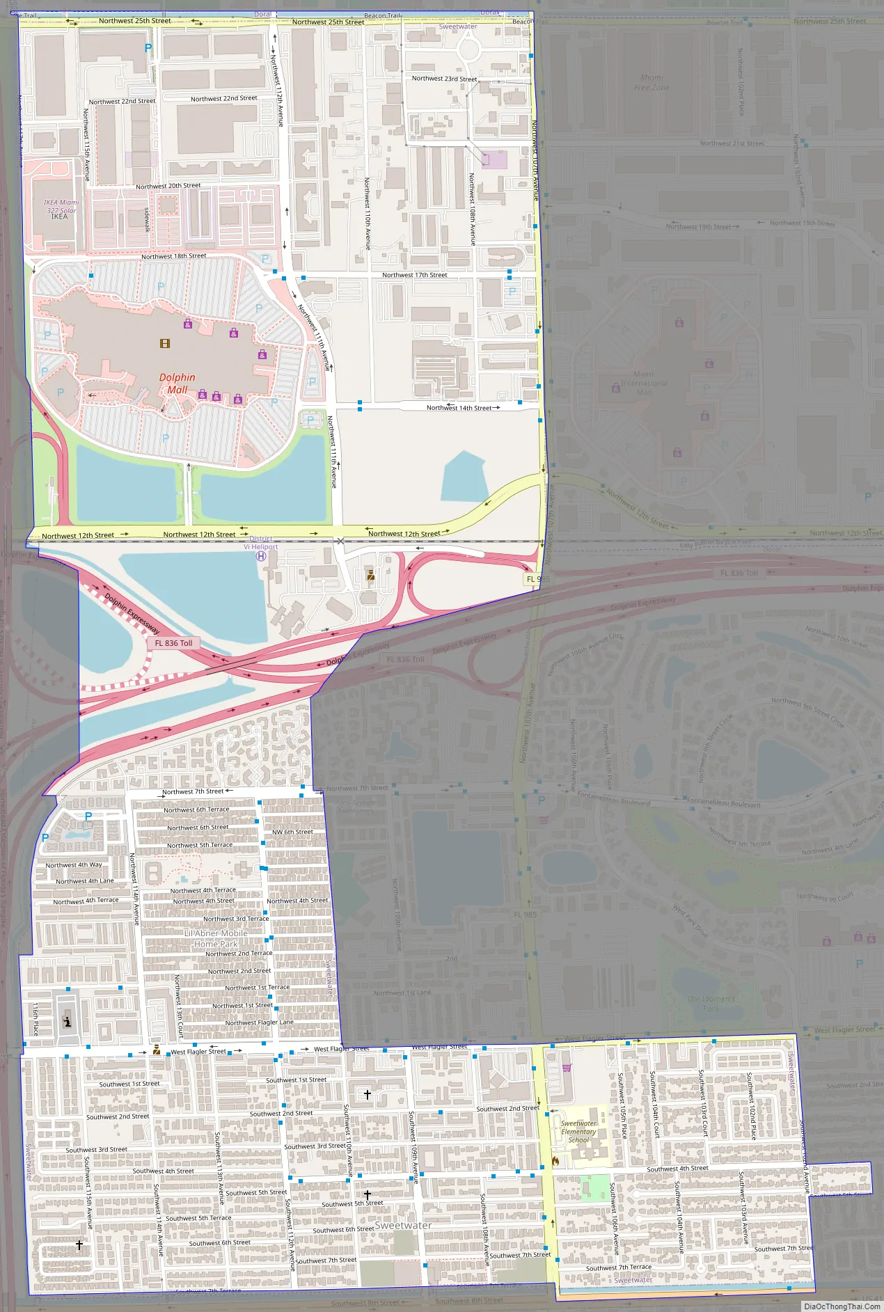
Sweetwater Road Map
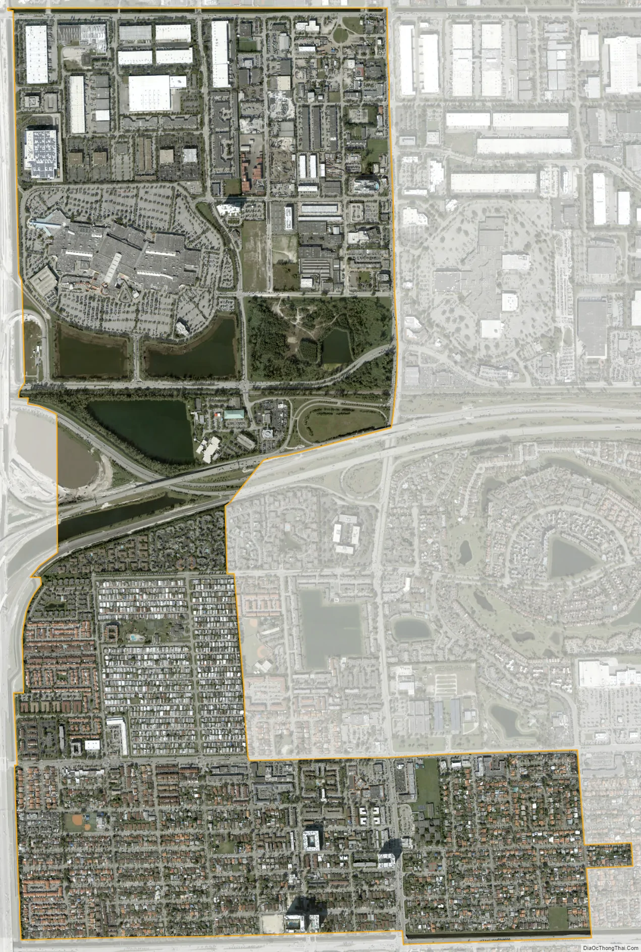
Sweetwater city Satellite Map
Geography
Sweetwater is located 12 miles (19 km) west of downtown Miami at 25°45′58″N 80°22′25″W / 25.76611°N 80.37361°W / 25.76611; -80.37361 (25.765977, –80.373624). It is bordered to the north and northeast by the city of Doral, to the southeast by Fontainebleau, to the south by Westchester, and to the west by Tamiami. The Ronald Reagan Turnpike forms the western edge of the city, and the Dolphin East-West Expressway crosses the center. U.S. Route 41 (Southwest 8th Street) follows the city’s southern border.
According to the United States Census Bureau, Sweetwater has a total area of 4.3 square miles (11 km), of which 3.9 square miles (10 km) are land and 0.4 square miles (1.0 km), or 9.58%, are water. The city tripled in size in 2010 upon the annexation of additional areas, including where Dolphin Mall is located. The annexed area is roughly bounded by Northwest Seventh and 25th streets, 107th Avenue and Florida’s Turnpike extension. The city on December 1, 2021, received approval from the county commission to annex 2 square miles of unincorporated land, bounded by NW 25th Street to the north, NW 12th Street to the south, Florida’s Turnpike extension to the east and NW 137th Avenue to the west. It doubled the size of Sweetwater, and the area includes many companies including the headquarters of the Telemundo television network, Topgolf, Amazon, Goya, Home Depot and City Furniture.
Surrounding areas
See also
Map of Florida State and its subdivision:- Alachua
- Baker
- Bay
- Bradford
- Brevard
- Broward
- Calhoun
- Charlotte
- Citrus
- Clay
- Collier
- Columbia
- Desoto
- Dixie
- Duval
- Escambia
- Flagler
- Franklin
- Gadsden
- Gilchrist
- Glades
- Gulf
- Hamilton
- Hardee
- Hendry
- Hernando
- Highlands
- Hillsborough
- Holmes
- Indian River
- Jackson
- Jefferson
- Lafayette
- Lake
- Lee
- Leon
- Levy
- Liberty
- Madison
- Manatee
- Marion
- Martin
- Miami-Dade
- Monroe
- Nassau
- Okaloosa
- Okeechobee
- Orange
- Osceola
- Palm Beach
- Pasco
- Pinellas
- Polk
- Putnam
- Saint Johns
- Saint Lucie
- Santa Rosa
- Sarasota
- Seminole
- Sumter
- Suwannee
- Taylor
- Union
- Volusia
- Wakulla
- Walton
- Washington
- Alabama
- Alaska
- Arizona
- Arkansas
- California
- Colorado
- Connecticut
- Delaware
- District of Columbia
- Florida
- Georgia
- Hawaii
- Idaho
- Illinois
- Indiana
- Iowa
- Kansas
- Kentucky
- Louisiana
- Maine
- Maryland
- Massachusetts
- Michigan
- Minnesota
- Mississippi
- Missouri
- Montana
- Nebraska
- Nevada
- New Hampshire
- New Jersey
- New Mexico
- New York
- North Carolina
- North Dakota
- Ohio
- Oklahoma
- Oregon
- Pennsylvania
- Rhode Island
- South Carolina
- South Dakota
- Tennessee
- Texas
- Utah
- Vermont
- Virginia
- Washington
- West Virginia
- Wisconsin
- Wyoming


