Thonotosassa is a census-designated place (CDP) in Hillsborough County, Florida, United States. The population was 15,238 at the 2020 census, up from 13,014 at the 2010 census.
| Name: | Thonotosassa CDP |
|---|---|
| LSAD Code: | 57 |
| LSAD Description: | CDP (suffix) |
| State: | Florida |
| County: | Hillsborough County |
| Elevation: | 33 ft (10 m) |
| Total Area: | 28.33 sq mi (73.37 km²) |
| Land Area: | 26.48 sq mi (68.59 km²) |
| Water Area: | 1.84 sq mi (4.78 km²) |
| Total Population: | 15,238 |
| Population Density: | 540/sq mi (210/km²) |
| ZIP code: | 33592 |
| Area code: | 813 |
| FIPS code: | 1271725 |
| GNISfeature ID: | 0292232 |
Online Interactive Map
Click on ![]() to view map in "full screen" mode.
to view map in "full screen" mode.
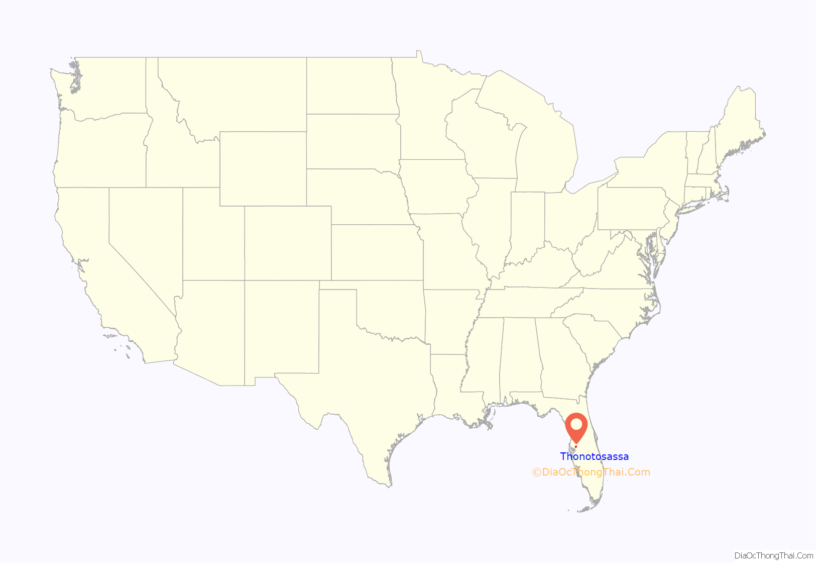
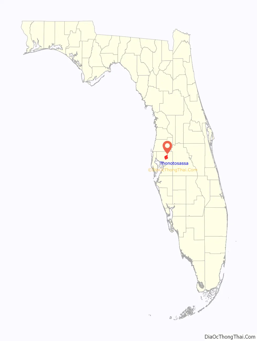
Thonotosassa location map. Where is Thonotosassa CDP?
History
The name “Thonotosassa” comes from the Seminole-Creek words ronoto “flint” and sasv “some”, meaning the place was a source of valuable flint. Following the establishment of Fort Brooke in 1824 in what is now Tampa, a road that ran northwest of Lake Thonotosassa was built between Fort Brooke and Fort King in Ocala. This road became known as the Fort King Road, which today is crossed in several locations by U.S. Route 301. Nevertheless, the presence of a Seminole village largely discouraged whites from moving into the area. After the Second Seminole War ended in 1842, whites began to settle.
In 1893, the Tampa and Thonotosassa Railroad opened a 13-mile (21 km) route between the two growing communities. This line today no longer extends into Thonotosassa, its northern tracks having been removed along with the town depot by the 1980s, but its southern portion remains a busy industrial spur, joining with the CSX main line at Neve Wye.
Among other areas for recreation for the youth is the Morris Bridge Road area and its Nature’s Classroom.
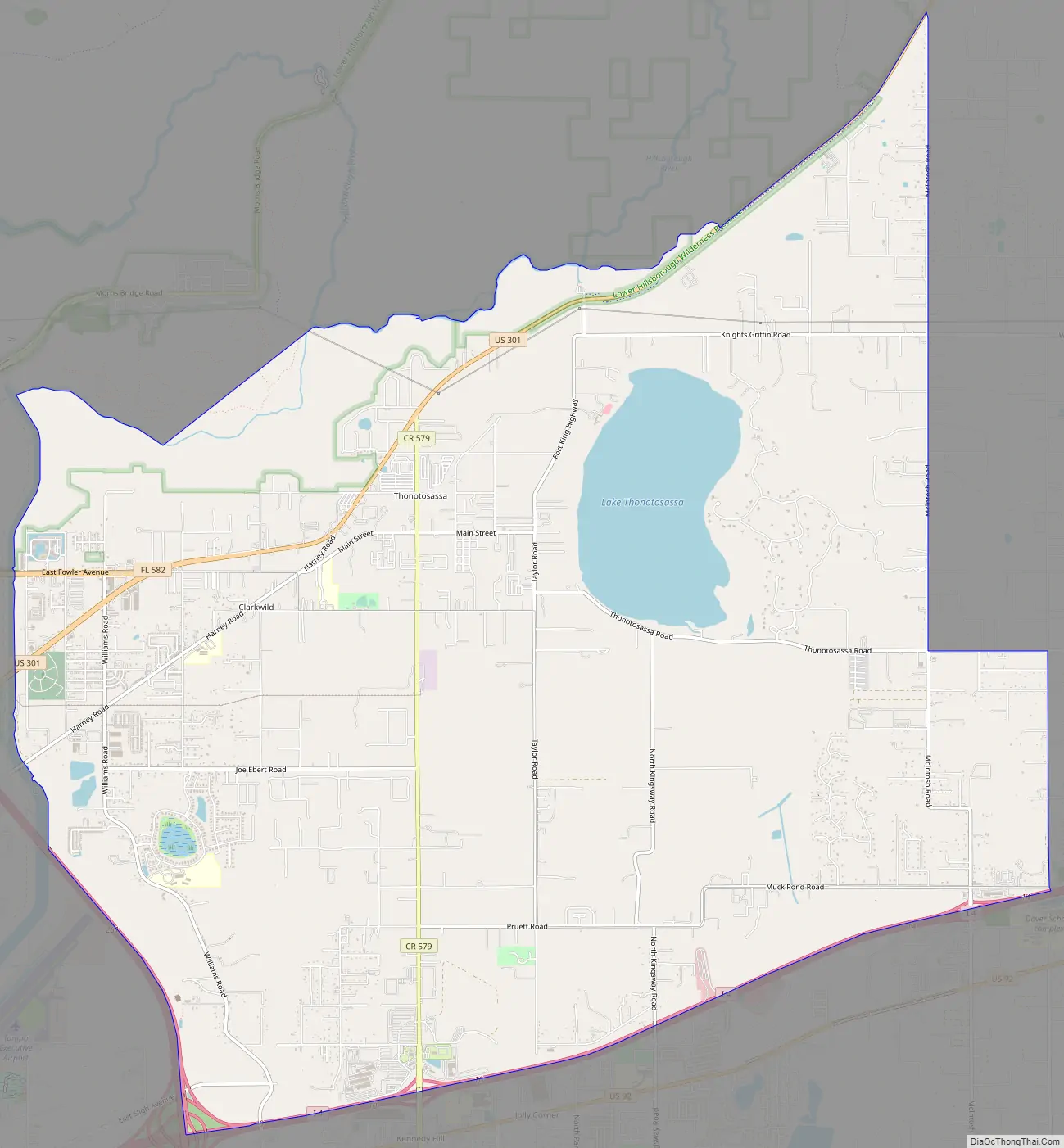
Thonotosassa Road Map
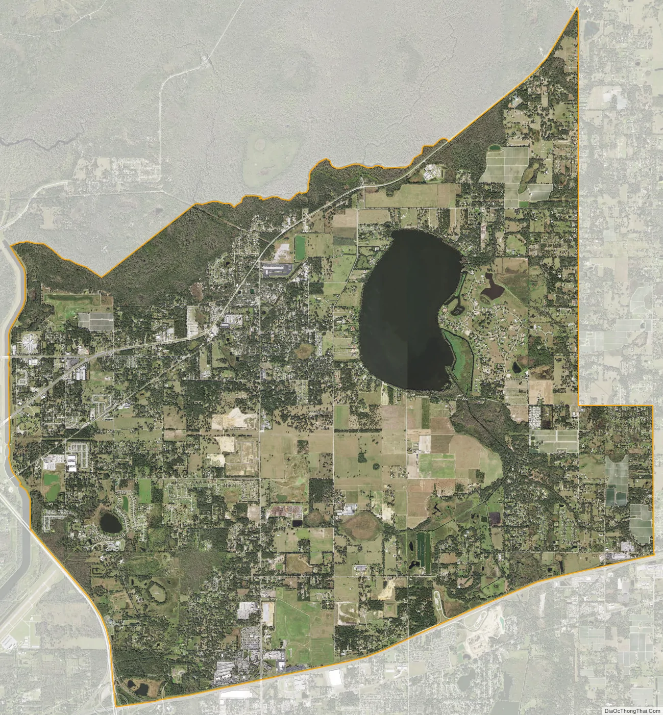
Thonotosassa city Satellite Map
Geography
Thonotosassa is located in northeastern Hillsborough County at 28°3′22″N 82°17′34″W / 28.05611°N 82.29278°W / 28.05611; -82.29278 (28.056135, -82.292663). It is bordered to the southwest by East Lake-Orient Park, and to the south by Mango and Seffner. The unincorporated community of Antioch is on the eastern edge of the CDP.
The Hillsborough River forms the northern edge of the CDP, Interstate 4 forms the southern edge, and Interstate 75 forms the western edge. I-4 leads east 24 miles (39 km) to Lakeland and west 11 miles (18 km) to downtown Tampa, while I-75 leads north 90 miles (140 km) to Ocala and south 46 miles (74 km) to Bradenton. U.S. Route 301 travels through the northern part of Thonotosassa, leading northeast 15 miles (24 km) to Zephyrhills and south 16 miles (26 km) to Riverview.
According to the United States Census Bureau, the CDP has a total area of 28.3 square miles (73.4 km), of which 26.5 square miles (68.6 km) are land and 1.9 square miles (4.8 km), or 6.51%, are water. It is 40 feet (12 m) above sea level. Plant City is 13 miles (21 km) to the east.
See also
Map of Florida State and its subdivision:- Alachua
- Baker
- Bay
- Bradford
- Brevard
- Broward
- Calhoun
- Charlotte
- Citrus
- Clay
- Collier
- Columbia
- Desoto
- Dixie
- Duval
- Escambia
- Flagler
- Franklin
- Gadsden
- Gilchrist
- Glades
- Gulf
- Hamilton
- Hardee
- Hendry
- Hernando
- Highlands
- Hillsborough
- Holmes
- Indian River
- Jackson
- Jefferson
- Lafayette
- Lake
- Lee
- Leon
- Levy
- Liberty
- Madison
- Manatee
- Marion
- Martin
- Miami-Dade
- Monroe
- Nassau
- Okaloosa
- Okeechobee
- Orange
- Osceola
- Palm Beach
- Pasco
- Pinellas
- Polk
- Putnam
- Saint Johns
- Saint Lucie
- Santa Rosa
- Sarasota
- Seminole
- Sumter
- Suwannee
- Taylor
- Union
- Volusia
- Wakulla
- Walton
- Washington
- Alabama
- Alaska
- Arizona
- Arkansas
- California
- Colorado
- Connecticut
- Delaware
- District of Columbia
- Florida
- Georgia
- Hawaii
- Idaho
- Illinois
- Indiana
- Iowa
- Kansas
- Kentucky
- Louisiana
- Maine
- Maryland
- Massachusetts
- Michigan
- Minnesota
- Mississippi
- Missouri
- Montana
- Nebraska
- Nevada
- New Hampshire
- New Jersey
- New Mexico
- New York
- North Carolina
- North Dakota
- Ohio
- Oklahoma
- Oregon
- Pennsylvania
- Rhode Island
- South Carolina
- South Dakota
- Tennessee
- Texas
- Utah
- Vermont
- Virginia
- Washington
- West Virginia
- Wisconsin
- Wyoming


