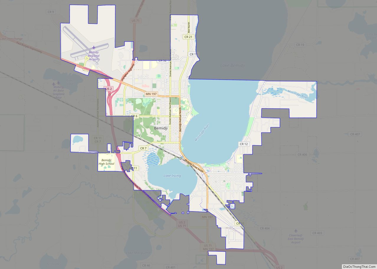
Bemidji (/bəˈmɪdʒiː/ bə-MIJ-ee) is a city and the county seat of Beltrami County, in northern Minnesota, United States. The population was 14,574 at the 2020 census. According to 2021 census estimates, the city is estimated to have a population of 15,279, making it the largest commercial center between Grand Forks, North Dakota and Duluth.
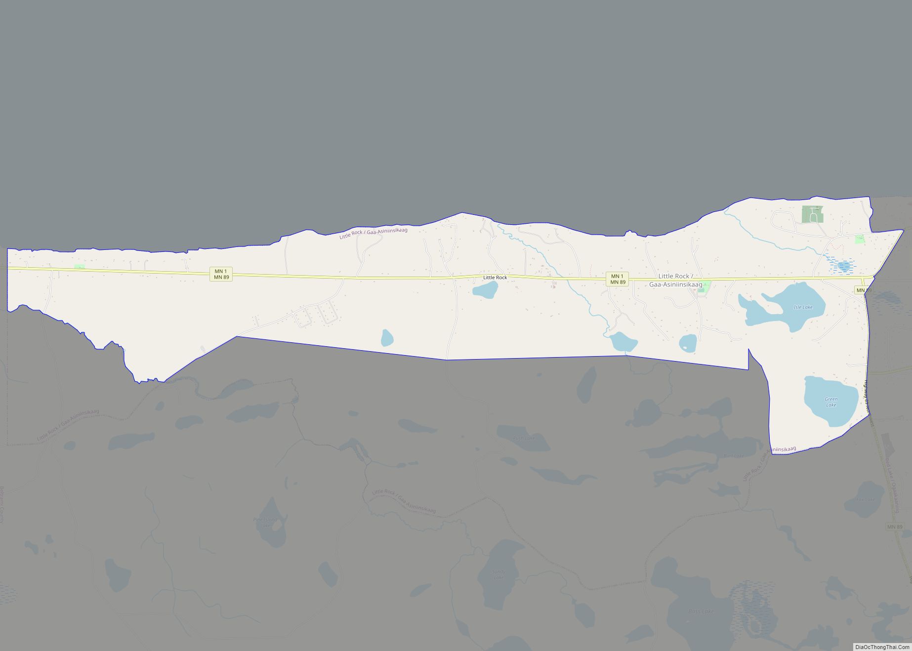
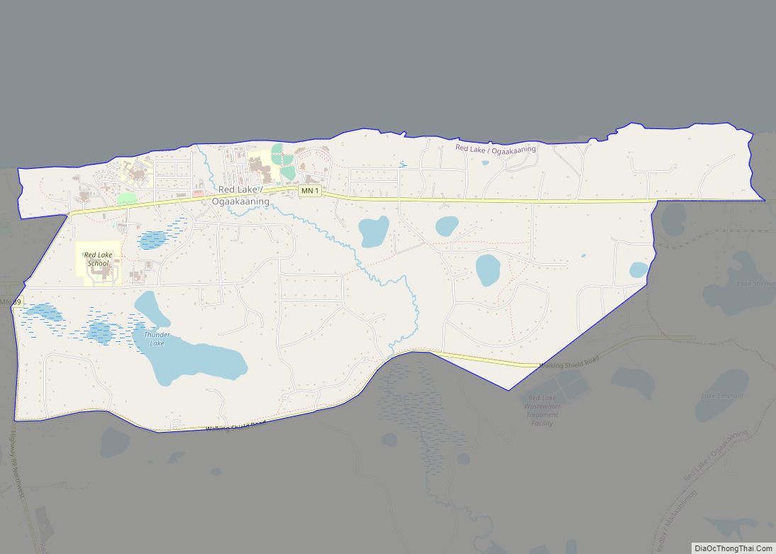
As a central city for three Indian reservations, Bemidji is the site of many Native American services, including the Indian Health Service. Near Bemidji are the Red Lake Indian Reservation, White Earth Indian Reservation, and the Leech Lake Indian Reservation. Bemidji lies on the southwest shore of Lake Bemidji, the northernmost lake feeding the Mississippi River; it is nicknamed “The First City on the Mississippi”. Bemidji is also the self-proclaimed “curling capital” of the U.S. and the alleged birthplace of legendary Paul Bunyan.
| Name: | Bemidji city |
|---|---|
| LSAD Code: | 25 |
| LSAD Description: | city (suffix) |
| State: | Minnesota |
| County: | Beltrami County |
| Founded: | 1888 |
| Incorporated: | 1896 |
| Elevation: | 1,365 ft (416 m) |
| Land Area: | 17.44 sq mi (45.17 km²) |
| Water Area: | 4.89 sq mi (12.68 km²) 21.90% |
| Population Density: | 835.71/sq mi (322.67/km²) |
| ZIP code: | 56601 |
| Area code: | 218 |
| FIPS code: | 2705068 |
| GNISfeature ID: | 0655325 |
| Website: | bemidji.govoffice.com |
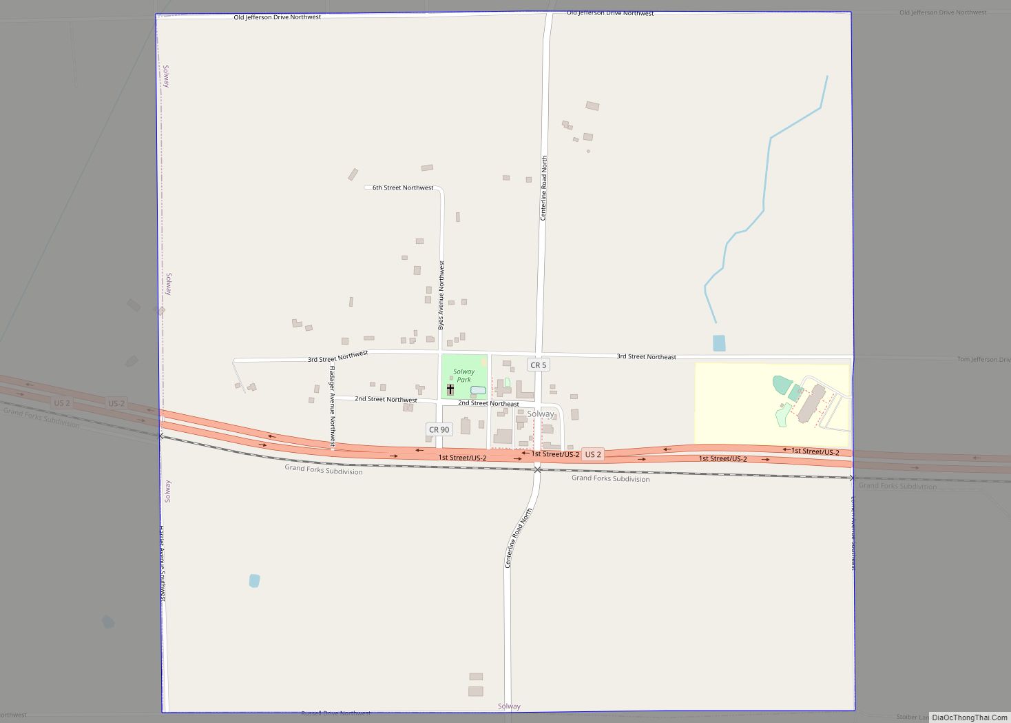
Online Interactive Map
Click on ![]() to view map in "full screen" mode.
to view map in "full screen" mode.
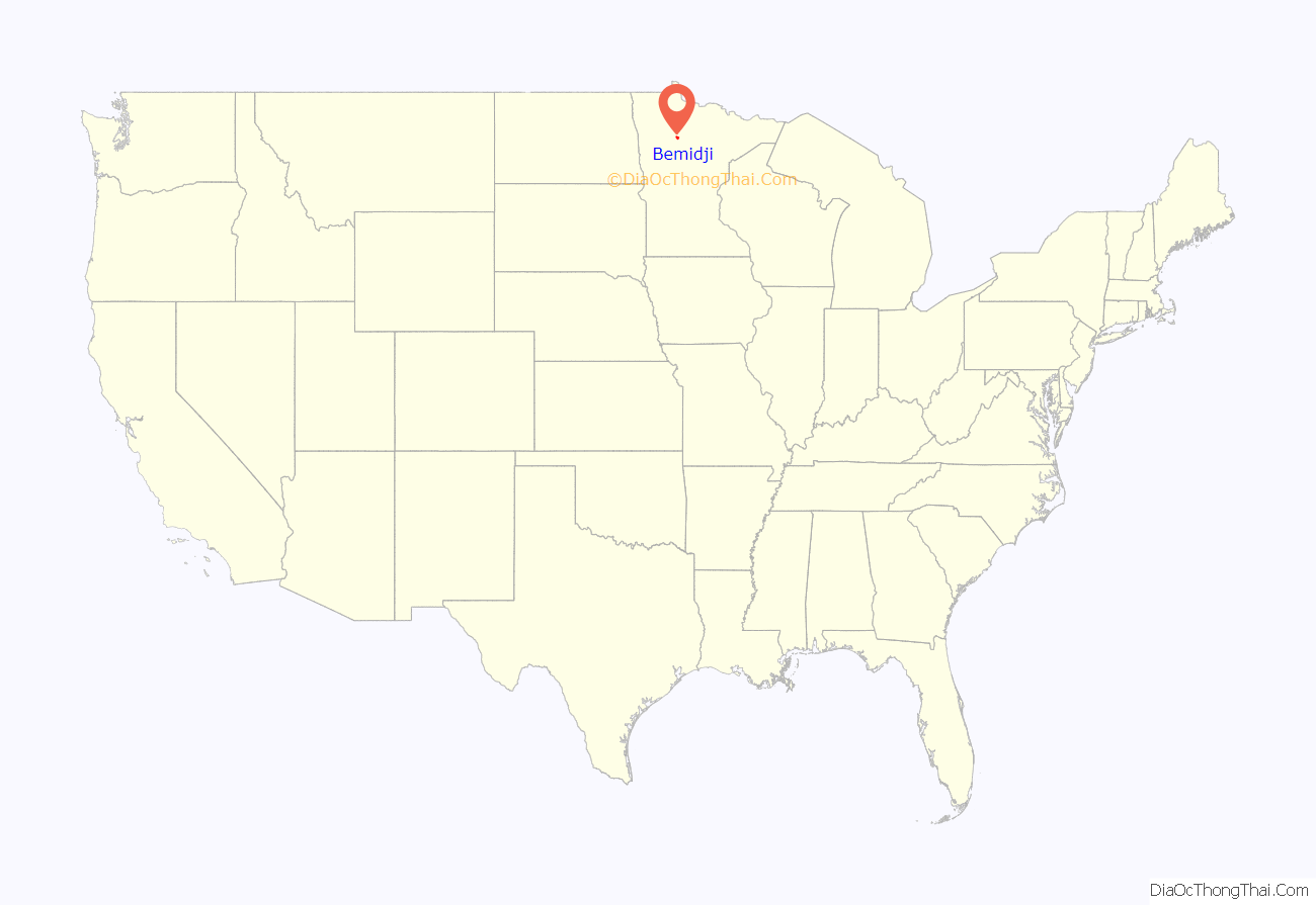
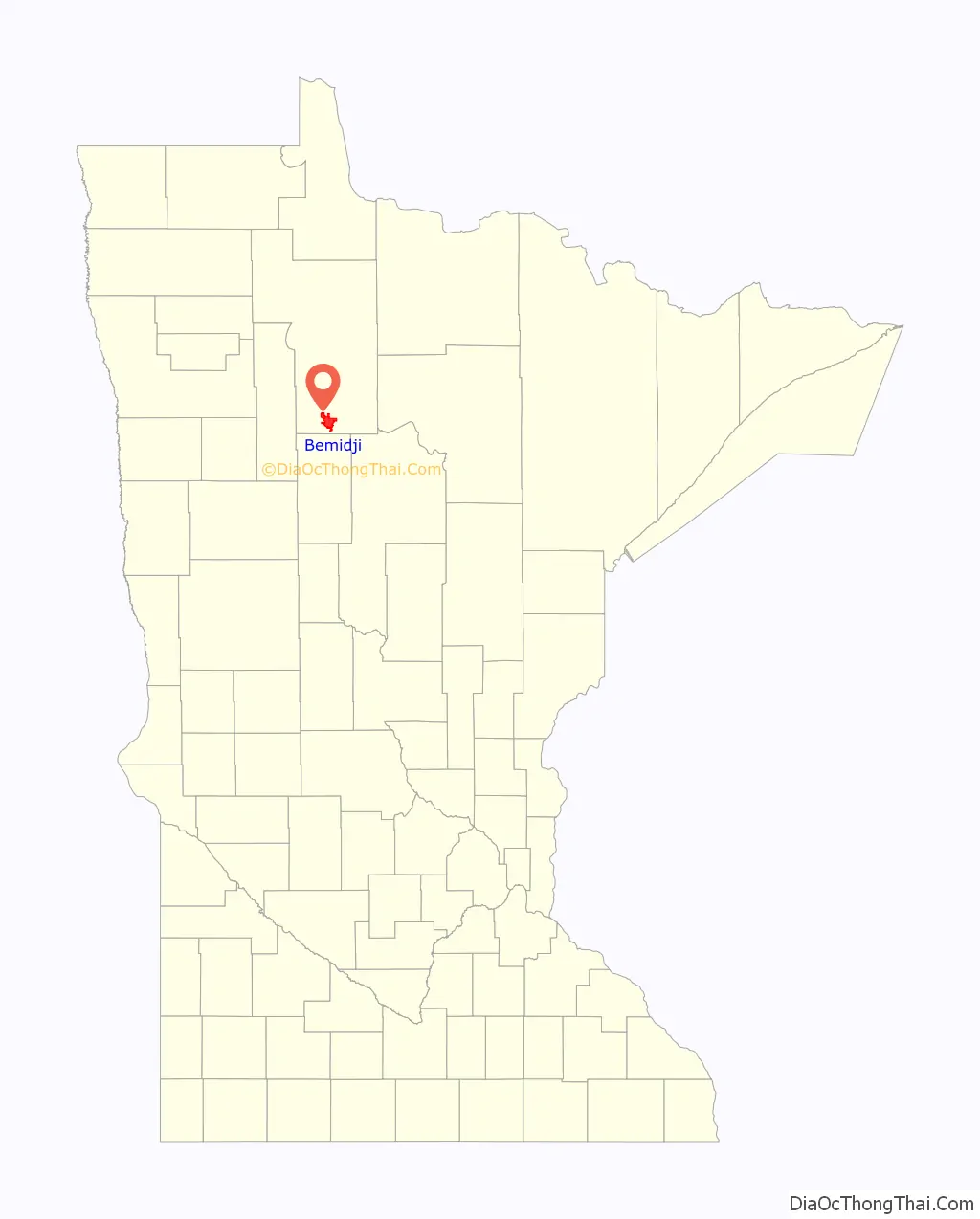
Bemidji location map. Where is Bemidji city?
History
Beltrami County was founded on February 28, 1866, by an act of legislation.
Bemidji Township was surveyed by European Americans in 1874. It was organized in 1896, 24 days after the village of Bemidji was chartered, and is the oldest township in the county. In 1897, the county attorney declared the original Bemidji township organization illegal (no reason given) and the township reorganized on June 26, 1897.
About 50 Leech Lake Indians lived along the south shore of the lake prior to the 1880s. They called the lake Bemidjigumaug, meaning “river or route flowing crosswise”. Freeman and Besty Doud claimed 160 acres west of and including present-day Diamond Point; they were Bemidji’s first homesteaders. The Porter Nye family soon followed them.
John Steidl’s sawmill was on the east bank of the Mississippi River, close to Carson’s Trading Post. Remore Hotel and Carl Carlson’s blacksmith shop were on the west side of the river. Bemidji was incorporated on May 20, 1896, and by that time there were three publishing companies, Alber Kaiser, The Bemidji Pioneer, and the Beltrami County News. William Bartleson’s Stage and Express Service was created to carry mail between Bemidji and Park Rapids. He was advertised by Speelman’s Eagle, owned by Clarence Speelman, along with other stores. By 1898, railroads came to Bemidji and brought even more business. By 1900 the Village of Bemidji’s population had grown to 2,000.
Thomas Barlow Walker and John S. and Charles Pillsbury invested millions into timber in 1874, since beaver pelts were nearing depletion by the mid-1890s. Walker owned Red River Lumber Company of Crookston, which claimed almost half of Beltrami County’s timber. He soon sold his sawmill and timber claim to Thomas Shevlin and Frank Hixon. Logging was done in the winter and sawmilling in the summer. Crookston opened 13 logging camps, which provided jobs and homes for lumberjacks. Between 1907 and 1910 drought and forest fires came to northern Minnesota. Lumber production was Bemidji’s major industry, but on July 19, 1914, a sawmill burned down, causing disaster for business. It was later rebuilt. During the Great Depression of the 1930s, Bemidji’s business profited, providing food, materials, and services for the Civilian Conservation Corps and Youth Conservation Corps programs. During the war years lumber business stopped, but when men came back from war lumber business boomed, since many people needed homes.
By the 1870s, timber cruisers were already making forays into the great pine forests that surrounded Bemidji. They were seeking new timberlands for Walker, the Pillsburys, Henry Akeley, Charles Ruggles and Frederick Weyerhaeuser, the barons of the wood industry.
Art Lee created the story that the folkloric figure Paul Bunyan came from the Northwoods. Tales about Paul Bunyan and Babe the Blue Ox led to public sculptures of them in the 1930s. According to Discover America, the Paul and Babe statues are “the second most photographed statues in America,” surpassed only by Mount Rushmore. The Rotarians of Bemidji commissioned the statue of Paul Bunyan during the Great Depression as a tourist attraction. It was unveiled on January 15, 1937, to kick off a Winter Carnival that drew more than 10,000 visitors.
Today Bemidji is an important educational, governmental, trade and medical center for north central Minnesota. The wood industry is still a significant part of the local economy, with Georgia-Pacific, Potlatch, and Northwood Panelboard all having waferboard plants in the local area. They use wood species that were once classified as waste trees.
Bemidji Road Map
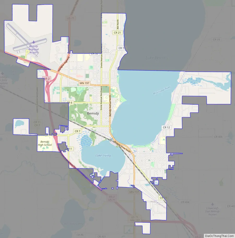
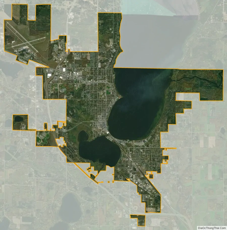
Bemidji city Satellite Map
Geography
According to the United States Census Bureau, the city has an area of 14.14 square miles (36.62 km), of which 12.92 square miles (33.46 km) is land and 1.22 square miles (3.16 km) is water.
Four-lane U.S. Route 2, U.S. Route 71 and Minnesota State Highway 197 are three of the main routes in the city. Minnesota State Highways 89 and 371 are nearby.
The largest earthquake on record for the Bemidji area was recorded on September 3, 1917. It is claimed that it shook houses in Bemidji and across northern Minnesota. The epicenter was about 95 miles (153 km) away in Staples, Minnesota, and it affected an area of 48,000 square kilometres (19,000 sq mi); it had a magnitude 4.4 with a maximum intensity of VI to VII. The closest and most recent quake occurred in Walker, Minnesota, on September 27, 1982, with a magnitude of 2.0.
See also
Map of Minnesota State and its subdivision:- Aitkin
- Anoka
- Becker
- Beltrami
- Benton
- Big Stone
- Blue Earth
- Brown
- Carlton
- Carver
- Cass
- Chippewa
- Chisago
- Clay
- Clearwater
- Cook
- Cottonwood
- Crow Wing
- Dakota
- Dodge
- Douglas
- Faribault
- Fillmore
- Freeborn
- Goodhue
- Grant
- Hennepin
- Houston
- Hubbard
- Isanti
- Itasca
- Jackson
- Kanabec
- Kandiyohi
- Kittson
- Koochiching
- Lac qui Parle
- Lake
- Lake of the Woods
- Lake Superior
- Le Sueur
- Lincoln
- Lyon
- Mahnomen
- Marshall
- Martin
- McLeod
- Meeker
- Mille Lacs
- Morrison
- Mower
- Murray
- Nicollet
- Nobles
- Norman
- Olmsted
- Otter Tail
- Pennington
- Pine
- Pipestone
- Polk
- Pope
- Ramsey
- Red Lake
- Redwood
- Renville
- Rice
- Rock
- Roseau
- Saint Louis
- Scott
- Sherburne
- Sibley
- Stearns
- Steele
- Stevens
- Swift
- Todd
- Traverse
- Wabasha
- Wadena
- Waseca
- Washington
- Watonwan
- Wilkin
- Winona
- Wright
- Yellow Medicine
- Alabama
- Alaska
- Arizona
- Arkansas
- California
- Colorado
- Connecticut
- Delaware
- District of Columbia
- Florida
- Georgia
- Hawaii
- Idaho
- Illinois
- Indiana
- Iowa
- Kansas
- Kentucky
- Louisiana
- Maine
- Maryland
- Massachusetts
- Michigan
- Minnesota
- Mississippi
- Missouri
- Montana
- Nebraska
- Nevada
- New Hampshire
- New Jersey
- New Mexico
- New York
- North Carolina
- North Dakota
- Ohio
- Oklahoma
- Oregon
- Pennsylvania
- Rhode Island
- South Carolina
- South Dakota
- Tennessee
- Texas
- Utah
- Vermont
- Virginia
- Washington
- West Virginia
- Wisconsin
- Wyoming