Aneta is a city in Nelson County, North Dakota, United States. The population was 234 at the 2020 census. Aneta was first settled in 1882 and incorporated as a city in 1893.
| Name: | Aneta city |
|---|---|
| LSAD Code: | 25 |
| LSAD Description: | city (suffix) |
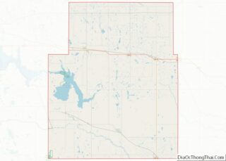
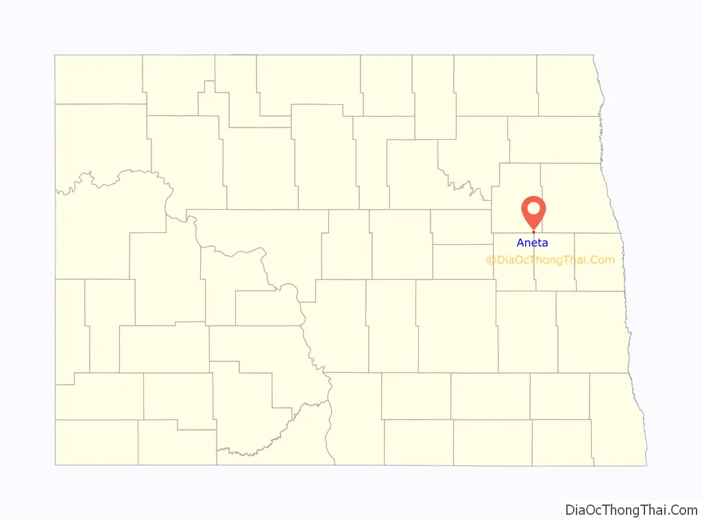
| State: | North Dakota |
| County: | Nelson County |
| Founded: | 1882 |
| Incorporated: | 1893 |
| Elevation: | 1,503 ft (458 m) |
| Total Area: | 1.00 sq mi (2.59 km²) |
| Land Area: | 0.99 sq mi (2.58 km²) |
| Water Area: | 0.00 sq mi (0.01 km²) |
| Total Population: | 234 |
| Population Density: | 235.18/sq mi (90.78/km²) |
| ZIP code: | 58212 |
| Area code: | 701 |
| FIPS code: | 3802380 |
| GNISfeature ID: | 1027704 |
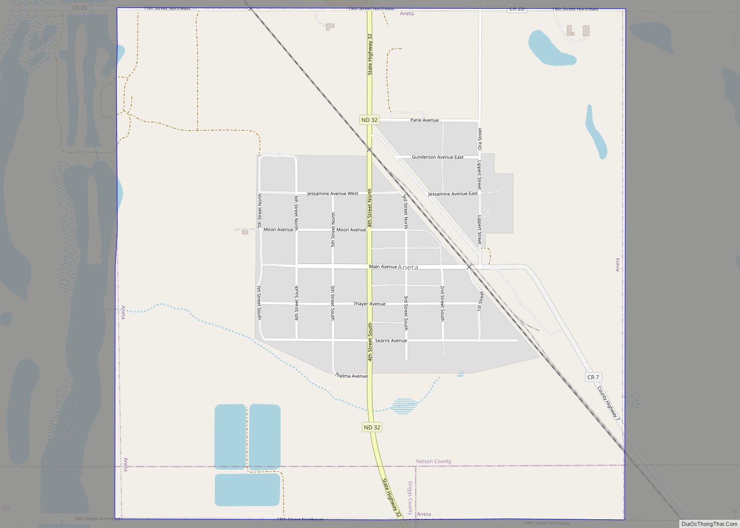
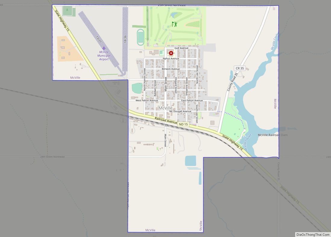
Online Interactive Map
Click on ![]() to view map in "full screen" mode.
to view map in "full screen" mode.
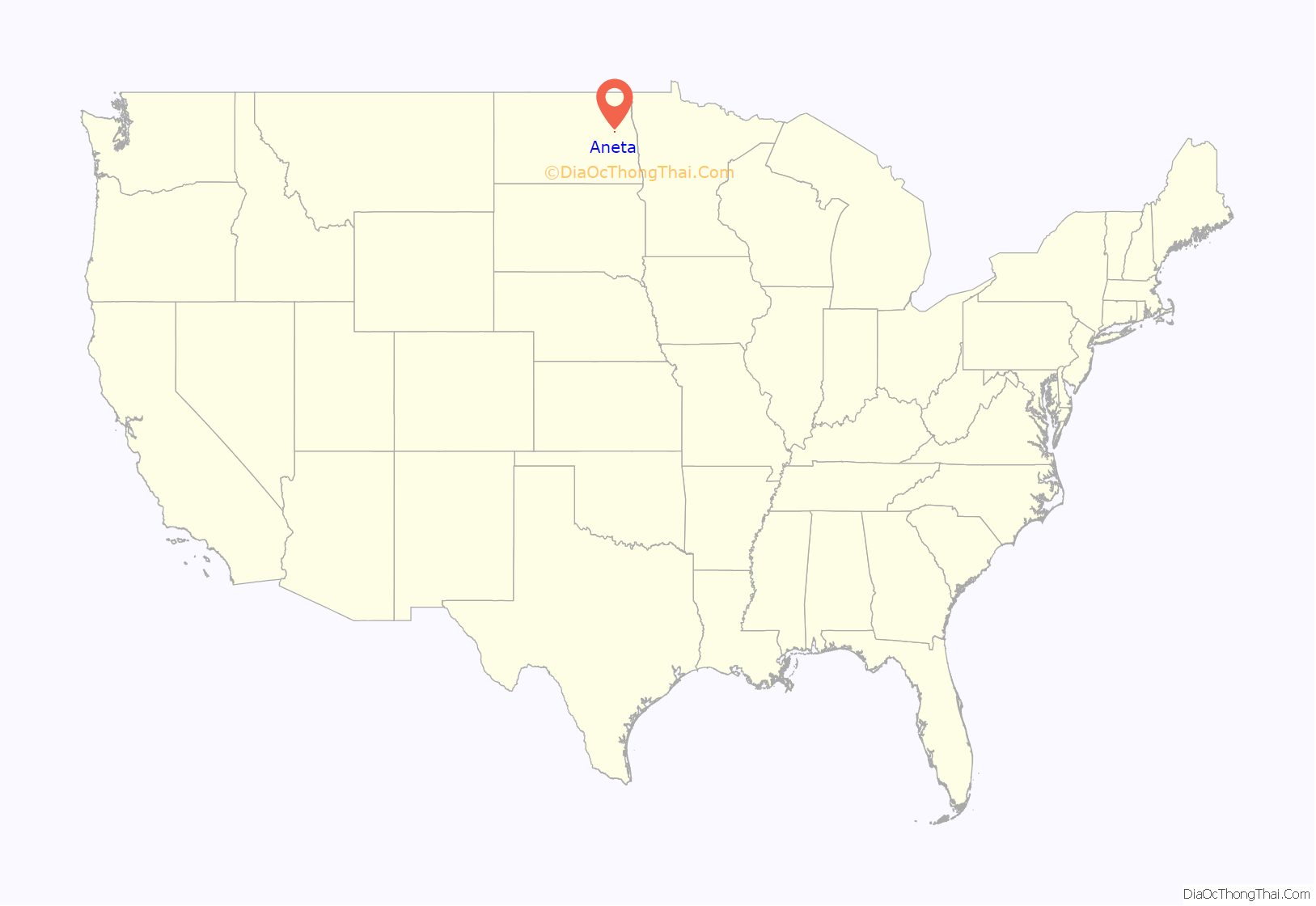
Aneta location map. Where is Aneta city?
History
Aneta was first settled in 1882. It was named after Anna Roseta Mitchell, the first woman settler in the community. Because the Sheyenne River flows nearby, the town was nicknamed, “The Queen City of the Upper Sheyenne.” In 1896, the Great Northern Railway extended a branch line 28 miles from Hope to Aneta and the city quickly became a boomtown.
In 1893, Aneta incorporated as a city, which in North Dakota required a population of 500. At the time, its population was 512. Only 100 residents voted in the election – 59 for, 39 against, and two spoiled votes. A subsequent election for mayor (held in Thayer Hall) resulted in Mayor George F. Thayer. Municipal services were provided to residents as follows: school in 1897, telephone in 1899, electric lights in 1912, civic auditorium in 1927, water in 1955, sewer in 1960, and paved streets in 1965.
Aneta’s Post Office was established in 1883 and a railroad station established 1896. Aneta was incorporated as a village in October 1897 and as a city on May 14, 1903. (ND Centennial Blue Book Page 502)
Aneta Road Map
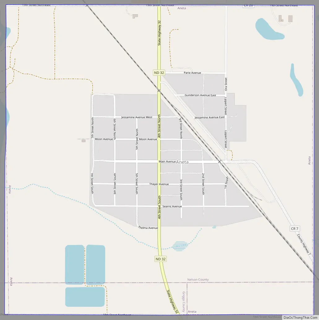
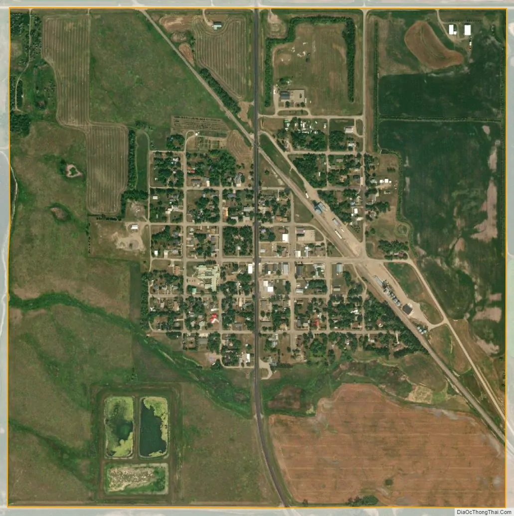
Aneta city Satellite Map
Geography
Aneta is located at 47°40′48″N 97°59′21″W / 47.68000°N 97.98917°W / 47.68000; -97.98917 (47.679923, −97.989231).
According to the United States Census Bureau, the city has a total area of 0.99 square miles (2.56 km), all land.
See also
Map of North Dakota State and its subdivision:- Adams
- Barnes
- Benson
- Billings
- Bottineau
- Bowman
- Burke
- Burleigh
- Cass
- Cavalier
- Dickey
- Divide
- Dunn
- Eddy
- Emmons
- Foster
- Golden Valley
- Grand Forks
- Grant
- Griggs
- Hettinger
- Kidder
- Lamoure
- Logan
- McHenry
- McIntosh
- McKenzie
- McLean
- Mercer
- Morton
- Mountrail
- Nelson
- Oliver
- Pembina
- Pierce
- Ramsey
- Ransom
- Renville
- Richland
- Rolette
- Sargent
- Sheridan
- Sioux
- Slope
- Stark
- Steele
- Stutsman
- Towner
- Traill
- Walsh
- Ward
- Wells
- Williams
- Alabama
- Alaska
- Arizona
- Arkansas
- California
- Colorado
- Connecticut
- Delaware
- District of Columbia
- Florida
- Georgia
- Hawaii
- Idaho
- Illinois
- Indiana
- Iowa
- Kansas
- Kentucky
- Louisiana
- Maine
- Maryland
- Massachusetts
- Michigan
- Minnesota
- Mississippi
- Missouri
- Montana
- Nebraska
- Nevada
- New Hampshire
- New Jersey
- New Mexico
- New York
- North Carolina
- North Dakota
- Ohio
- Oklahoma
- Oregon
- Pennsylvania
- Rhode Island
- South Carolina
- South Dakota
- Tennessee
- Texas
- Utah
- Vermont
- Virginia
- Washington
- West Virginia
- Wisconsin
- Wyoming