Buchanan is a city in Stutsman County, North Dakota, United States. The population was 87 at the 2020 census. Buchanan was founded in 1887.
Buchanan was once home to Henry Leuhr’s Giant Bull, inspired by the World’s Largest Buffalo in Jamestown, North Dakota, which stood 30 feet (9.1 m) tall and was 50 feet (15 m) long until it deteriorated and was removed from its site in January 2007.
| Name: | Buchanan city |
|---|---|
| LSAD Code: | 25 |
| LSAD Description: | city (suffix) |
| State: | North Dakota |
| County: | Stutsman County |
| Elevation: | 1,555 ft (474 m) |
| Total Area: | 0.08 sq mi (0.20 km²) |
| Land Area: | 0.08 sq mi (0.20 km²) |
| Water Area: | 0.00 sq mi (0.00 km²) |
| Total Population: | 87 |
| Population Density: | 1,144.74/sq mi (441.13/km²) |
| ZIP code: | 58420 |
| Area code: | 701 |
| FIPS code: | 3810060 |
| GNISfeature ID: | 1028167 |
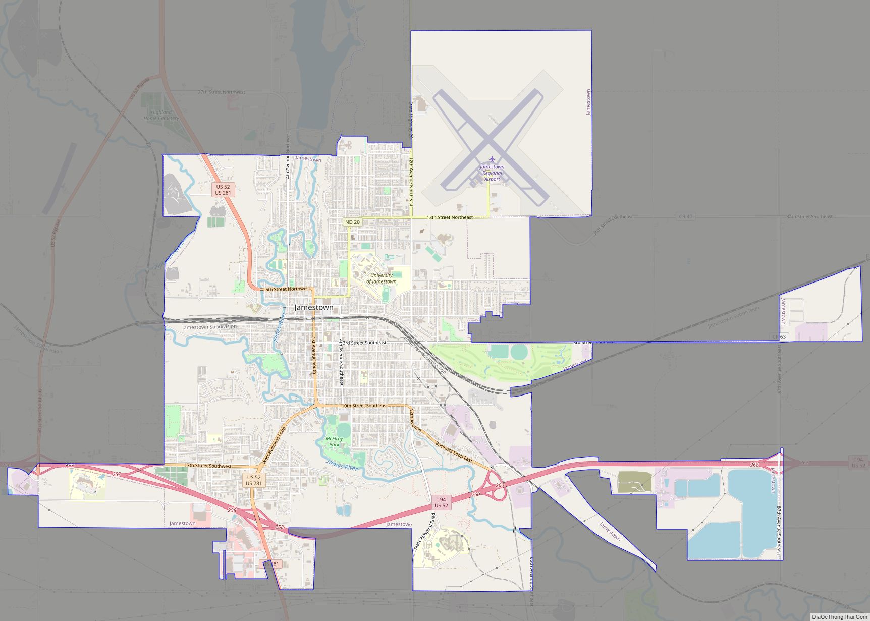
Online Interactive Map
Click on ![]() to view map in "full screen" mode.
to view map in "full screen" mode.
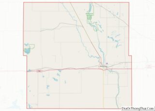
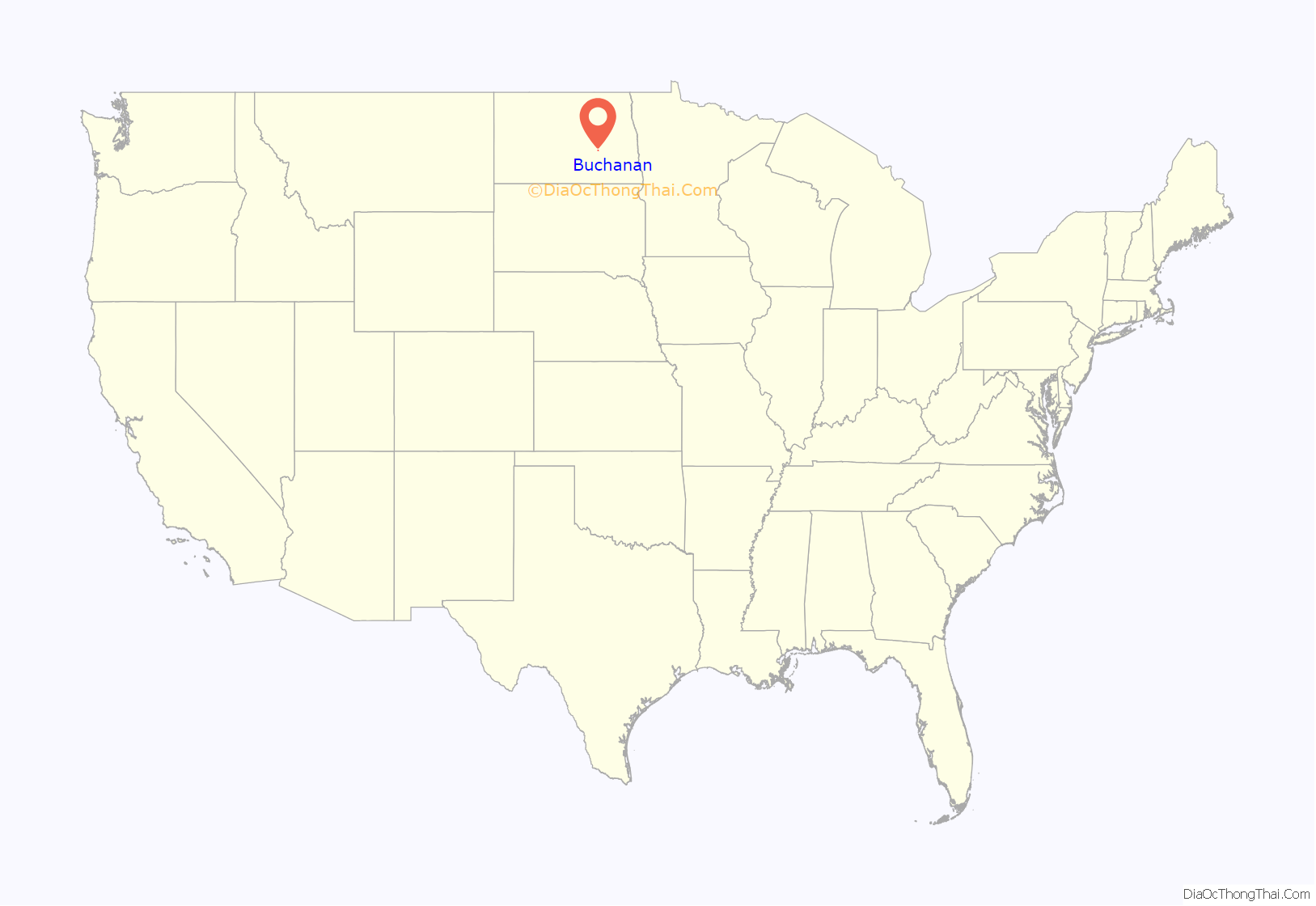
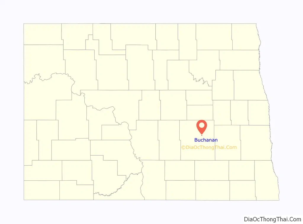
Buchanan location map. Where is Buchanan city?
History
A post office called Buchanan has been in operation since 1894. The city’s name honors James A. Buchanan, a local pioneer.
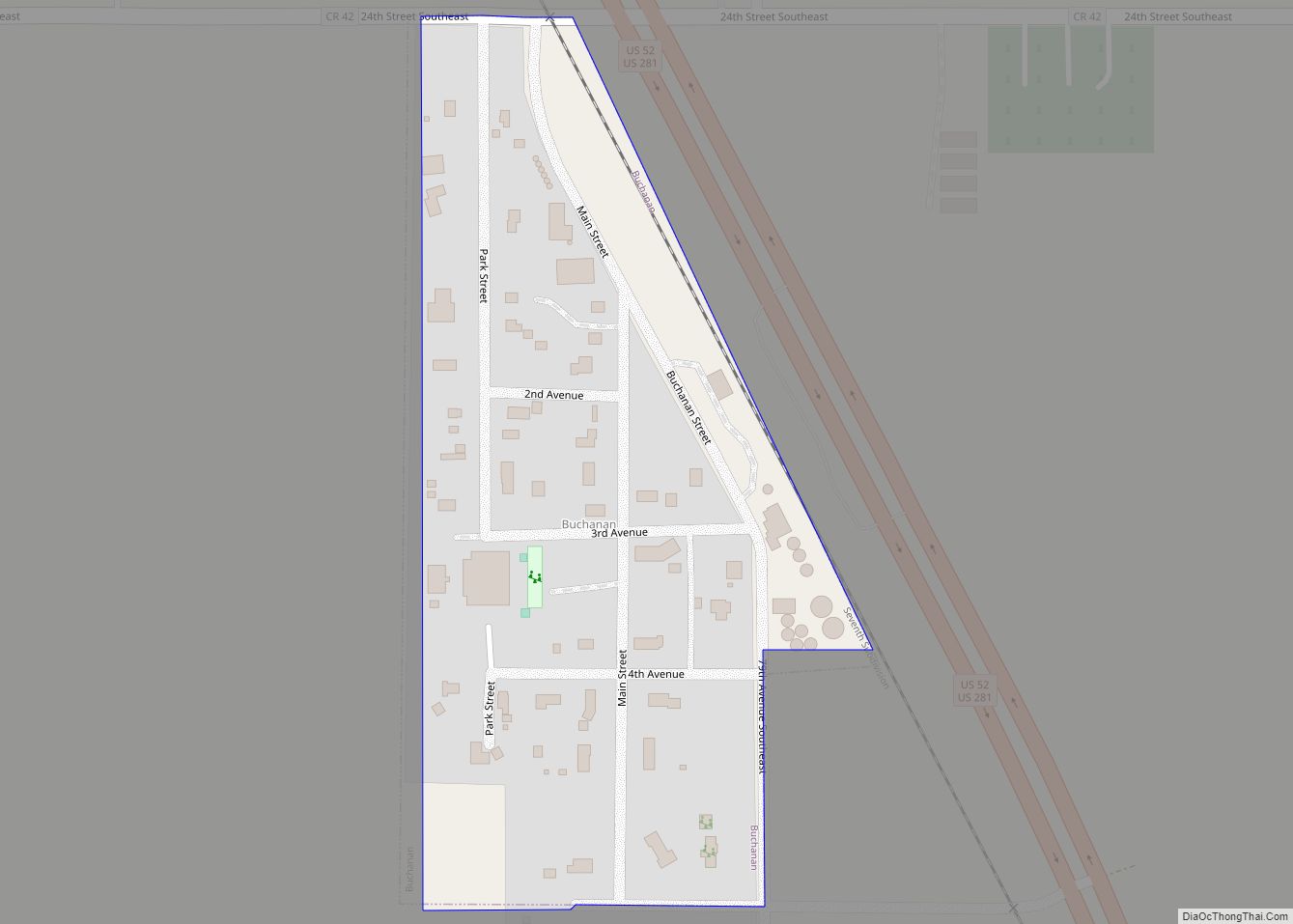
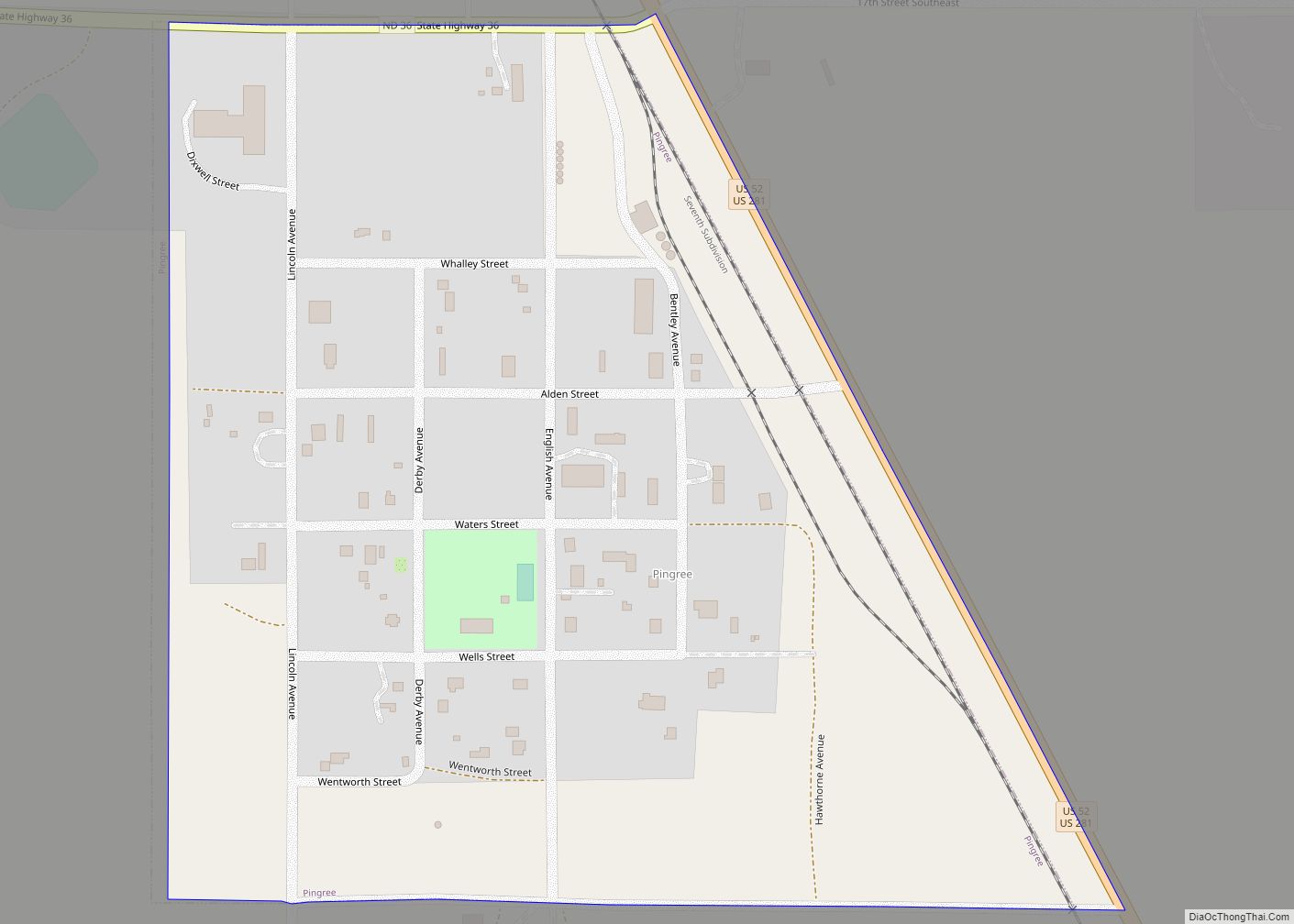
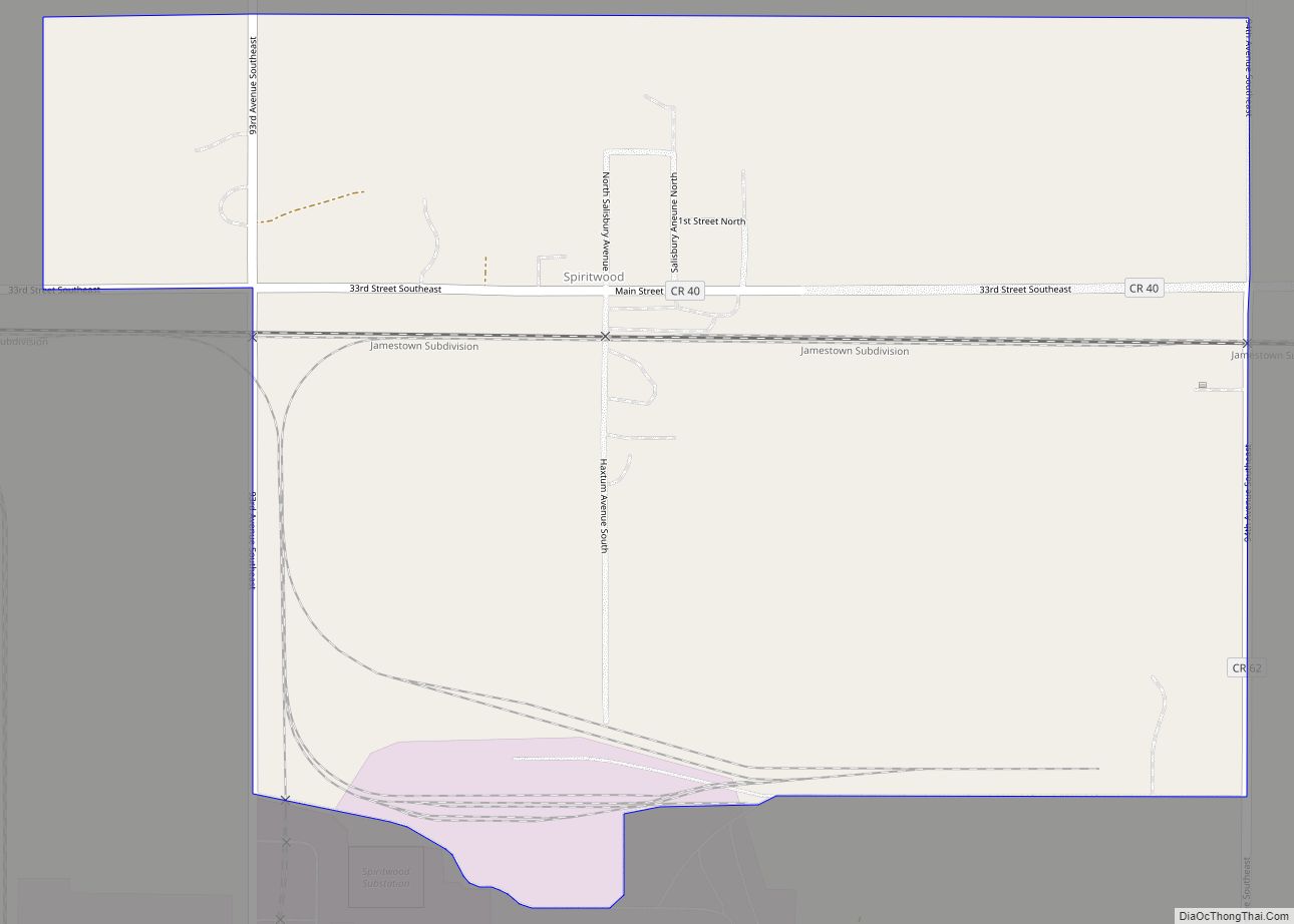
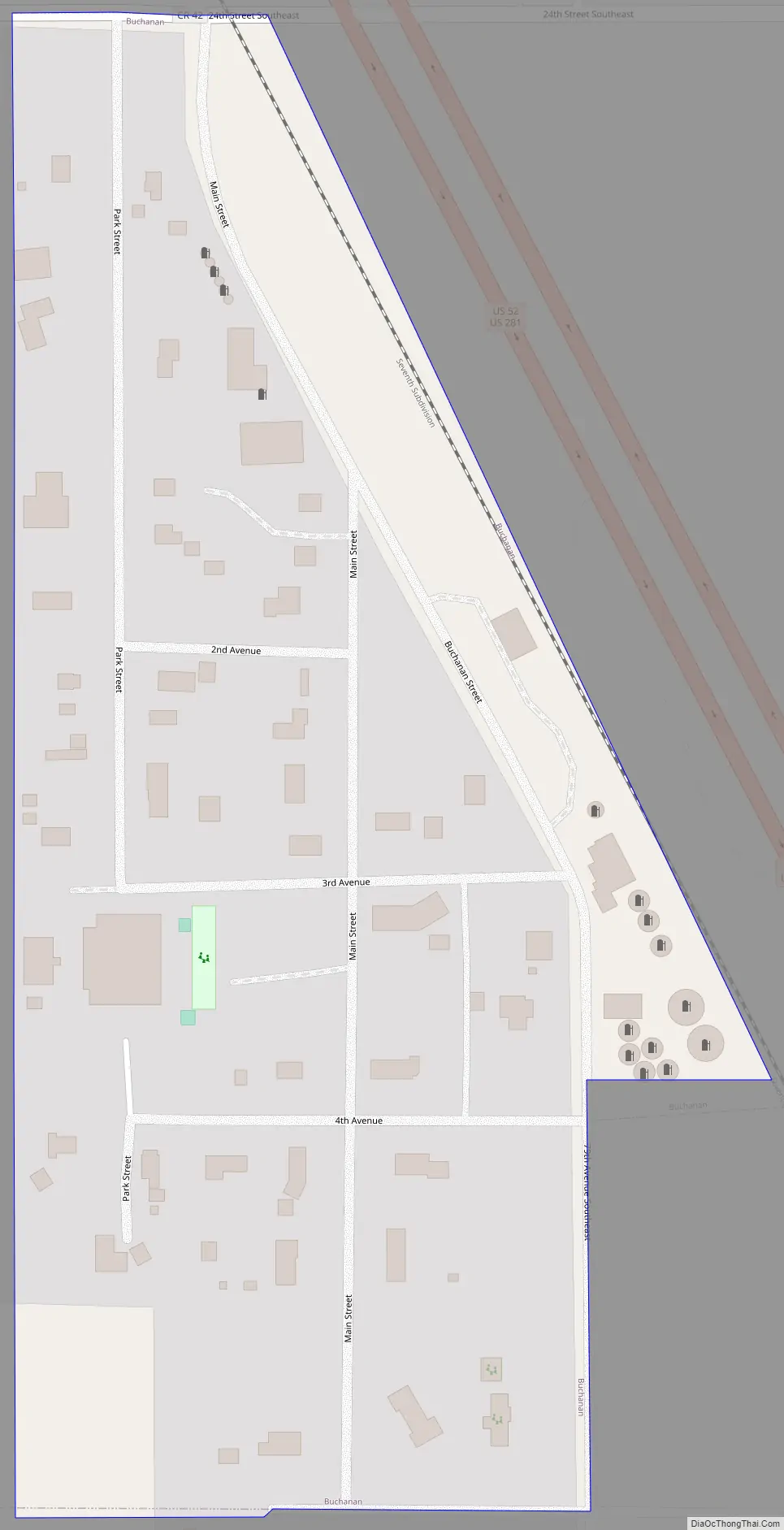
Buchanan Road Map
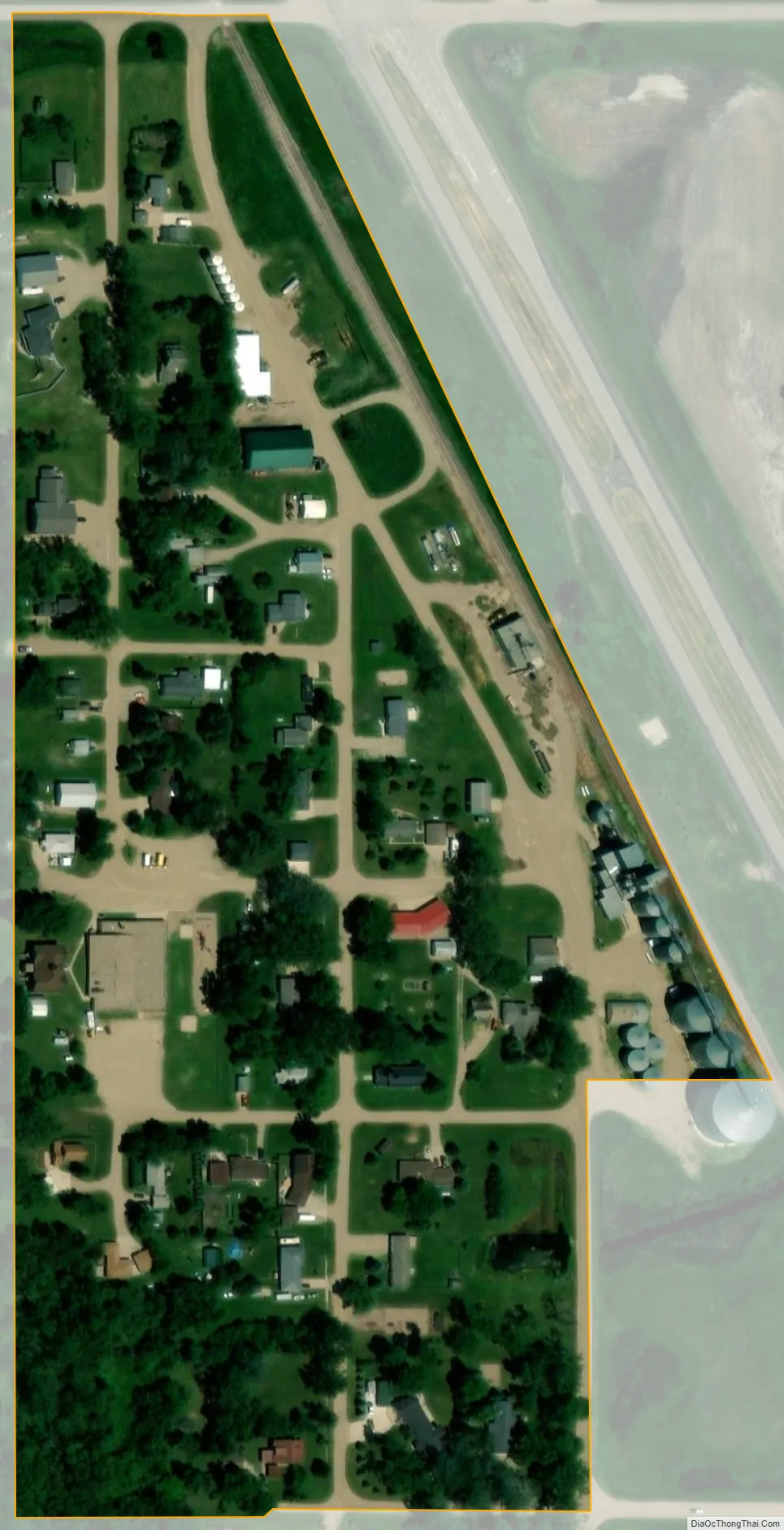
Buchanan city Satellite Map
Geography
Buchanan is located at 47°3′46″N 98°49′42″W / 47.06278°N 98.82833°W / 47.06278; -98.82833 (47.062680, -98.828245).
According to the United States Census Bureau, the city has a total area of 0.08 square miles (0.21 km), all land.
See also
Map of North Dakota State and its subdivision:- Adams
- Barnes
- Benson
- Billings
- Bottineau
- Bowman
- Burke
- Burleigh
- Cass
- Cavalier
- Dickey
- Divide
- Dunn
- Eddy
- Emmons
- Foster
- Golden Valley
- Grand Forks
- Grant
- Griggs
- Hettinger
- Kidder
- Lamoure
- Logan
- McHenry
- McIntosh
- McKenzie
- McLean
- Mercer
- Morton
- Mountrail
- Nelson
- Oliver
- Pembina
- Pierce
- Ramsey
- Ransom
- Renville
- Richland
- Rolette
- Sargent
- Sheridan
- Sioux
- Slope
- Stark
- Steele
- Stutsman
- Towner
- Traill
- Walsh
- Ward
- Wells
- Williams
- Alabama
- Alaska
- Arizona
- Arkansas
- California
- Colorado
- Connecticut
- Delaware
- District of Columbia
- Florida
- Georgia
- Hawaii
- Idaho
- Illinois
- Indiana
- Iowa
- Kansas
- Kentucky
- Louisiana
- Maine
- Maryland
- Massachusetts
- Michigan
- Minnesota
- Mississippi
- Missouri
- Montana
- Nebraska
- Nevada
- New Hampshire
- New Jersey
- New Mexico
- New York
- North Carolina
- North Dakota
- Ohio
- Oklahoma
- Oregon
- Pennsylvania
- Rhode Island
- South Carolina
- South Dakota
- Tennessee
- Texas
- Utah
- Vermont
- Virginia
- Washington
- West Virginia
- Wisconsin
- Wyoming