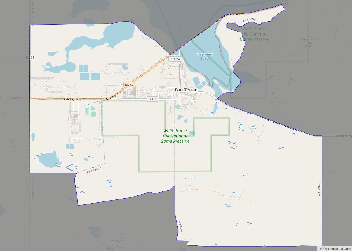
Fort Totten is a census-designated place (CDP) in Benson County, North Dakota, United States. The population was 1,243 at the 2010 census. Fort Totten is located within the Spirit Lake Reservation and is the site of tribal headquarters. The reservation has a total population estimated at 6,000. Although not formally incorporated as a city, Fort Totten has the largest population of any community in Benson County.
| Name: | Fort Totten CDP |
|---|---|
| LSAD Code: | 57 |
| LSAD Description: | CDP (suffix) |
| State: | North Dakota |
| County: | Benson County |
| Elevation: | 1,490 ft (454 m) |
| Total Area: | 8.84 sq mi (22.91 km²) |
| Land Area: | 8.60 sq mi (22.27 km²) |
| Water Area: | 0.24 sq mi (0.63 km²) |
| Total Population: | 1,160 |
| Population Density: | 134.88/sq mi (52.08/km²) |
| ZIP code: | 58335 |
| Area code: | 701 |
| FIPS code: | 3827700 |
| GNISfeature ID: | 1029023 |
Online Interactive Map
Click on ![]() to view map in "full screen" mode.
to view map in "full screen" mode.
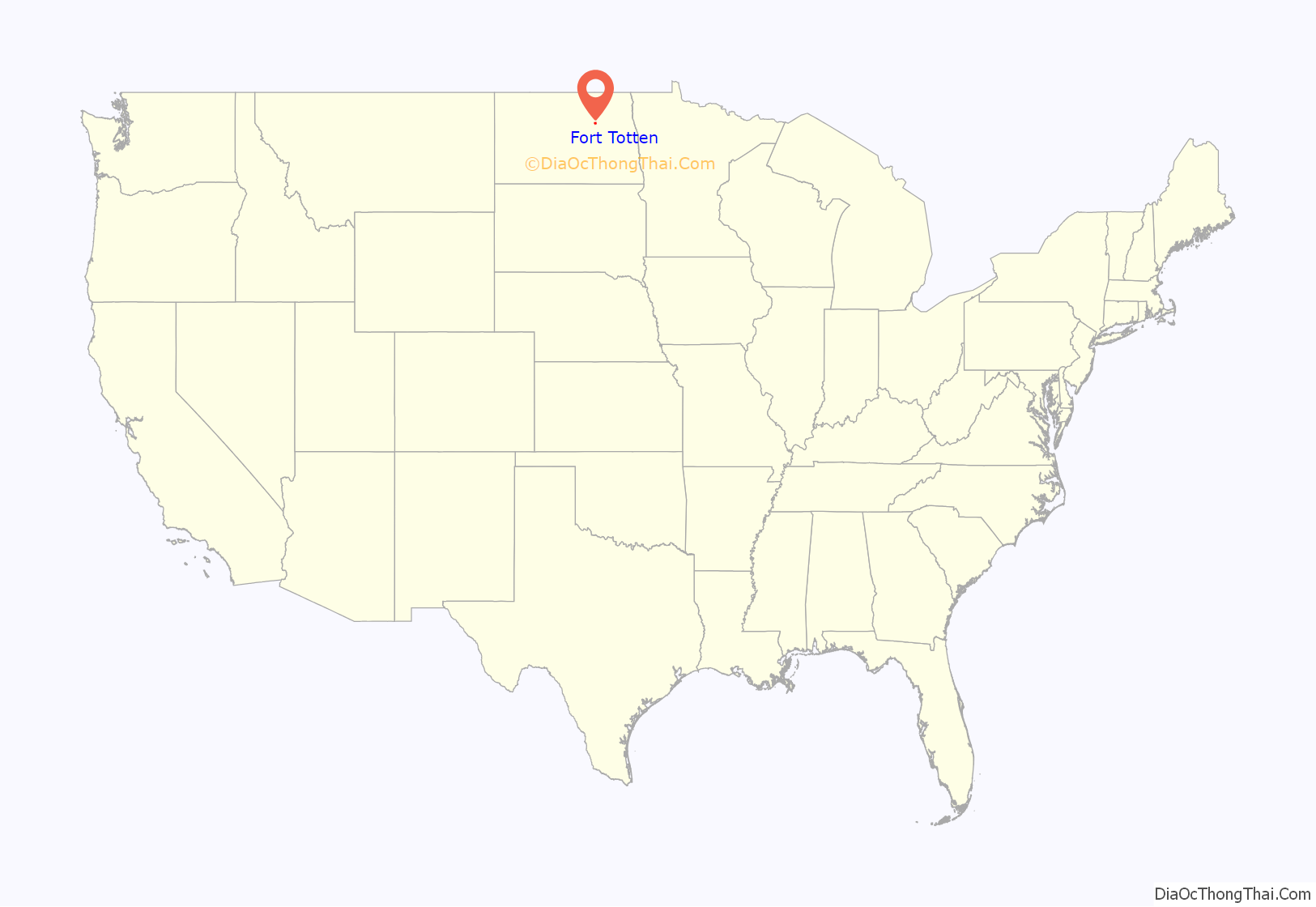
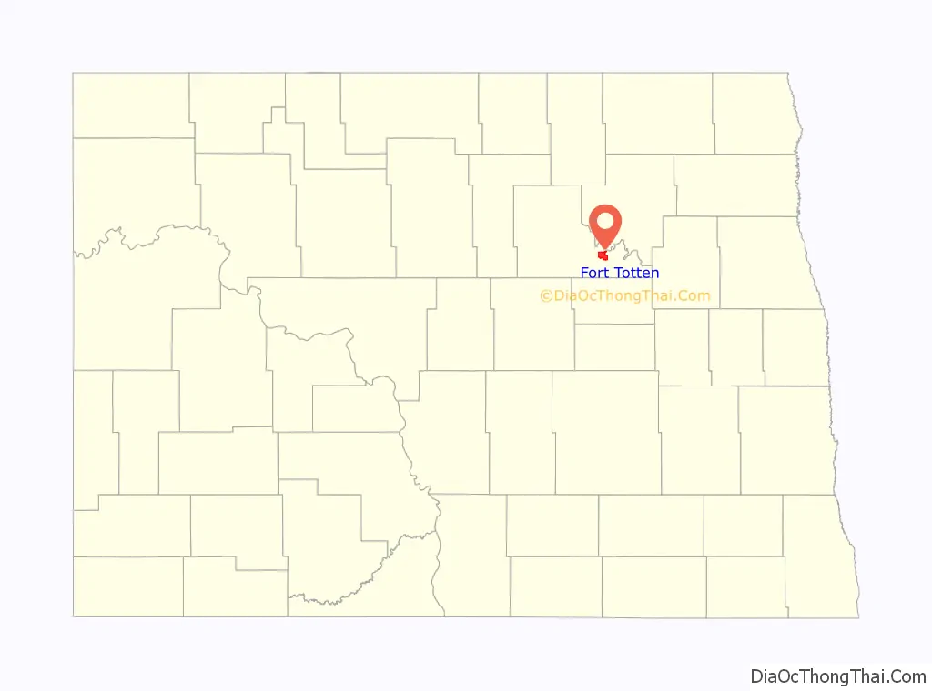
Fort Totten location map. Where is Fort Totten CDP?
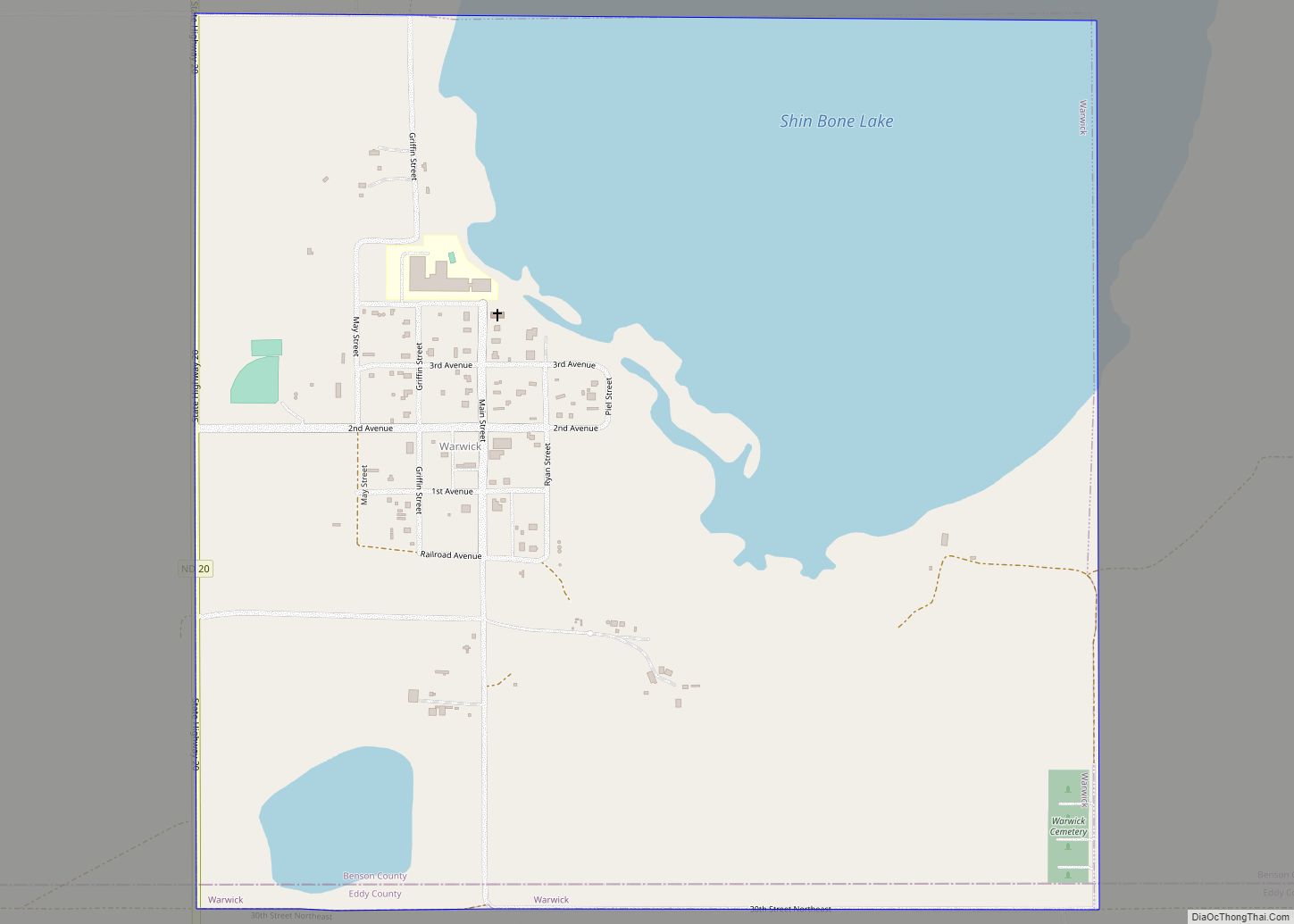
Fort Totten Road Map
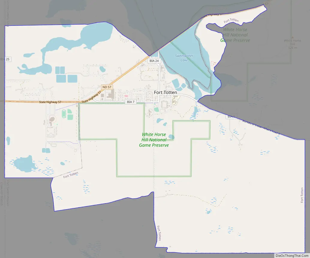
Fort Totten city Satellite Map

Geography
According to the United States Census Bureau, the CDP has a total area of 8.8 square miles (23 km), of which 8.6 square miles (22 km) is land and 0.2 square miles (0.52 km) (2.77%) is water.
See also
Map of North Dakota State and its subdivision:- Adams
- Barnes
- Benson
- Billings
- Bottineau
- Bowman
- Burke
- Burleigh
- Cass
- Cavalier
- Dickey
- Divide
- Dunn
- Eddy
- Emmons
- Foster
- Golden Valley
- Grand Forks
- Grant
- Griggs
- Hettinger
- Kidder
- Lamoure
- Logan
- McHenry
- McIntosh
- McKenzie
- McLean
- Mercer
- Morton
- Mountrail
- Nelson
- Oliver
- Pembina
- Pierce
- Ramsey
- Ransom
- Renville
- Richland
- Rolette
- Sargent
- Sheridan
- Sioux
- Slope
- Stark
- Steele
- Stutsman
- Towner
- Traill
- Walsh
- Ward
- Wells
- Williams
- Alabama
- Alaska
- Arizona
- Arkansas
- California
- Colorado
- Connecticut
- Delaware
- District of Columbia
- Florida
- Georgia
- Hawaii
- Idaho
- Illinois
- Indiana
- Iowa
- Kansas
- Kentucky
- Louisiana
- Maine
- Maryland
- Massachusetts
- Michigan
- Minnesota
- Mississippi
- Missouri
- Montana
- Nebraska
- Nevada
- New Hampshire
- New Jersey
- New Mexico
- New York
- North Carolina
- North Dakota
- Ohio
- Oklahoma
- Oregon
- Pennsylvania
- Rhode Island
- South Carolina
- South Dakota
- Tennessee
- Texas
- Utah
- Vermont
- Virginia
- Washington
- West Virginia
- Wisconsin
- Wyoming