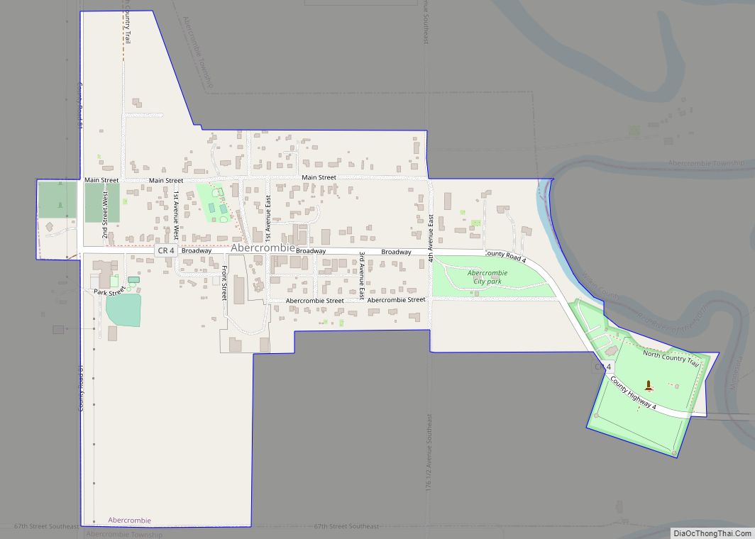
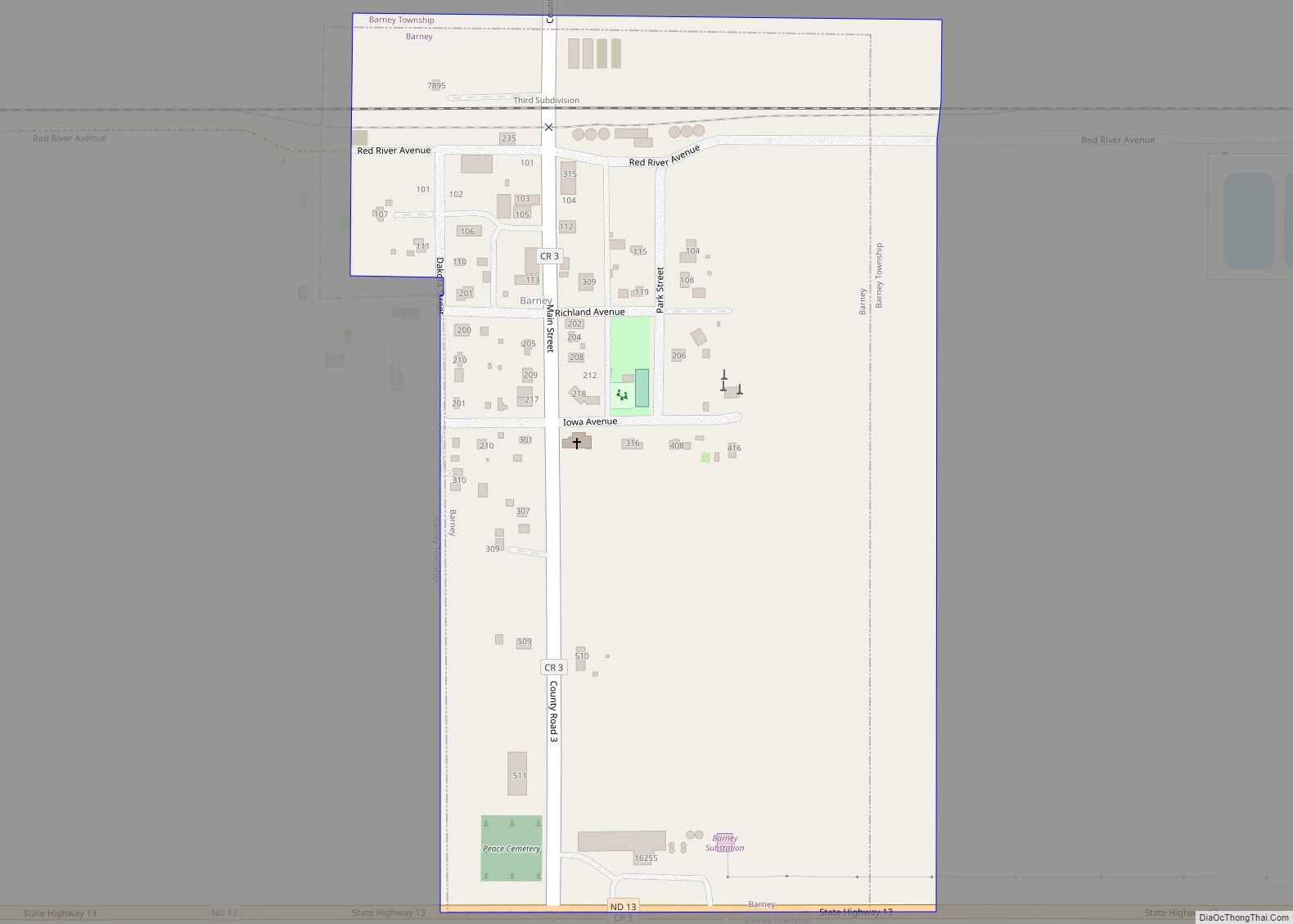
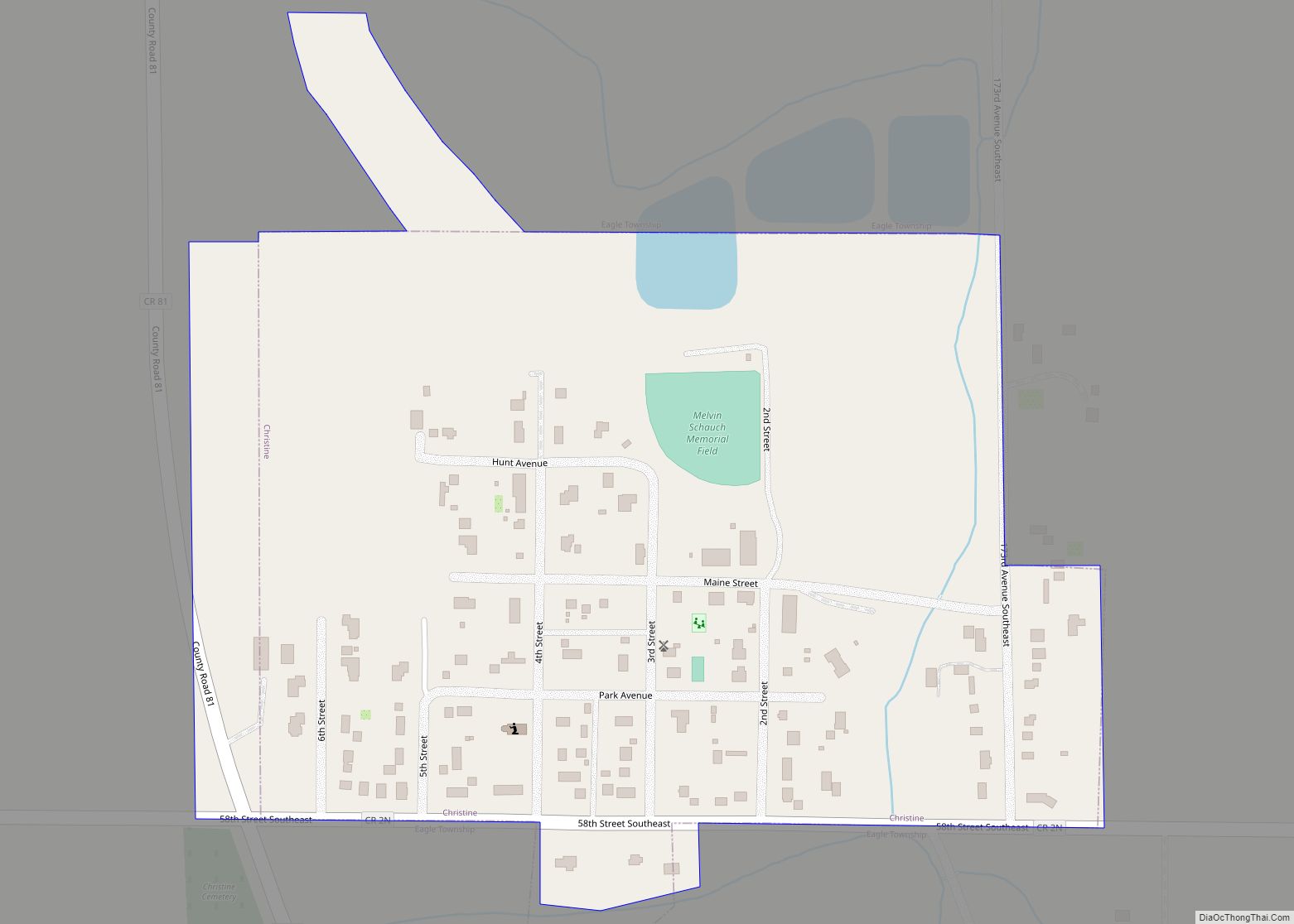
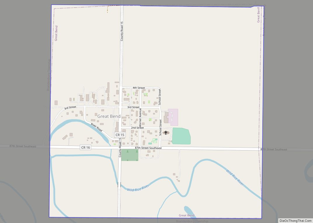
Great Bend is a city in Richland County, North Dakota, United States, on the banks of the Wild Rice River. Its population was 49 at the 2020 census. It was founded in 1888, and incorporated as a village in 1908. It is part of the Wahpeton, ND–MN Micropolitan Statistical Area.
| Name: | Great Bend city |
|---|---|
| LSAD Code: | 25 |
| LSAD Description: | city (suffix) |
| State: | North Dakota |
| County: | Richland County |
| Founded: | 1888 |
| Elevation: | 974 ft (297 m) |
| Total Area: | 0.56 sq mi (1.45 km²) |
| Land Area: | 0.56 sq mi (1.45 km²) |
| Water Area: | 0.00 sq mi (0.00 km²) |
| Total Population: | 49 |
| Population Density: | 87.34/sq mi (33.74/km²) |
| ZIP code: | 58075 |
| Area code: | 701 |
| FIPS code: | 3832900 |
| GNISfeature ID: | 1029232 |
Online Interactive Map
Click on ![]() to view map in "full screen" mode.
to view map in "full screen" mode.
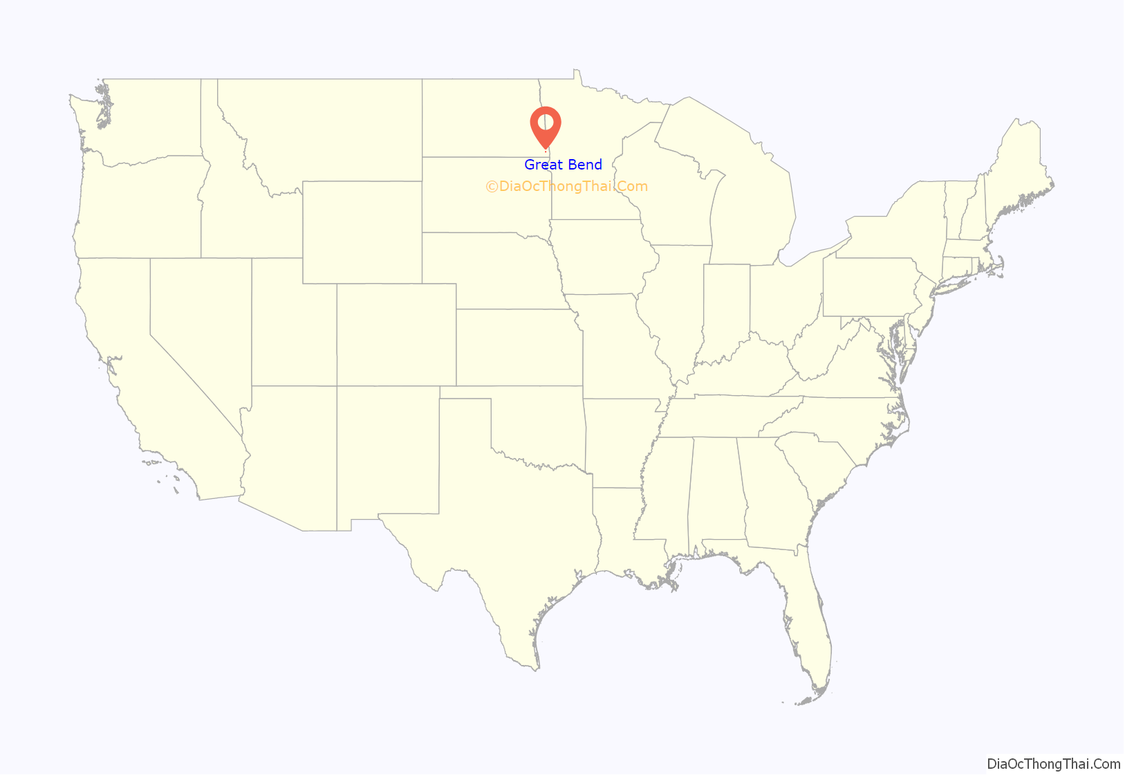
Great Bend location map. Where is Great Bend city?

History
Great Bend was founded in 1888 on land homesteaded by George Worner (1855 – 1950), who was born in Germany and moved to Brandenburg Township in 1874 when his family moved there from Wisconsin. In 1875, Worner established a rural post office and named it Berlin after the German capital. The post office was moved closer to Great Bend in 1882, and disbanded on July 12, 1883. Worner, who was instrumental in the town’s founding and development, served as one of the area’s first station agents for the Northern Pacific Railroad, operated the town’s first general store, and was one of its first postmasters. He later served in the North Dakota House of Representatives.
Great Bend Road Map
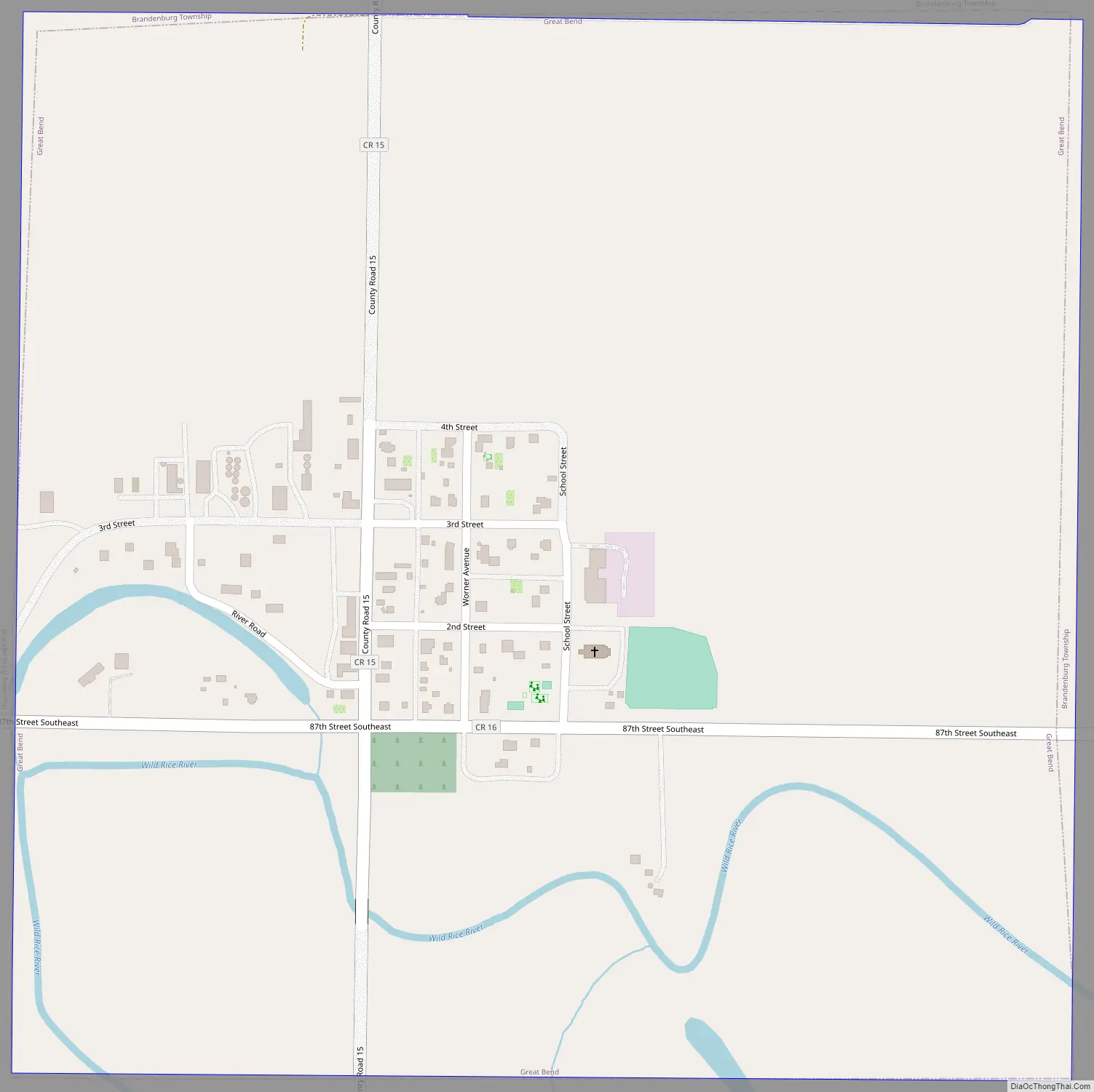
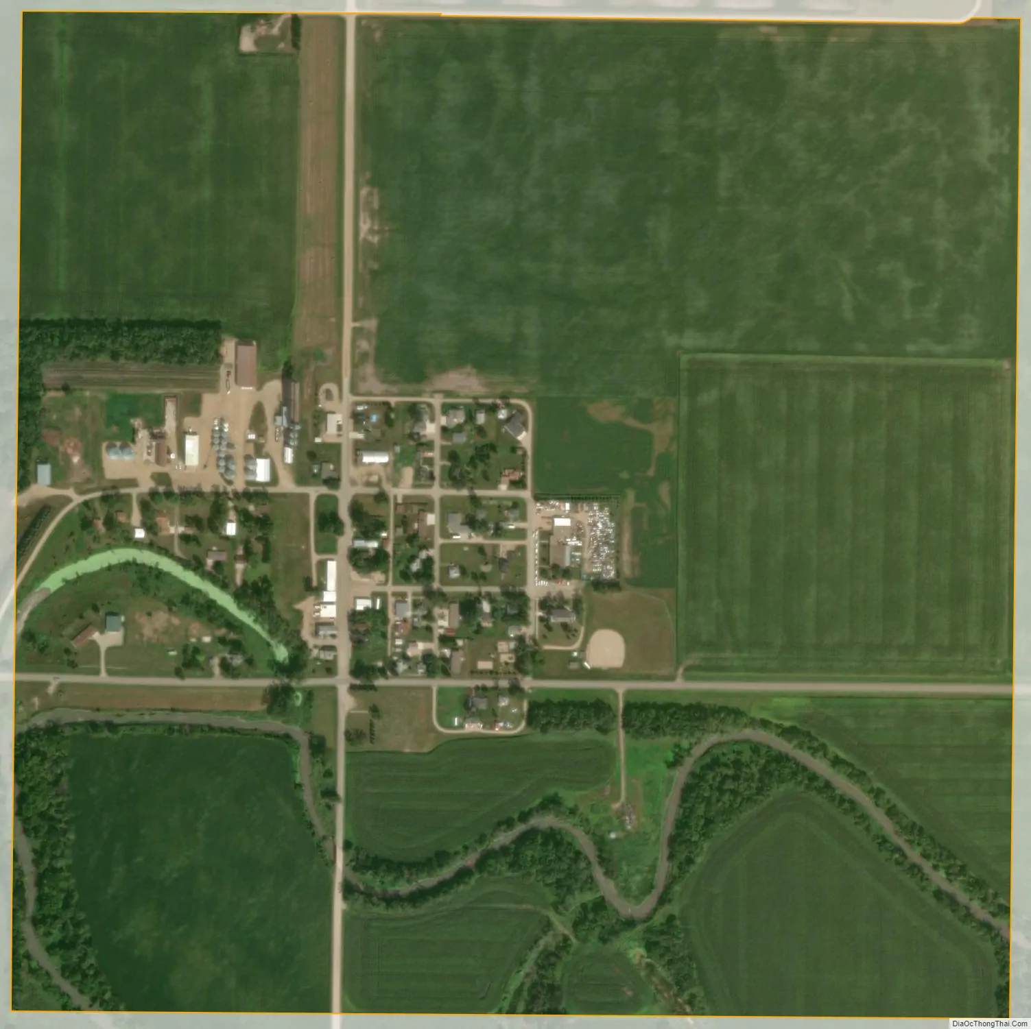
Great Bend city Satellite Map
Geography
Great Bend is located at 46°9′12″N 96°48′11″W / 46.15333°N 96.80306°W / 46.15333; -96.80306 (46.153413, -96.803000). According to the United States Census Bureau, it has a total area of 0.55 square miles (1.42 km), all land.
See also
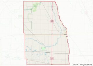
Map of North Dakota State and its subdivision:- Adams
- Barnes
- Benson
- Billings
- Bottineau
- Bowman
- Burke
- Burleigh
- Cass
- Cavalier
- Dickey
- Divide
- Dunn
- Eddy
- Emmons
- Foster
- Golden Valley
- Grand Forks
- Grant
- Griggs
- Hettinger
- Kidder
- Lamoure
- Logan
- McHenry
- McIntosh
- McKenzie
- McLean
- Mercer
- Morton
- Mountrail
- Nelson
- Oliver
- Pembina
- Pierce
- Ramsey
- Ransom
- Renville
- Richland
- Rolette
- Sargent
- Sheridan
- Sioux
- Slope
- Stark
- Steele
- Stutsman
- Towner
- Traill
- Walsh
- Ward
- Wells
- Williams
- Alabama
- Alaska
- Arizona
- Arkansas
- California
- Colorado
- Connecticut
- Delaware
- District of Columbia
- Florida
- Georgia
- Hawaii
- Idaho
- Illinois
- Indiana
- Iowa
- Kansas
- Kentucky
- Louisiana
- Maine
- Maryland
- Massachusetts
- Michigan
- Minnesota
- Mississippi
- Missouri
- Montana
- Nebraska
- Nevada
- New Hampshire
- New Jersey
- New Mexico
- New York
- North Carolina
- North Dakota
- Ohio
- Oklahoma
- Oregon
- Pennsylvania
- Rhode Island
- South Carolina
- South Dakota
- Tennessee
- Texas
- Utah
- Vermont
- Virginia
- Washington
- West Virginia
- Wisconsin
- Wyoming