LaMoure is a city in LaMoure County, North Dakota, United States. The population was 764 at the 2020 census. It is the county seat of LaMoure County.
LaMoure was founded in 1882 and was named after Judson LaMoure, a territorial legislator (LaMoure County and the cities of Jud and Judson are also named after him).
LaMoure was one of eight global transmission sites of the Omega Navigation System until its closure on September 30, 1997. The station is now used for VLF communication purposes by the U.S. Navy.
| Name: | LaMoure city |
|---|---|
| LSAD Code: | 25 |
| LSAD Description: | city (suffix) |
| State: | North Dakota |
| County: | LaMoure County |
| Founded: | 1882 |
| Elevation: | 1,312 ft (400 m) |
| Total Area: | 1.34 sq mi (3.48 km²) |
| Land Area: | 1.34 sq mi (3.48 km²) |
| Water Area: | 0.00 sq mi (0.00 km²) |
| Total Population: | 764 |
| Population Density: | 568.88/sq mi (219.68/km²) |
| ZIP code: | 58415, 58431, 58458 |
| Area code: | 701 |
| FIPS code: | 3844540 |
| GNISfeature ID: | 1033650 |
| Website: | lamourend.com |
Online Interactive Map
Click on ![]() to view map in "full screen" mode.
to view map in "full screen" mode.
LaMoure location map. Where is LaMoure city?


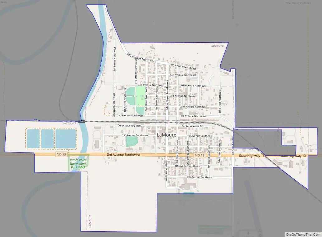
LaMoure Road Map
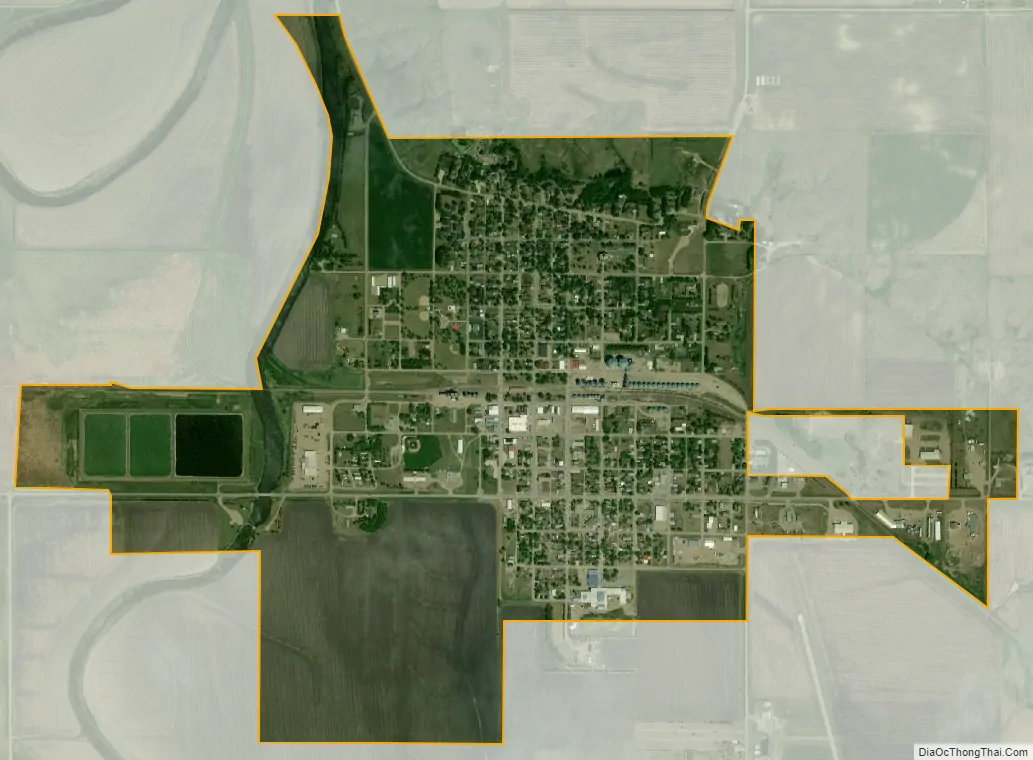
LaMoure city Satellite Map
Geography
LaMoure is located at 46°21′31″N 98°17′37″W / 46.35861°N 98.29361°W / 46.35861; -98.29361 (46.358569, -98.293697) on the James River.
According to the United States Census Bureau, the city has a total area of 1.32 square miles (3.42 km), all land.
See also
Map of North Dakota State and its subdivision:- Adams
- Barnes
- Benson
- Billings
- Bottineau
- Bowman
- Burke
- Burleigh
- Cass
- Cavalier
- Dickey
- Divide
- Dunn
- Eddy
- Emmons
- Foster
- Golden Valley
- Grand Forks
- Grant
- Griggs
- Hettinger
- Kidder
- Lamoure
- Logan
- McHenry
- McIntosh
- McKenzie
- McLean
- Mercer
- Morton
- Mountrail
- Nelson
- Oliver
- Pembina
- Pierce
- Ramsey
- Ransom
- Renville
- Richland
- Rolette
- Sargent
- Sheridan
- Sioux
- Slope
- Stark
- Steele
- Stutsman
- Towner
- Traill
- Walsh
- Ward
- Wells
- Williams
- Alabama
- Alaska
- Arizona
- Arkansas
- California
- Colorado
- Connecticut
- Delaware
- District of Columbia
- Florida
- Georgia
- Hawaii
- Idaho
- Illinois
- Indiana
- Iowa
- Kansas
- Kentucky
- Louisiana
- Maine
- Maryland
- Massachusetts
- Michigan
- Minnesota
- Mississippi
- Missouri
- Montana
- Nebraska
- Nevada
- New Hampshire
- New Jersey
- New Mexico
- New York
- North Carolina
- North Dakota
- Ohio
- Oklahoma
- Oregon
- Pennsylvania
- Rhode Island
- South Carolina
- South Dakota
- Tennessee
- Texas
- Utah
- Vermont
- Virginia
- Washington
- West Virginia
- Wisconsin
- Wyoming


