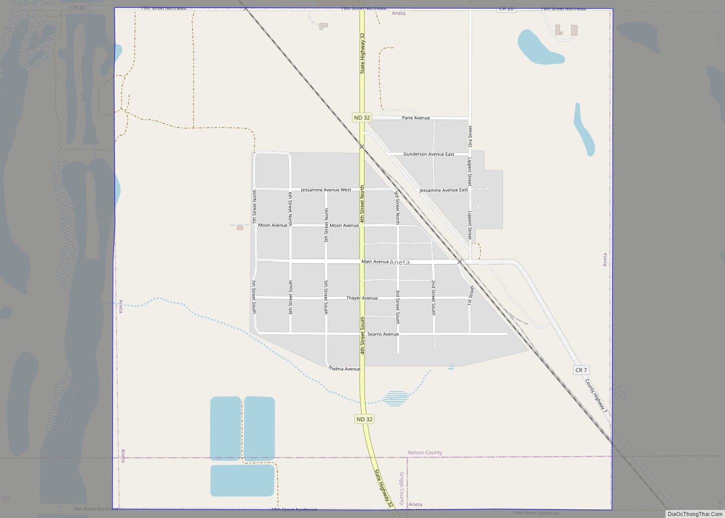
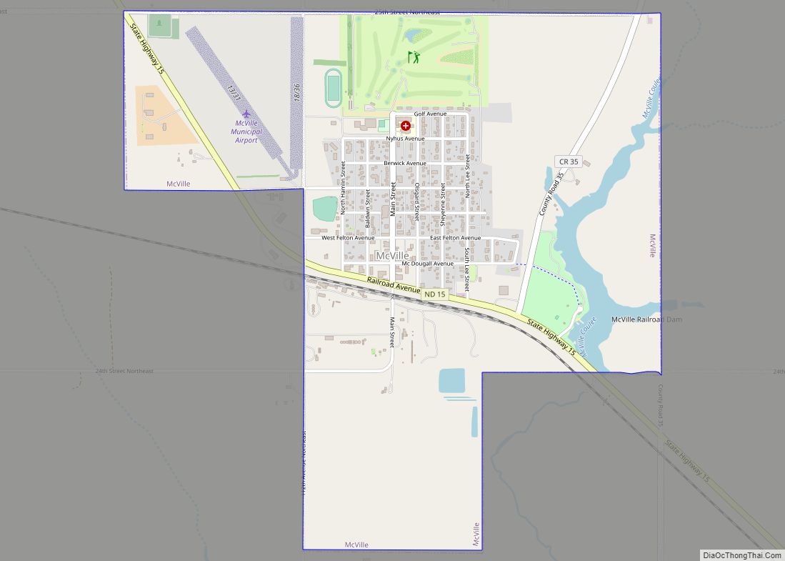
McVille is a city in Nelson County, North Dakota, United States. The population was 392 at the 2020 census. McVille was founded in 1906.
| Name: | McVille city |
|---|---|
| LSAD Code: | 25 |
| LSAD Description: | city (suffix) |
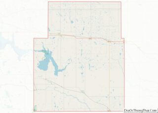
| State: | North Dakota |
| County: | Nelson County |
| Founded: | 1906 |
| Elevation: | 1,470 ft (448 m) |
| Total Area: | 1.50 sq mi (3.89 km²) |
| Land Area: | 1.44 sq mi (3.72 km²) |
| Water Area: | 0.07 sq mi (0.17 km²) |
| Total Population: | 392 |
| Population Density: | 272.98/sq mi (105.37/km²) |
| ZIP code: | 58254 |
| Area code: | 701 |
| FIPS code: | 3849580 |
| GNISfeature ID: | 1030165 |
| Website: | mcville.com |
Online Interactive Map
Click on ![]() to view map in "full screen" mode.
to view map in "full screen" mode.
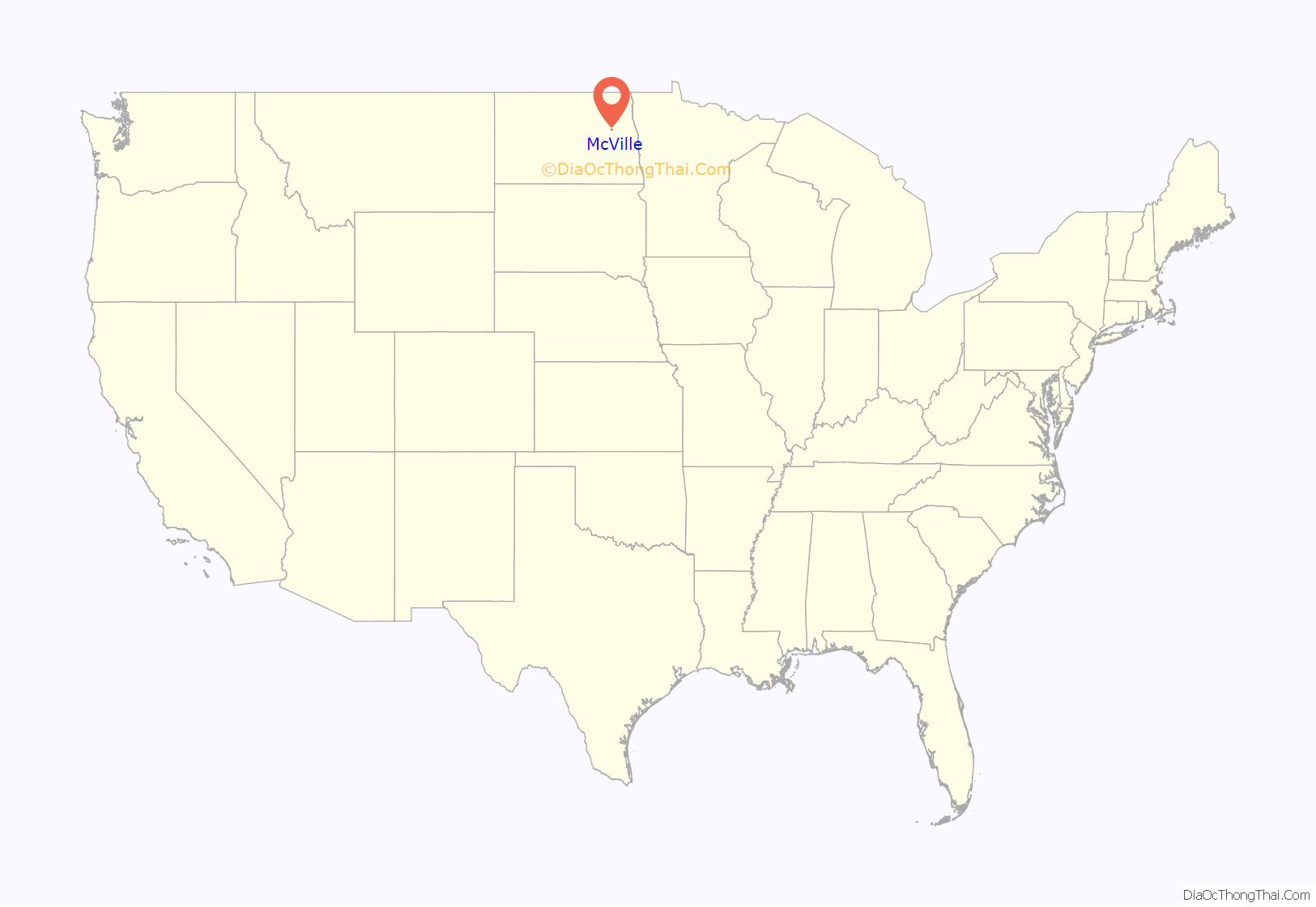
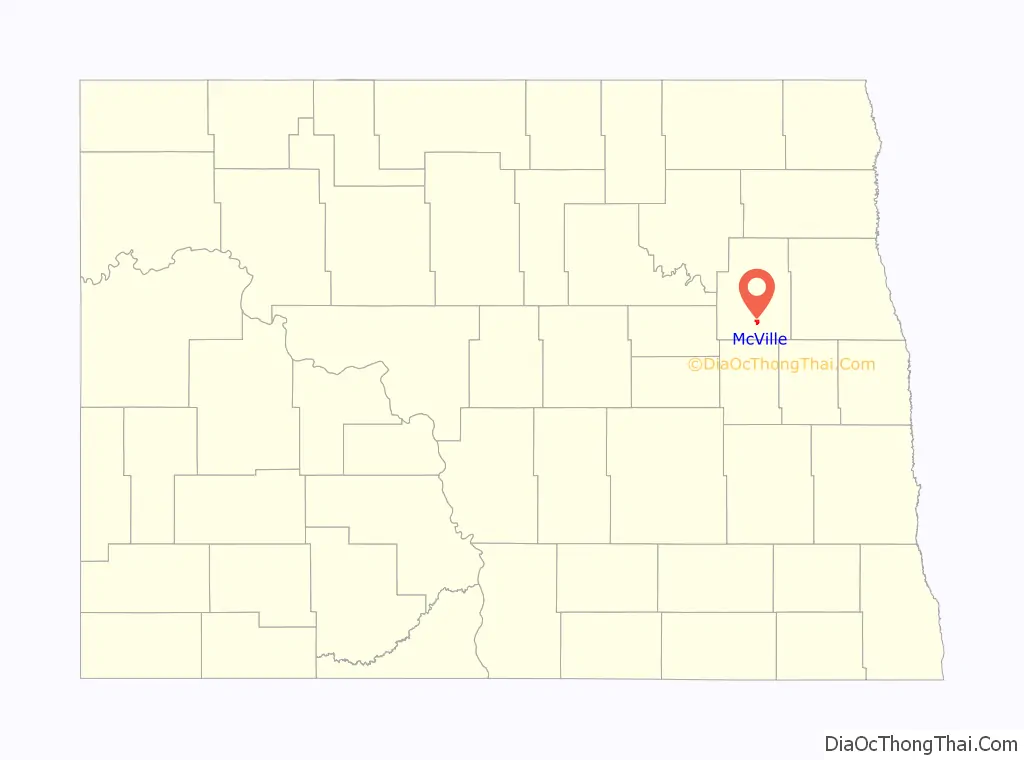
McVille location map. Where is McVille city?
History
McVille was founded in 1906 after the railroad was established as a continuation from Aneta, North Dakota. McVille was founded by the McDougall family. The town was so named because many of the early residents in the area had last names starting with “Mc”.
The original town was a few miles away from its present location. With the advancement of the railroad system, the town was moved.
Prominent early businesses included an elevator, a bank, a blacksmith shop, and a general store.
McVille Road Map
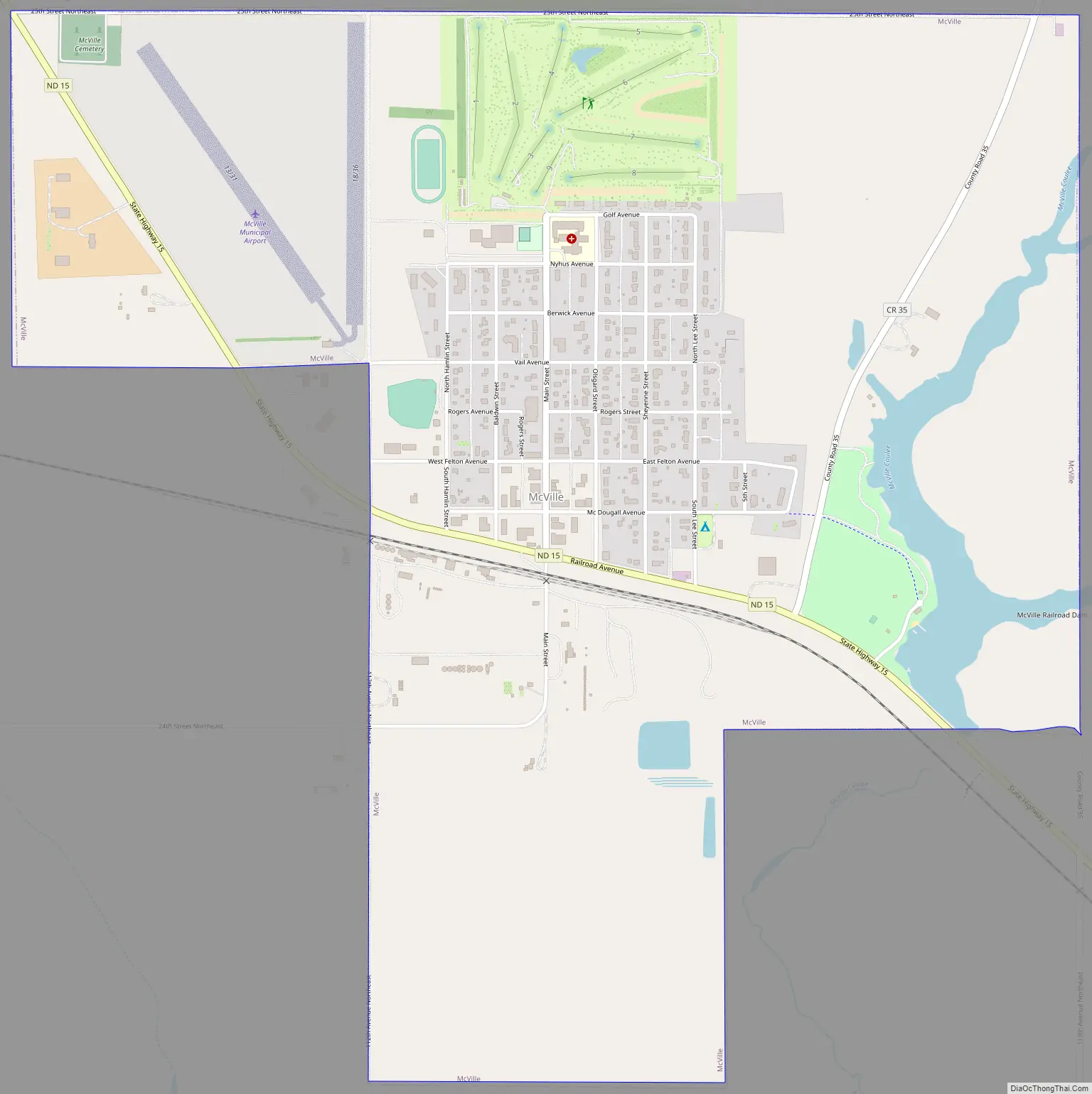
McVille city Satellite Map
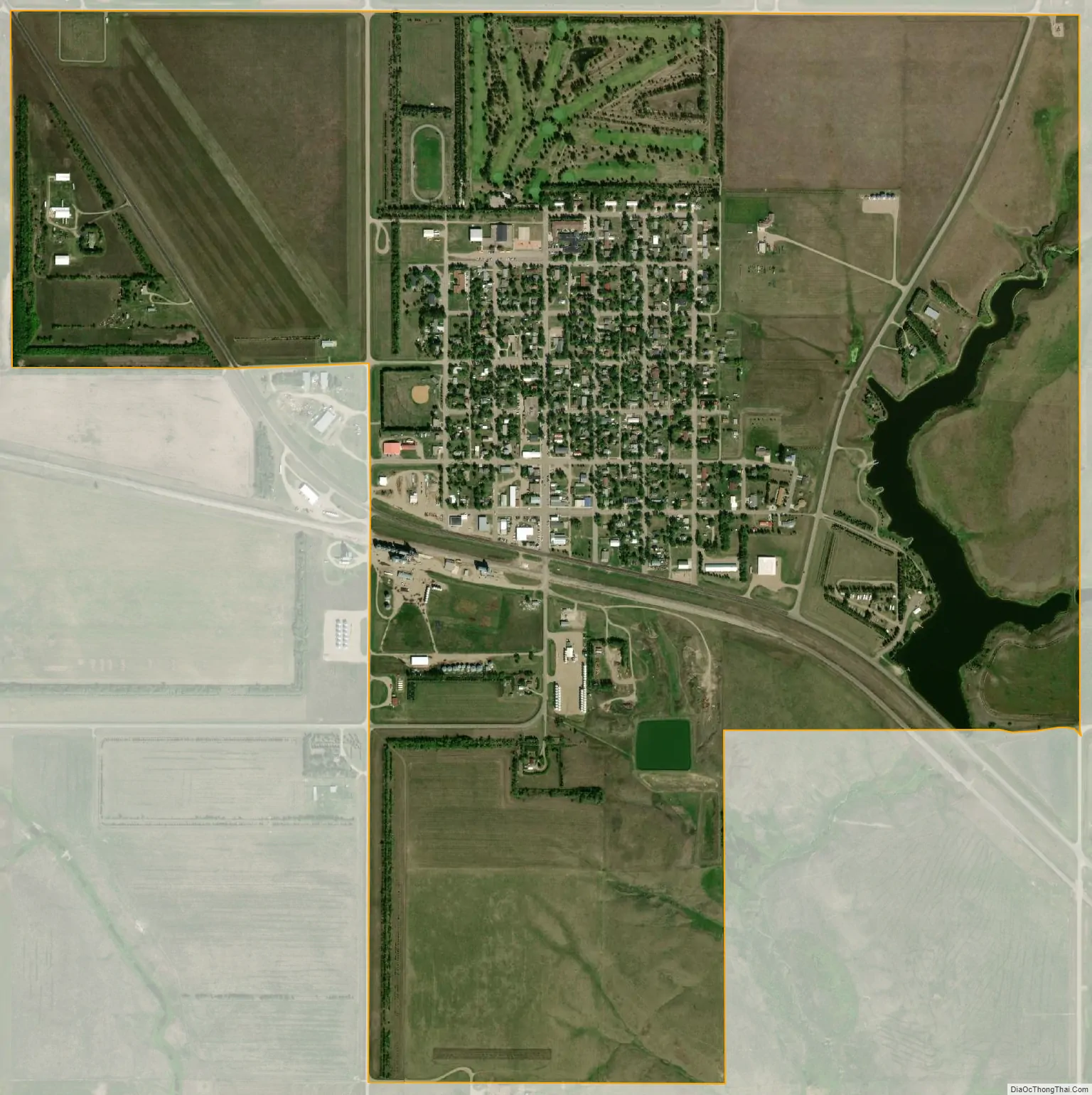
Geography
McVille is located at 47°45′54″N 98°10′35″W / 47.76500°N 98.17639°W / 47.76500; -98.17639 (47.765046, -98.176521).
According to the United States Census Bureau, the city has an area of 1.51 square miles (3.91 km), of which 1.44 square miles (3.73 km) is land and 0.07 square miles (0.18 km) is water.
See also
Map of North Dakota State and its subdivision:- Adams
- Barnes
- Benson
- Billings
- Bottineau
- Bowman
- Burke
- Burleigh
- Cass
- Cavalier
- Dickey
- Divide
- Dunn
- Eddy
- Emmons
- Foster
- Golden Valley
- Grand Forks
- Grant
- Griggs
- Hettinger
- Kidder
- Lamoure
- Logan
- McHenry
- McIntosh
- McKenzie
- McLean
- Mercer
- Morton
- Mountrail
- Nelson
- Oliver
- Pembina
- Pierce
- Ramsey
- Ransom
- Renville
- Richland
- Rolette
- Sargent
- Sheridan
- Sioux
- Slope
- Stark
- Steele
- Stutsman
- Towner
- Traill
- Walsh
- Ward
- Wells
- Williams
- Alabama
- Alaska
- Arizona
- Arkansas
- California
- Colorado
- Connecticut
- Delaware
- District of Columbia
- Florida
- Georgia
- Hawaii
- Idaho
- Illinois
- Indiana
- Iowa
- Kansas
- Kentucky
- Louisiana
- Maine
- Maryland
- Massachusetts
- Michigan
- Minnesota
- Mississippi
- Missouri
- Montana
- Nebraska
- Nevada
- New Hampshire
- New Jersey
- New Mexico
- New York
- North Carolina
- North Dakota
- Ohio
- Oklahoma
- Oregon
- Pennsylvania
- Rhode Island
- South Carolina
- South Dakota
- Tennessee
- Texas
- Utah
- Vermont
- Virginia
- Washington
- West Virginia
- Wisconsin
- Wyoming