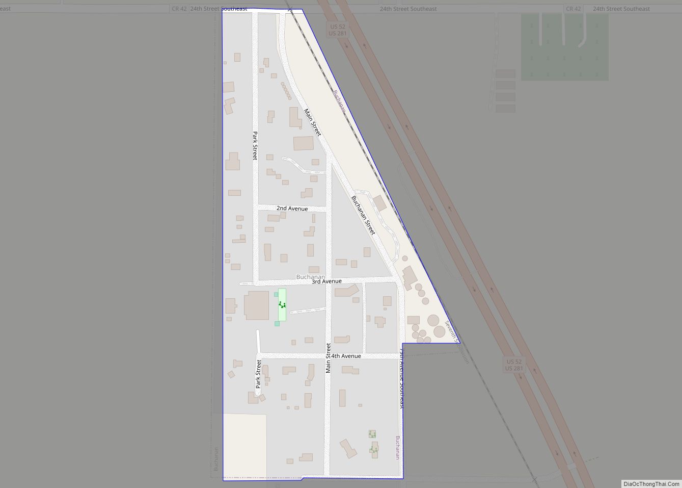
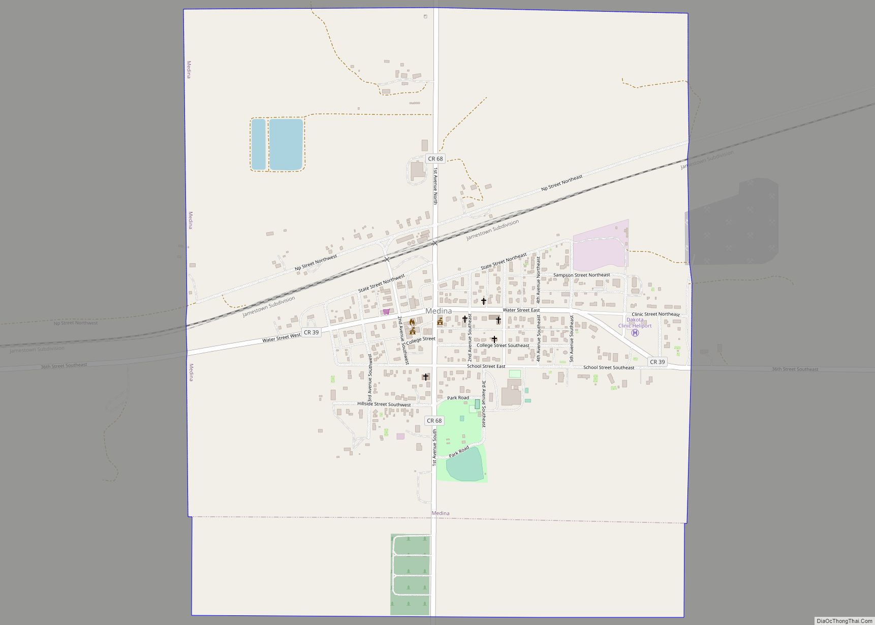
Medina is a city in Stutsman County, North Dakota, United States. The population was 264 at the 2020 census. Medina was founded in 1899.
| Name: | Medina city |
|---|---|
| LSAD Code: | 25 |
| LSAD Description: | city (suffix) |
| State: | North Dakota |
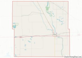
| County: | Stutsman County |
| Elevation: | 1,808 ft (551 m) |
| Total Area: | 1.21 sq mi (3.14 km²) |
| Land Area: | 1.21 sq mi (3.14 km²) |
| Water Area: | 0.00 sq mi (0.00 km²) |
| Total Population: | 264 |
| Population Density: | 217.46/sq mi (83.95/km²) |
| ZIP code: | 58467 |
| Area code: | 701 |
| FIPS code: | 3851860 |
| GNISfeature ID: | 1030183 |
| Website: | medinand.com |
Online Interactive Map
Click on ![]() to view map in "full screen" mode.
to view map in "full screen" mode.
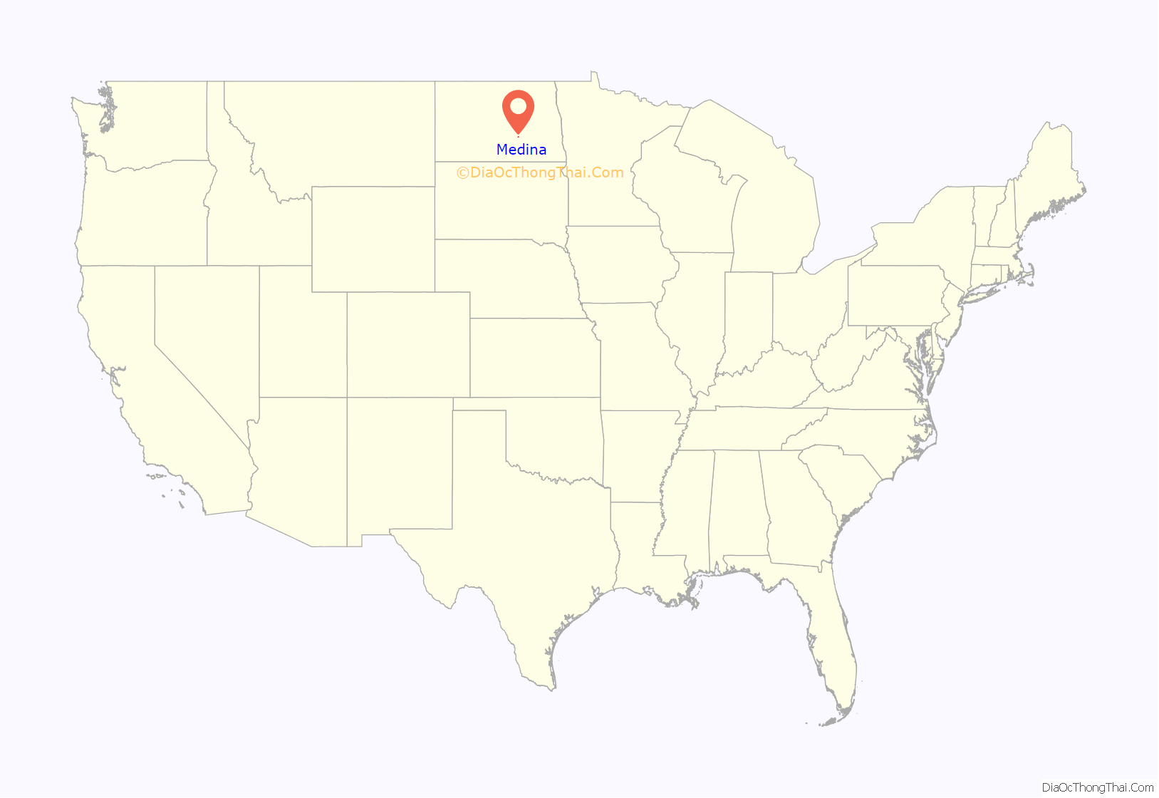
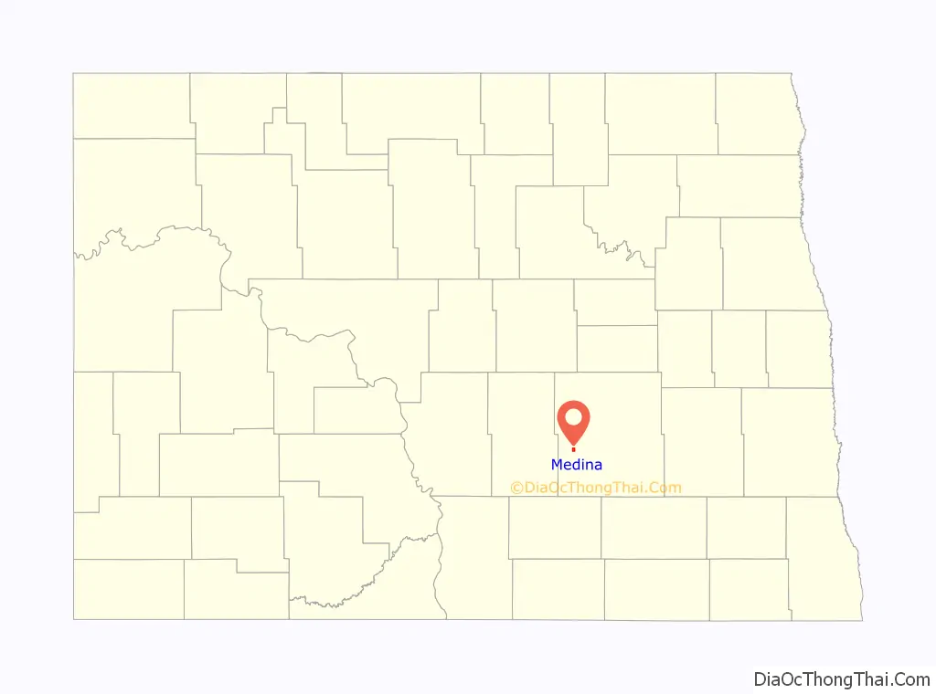
Medina location map. Where is Medina city?
History
Medina was originally called Eleventh Siding, and under the latter name got its start in the 1870s when the railroad was extended to that point. A post office called Medina has been in operation since 1888. The city took its name after Medina, New York.
The town made national news on February 13, 1983 when it was the site of a shoot-out in which two U.S. Marshals were slain.
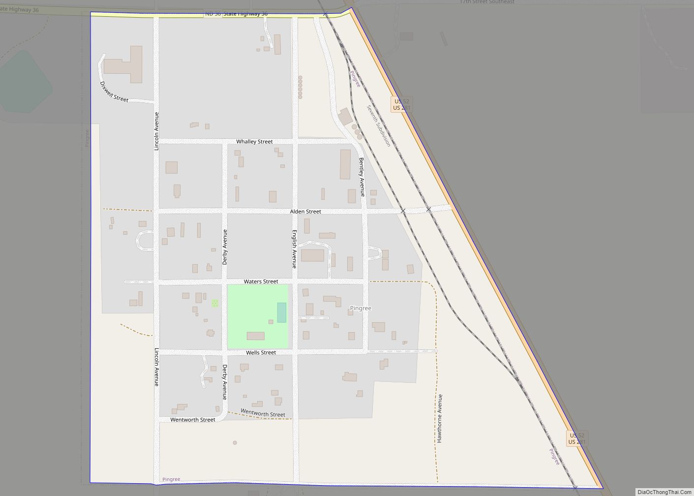
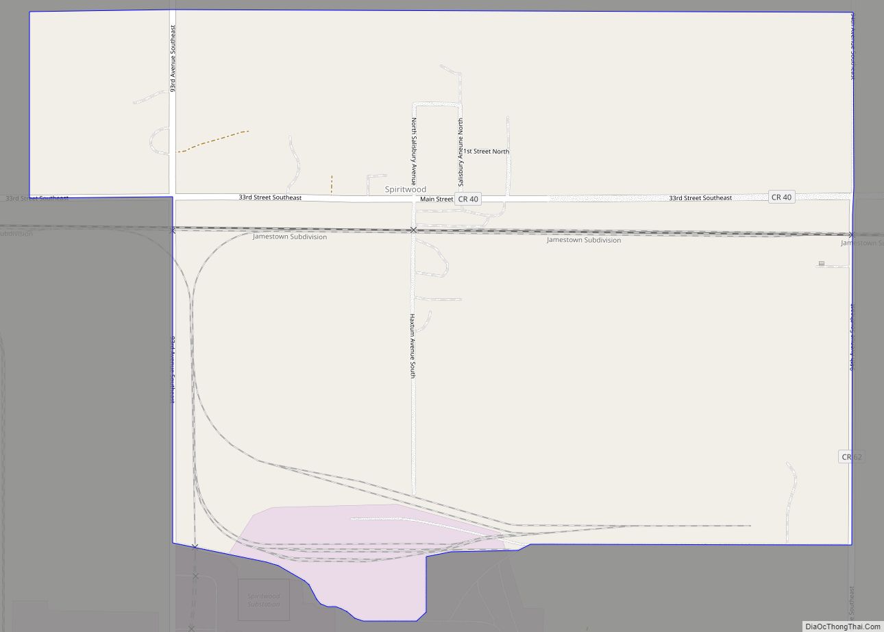
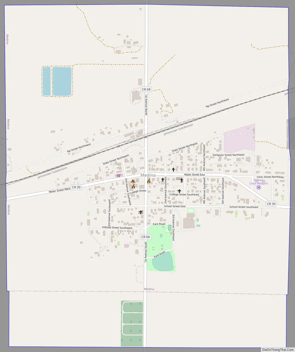
Medina Road Map
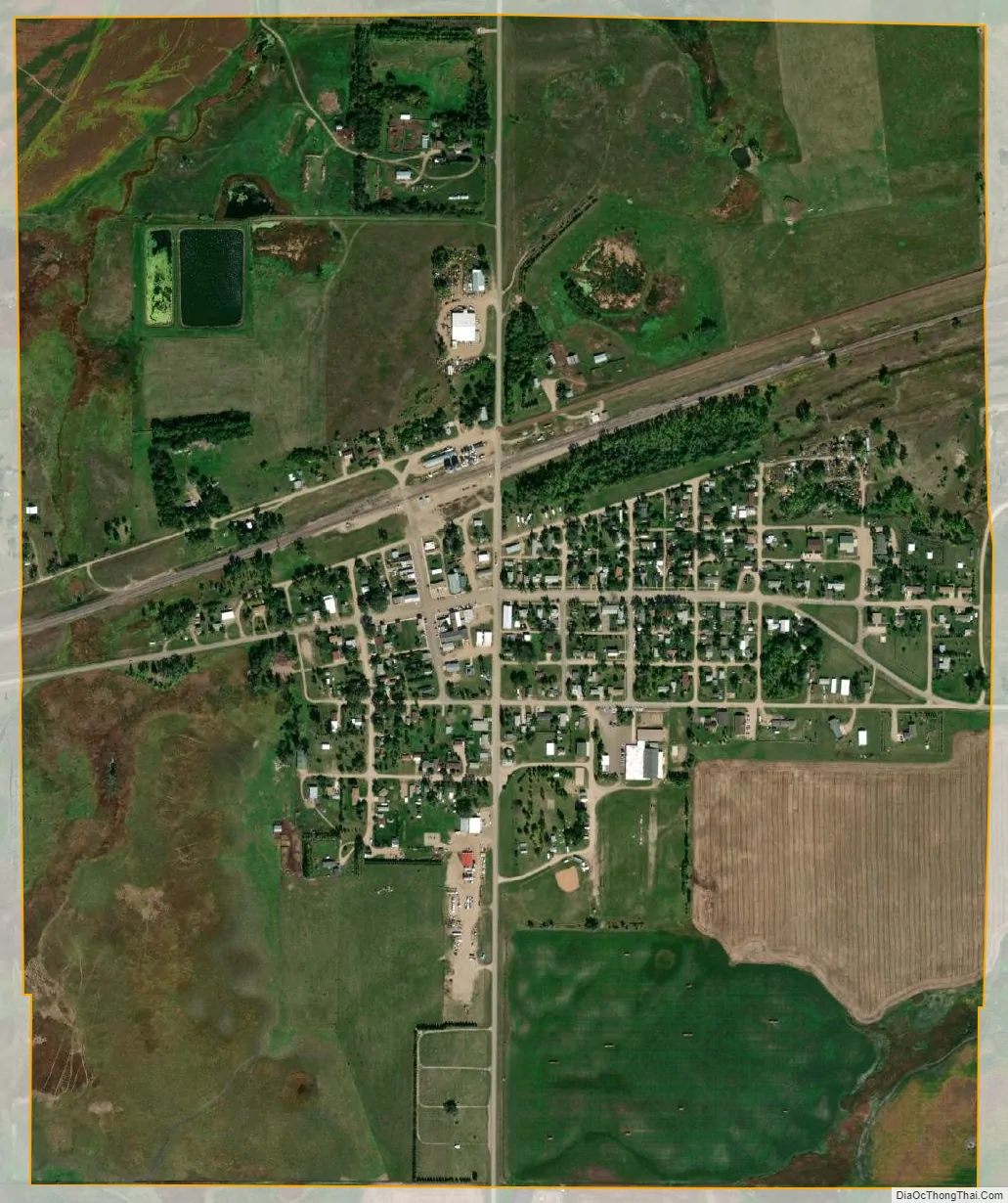
Medina city Satellite Map
Geography
Medina is located at 46°53′41″N 99°17′53″W / 46.89472°N 99.29806°W / 46.89472; -99.29806 (46.894668, −99.298065).
According to the United States Census Bureau, the city has a total area of 1.02 square miles (2.64 km), all land.
See also
Map of North Dakota State and its subdivision:- Adams
- Barnes
- Benson
- Billings
- Bottineau
- Bowman
- Burke
- Burleigh
- Cass
- Cavalier
- Dickey
- Divide
- Dunn
- Eddy
- Emmons
- Foster
- Golden Valley
- Grand Forks
- Grant
- Griggs
- Hettinger
- Kidder
- Lamoure
- Logan
- McHenry
- McIntosh
- McKenzie
- McLean
- Mercer
- Morton
- Mountrail
- Nelson
- Oliver
- Pembina
- Pierce
- Ramsey
- Ransom
- Renville
- Richland
- Rolette
- Sargent
- Sheridan
- Sioux
- Slope
- Stark
- Steele
- Stutsman
- Towner
- Traill
- Walsh
- Ward
- Wells
- Williams
- Alabama
- Alaska
- Arizona
- Arkansas
- California
- Colorado
- Connecticut
- Delaware
- District of Columbia
- Florida
- Georgia
- Hawaii
- Idaho
- Illinois
- Indiana
- Iowa
- Kansas
- Kentucky
- Louisiana
- Maine
- Maryland
- Massachusetts
- Michigan
- Minnesota
- Mississippi
- Missouri
- Montana
- Nebraska
- Nevada
- New Hampshire
- New Jersey
- New Mexico
- New York
- North Carolina
- North Dakota
- Ohio
- Oklahoma
- Oregon
- Pennsylvania
- Rhode Island
- South Carolina
- South Dakota
- Tennessee
- Texas
- Utah
- Vermont
- Virginia
- Washington
- West Virginia
- Wisconsin
- Wyoming