Overly is a city in Bottineau County in the U.S. state of North Dakota. The population was 10 at the 2020 census.
| Name: | Overly city |
|---|---|
| LSAD Code: | 25 |
| LSAD Description: | city (suffix) |
| State: | North Dakota |
| County: | Bottineau County |
| Founded: | August 21, 1905 |
| Elevation: | 1,542 ft (470 m) |
| Total Area: | 0.37 sq mi (0.96 km²) |
| Land Area: | 0.37 sq mi (0.96 km²) |
| Water Area: | 0.00 sq mi (0.00 km²) |
| Total Population: | 10 |
| Population Density: | 26.95/sq mi (10.40/km²) |
| ZIP code: | 58360 (until 1996) 58384 (1996-present) |
| Area code: | 701 |
| FIPS code: | 3860380 |
| GNISfeature ID: | 1036209 |
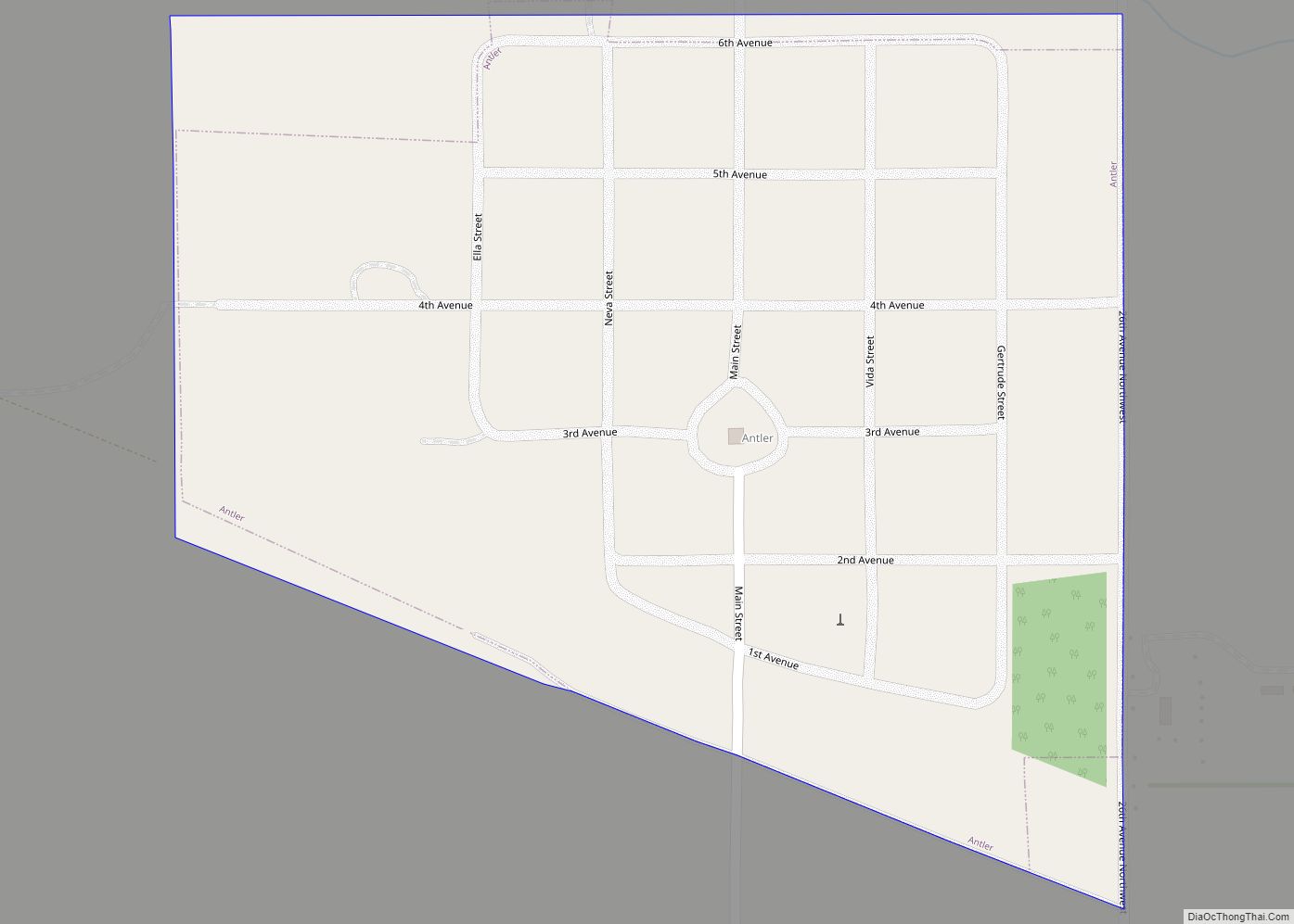
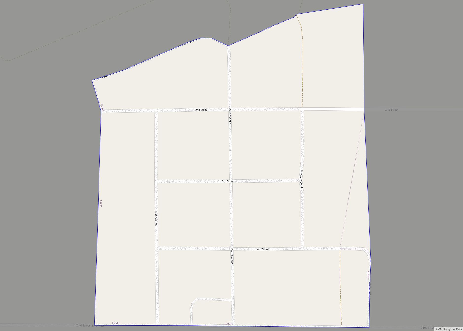
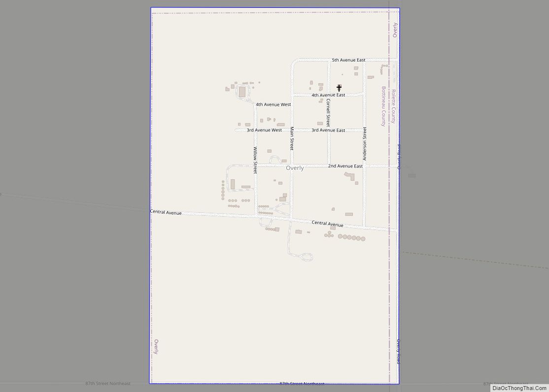
Online Interactive Map
Click on ![]() to view map in "full screen" mode.
to view map in "full screen" mode.
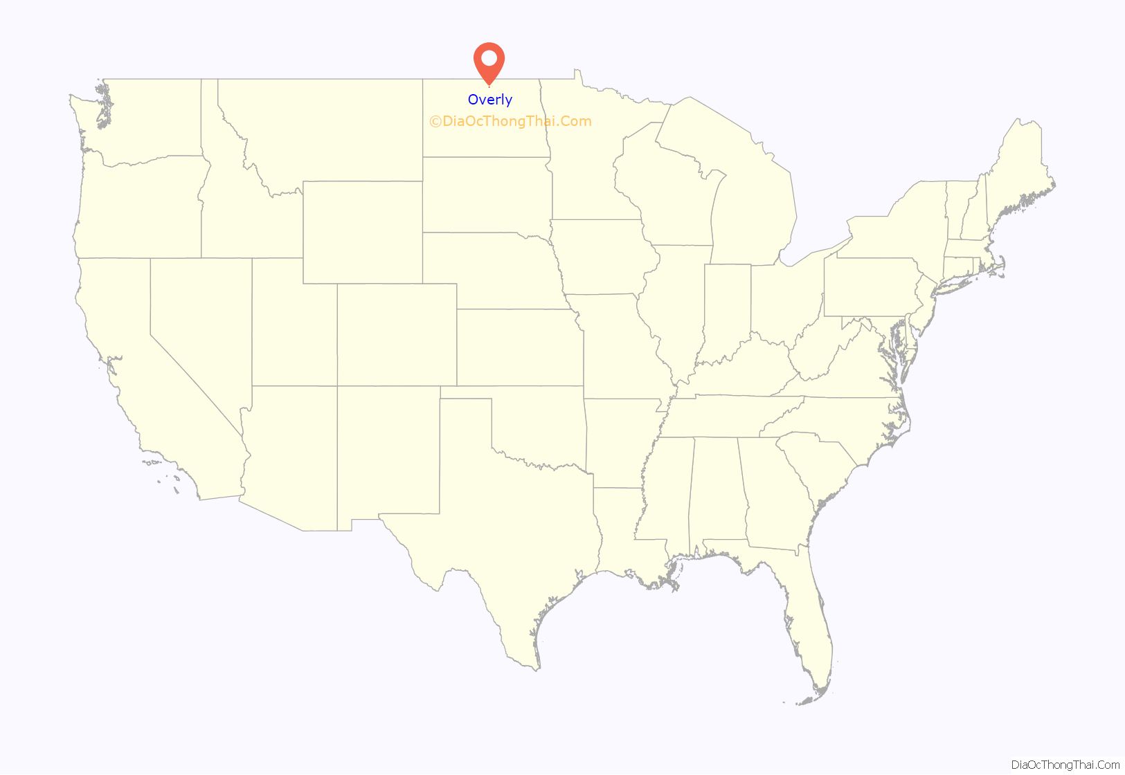
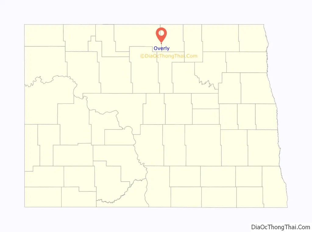
Overly location map. Where is Overly city?
History
Overly was founded in 1905 as a railroad loading station along the Soo Line Railroad. Overly’s post office was established August 21, 1905, and service discontinued November 9, 1996. The city now shares the ZIP code of 58384 with nearby Willow City.
For many years, the city thrived as a railroad center, serving as a crew transfer point for the railroads traveling east and west along the line. The railroad installed a roundhouse for servicing locomotives as well as coal and water facilities. A popular pastime for city residents was to gather at the rail depot on the edge of town to watch the trains in the mornings and evenings. Many speculate that the town’s name was meant to describe the numerous rail crews that “laid over” in town during the shift changes. Others say the town is named for Hans Overlie, an early settler.
The United States Census Bureau recorded a high population of 193 in 1920. Wheat shipments and the city’s status as a railroad hub seemed to indicate future growth, but the frequency of trains dwindled until the 1950s when trains just passed by without stopping. The railroad tore down the roundhouse and other facilities, commercial businesses closed down, and the city began a steady population decline to just 32 by the 1980 Census. The Census Bureau currently places the 2021 population of the city at 10 people.
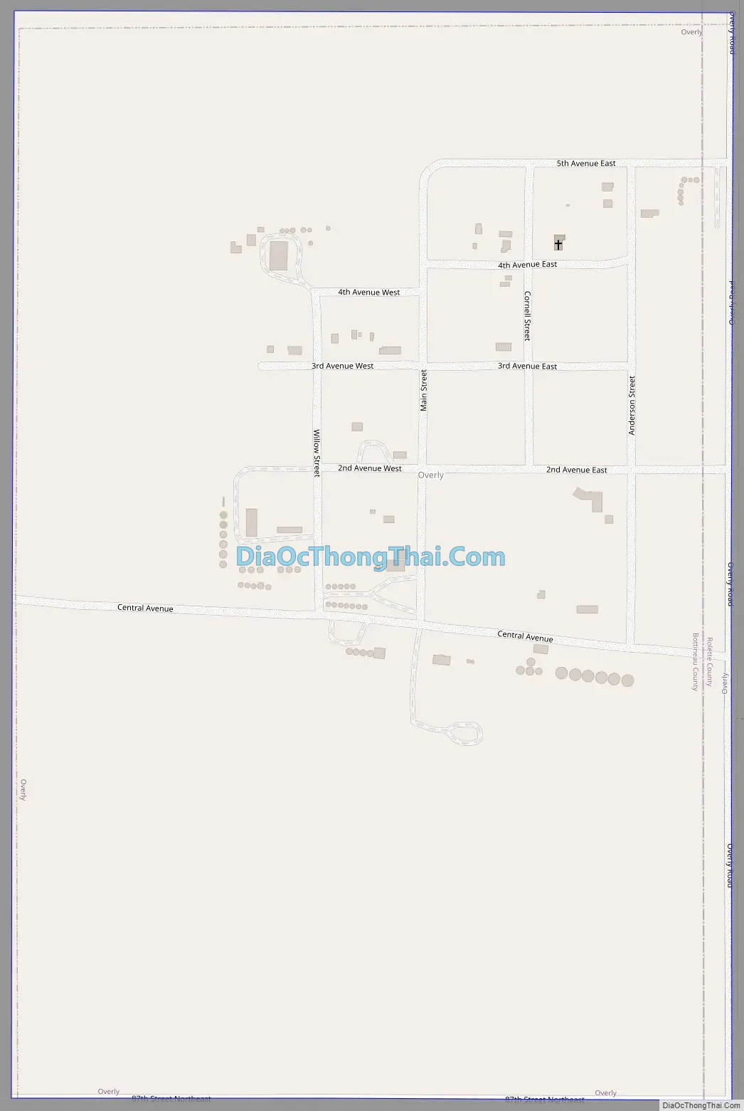
Overly Road Map
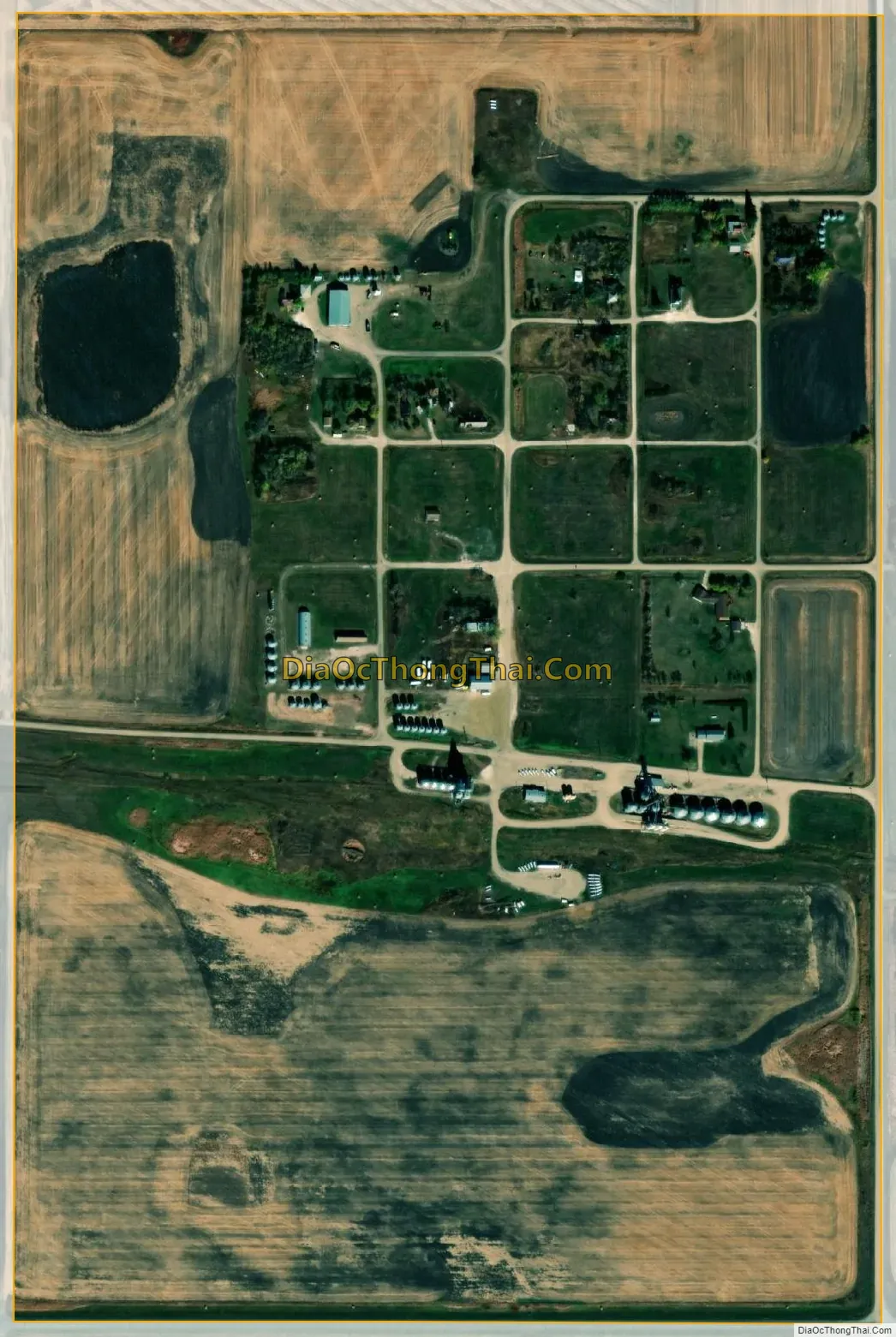
Overly city Satellite Map
Geography
Overly is located in Cecil Township in the eastern part of Bottineau County. The city lies along the border with neighboring Rolette County, and a 5-block portion of the city was actually platted in that county. However, the 2000 Census did not record any population for Overly in that county, and the North Dakota League of Cities does not count Overly as a multi-county municipality.
According to the United States Census Bureau, the city has a total area of 0.36 square miles (0.93 km), all land.
See also
Map of North Dakota State and its subdivision:- Adams
- Barnes
- Benson
- Billings
- Bottineau
- Bowman
- Burke
- Burleigh
- Cass
- Cavalier
- Dickey
- Divide
- Dunn
- Eddy
- Emmons
- Foster
- Golden Valley
- Grand Forks
- Grant
- Griggs
- Hettinger
- Kidder
- Lamoure
- Logan
- McHenry
- McIntosh
- McKenzie
- McLean
- Mercer
- Morton
- Mountrail
- Nelson
- Oliver
- Pembina
- Pierce
- Ramsey
- Ransom
- Renville
- Richland
- Rolette
- Sargent
- Sheridan
- Sioux
- Slope
- Stark
- Steele
- Stutsman
- Towner
- Traill
- Walsh
- Ward
- Wells
- Williams
- Alabama
- Alaska
- Arizona
- Arkansas
- California
- Colorado
- Connecticut
- Delaware
- District of Columbia
- Florida
- Georgia
- Hawaii
- Idaho
- Illinois
- Indiana
- Iowa
- Kansas
- Kentucky
- Louisiana
- Maine
- Maryland
- Massachusetts
- Michigan
- Minnesota
- Mississippi
- Missouri
- Montana
- Nebraska
- Nevada
- New Hampshire
- New Jersey
- New Mexico
- New York
- North Carolina
- North Dakota
- Ohio
- Oklahoma
- Oregon
- Pennsylvania
- Rhode Island
- South Carolina
- South Dakota
- Tennessee
- Texas
- Utah
- Vermont
- Virginia
- Washington
- West Virginia
- Wisconsin
- Wyoming