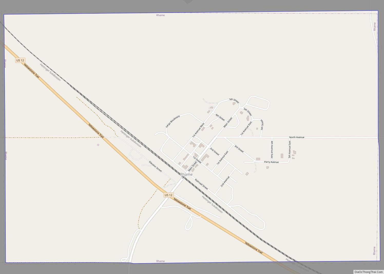
Rhame (/reɪm/, RAYM) is a city in Bowman County, North Dakota, United States. The population was 158 at the 2020 census. Rhame was founded in 1908.
| Name: | Rhame city |
|---|---|
| LSAD Code: | 25 |
| LSAD Description: | city (suffix) |
| State: | North Dakota |
| County: | Bowman County |
| Founded: | 1908 |
| Elevation: | 3,192 ft (973 m) |
| Total Area: | 1.50 sq mi (3.87 km²) |
| Land Area: | 1.50 sq mi (3.87 km²) |
| Water Area: | 0.00 sq mi (0.00 km²) |
| Total Population: | 158 |
| Population Density: | 105.69/sq mi (40.80/km²) |
| ZIP code: | 58651 |
| Area code: | 701 |
| FIPS code: | 3866300 |
| GNISfeature ID: | 1030890 |
Online Interactive Map
Click on ![]() to view map in "full screen" mode.
to view map in "full screen" mode.
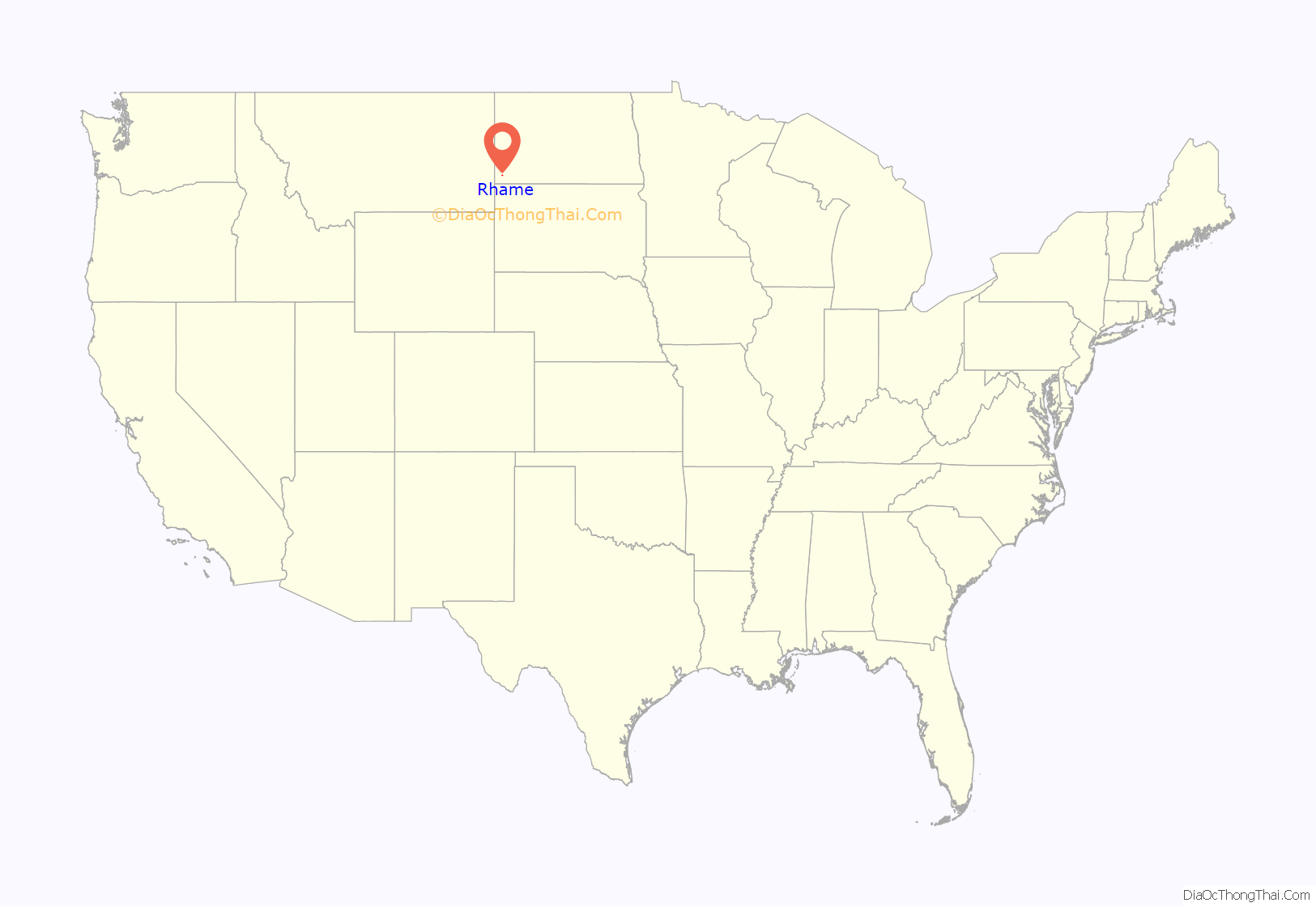
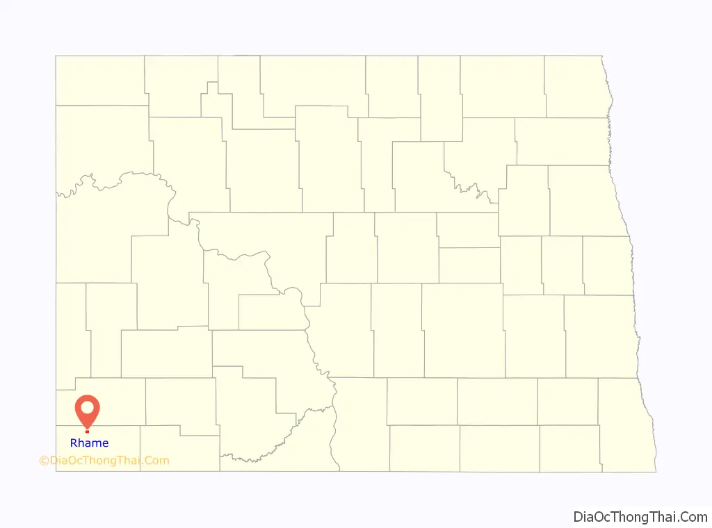
Rhame location map. Where is Rhame city?
History
Rhame was founded in 1908 as Petrel, North Dakota, when the Chicago, Milwaukee, St. Paul and Pacific Railroad, the “Milwaukee Road,” established a station here. The post office was established February 8, 1908, but was changed to Rhame in June 1908, since Petrel was already in use for a railroad station in neighboring Adams County. The city and surrounding Rhame Township were named for Mitchell Davison Rhame (1846 – 1913), who was a district engineer for the railroad.
Rhame incorporated as a village in 1913. It became a city in 1967 after the North Dakota Legislature eliminated incorporation titles for villages and towns. As a result, all incorporated municipalities in North Dakota automatically adopted a city form of government.
Rhame had a weekly newspaper from 1908 through 1953: Rhame Review (1908-1918), Farmers Review (1918-1920), Rhame Review (1920-1953). The editor beginning in 1918 was Alfred D. Fuller, a person born Hattie Fuller who then identified as a man after moving to Chicago as a young woman.
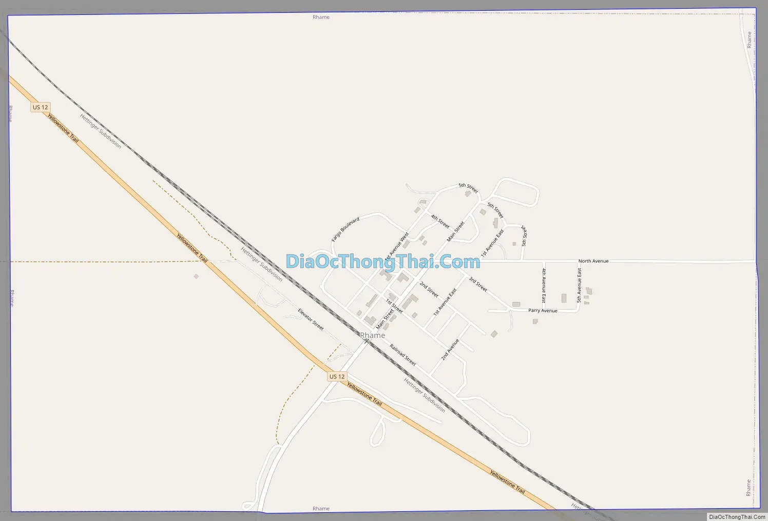
Rhame Road Map
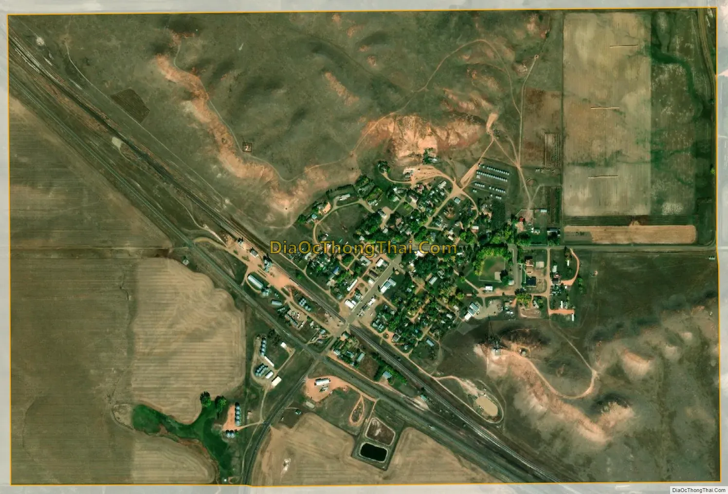
Rhame city Satellite Map
Geography
According to the United States Census Bureau, the city has a total area of 1.51 square miles (3.91 km), all land. The city’s elevation of 3,192 feet (973 m) makes it the highest town in North Dakota.
See also
Map of North Dakota State and its subdivision:- Adams
- Barnes
- Benson
- Billings
- Bottineau
- Bowman
- Burke
- Burleigh
- Cass
- Cavalier
- Dickey
- Divide
- Dunn
- Eddy
- Emmons
- Foster
- Golden Valley
- Grand Forks
- Grant
- Griggs
- Hettinger
- Kidder
- Lamoure
- Logan
- McHenry
- McIntosh
- McKenzie
- McLean
- Mercer
- Morton
- Mountrail
- Nelson
- Oliver
- Pembina
- Pierce
- Ramsey
- Ransom
- Renville
- Richland
- Rolette
- Sargent
- Sheridan
- Sioux
- Slope
- Stark
- Steele
- Stutsman
- Towner
- Traill
- Walsh
- Ward
- Wells
- Williams
- Alabama
- Alaska
- Arizona
- Arkansas
- California
- Colorado
- Connecticut
- Delaware
- District of Columbia
- Florida
- Georgia
- Hawaii
- Idaho
- Illinois
- Indiana
- Iowa
- Kansas
- Kentucky
- Louisiana
- Maine
- Maryland
- Massachusetts
- Michigan
- Minnesota
- Mississippi
- Missouri
- Montana
- Nebraska
- Nevada
- New Hampshire
- New Jersey
- New Mexico
- New York
- North Carolina
- North Dakota
- Ohio
- Oklahoma
- Oregon
- Pennsylvania
- Rhode Island
- South Carolina
- South Dakota
- Tennessee
- Texas
- Utah
- Vermont
- Virginia
- Washington
- West Virginia
- Wisconsin
- Wyoming