Clarkson is a city in Colfax County, Nebraska, United States. The population was 658 at the 2010 census.
| Name: | Clarkson city |
|---|---|
| LSAD Code: | 25 |
| LSAD Description: | city (suffix) |
| State: | Nebraska |
| County: | Colfax County |
| Elevation: | 1,496 ft (456 m) |
| Total Area: | 0.79 sq mi (2.05 km²) |
| Land Area: | 0.79 sq mi (2.05 km²) |
| Water Area: | 0.00 sq mi (0.00 km²) |
| Total Population: | 641 |
| Population Density: | 810.37/sq mi (312.75/km²) |
| ZIP code: | 68629 |
| Area code: | 402 |
| FIPS code: | 3109200 |
| GNISfeature ID: | 0828161 |
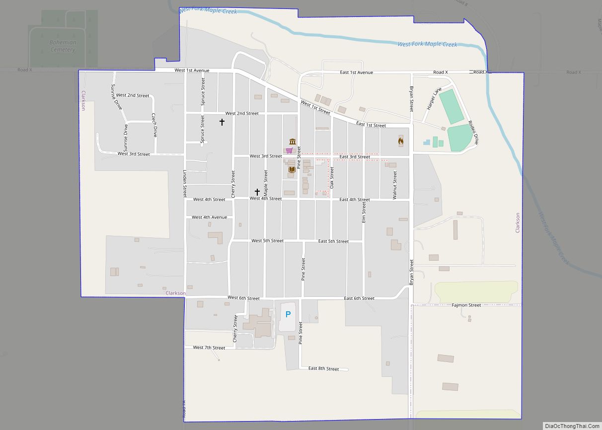
Online Interactive Map
Click on ![]() to view map in "full screen" mode.
to view map in "full screen" mode.
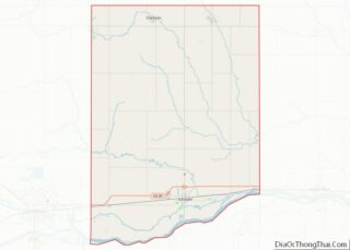
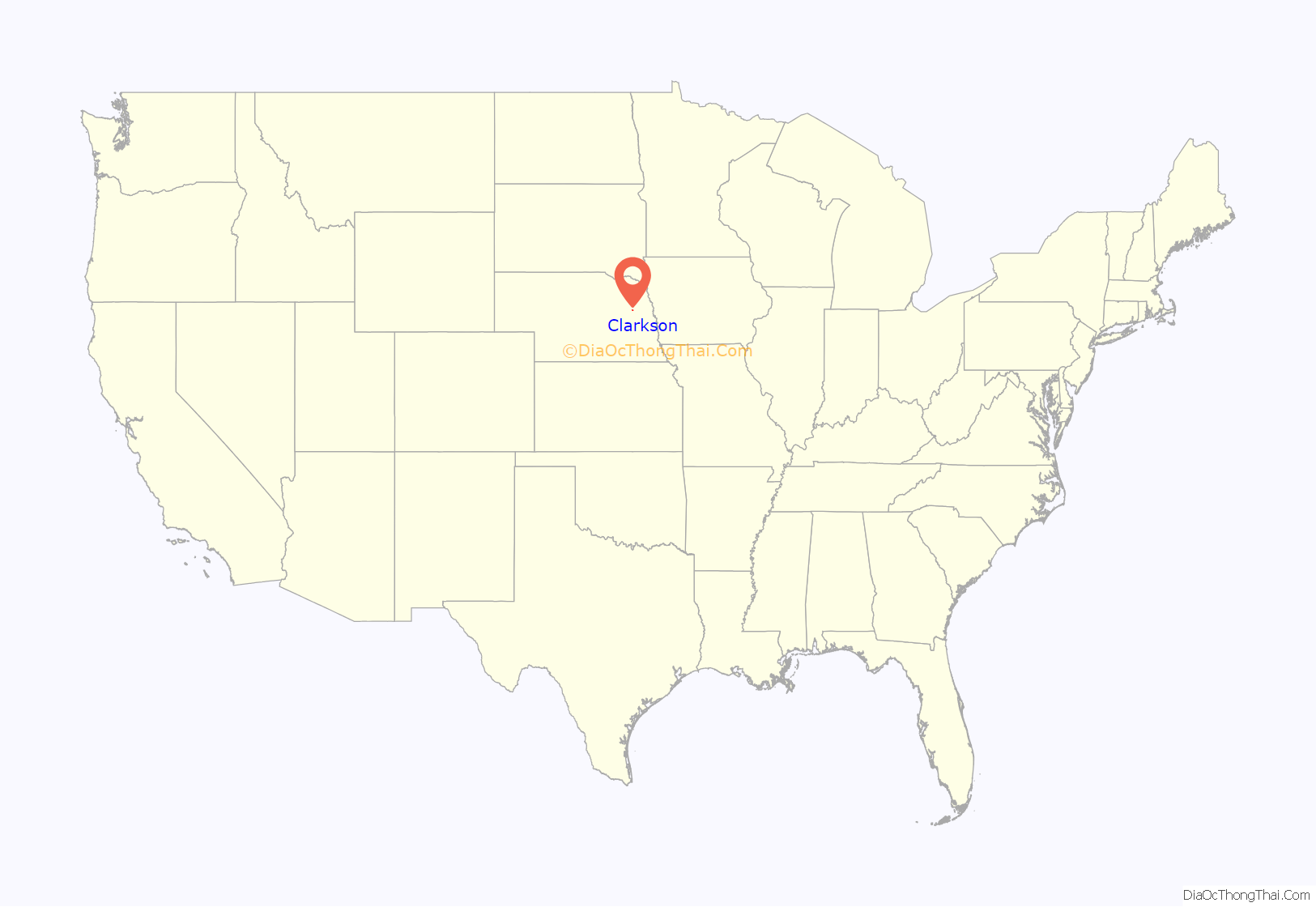
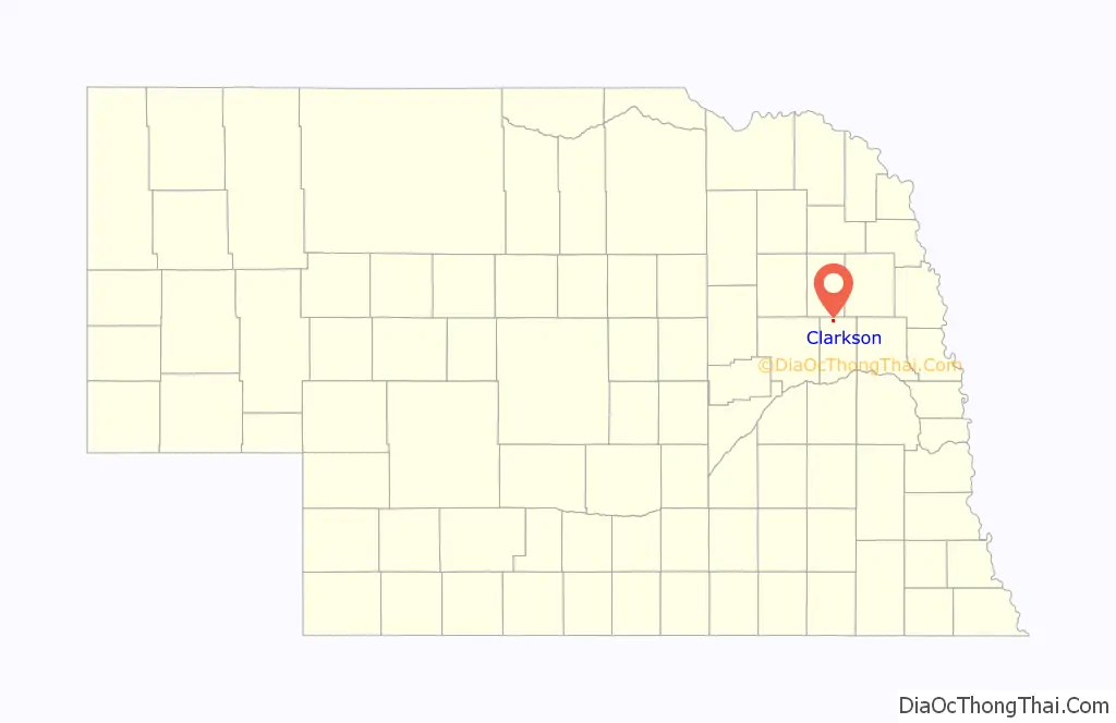
Clarkson location map. Where is Clarkson city?
History
Clarkson was platted in 1886 when it was certain that a new railroad line extended to the site. It was named for T. S. Clarkson, a postal official who helped establish the town’s first post office.
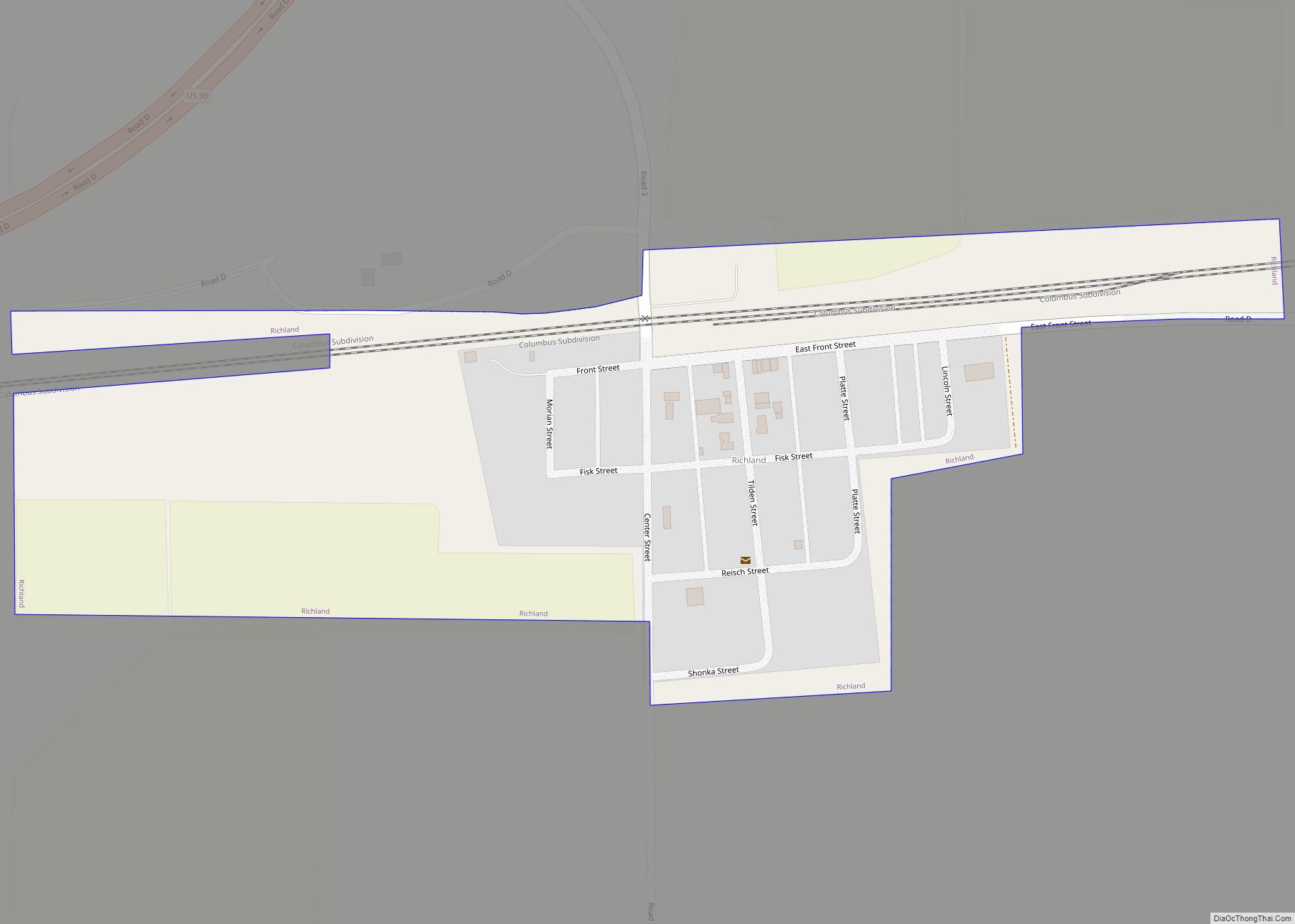
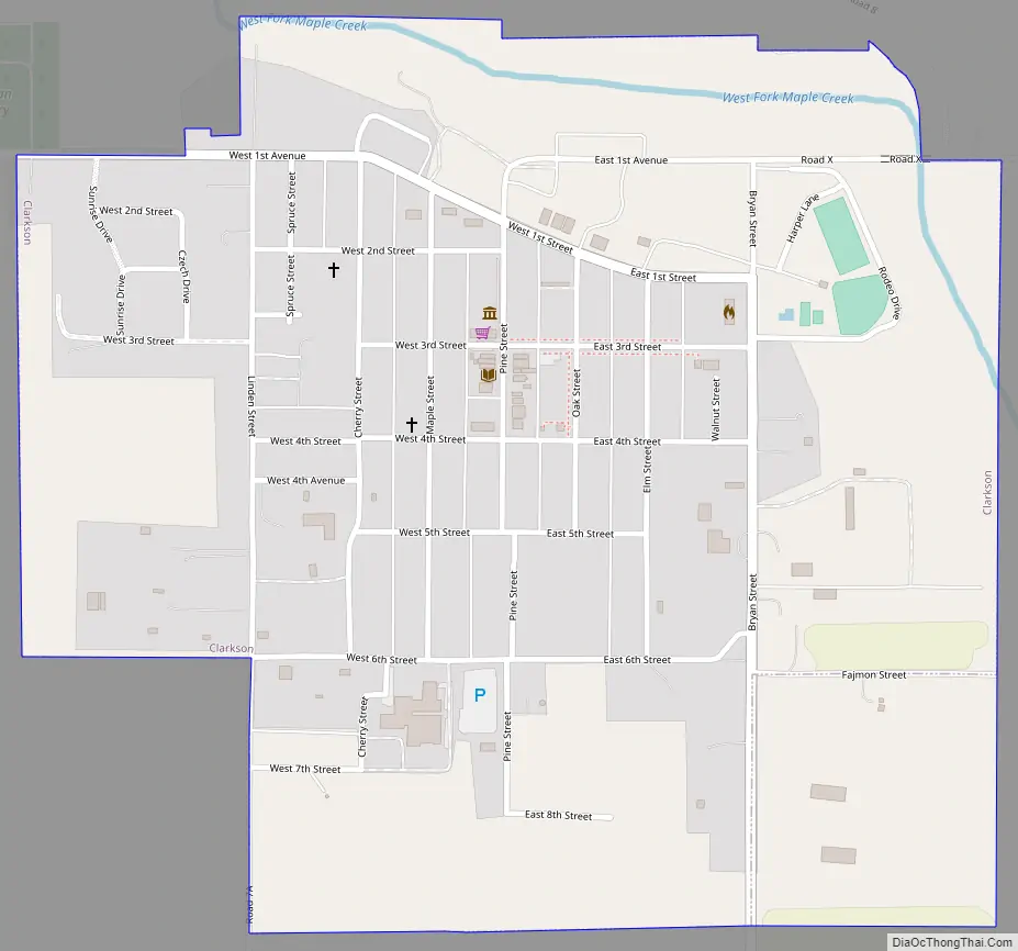
Clarkson Road Map
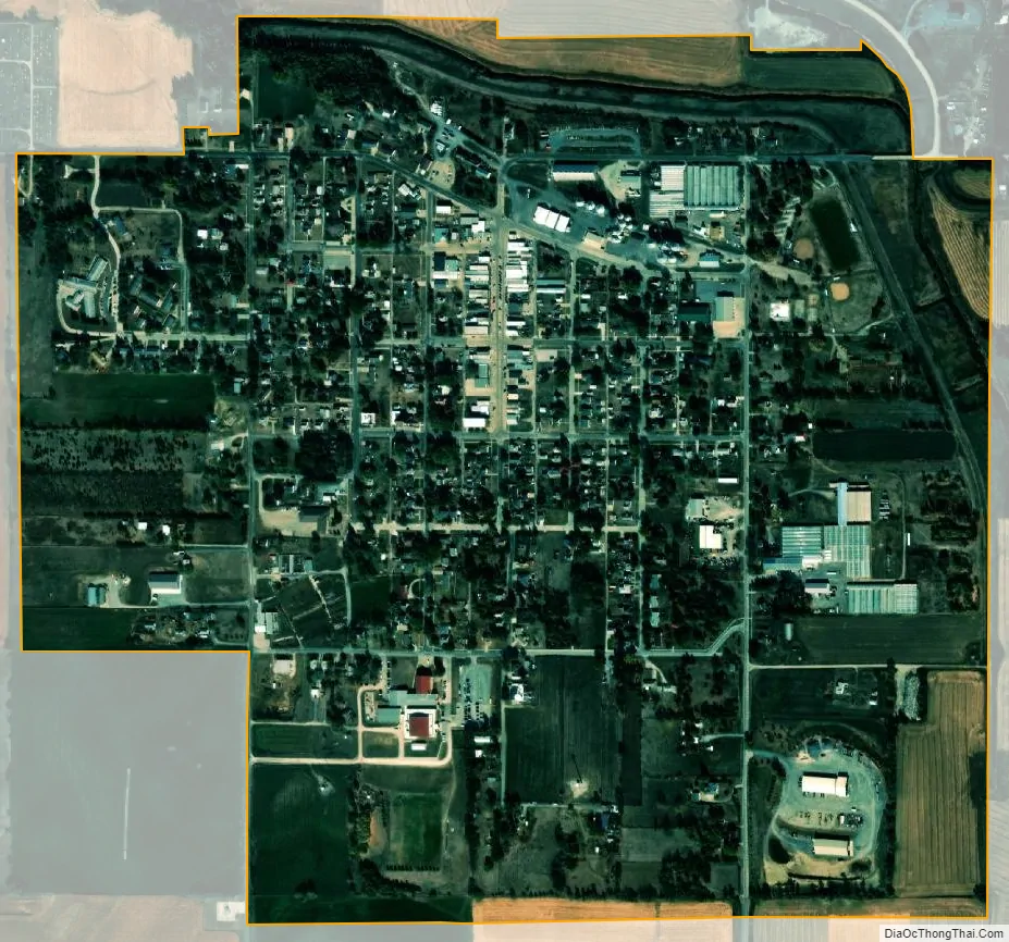
Clarkson city Satellite Map
Geography
Clarkson is located at 41°43′29″N 97°7′23″W / 41.72472°N 97.12306°W / 41.72472; -97.12306 (41.724676, -97.123015).
According to the United States Census Bureau, the city has a total area of 0.79 square miles (2.05 km), all land.
Clarkson is located in northeast Nebraska, three miles west of the junction of Nebraska Highways 15 and 91. Clarkson lies 35 miles southeast of Norfolk; 35 miles northeast of Columbus; 85 miles northwest of Omaha; and 90 miles northwest of Lincoln.
See also
Map of Nebraska State and its subdivision:- Adams
- Antelope
- Arthur
- Banner
- Blaine
- Boone
- Box Butte
- Boyd
- Brown
- Buffalo
- Burt
- Butler
- Cass
- Cedar
- Chase
- Cherry
- Cheyenne
- Clay
- Colfax
- Cuming
- Custer
- Dakota
- Dawes
- Dawson
- Deuel
- Dixon
- Dodge
- Douglas
- Dundy
- Fillmore
- Franklin
- Frontier
- Furnas
- Gage
- Garden
- Garfield
- Gosper
- Grant
- Greeley
- Hall
- Hamilton
- Harlan
- Hayes
- Hitchcock
- Holt
- Hooker
- Howard
- Jefferson
- Johnson
- Kearney
- Keith
- Keya Paha
- Kimball
- Knox
- Lancaster
- Lincoln
- Logan
- Loup
- Madison
- McPherson
- Merrick
- Morrill
- Nance
- Nemaha
- Nuckolls
- Otoe
- Pawnee
- Perkins
- Phelps
- Pierce
- Platte
- Polk
- Red Willow
- Richardson
- Rock
- Saline
- Sarpy
- Saunders
- Scotts Bluff
- Seward
- Sheridan
- Sherman
- Sioux
- Stanton
- Thayer
- Thomas
- Thurston
- Valley
- Washington
- Wayne
- Webster
- Wheeler
- York
- Alabama
- Alaska
- Arizona
- Arkansas
- California
- Colorado
- Connecticut
- Delaware
- District of Columbia
- Florida
- Georgia
- Hawaii
- Idaho
- Illinois
- Indiana
- Iowa
- Kansas
- Kentucky
- Louisiana
- Maine
- Maryland
- Massachusetts
- Michigan
- Minnesota
- Mississippi
- Missouri
- Montana
- Nebraska
- Nevada
- New Hampshire
- New Jersey
- New Mexico
- New York
- North Carolina
- North Dakota
- Ohio
- Oklahoma
- Oregon
- Pennsylvania
- Rhode Island
- South Carolina
- South Dakota
- Tennessee
- Texas
- Utah
- Vermont
- Virginia
- Washington
- West Virginia
- Wisconsin
- Wyoming