Crete is a city in Saline County, Nebraska, United States. The population was 7,099 at the 2020 census.
| Name: | Crete city |
|---|---|
| LSAD Code: | 25 |
| LSAD Description: | city (suffix) |
| State: | Nebraska |
| County: | Saline County |
| Elevation: | 1,352 ft (412 m) |
| Total Area: | 3.85 sq mi (9.97 km²) |
| Land Area: | 3.80 sq mi (9.84 km²) |
| Water Area: | 0.05 sq mi (0.13 km²) |
| Total Population: | 7,099 |
| Population Density: | 1,869.14/sq mi (721.72/km²) |
| ZIP code: | 68333 |
| Area code: | 402 |
| FIPS code: | 3111370 |
| GNISfeature ID: | 2393673 |
| Website: | http://www.crete.ne.gov |
Online Interactive Map
Click on ![]() to view map in "full screen" mode.
to view map in "full screen" mode.
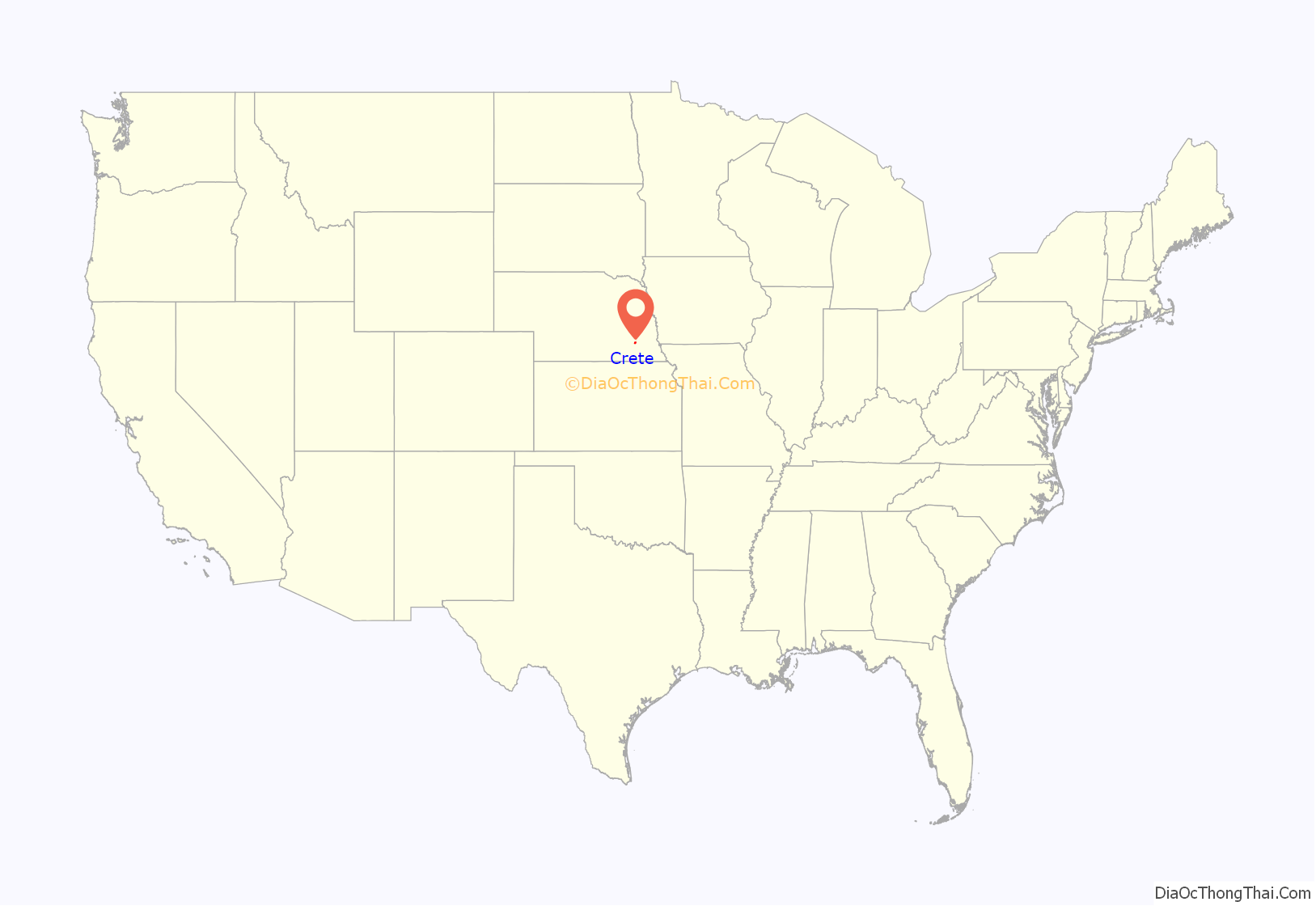
Crete location map. Where is Crete city?
History
The railroad was extended to the area in 1870, bringing settlers. In 1871, two rival towns merged to form a new town, which was named after Crete, Illinois, the former hometown of an early settler. The name was also chosen to conform with the alphabetical stops on the new Burlington & Quincy Railroad line traveling westward from Lincoln: Berks, Crete, Dorchester, Exeter, Fairmont, Grafton, Harvard, Inland, Junianta, Kenesaw, Lowell, Minden etc. Some towns were already in existence, with Friend and Sutton inserted into the alphabetical town names. It was planned to have a town every 9 miles on the railroad, as a steam engine needed to fill up with water periodically. are Crete was once a contender for county seat.
On February 18, 1969, Crete was the site of a railroad accident that released a fog of anhydrous ammonia fumes from a ruptured railroad tank car, killing five residents and seriously injuring 11 others in their homes. Another three people, hoboes who had been riding on the Chicago, Burlington and Quincy Railroad freight train as it traveled from Denver to Chicago, died of injuries received in the train derailment.
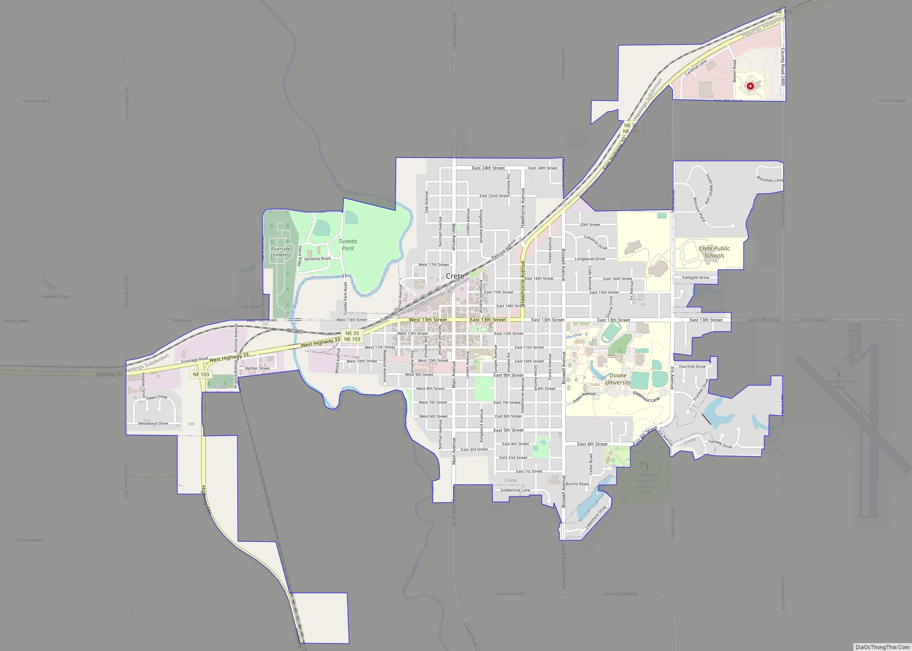
Crete Road Map
Crete city Satellite Map
Geography
According to the United States Census Bureau, the city has a total area of 2.97 square miles (7.69 km), of which 2.92 square miles (7.56 km) is land and 0.05 square miles (0.13 km) is water.
Climate
See also
Map of Nebraska State and its subdivision:- Adams
- Antelope
- Arthur
- Banner
- Blaine
- Boone
- Box Butte
- Boyd
- Brown
- Buffalo
- Burt
- Butler
- Cass
- Cedar
- Chase
- Cherry
- Cheyenne
- Clay
- Colfax
- Cuming
- Custer
- Dakota
- Dawes
- Dawson
- Deuel
- Dixon
- Dodge
- Douglas
- Dundy
- Fillmore
- Franklin
- Frontier
- Furnas
- Gage
- Garden
- Garfield
- Gosper
- Grant
- Greeley
- Hall
- Hamilton
- Harlan
- Hayes
- Hitchcock
- Holt
- Hooker
- Howard
- Jefferson
- Johnson
- Kearney
- Keith
- Keya Paha
- Kimball
- Knox
- Lancaster
- Lincoln
- Logan
- Loup
- Madison
- McPherson
- Merrick
- Morrill
- Nance
- Nemaha
- Nuckolls
- Otoe
- Pawnee
- Perkins
- Phelps
- Pierce
- Platte
- Polk
- Red Willow
- Richardson
- Rock
- Saline
- Sarpy
- Saunders
- Scotts Bluff
- Seward
- Sheridan
- Sherman
- Sioux
- Stanton
- Thayer
- Thomas
- Thurston
- Valley
- Washington
- Wayne
- Webster
- Wheeler
- York
- Alabama
- Alaska
- Arizona
- Arkansas
- California
- Colorado
- Connecticut
- Delaware
- District of Columbia
- Florida
- Georgia
- Hawaii
- Idaho
- Illinois
- Indiana
- Iowa
- Kansas
- Kentucky
- Louisiana
- Maine
- Maryland
- Massachusetts
- Michigan
- Minnesota
- Mississippi
- Missouri
- Montana
- Nebraska
- Nevada
- New Hampshire
- New Jersey
- New Mexico
- New York
- North Carolina
- North Dakota
- Ohio
- Oklahoma
- Oregon
- Pennsylvania
- Rhode Island
- South Carolina
- South Dakota
- Tennessee
- Texas
- Utah
- Vermont
- Virginia
- Washington
- West Virginia
- Wisconsin
- Wyoming
