Crete is a village in Will County, Illinois, United States. It is a far south suburb of Chicago, 30 miles from the Loop and only 6 miles from the Indiana border. The population was 8,465 at the 2020 census. Originally named Wood’s Corner, it was founded in 1836 by Vermonters Dyantha and Willard Wood.
| Name: | Crete village |
|---|---|
| LSAD Code: | 47 |
| LSAD Description: | village (suffix) |
| State: | Illinois |
| County: | Cook County, Will County |
| Founded: | 1836 |
| Total Area: | 9.47 sq mi (24.52 km²) |
| Land Area: | 9.45 sq mi (24.47 km²) |
| Water Area: | 0.02 sq mi (0.04 km²) |
| Total Population: | 8,465 |
| Population Density: | 890/sq mi (350/km²) |
| Area code: | 708 |
| FIPS code: | 1717523 |
| Website: | villageofcrete.org |
Online Interactive Map
Click on ![]() to view map in "full screen" mode.
to view map in "full screen" mode.
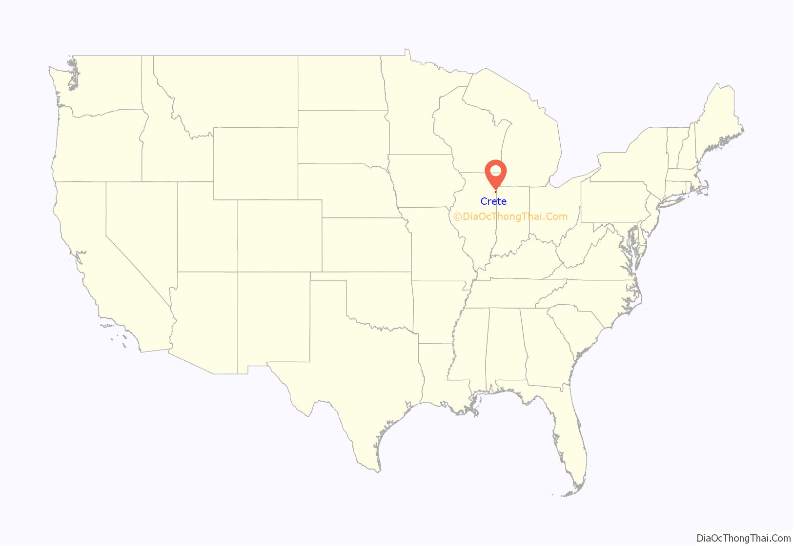
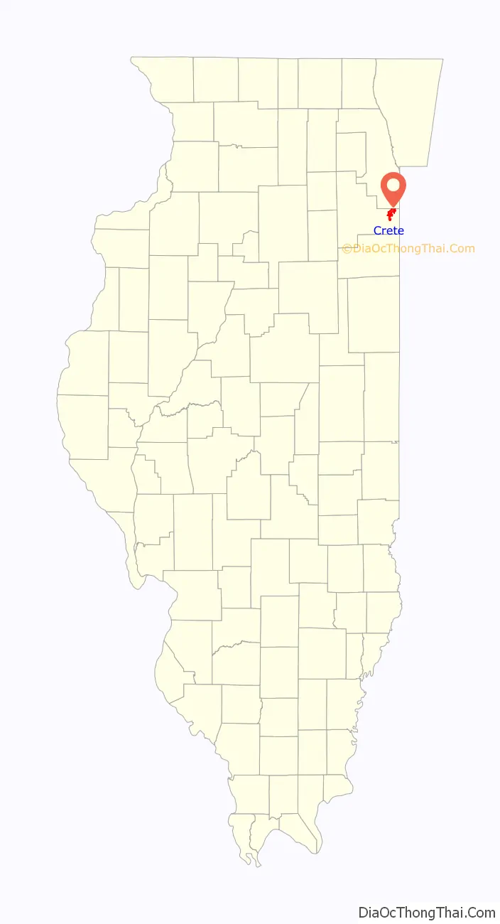
Crete location map. Where is Crete village?
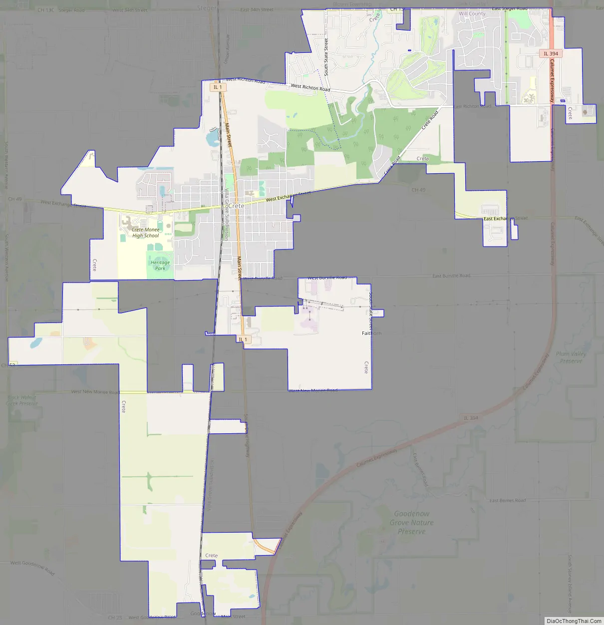
Crete Road Map
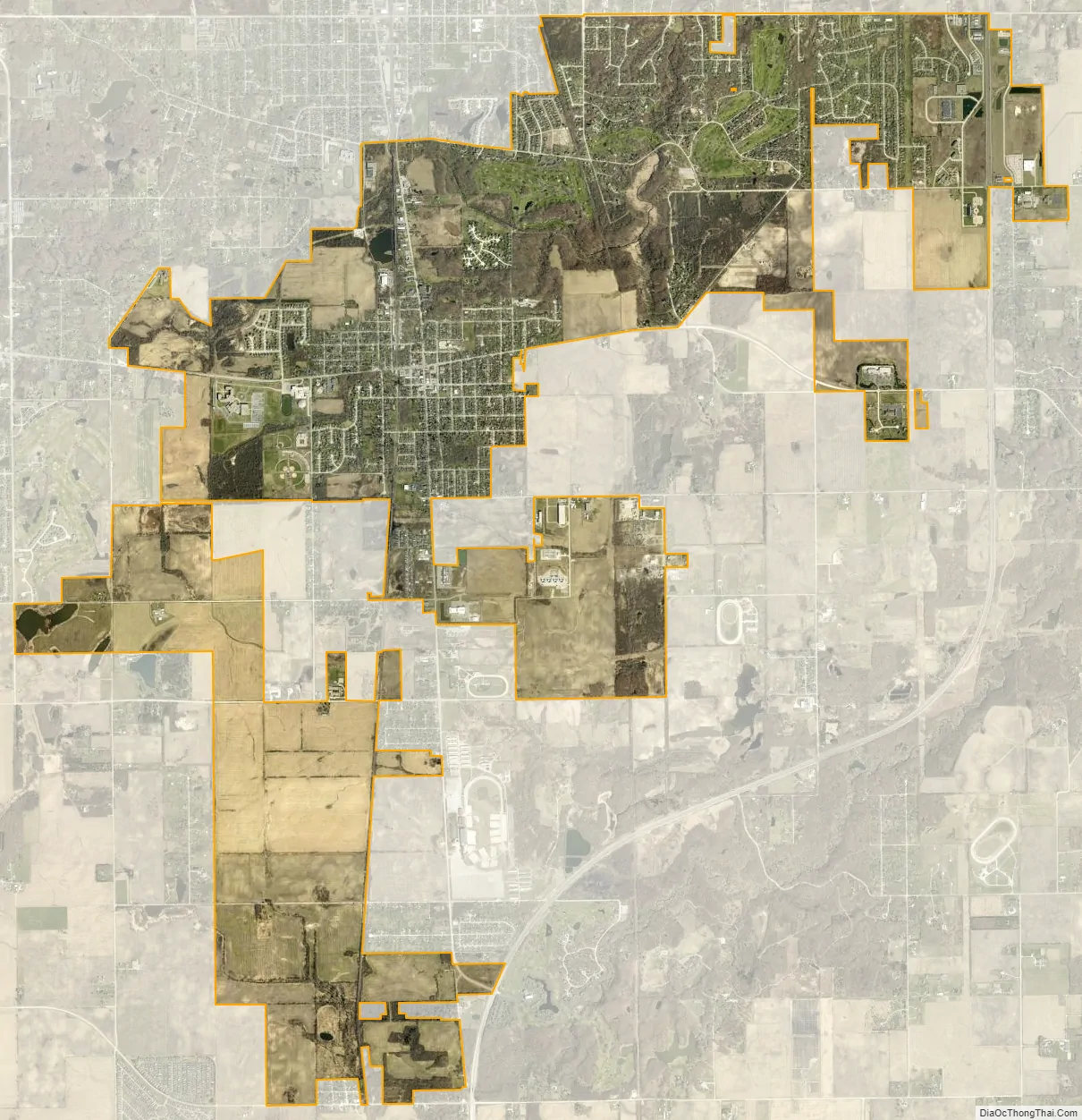
Crete city Satellite Map
Geography
Crete is located at 41°27′21″N 87°37′8″W / 41.45583°N 87.61889°W / 41.45583; -87.61889 (41.455910, -87.618798).
According to the 2010 census, Crete has a total area of 9.627 square miles (24.93 km), of which 9.61 square miles (24.89 km) (or 99.82%) is land and 0.017 square miles (0.04 km) (or 0.18%) is water. Crete is located about 2 miles (3.2 km) west of Illinois Route 394 and within 40 miles (64 km) of downtown Chicago. Willow Brook Estates, an unincorporated area between Crete and the Indiana border, uses the Crete postal code and is considered an eastern extension of the village.
See also
Map of Illinois State and its subdivision:- Adams
- Alexander
- Bond
- Boone
- Brown
- Bureau
- Calhoun
- Carroll
- Cass
- Champaign
- Christian
- Clark
- Clay
- Clinton
- Coles
- Cook
- Crawford
- Cumberland
- De Kalb
- De Witt
- Douglas
- Dupage
- Edgar
- Edwards
- Effingham
- Fayette
- Ford
- Franklin
- Fulton
- Gallatin
- Greene
- Grundy
- Hamilton
- Hancock
- Hardin
- Henderson
- Henry
- Iroquois
- Jackson
- Jasper
- Jefferson
- Jersey
- Jo Daviess
- Johnson
- Kane
- Kankakee
- Kendall
- Knox
- La Salle
- Lake
- Lake Michigan
- Lawrence
- Lee
- Livingston
- Logan
- Macon
- Macoupin
- Madison
- Marion
- Marshall
- Mason
- Massac
- McDonough
- McHenry
- McLean
- Menard
- Mercer
- Monroe
- Montgomery
- Morgan
- Moultrie
- Ogle
- Peoria
- Perry
- Piatt
- Pike
- Pope
- Pulaski
- Putnam
- Randolph
- Richland
- Rock Island
- Saint Clair
- Saline
- Sangamon
- Schuyler
- Scott
- Shelby
- Stark
- Stephenson
- Tazewell
- Union
- Vermilion
- Wabash
- Warren
- Washington
- Wayne
- White
- Whiteside
- Will
- Williamson
- Winnebago
- Woodford
- Alabama
- Alaska
- Arizona
- Arkansas
- California
- Colorado
- Connecticut
- Delaware
- District of Columbia
- Florida
- Georgia
- Hawaii
- Idaho
- Illinois
- Indiana
- Iowa
- Kansas
- Kentucky
- Louisiana
- Maine
- Maryland
- Massachusetts
- Michigan
- Minnesota
- Mississippi
- Missouri
- Montana
- Nebraska
- Nevada
- New Hampshire
- New Jersey
- New Mexico
- New York
- North Carolina
- North Dakota
- Ohio
- Oklahoma
- Oregon
- Pennsylvania
- Rhode Island
- South Carolina
- South Dakota
- Tennessee
- Texas
- Utah
- Vermont
- Virginia
- Washington
- West Virginia
- Wisconsin
- Wyoming


