Grand Island is a city in and the county seat of Hall County, Nebraska, United States. The population was 53,131 at the 2020 census.
Grand Island is the principal city of the Grand Island metropolitan area, which consists of Hall, Merrick, Howard and Hamilton counties. The Grand Island metropolitan area has an official population of 83,472 residents.
Grand Island has been given the All-America City Award four times (1955, 1967, 1981, and 1982) by the National Civic League.
Grand Island is home to the Nebraska Law Enforcement Training Center, which is the sole agency responsible for training law enforcement officers throughout the state, as well as the home of the Southern Power District serving southern Nebraska.
| Name: | Grand Island city |
|---|---|
| LSAD Code: | 25 |
| LSAD Description: | city (suffix) |
| State: | Nebraska |
| County: | Hall County |
| Elevation: | 1,860 ft (567 m) |
| Total Area: | 30.28 sq mi (78.44 km²) |
| Land Area: | 30.09 sq mi (77.92 km²) |
| Water Area: | 0.20 sq mi (0.51 km²) |
| Total Population: | 53,131 |
| Population Density: | 1,765.97/sq mi (681.85/km²) |
| ZIP code: | 68801-68803 |
| Area code: | 308 |
| FIPS code: | 3119595 |
| GNISfeature ID: | 0829622 |
| Website: | grand-island.com |
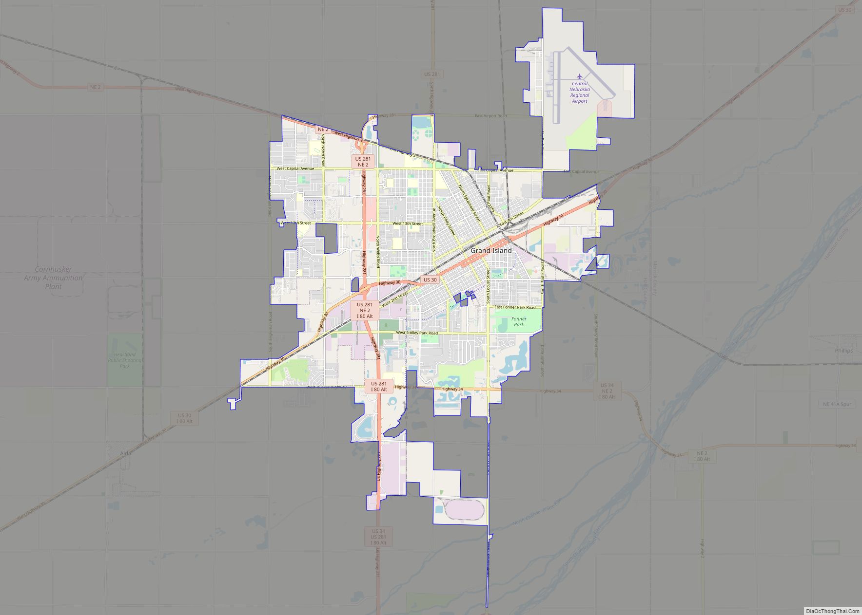
Online Interactive Map
Click on ![]() to view map in "full screen" mode.
to view map in "full screen" mode.
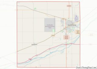
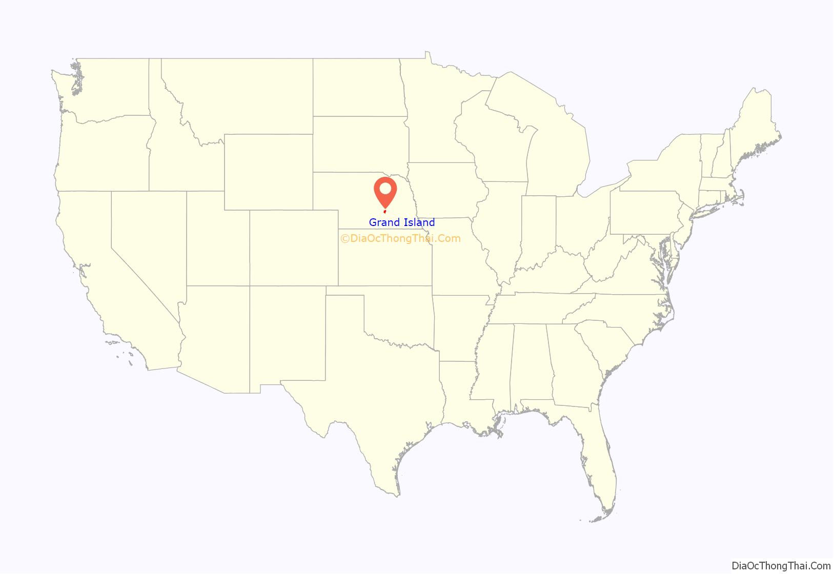
Grand Island location map. Where is Grand Island city?
History
In 1857, 35 German settlers left Davenport, Iowa, and headed west to Nebraska to start a new settlement on an island known by French traders as La Grande Isle, which was formed by the Wood River and the Platte River. The settlers reached their destination on July 4, 1857, and by September had built housing using local timber. They set up farms but initially had no market to sell their goods until a market opened at Fort Kearny. When the Pike’s Peak Gold Rush began, Grand Island was the last place travelers could obtain supplies before they crossed the plains.
Surveyors from the Union Pacific Railroad (UP) laid out a town called Grand Island Station and many settlers living on Grand Island moved to the new town, located slightly inland from the island. In 1868 the railroad reached the area, bringing increased trade and business. Grand Island became the end of the east division of the railroad and UP built service facilities for their locomotives in the town as well as an elegant hotel for passengers providing a boost for the local economy. The cost of the railroad coming into town was the denudement of most of the hardwood trees on the island for use as ties for the railroad. By 1870, 1,057 people lived in the town and in 1872 the town was incorporated as Grand Island.
In about 1890, sugar beets were introduced as a crop in Nebraska. The first sugar beet processing factory in the United States was built in the southwest part of Grand Island.
1980 tornadoes
On June 3, 1980, Grand Island was hit by a massive supercell storm. Through the course of the evening, the city was ravaged by seven tornadoes, the worst of which was rated F4 on the Fujita Scale. The hardest hit area of town was the South Locust business district. There were five deaths as a result of the tornadoes.
Tornado Hill is a local landmark created as a direct result of the tornadoes. Debris that could not be recycled was burned near Fonner Park and what remained was buried within Ryder Park, on the west end of town. The base of the hill was a hole 6–8 feet deep and nearly 200 feet across, and the hill is 40 feet high. It is used for sledding in this otherwise flat area.
A book, Night of the Twisters, by Ivy Ruckman, and movie were based on this event.
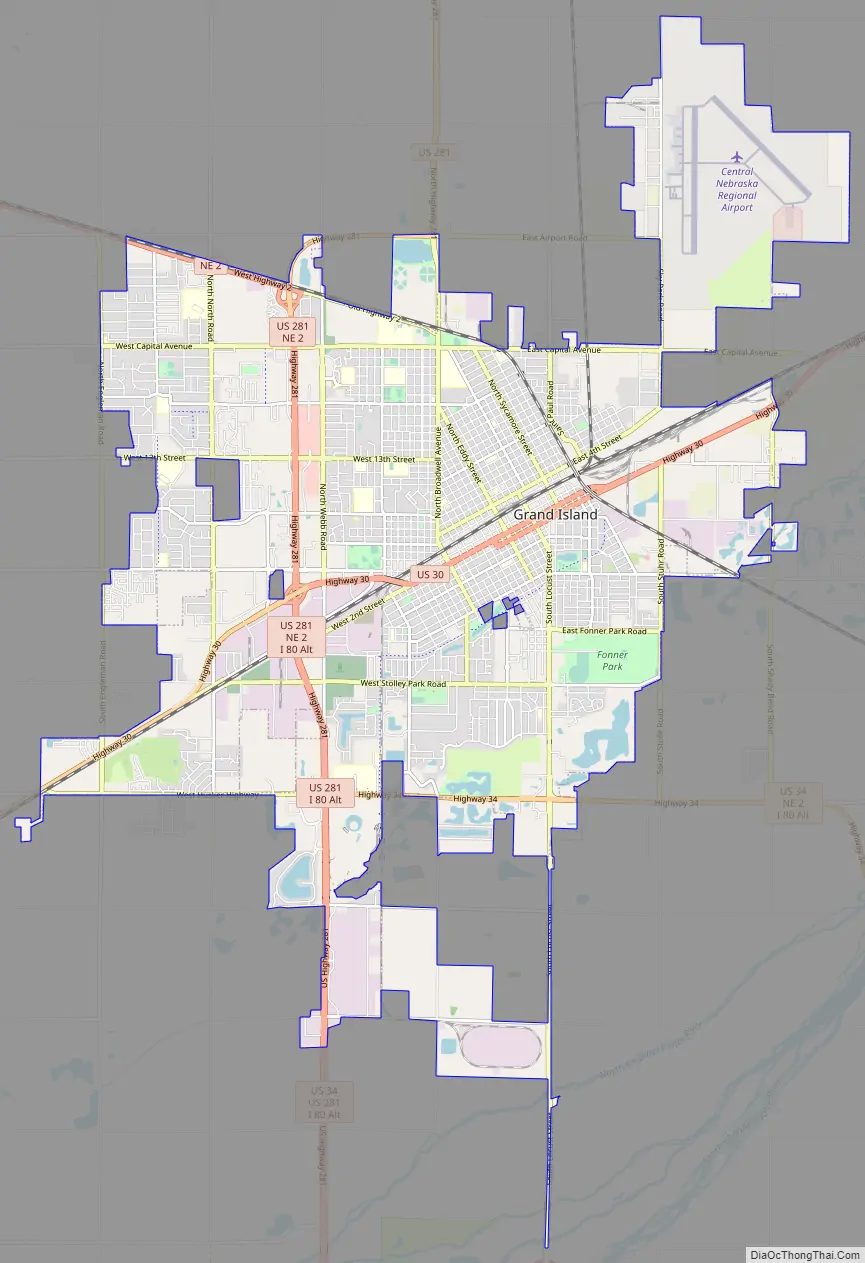
Grand Island Road Map
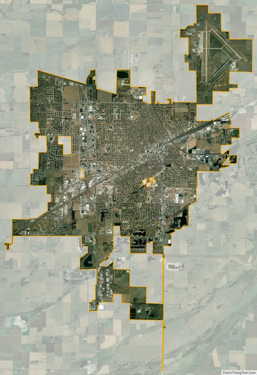
Grand Island city Satellite Map
Geography
According to the United States Census Bureau, the city has a total area of 28.55 square miles (73.94 km), of which 28.41 square miles (73.58 km) is land and 0.14 square miles (0.36 km) is water.
See also
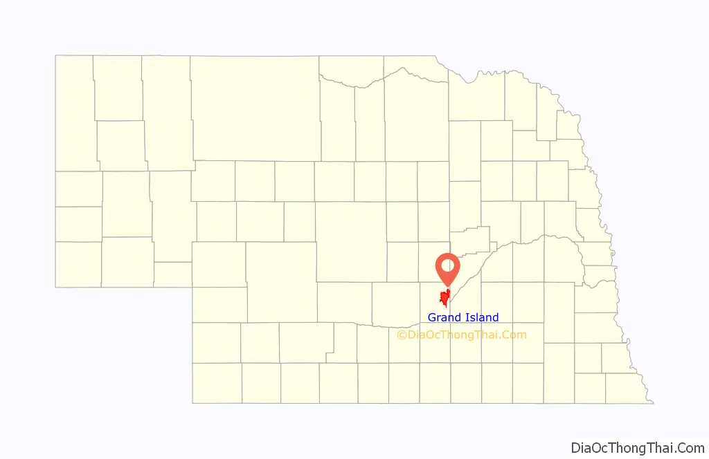
Map of Nebraska State and its subdivision:- Adams
- Antelope
- Arthur
- Banner
- Blaine
- Boone
- Box Butte
- Boyd
- Brown
- Buffalo
- Burt
- Butler
- Cass
- Cedar
- Chase
- Cherry
- Cheyenne
- Clay
- Colfax
- Cuming
- Custer
- Dakota
- Dawes
- Dawson
- Deuel
- Dixon
- Dodge
- Douglas
- Dundy
- Fillmore
- Franklin
- Frontier
- Furnas
- Gage
- Garden
- Garfield
- Gosper
- Grant
- Greeley
- Hall
- Hamilton
- Harlan
- Hayes
- Hitchcock
- Holt
- Hooker
- Howard
- Jefferson
- Johnson
- Kearney
- Keith
- Keya Paha
- Kimball
- Knox
- Lancaster
- Lincoln
- Logan
- Loup
- Madison
- McPherson
- Merrick
- Morrill
- Nance
- Nemaha
- Nuckolls
- Otoe
- Pawnee
- Perkins
- Phelps
- Pierce
- Platte
- Polk
- Red Willow
- Richardson
- Rock
- Saline
- Sarpy
- Saunders
- Scotts Bluff
- Seward
- Sheridan
- Sherman
- Sioux
- Stanton
- Thayer
- Thomas
- Thurston
- Valley
- Washington
- Wayne
- Webster
- Wheeler
- York
- Alabama
- Alaska
- Arizona
- Arkansas
- California
- Colorado
- Connecticut
- Delaware
- District of Columbia
- Florida
- Georgia
- Hawaii
- Idaho
- Illinois
- Indiana
- Iowa
- Kansas
- Kentucky
- Louisiana
- Maine
- Maryland
- Massachusetts
- Michigan
- Minnesota
- Mississippi
- Missouri
- Montana
- Nebraska
- Nevada
- New Hampshire
- New Jersey
- New Mexico
- New York
- North Carolina
- North Dakota
- Ohio
- Oklahoma
- Oregon
- Pennsylvania
- Rhode Island
- South Carolina
- South Dakota
- Tennessee
- Texas
- Utah
- Vermont
- Virginia
- Washington
- West Virginia
- Wisconsin
- Wyoming