Lindsay is a village in Platte County, Nebraska, United States. The population was 255 at the 2010 census.
| Name: | Lindsay village |
|---|---|
| LSAD Code: | 47 |
| LSAD Description: | village (suffix) |
| State: | Nebraska |
| County: | Platte County |
| Elevation: | 1,690 ft (515 m) |
| Total Area: | 0.48 sq mi (1.24 km²) |
| Land Area: | 0.47 sq mi (1.23 km²) |
| Water Area: | 0.01 sq mi (0.02 km²) |
| Total Population: | 283 |
| Population Density: | 597.05/sq mi (230.59/km²) |
| ZIP code: | 68644 |
| Area code: | 402 |
| FIPS code: | 3128105 |
| GNISfeature ID: | 0830744 |
Online Interactive Map
Click on ![]() to view map in "full screen" mode.
to view map in "full screen" mode.
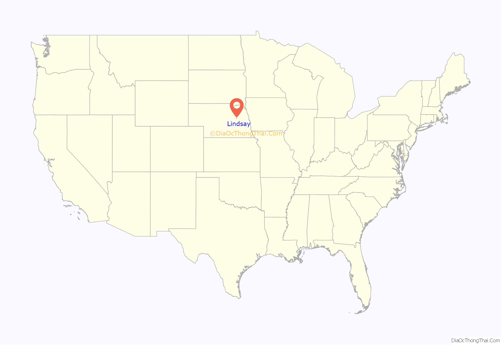
Lindsay location map. Where is Lindsay village?
History
Founding and Naming
In 1862, subject to the provisions of the Homestead Act, Families began settling in the fertile land near Shell Creek. Lindsay was platted in 1886. A large share of the early settlers being natives of Lindsay, Ontario, Canada caused the name to be selected. Lindsay was incorporated as a village on March 7, 1888.
Early 20th century
By the early 20th century, Lindsay had an electric utility and water system comprising a 100-ft well and a 60,000-gallon tank.
The Chicago and North Western Railroad’s Albion Line consisted of 115 miles of tracks through Lindsay, on which were operated four freight trains and two passenger trains daily. By 1917, the population of Lindsay had grown to almost 500 people.
Lindsay Corporation
What is now the Lindsay Corporation was founded in the village in 1955 by Paul Zimmerer as the Lindsay Manufacturing Company to be a maker of irrigation and farm automation equipment. The company has retained a manufacturing facility in Lindsay, but is now headquartered in Omaha, Nebraska and its stock is traded on the New York Stock Exchange with a ticker symbol of LNN. In 2005, the company accounted for 80% of employment in Lindsay, employing about 460 persons of the village’s total employment of 577.
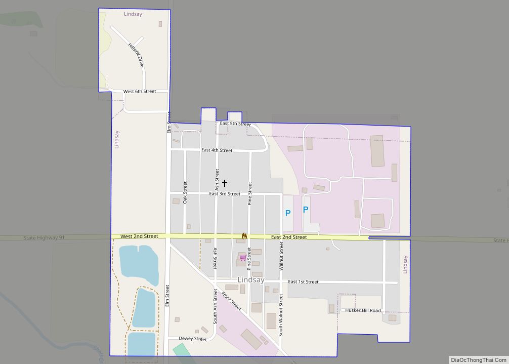
Lindsay Road Map
Lindsay city Satellite Map
Geography
Lindsay is located at 41°42′2″N 97°41′41″W / 41.70056°N 97.69472°W / 41.70056; -97.69472 (41.700622, -97.694605).
According to the United States Census Bureau, the village has a total area of 0.34 square miles (0.88 km), all land.
See also
Map of Nebraska State and its subdivision:- Adams
- Antelope
- Arthur
- Banner
- Blaine
- Boone
- Box Butte
- Boyd
- Brown
- Buffalo
- Burt
- Butler
- Cass
- Cedar
- Chase
- Cherry
- Cheyenne
- Clay
- Colfax
- Cuming
- Custer
- Dakota
- Dawes
- Dawson
- Deuel
- Dixon
- Dodge
- Douglas
- Dundy
- Fillmore
- Franklin
- Frontier
- Furnas
- Gage
- Garden
- Garfield
- Gosper
- Grant
- Greeley
- Hall
- Hamilton
- Harlan
- Hayes
- Hitchcock
- Holt
- Hooker
- Howard
- Jefferson
- Johnson
- Kearney
- Keith
- Keya Paha
- Kimball
- Knox
- Lancaster
- Lincoln
- Logan
- Loup
- Madison
- McPherson
- Merrick
- Morrill
- Nance
- Nemaha
- Nuckolls
- Otoe
- Pawnee
- Perkins
- Phelps
- Pierce
- Platte
- Polk
- Red Willow
- Richardson
- Rock
- Saline
- Sarpy
- Saunders
- Scotts Bluff
- Seward
- Sheridan
- Sherman
- Sioux
- Stanton
- Thayer
- Thomas
- Thurston
- Valley
- Washington
- Wayne
- Webster
- Wheeler
- York
- Alabama
- Alaska
- Arizona
- Arkansas
- California
- Colorado
- Connecticut
- Delaware
- District of Columbia
- Florida
- Georgia
- Hawaii
- Idaho
- Illinois
- Indiana
- Iowa
- Kansas
- Kentucky
- Louisiana
- Maine
- Maryland
- Massachusetts
- Michigan
- Minnesota
- Mississippi
- Missouri
- Montana
- Nebraska
- Nevada
- New Hampshire
- New Jersey
- New Mexico
- New York
- North Carolina
- North Dakota
- Ohio
- Oklahoma
- Oregon
- Pennsylvania
- Rhode Island
- South Carolina
- South Dakota
- Tennessee
- Texas
- Utah
- Vermont
- Virginia
- Washington
- West Virginia
- Wisconsin
- Wyoming
