Oakland is a city in Burt County, Nebraska, United States. The population was 1,244 at the 2010 census. Oakland continues to build on its strong foundation with its bi-annual Swedish Festival and is known by its proclamation from the Swedish Consul-General and the Governor of Nebraska as the “Swedish Capital of Nebraska.”
| Name: | Oakland city |
|---|---|
| LSAD Code: | 25 |
| LSAD Description: | city (suffix) |
| State: | Nebraska |
| County: | Burt County |
| Elevation: | 1,293 ft (394 m) |
| Total Area: | 0.95 sq mi (2.46 km²) |
| Land Area: | 0.95 sq mi (2.46 km²) |
| Water Area: | 0.00 sq mi (0.00 km²) |
| Total Population: | 1,369 |
| Population Density: | 1,442.57/sq mi (557.21/km²) |
| ZIP code: | 68045 |
| Area code: | 402 |
| FIPS code: | 3135490 |
| GNISfeature ID: | 0831822 |
| Website: | www.ci.oakland.ne.us |
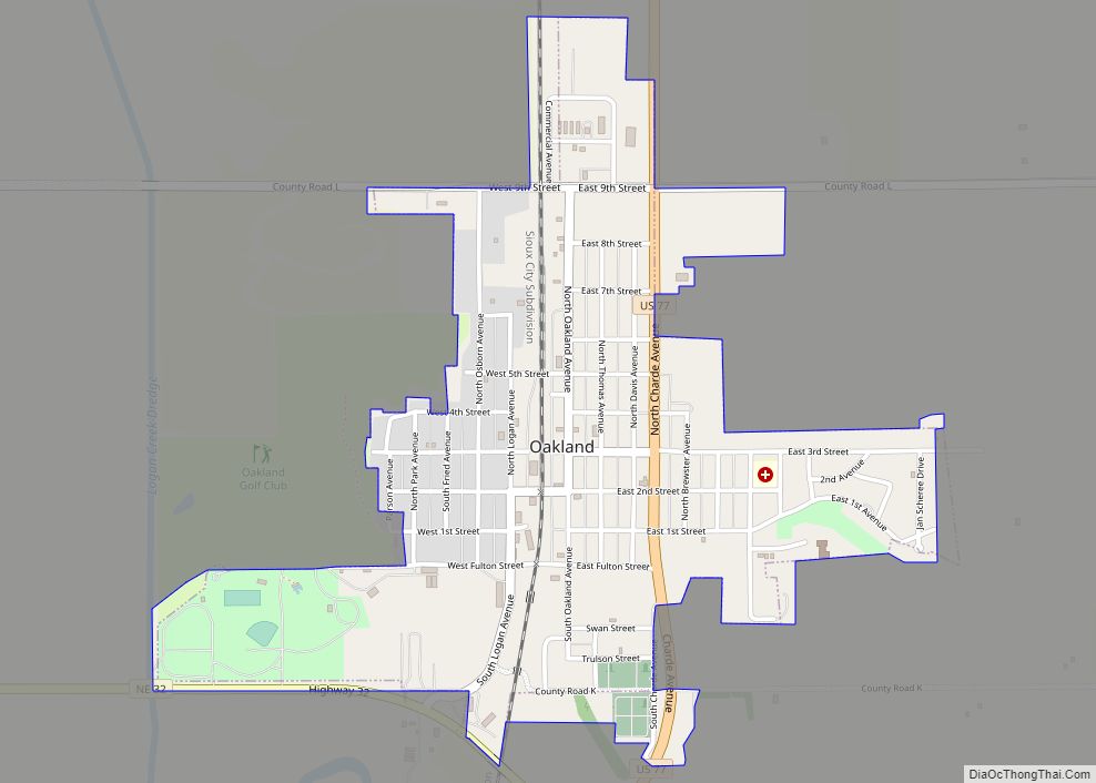
Online Interactive Map
Click on ![]() to view map in "full screen" mode.
to view map in "full screen" mode.
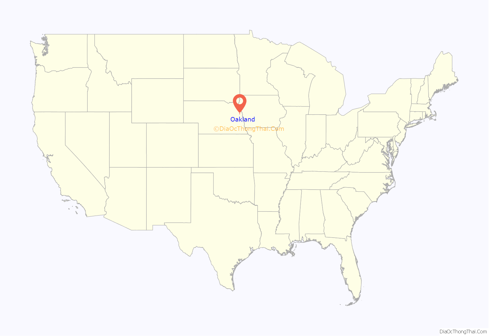
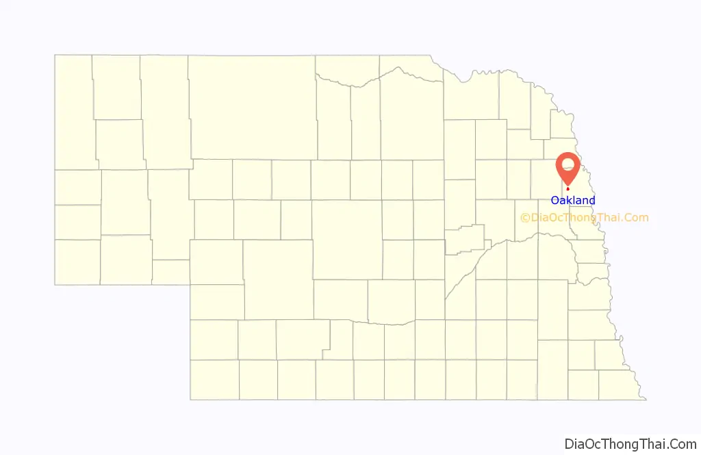
Oakland location map. Where is Oakland city?
History
Oakland was named after John Oak, an early settler. The village was incorporated April 13, 1881, with 30 businesses, two banks and one printing office in operation. Basic economic activities in the Oakland area soon included farming, cattle and hog production, feed processing, wholesale and retail sales. In 1900, the Chicago, Burlington and Quincy Railroad were built to Oakland.
Oakland was home to the Swedish Basketball Classic from 1993 to 2006, which has since moved to Midland University in Fremont and changed its name to the Warrior Classic. Oakland has also been home to the Burt County Fair since 1913.
Police Chief Terry Poland embezzled nearly $15,000 in funds from Oakland according to the Nebraska State Auditor’s Office in 2022. Poland purchased ice-fishing equipment, a wake surfboard, and a glass basketball backboard for personal use with city funds.
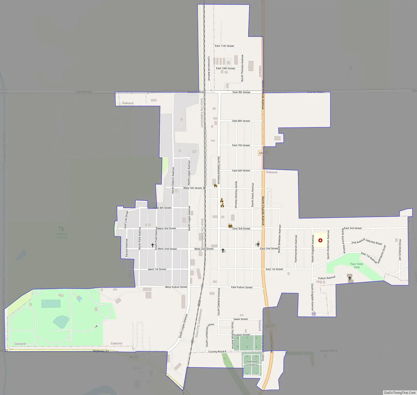
Oakland Road Map
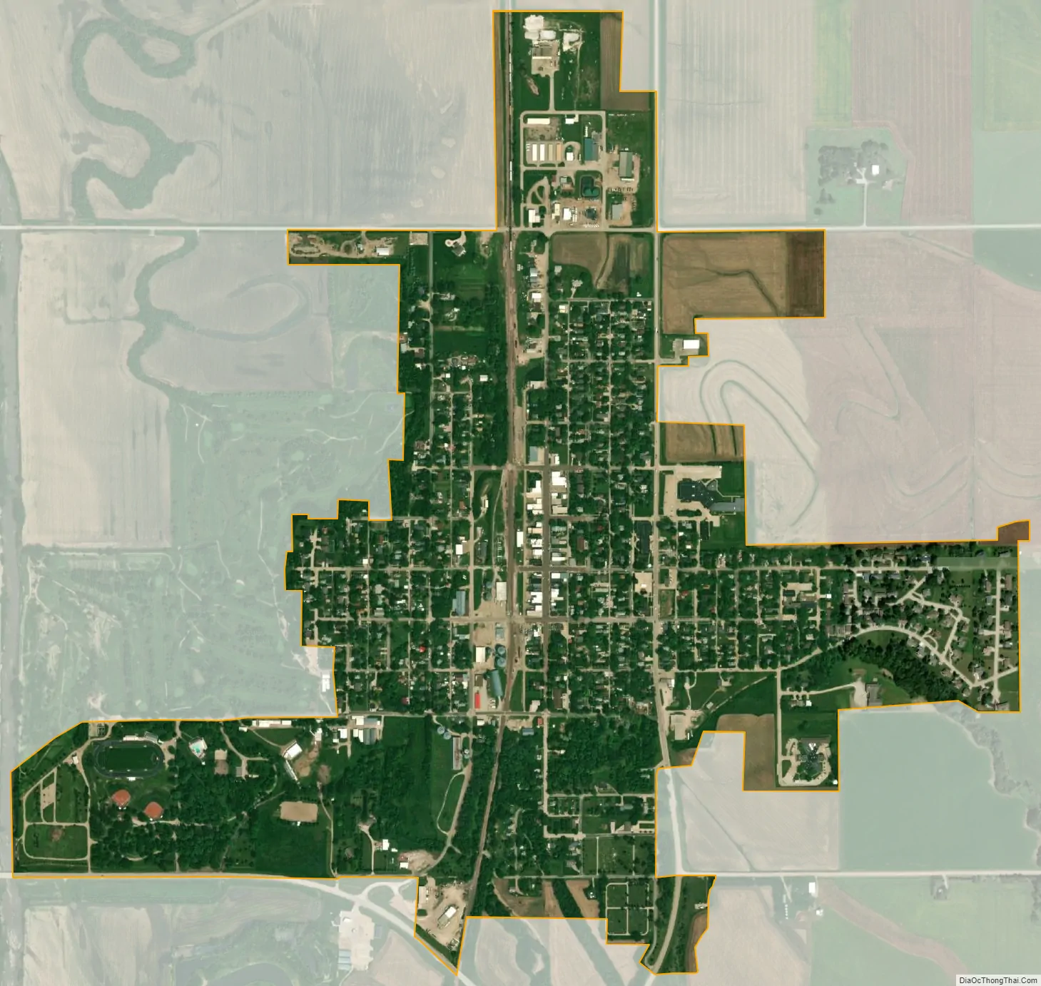
Oakland city Satellite Map
Geography
Oakland is located at 41°50′6″N 96°27′58″W / 41.83500°N 96.46611°W / 41.83500; -96.46611 (41.835133, -96.466075). According to the United States Census Bureau, the city has a total area of 0.93 square miles (2.41 km), all land.
See also
Map of Nebraska State and its subdivision:- Adams
- Antelope
- Arthur
- Banner
- Blaine
- Boone
- Box Butte
- Boyd
- Brown
- Buffalo
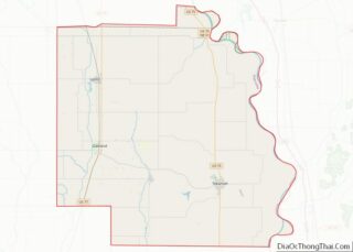
- Burt
- Butler
- Cass
- Cedar
- Chase
- Cherry
- Cheyenne
- Clay
- Colfax
- Cuming
- Custer
- Dakota
- Dawes
- Dawson
- Deuel
- Dixon
- Dodge
- Douglas
- Dundy
- Fillmore
- Franklin
- Frontier
- Furnas
- Gage
- Garden
- Garfield
- Gosper
- Grant
- Greeley
- Hall
- Hamilton
- Harlan
- Hayes
- Hitchcock
- Holt
- Hooker
- Howard
- Jefferson
- Johnson
- Kearney
- Keith
- Keya Paha
- Kimball
- Knox
- Lancaster
- Lincoln
- Logan
- Loup
- Madison
- McPherson
- Merrick
- Morrill
- Nance
- Nemaha
- Nuckolls
- Otoe
- Pawnee
- Perkins
- Phelps
- Pierce
- Platte
- Polk
- Red Willow
- Richardson
- Rock
- Saline
- Sarpy
- Saunders
- Scotts Bluff
- Seward
- Sheridan
- Sherman
- Sioux
- Stanton
- Thayer
- Thomas
- Thurston
- Valley
- Washington
- Wayne
- Webster
- Wheeler
- York
- Alabama
- Alaska
- Arizona
- Arkansas
- California
- Colorado
- Connecticut
- Delaware
- District of Columbia
- Florida
- Georgia
- Hawaii
- Idaho
- Illinois
- Indiana
- Iowa
- Kansas
- Kentucky
- Louisiana
- Maine
- Maryland
- Massachusetts
- Michigan
- Minnesota
- Mississippi
- Missouri
- Montana
- Nebraska
- Nevada
- New Hampshire
- New Jersey
- New Mexico
- New York
- North Carolina
- North Dakota
- Ohio
- Oklahoma
- Oregon
- Pennsylvania
- Rhode Island
- South Carolina
- South Dakota
- Tennessee
- Texas
- Utah
- Vermont
- Virginia
- Washington
- West Virginia
- Wisconsin
- Wyoming