Sidney is a city in and the county seat of Cheyenne County, Nebraska, United States. The city is nine miles (14 km) north of the Colorado state line. The population was 6,757 at the 2010 census.
| Name: | Sidney city |
|---|---|
| LSAD Code: | 25 |
| LSAD Description: | city (suffix) |
| State: | Nebraska |
| County: | Cheyenne County |
| Elevation: | 4,088 ft (1,246 m) |
| Total Area: | 7.49 sq mi (19.39 km²) |
| Land Area: | 7.49 sq mi (19.38 km²) |
| Water Area: | 0.00 sq mi (0.00 km²) |
| Total Population: | 6,410 |
| Population Density: | 856.38/sq mi (330.67/km²) |
| ZIP code: | 69160, 69162 |
| Area code: | 308 |
| FIPS code: | 3145295 |
| GNISfeature ID: | 0833422 |
| Website: | cityofsidney.org |
Online Interactive Map
Click on ![]() to view map in "full screen" mode.
to view map in "full screen" mode.
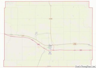
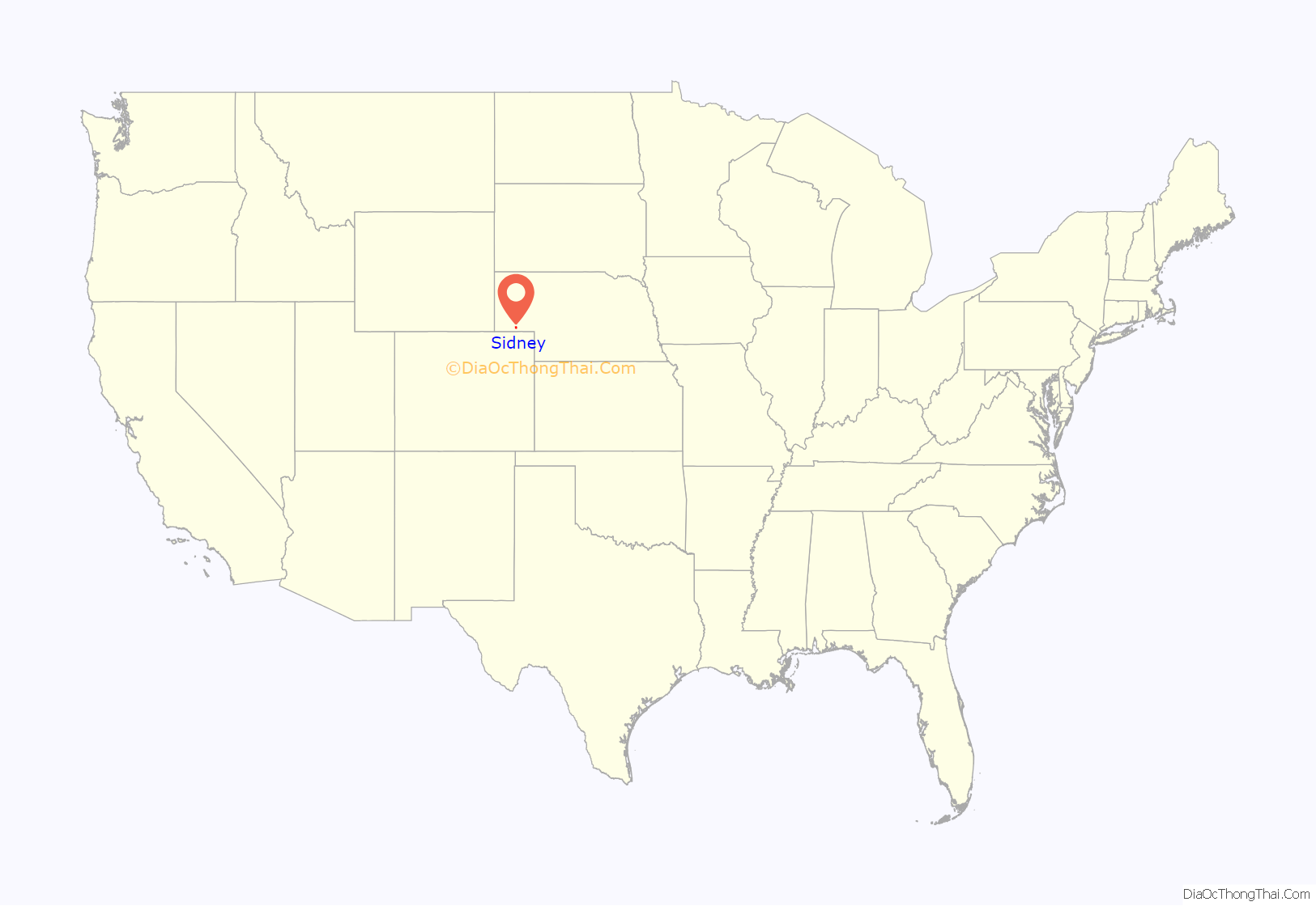
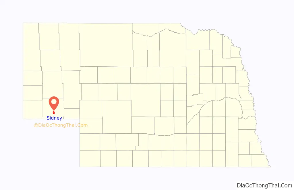
Sidney location map. Where is Sidney city?
History
The city was named for Sidney Dillon, president of the Union Pacific Railroad. It was founded in 1867 by the Union Pacific and grew up around the military base of Fort Sidney (also known as Sidney Barracks), where soldiers were stationed to guard the transcontinental railroad against potential Native American attacks.
The town became the southern terminus of the Sidney Black Hills Stage Road which used Clarke’s Bridge (near Bridgeport, Nebraska) to allow military and civilian traffic to reach Fort Robinson, Red Cloud Agency, Spotted Tail Agency, Custer, South Dakota, and Deadwood, South Dakota in the late 1870s and 1880s.
When the railroad reached Sidney, it was the end of a sub-division of the rail line and played host to a roundhouse, repair facilities, and a railroad hotel for passengers.
Sidney is home to one of the Old West’s Boot Hill cemeteries; many of those interred there were soldiers from the fort.
The former headquarters for Cabela’s was located in Sidney until 2017, when Sidney lost 2,000 jobs due to Cabela’s merger with Bass Pro Shops. Approximately 120 of those jobs were relocated to the Bass Pro Shops headquarters in Springfield, Missouri.
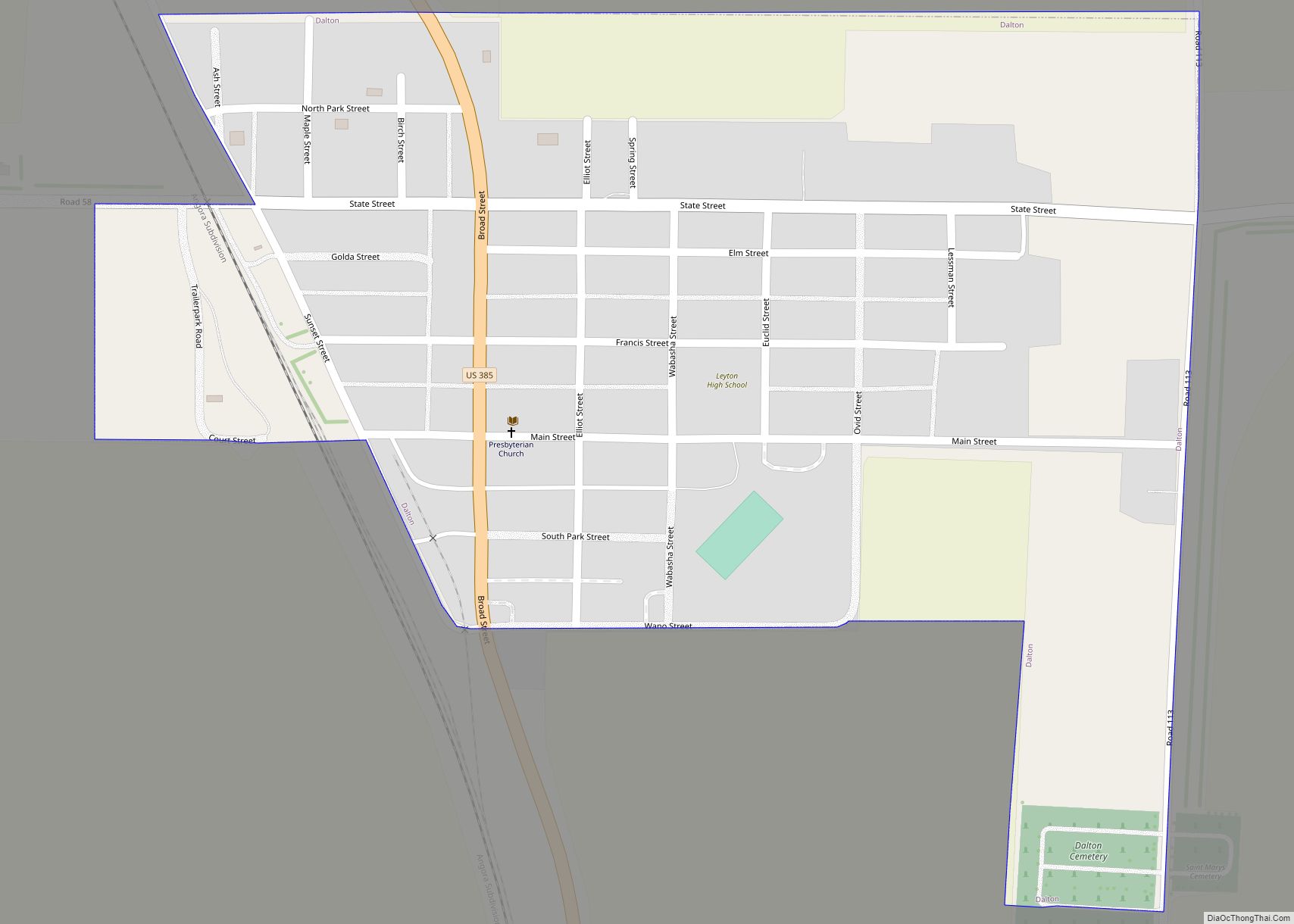
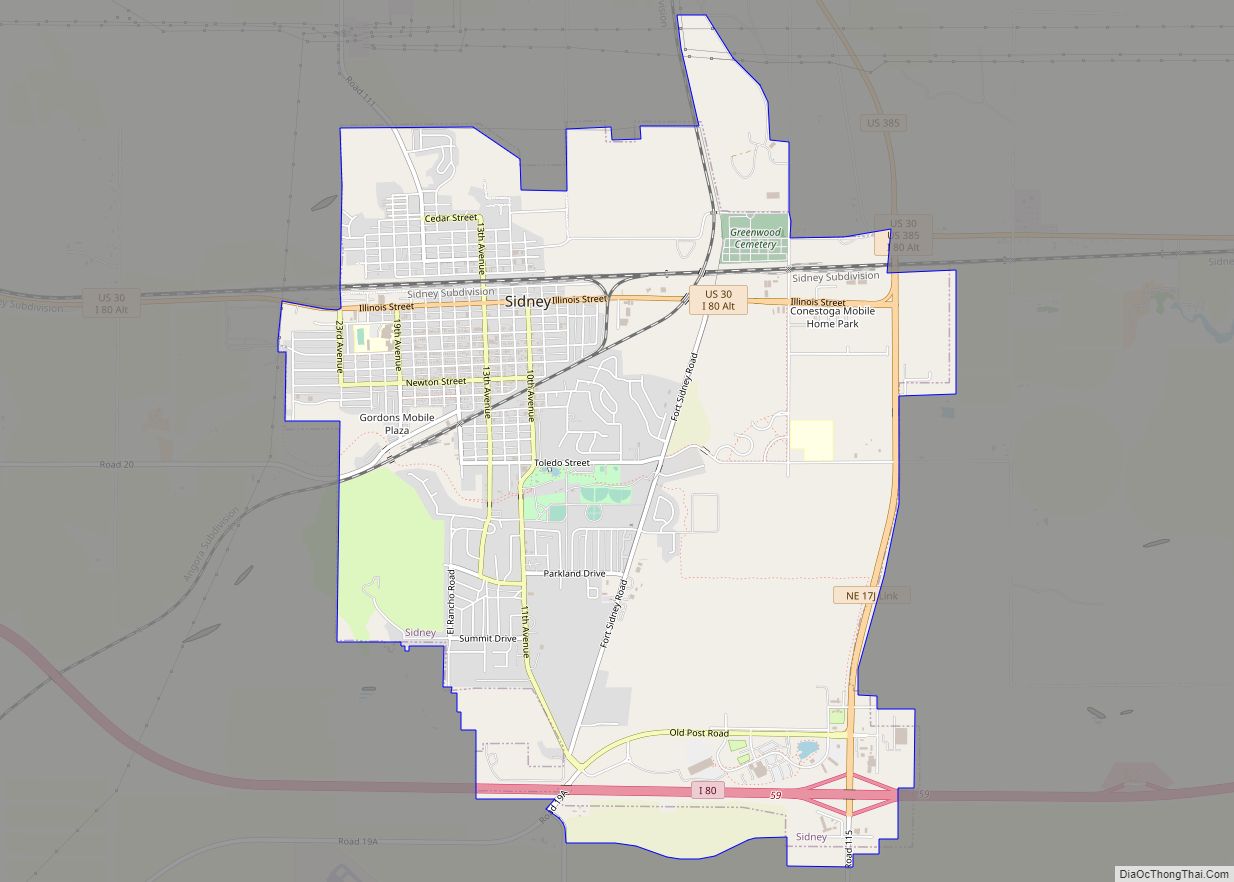
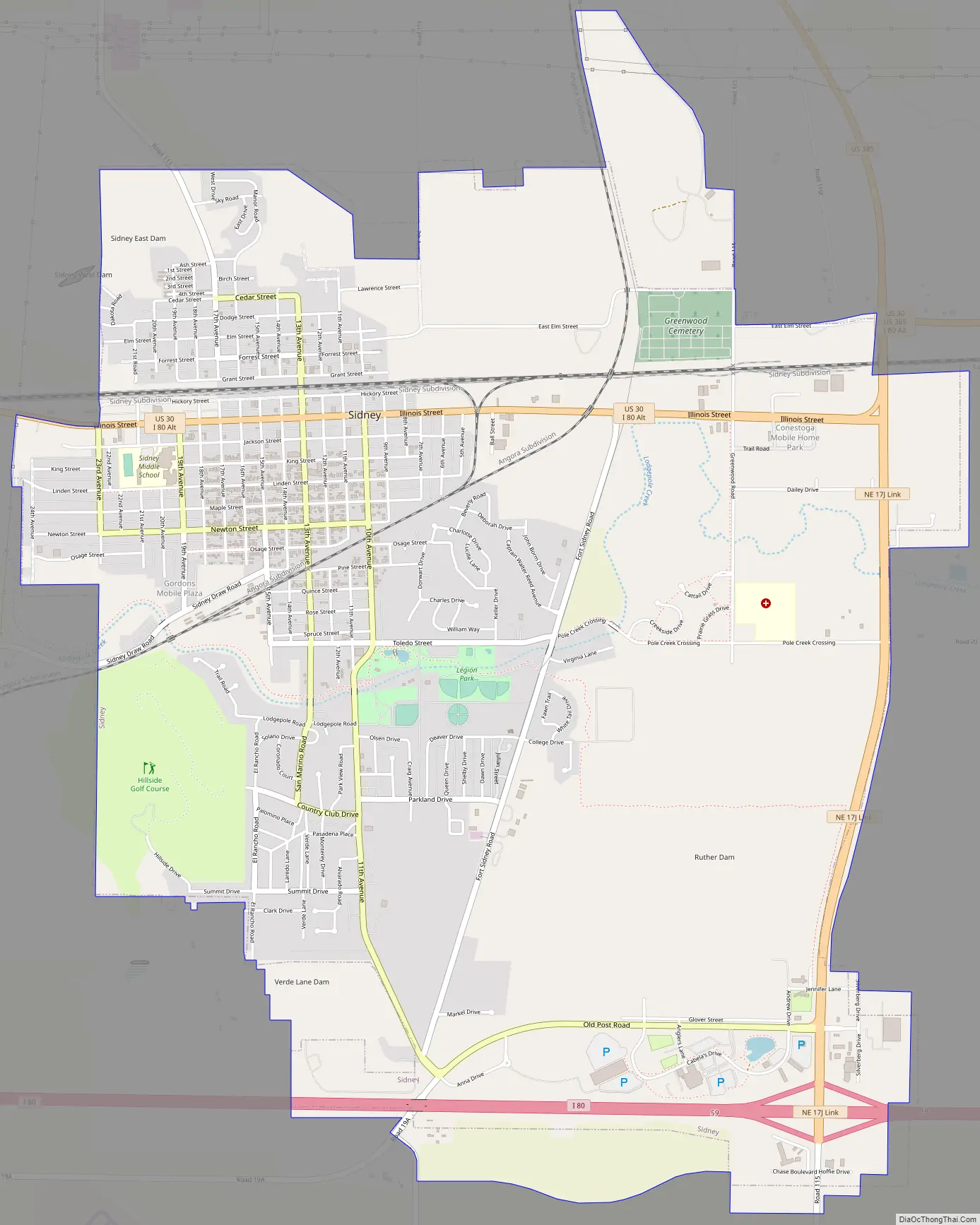
Sidney Road Map
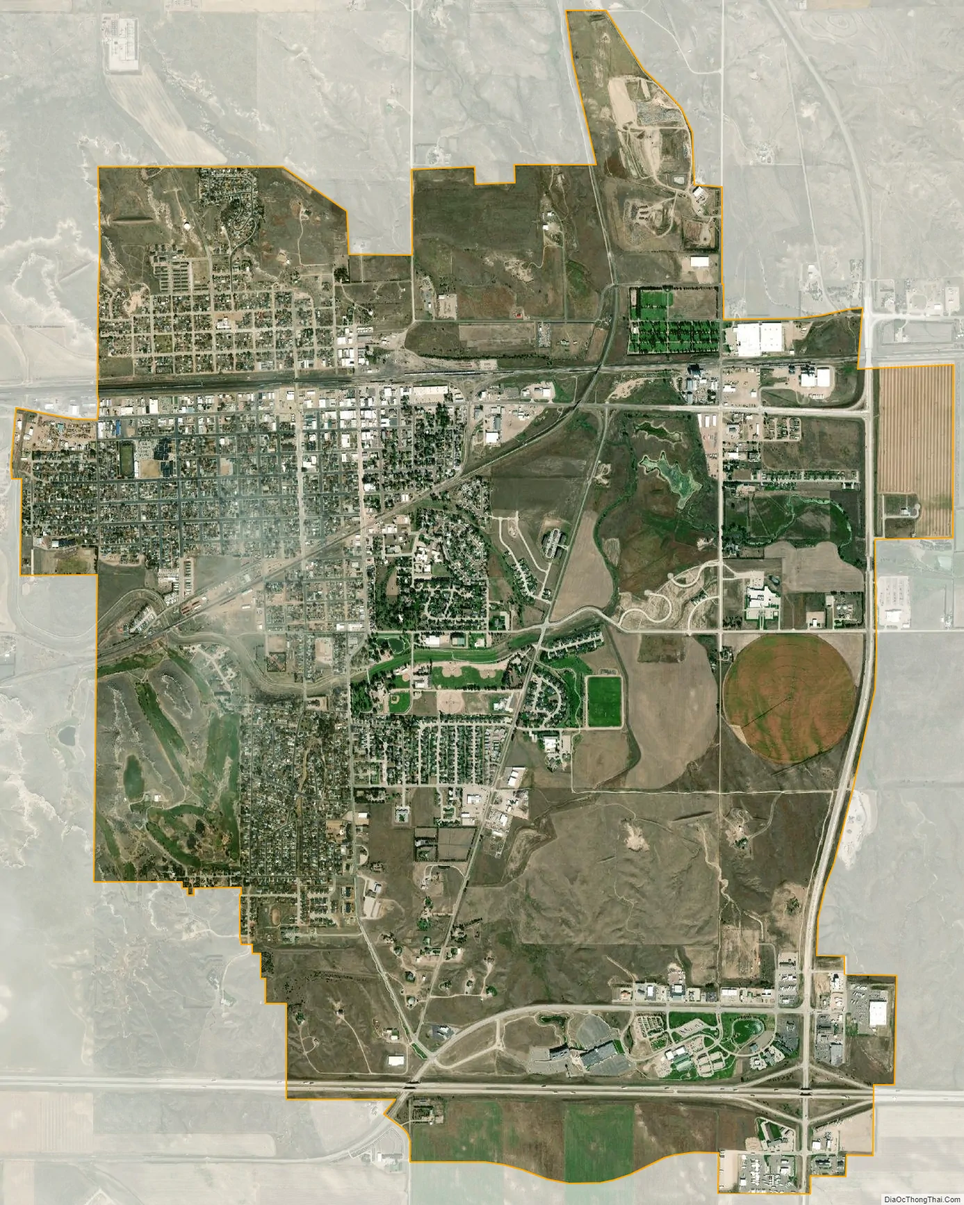
Sidney city Satellite Map
Geography
According to the United States Census Bureau, the city has a total area of 6.93 square miles (17.95 km), all land.
Sidney is toward the western edge of the Midwestern wheat-growing region. West of the city, the land is increasingly used for cattle ranching. Sidney is located along Lodgepole Creek, which is along present-day Interstate 80.
The city is presently located at the junction of U.S. Route 385 with I-80, and its location approximately halfway between Cheyenne, Wyoming, and North Platte, Nebraska, has encouraged the growth of the city as a major transportation service area on the Interstate. Because the I-80/US 385 interchange is located several miles southeast of the town center, a new commercial area has developed, including truck stops, convenience stores, the building that housed Cabela’s former world headquarters, shopping centers, motels, restaurants, and other commercial enterprises. In recent years, the city has seen further growth with the construction of wind farms in this portion of the Nebraska Panhandle and adjacent areas of Colorado, including Peetz.
See also
Map of Nebraska State and its subdivision:- Adams
- Antelope
- Arthur
- Banner
- Blaine
- Boone
- Box Butte
- Boyd
- Brown
- Buffalo
- Burt
- Butler
- Cass
- Cedar
- Chase
- Cherry
- Cheyenne
- Clay
- Colfax
- Cuming
- Custer
- Dakota
- Dawes
- Dawson
- Deuel
- Dixon
- Dodge
- Douglas
- Dundy
- Fillmore
- Franklin
- Frontier
- Furnas
- Gage
- Garden
- Garfield
- Gosper
- Grant
- Greeley
- Hall
- Hamilton
- Harlan
- Hayes
- Hitchcock
- Holt
- Hooker
- Howard
- Jefferson
- Johnson
- Kearney
- Keith
- Keya Paha
- Kimball
- Knox
- Lancaster
- Lincoln
- Logan
- Loup
- Madison
- McPherson
- Merrick
- Morrill
- Nance
- Nemaha
- Nuckolls
- Otoe
- Pawnee
- Perkins
- Phelps
- Pierce
- Platte
- Polk
- Red Willow
- Richardson
- Rock
- Saline
- Sarpy
- Saunders
- Scotts Bluff
- Seward
- Sheridan
- Sherman
- Sioux
- Stanton
- Thayer
- Thomas
- Thurston
- Valley
- Washington
- Wayne
- Webster
- Wheeler
- York
- Alabama
- Alaska
- Arizona
- Arkansas
- California
- Colorado
- Connecticut
- Delaware
- District of Columbia
- Florida
- Georgia
- Hawaii
- Idaho
- Illinois
- Indiana
- Iowa
- Kansas
- Kentucky
- Louisiana
- Maine
- Maryland
- Massachusetts
- Michigan
- Minnesota
- Mississippi
- Missouri
- Montana
- Nebraska
- Nevada
- New Hampshire
- New Jersey
- New Mexico
- New York
- North Carolina
- North Dakota
- Ohio
- Oklahoma
- Oregon
- Pennsylvania
- Rhode Island
- South Carolina
- South Dakota
- Tennessee
- Texas
- Utah
- Vermont
- Virginia
- Washington
- West Virginia
- Wisconsin
- Wyoming