Stella is a village in Richardson County, Nebraska, United States. The population was 150 at the 2020 census.
| Name: | Stella village |
|---|---|
| LSAD Code: | 47 |
| LSAD Description: | village (suffix) |
| State: | Nebraska |
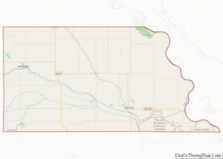
| County: | Richardson County |
| Elevation: | 1,037 ft (316 m) |
| Total Area: | 0.18 sq mi (0.46 km²) |
| Land Area: | 0.18 sq mi (0.46 km²) |
| Water Area: | 0.00 sq mi (0.00 km²) |
| Total Population: | 150 |
| Population Density: | 830/sq mi (330/km²) |
| ZIP code: | 68442 |
| Area code: | 402 |
| FIPS code: | 3147115 |
| GNISfeature ID: | 2399894 |
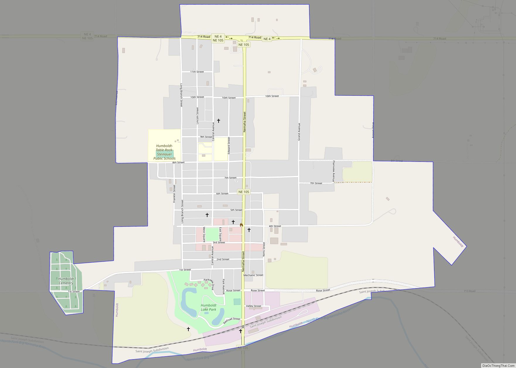
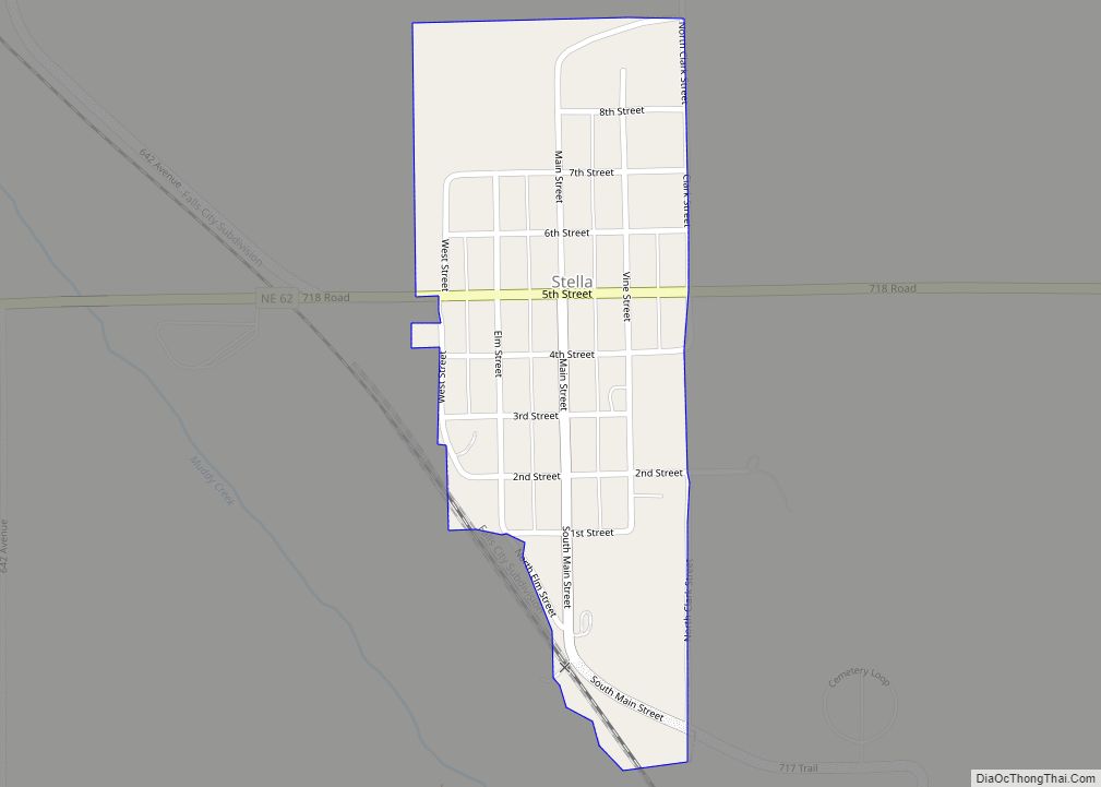
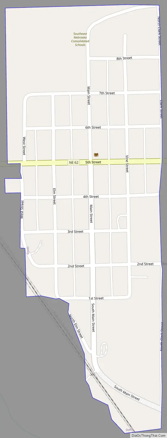
Online Interactive Map
Click on ![]() to view map in "full screen" mode.
to view map in "full screen" mode.
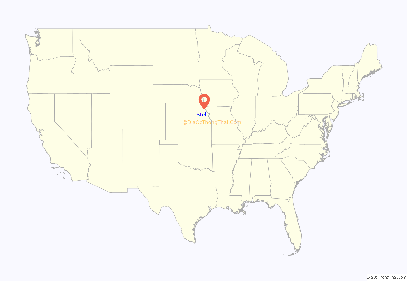
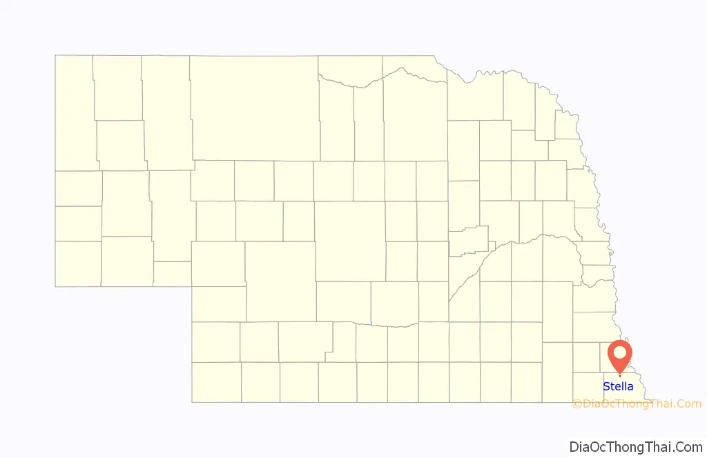
Stella location map. Where is Stella village?
History
The earliest settlers in the Stella area arrived in about 1855. An August 1881 public meeting of local farmers led to an arrangement for the Missouri Pacific Railroad to be extended to that point. Stella was platted the same year, and was named for Stella Clark, the daughter of the original owner of the town site. The track reached Stella in December 1881 and a station building was raised on January 7, 1882.
The village was incorporated in 1882 and grew quickly. By fall 1882 there were 25 business firms in town. A 56-page “Souvenir” of the Stella Press was issued on April 1, 1901, recounting the steady growth of the town to that point, which proved to be the peak of the town population. By that time there were five churches: the Baptist, Methodist, Christian, Lutheran, and Church of Christ Scientist. Residents had a choice of nine lodges and a number of social organizations. The school commenced in 1884, a water system was begun in 1887, an opera house was built in 1898, telephones were introduced in 1899, and an electrical system was in the planning stage in 1901. Detailed biographical sketches of more than 200 local families were included in the “Souvenir.”
Stella Road Map
Stella city Satellite Map

Geography
According to the United States Census Bureau, the village has a total area of 0.18 square miles (0.47 km), all land.
See also
Map of Nebraska State and its subdivision:- Adams
- Antelope
- Arthur
- Banner
- Blaine
- Boone
- Box Butte
- Boyd
- Brown
- Buffalo
- Burt
- Butler
- Cass
- Cedar
- Chase
- Cherry
- Cheyenne
- Clay
- Colfax
- Cuming
- Custer
- Dakota
- Dawes
- Dawson
- Deuel
- Dixon
- Dodge
- Douglas
- Dundy
- Fillmore
- Franklin
- Frontier
- Furnas
- Gage
- Garden
- Garfield
- Gosper
- Grant
- Greeley
- Hall
- Hamilton
- Harlan
- Hayes
- Hitchcock
- Holt
- Hooker
- Howard
- Jefferson
- Johnson
- Kearney
- Keith
- Keya Paha
- Kimball
- Knox
- Lancaster
- Lincoln
- Logan
- Loup
- Madison
- McPherson
- Merrick
- Morrill
- Nance
- Nemaha
- Nuckolls
- Otoe
- Pawnee
- Perkins
- Phelps
- Pierce
- Platte
- Polk
- Red Willow
- Richardson
- Rock
- Saline
- Sarpy
- Saunders
- Scotts Bluff
- Seward
- Sheridan
- Sherman
- Sioux
- Stanton
- Thayer
- Thomas
- Thurston
- Valley
- Washington
- Wayne
- Webster
- Wheeler
- York
- Alabama
- Alaska
- Arizona
- Arkansas
- California
- Colorado
- Connecticut
- Delaware
- District of Columbia
- Florida
- Georgia
- Hawaii
- Idaho
- Illinois
- Indiana
- Iowa
- Kansas
- Kentucky
- Louisiana
- Maine
- Maryland
- Massachusetts
- Michigan
- Minnesota
- Mississippi
- Missouri
- Montana
- Nebraska
- Nevada
- New Hampshire
- New Jersey
- New Mexico
- New York
- North Carolina
- North Dakota
- Ohio
- Oklahoma
- Oregon
- Pennsylvania
- Rhode Island
- South Carolina
- South Dakota
- Tennessee
- Texas
- Utah
- Vermont
- Virginia
- Washington
- West Virginia
- Wisconsin
- Wyoming