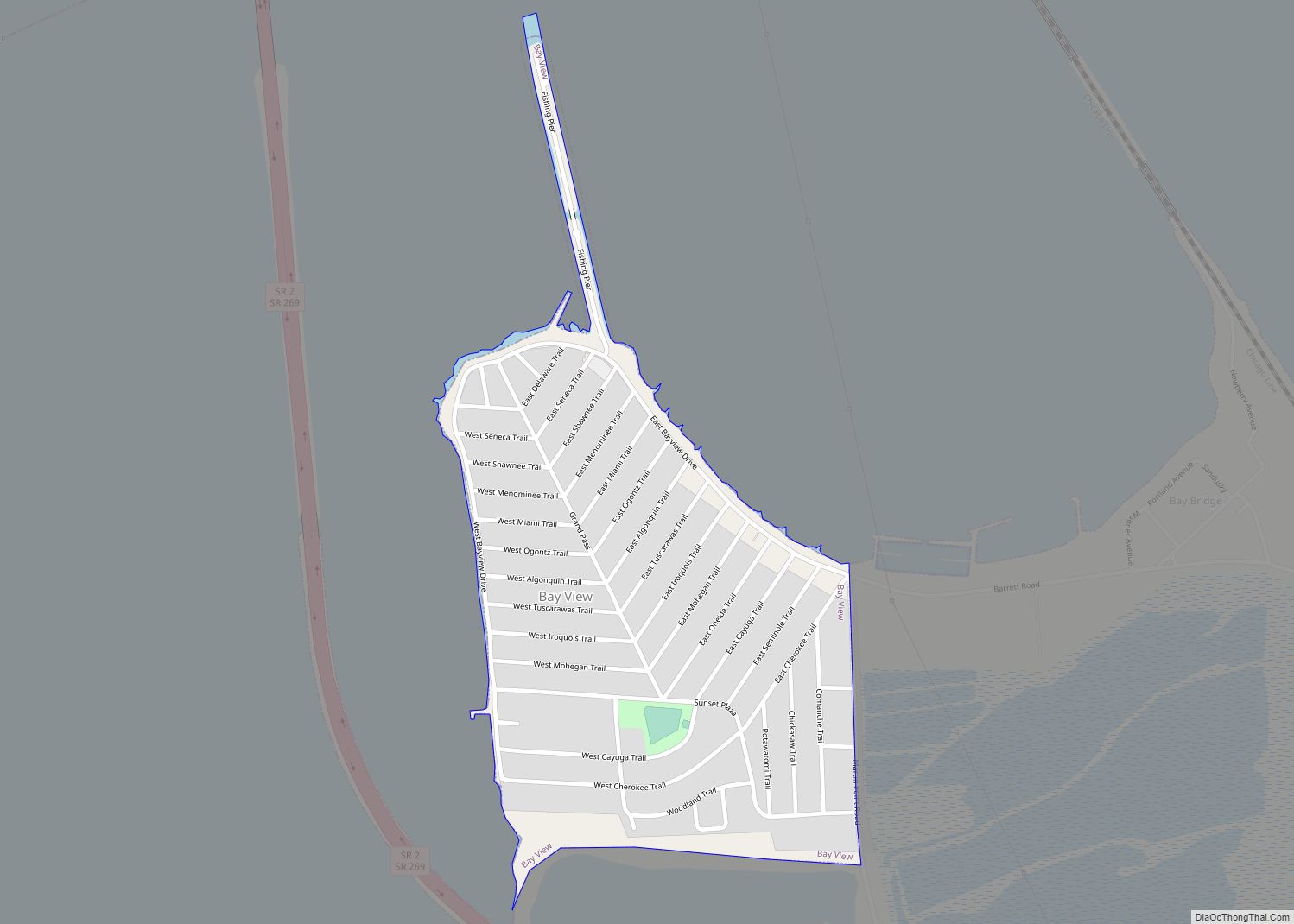
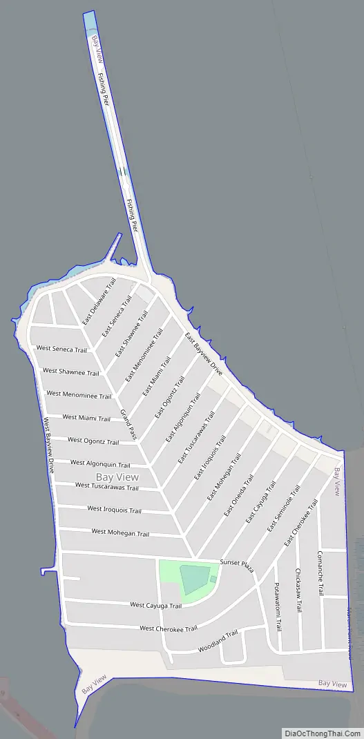
Bay View is a village in Erie County, Ohio, United States. The population was 632 at the 2010 census. It is part of the Sandusky, Ohio Metropolitan Statistical Area.
The village consists primarily of summer homes (many converted to year-round use) and a few small businesses. The community has a scenic view of Sandusky Bay. The village was incorporated in 1951.
| Name: | Bay View village |
|---|---|
| LSAD Code: | 47 |
| LSAD Description: | village (suffix) |
| State: | Ohio |
| County: | Erie County |
| Elevation: | 581 ft (177 m) |
| Total Area: | 0.28 sq mi (0.72 km²) |
| Land Area: | 0.28 sq mi (0.72 km²) |
| Water Area: | 0.00 sq mi (0.00 km²) |
| Total Population: | 608 |
| Population Density: | 2,202.90/sq mi (850.23/km²) |
| ZIP code: | 44870 |
| Area code: | 419 / 567 |
| FIPS code: | 3904402 |
| GNISfeature ID: | 1048490 |
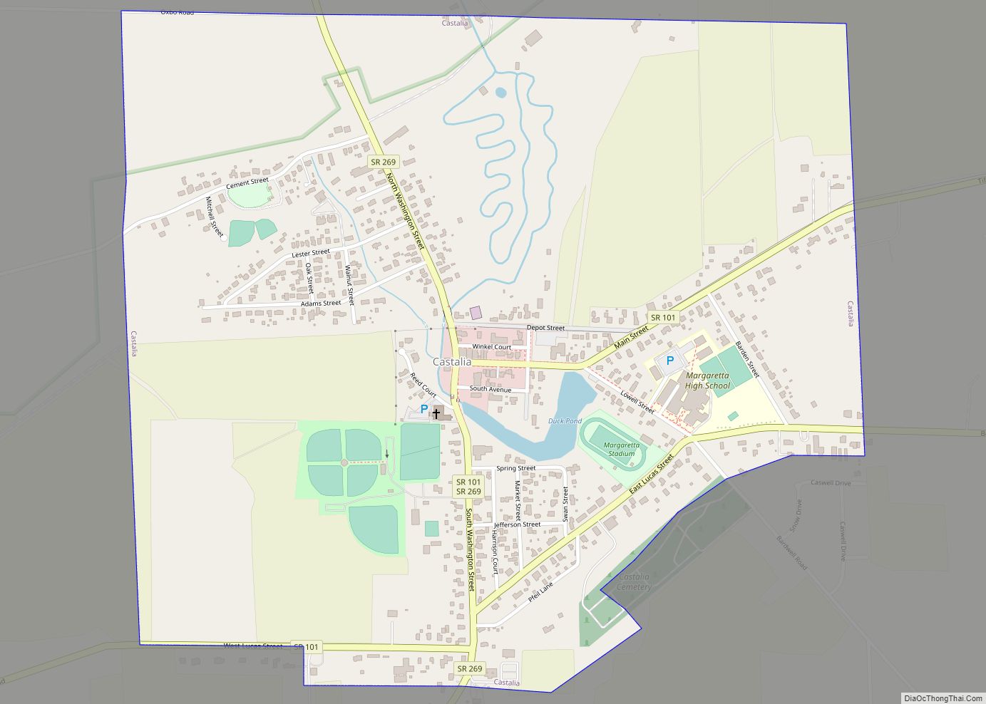
Online Interactive Map
Click on ![]() to view map in "full screen" mode.
to view map in "full screen" mode.
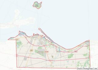
Bay View location map. Where is Bay View village?
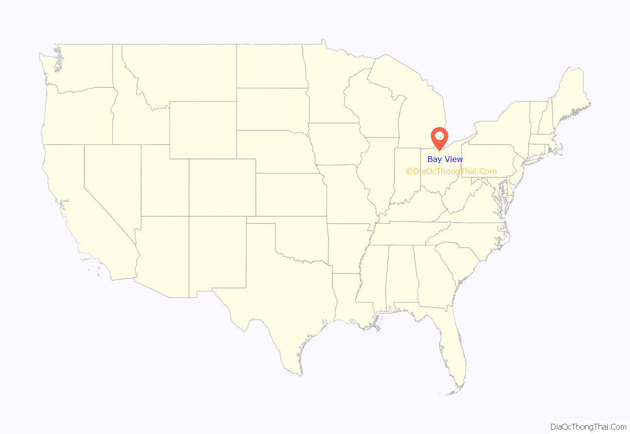
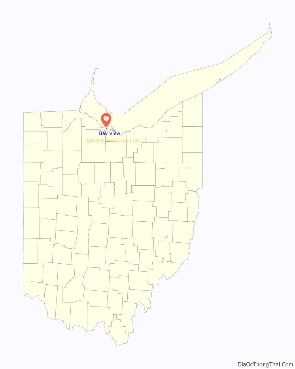
Bay View Road Map
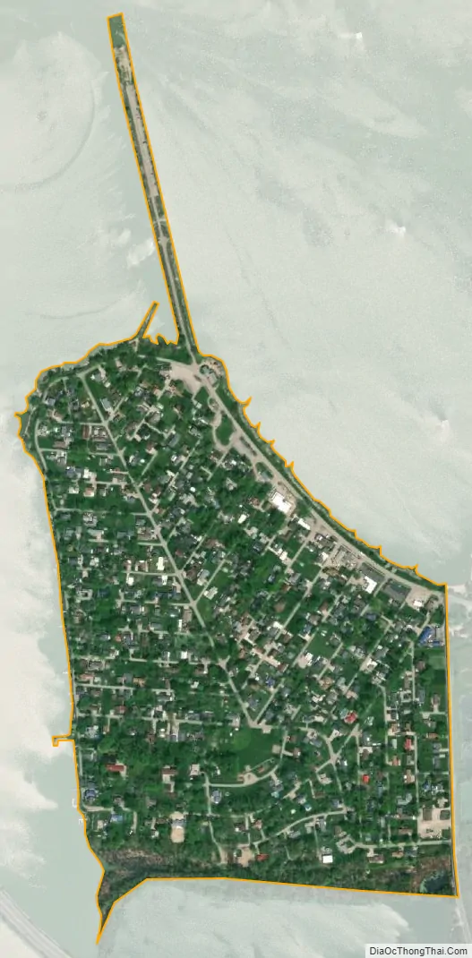
Bay View city Satellite Map
Geography
Bay View is located at 41°28′10″N 82°49′26″W / 41.469349°N 82.823974°W / 41.469349; -82.823974.
According to the United States Census Bureau, the village has a total area of 0.28 square miles (0.73 km), all land.
See also
Map of Ohio State and its subdivision:- Adams
- Allen
- Ashland
- Ashtabula
- Athens
- Auglaize
- Belmont
- Brown
- Butler
- Carroll
- Champaign
- Clark
- Clermont
- Clinton
- Columbiana
- Coshocton
- Crawford
- Cuyahoga
- Darke
- Defiance
- Delaware
- Erie
- Fairfield
- Fayette
- Franklin
- Fulton
- Gallia
- Geauga
- Greene
- Guernsey
- Hamilton
- Hancock
- Hardin
- Harrison
- Henry
- Highland
- Hocking
- Holmes
- Huron
- Jackson
- Jefferson
- Knox
- Lake
- Lake Erie
- Lawrence
- Licking
- Logan
- Lorain
- Lucas
- Madison
- Mahoning
- Marion
- Medina
- Meigs
- Mercer
- Miami
- Monroe
- Montgomery
- Morgan
- Morrow
- Muskingum
- Noble
- Ottawa
- Paulding
- Perry
- Pickaway
- Pike
- Portage
- Preble
- Putnam
- Richland
- Ross
- Sandusky
- Scioto
- Seneca
- Shelby
- Stark
- Summit
- Trumbull
- Tuscarawas
- Union
- Van Wert
- Vinton
- Warren
- Washington
- Wayne
- Williams
- Wood
- Wyandot
- Alabama
- Alaska
- Arizona
- Arkansas
- California
- Colorado
- Connecticut
- Delaware
- District of Columbia
- Florida
- Georgia
- Hawaii
- Idaho
- Illinois
- Indiana
- Iowa
- Kansas
- Kentucky
- Louisiana
- Maine
- Maryland
- Massachusetts
- Michigan
- Minnesota
- Mississippi
- Missouri
- Montana
- Nebraska
- Nevada
- New Hampshire
- New Jersey
- New Mexico
- New York
- North Carolina
- North Dakota
- Ohio
- Oklahoma
- Oregon
- Pennsylvania
- Rhode Island
- South Carolina
- South Dakota
- Tennessee
- Texas
- Utah
- Vermont
- Virginia
- Washington
- West Virginia
- Wisconsin
- Wyoming