Berea (/bəˈriːə/ bə-REE-ə) is a city in Cuyahoga County in the U.S. state of Ohio and is a western suburb of Cleveland. The population was 19,093 at the 2010 census. Berea is home to Baldwin Wallace University, as well as the training facility for the Cleveland Browns and the Cuyahoga County Fairgrounds. Also near Berea is the Cleveland Hopkins International Airport.
| Name: | Berea city |
|---|---|
| LSAD Code: | 25 |
| LSAD Description: | city (suffix) |
| State: | Ohio |
| County: | Cuyahoga County |
| Elevation: | 755 ft (230 m) |
| Total Area: | 5.79 sq mi (15.01 km²) |
| Land Area: | 5.68 sq mi (14.71 km²) |
| Water Area: | 0.11 sq mi (0.29 km²) |
| Total Population: | 18,545 |
| Population Density: | 3,264.96/sq mi (1,260.52/km²) |
| ZIP code: | 44017 |
| Area code: | 440 |
| FIPS code: | 3905690 |
| GNISfeature ID: | 1072192 |
| Website: | https://www.cityofberea.org/ |
Online Interactive Map
Click on ![]() to view map in "full screen" mode.
to view map in "full screen" mode.
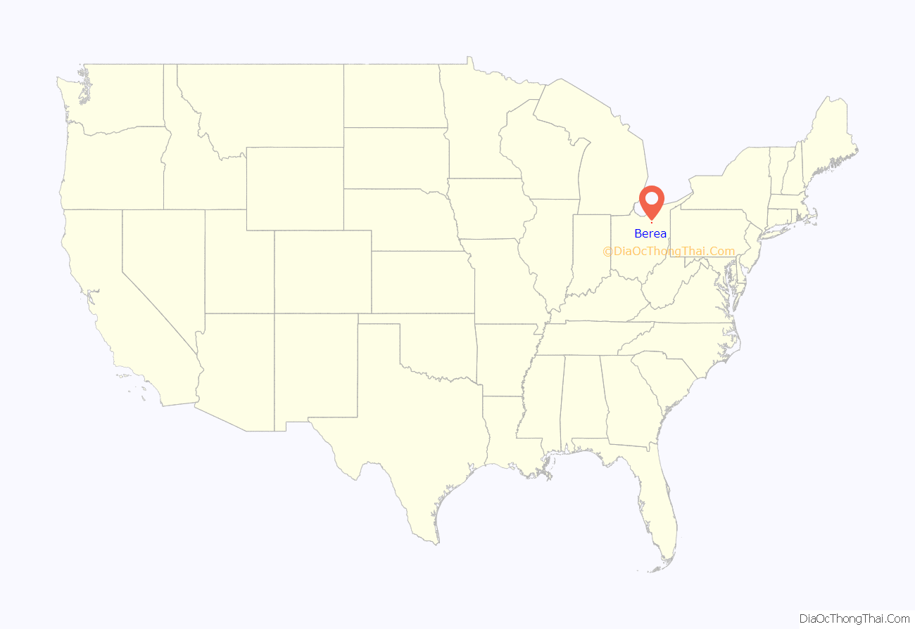
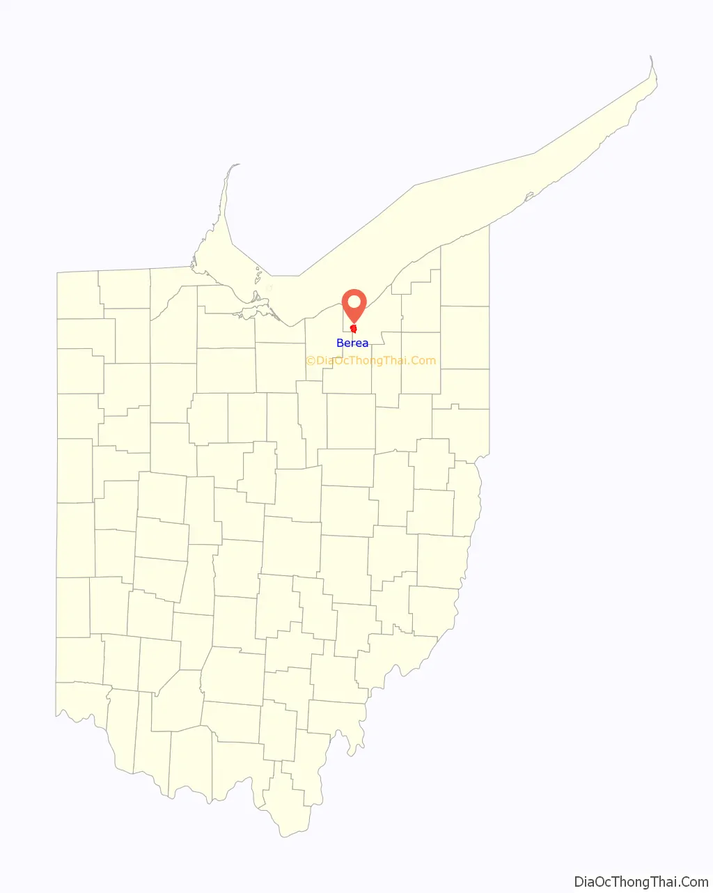
Berea location map. Where is Berea city?
History
Berea was established in 1836. The first European settlers were originally from Connecticut. Berea fell within Connecticut’s Western Reserve and was surveyed and divided into townships and ranges by Gideon Granger, who served as Postmaster General under President Thomas Jefferson. Abram Hickox, a Revolutionary War veteran, bought the first plot in what is today Middleburg Heights and in 1808 traveled west from Connecticut to his new purchase. Dissuaded by the swampy and heavily forested land he decided to settle in Cleveland. He became successful as Cleveland’s first full-time blacksmith. His plot of land was sold to his nephew, Jared Hickox, who came to the area with his wife Sarah and family in 1809. They followed an ancient Indian highway down through the forest from Cleveland and then, at what is now the corner of Bagley and Pearl roads, began to hack their way directly west. About two miles (3.2 km) in, they found Granger’s plot markers and set up their homestead. Today, this area is a strip mall on Bagley Road, just down the road from Berea. At the time Hickox discovered Granger’s plot markers, the area was a swampy lowland and, as fate would have it, the Hickox’s two grown up sons died from typhoid fever shortly after the family’s arrival. The family farm was in dire straits, having been so severely depleted of male laborers. Love came to the rescue, however; and the area’s spirits were lifted by its first marriage, that of Jared’s daughter Amy Hickox to a recent arrival, Abijah Bagley. Bagley ended up taking over the farm and managing it into a successful concern. Today, Berea’s largest street bears his name.
In 1827, educator John Baldwin moved to Middeburg Township where he joined forces with James Gilruth and Henry Olcott Sheldon, Methodist circuit preachers who wanted to form an ideal Christian community. In 1836, they pledged to pool all their properties to create a Utopian “Community of United Christians.” Members of the Community vowed to avoid all luxuries and temptations that would prevent them from achieving the Methodist ideal of “sanctification,” or perfect love of God. In 1836, Baldwin and the others of the Utopian Community tried to think of a name for their new town. Nehemiah Brown proposed Tabor (perhaps from the biblical Mount Tabor), but Henry Sheldon suggested Berea, citing the biblical Berea in the Acts 17:10-11. They decided to let God decide the Community’s place name by flipping a coin, and the coin came up Berea. Financial disputes led to the dissolution of the Community and the departure of James Gilruth within a year. John Baldwin and Henry Sheldon then teamed up with Josiah Holbrook, the founder of the American Lyceum movement for adult and community education, to found the Berea Seminary, a central instructional facility for Lyceum teachers, and a Lyceum Village composed of community members dedicated to creation of an educated population. The Lyceum Village concept never caught on in Berea due to the 1838 Public School Act, but the idea of an ideal community centered around a school continued even after the Berea Seminary closed.
The failure of these two Utopian experiments left John Baldwin and Henry Sheldon in deep debt. However, Baldwin had since 1838 been making grindstones from sandstone in the creek bed of the Rocky River. In the 1840s, Henry Sheldon began selling them via the Erie Canal in New York State. This was the beginning of the Berea quarrying industry. After the Big Four Railroad was built from Cleveland to Cincinnati, Baldwin built a railroad to connect his quarries to the Big Four Depot.
In 1845, Baldwin convinced the North Ohio Conference of the Methodist Church to charter a new school: a new Utopian venture of sorts, because the new school, the Baldwin Institute, would provide education to all, regardless of sex, race, religious creed, or ability to pay. In 1855, it was renamed Baldwin University. By the 1880s, the quarries had begun to intrude on the site of the university. In 1891, the school broke ground for a new campus at Front Street and Bagley Road. New buildings were constructed and old buildings were moved. In 1866, James Wallace purchased the site of the Lyceum Village from the German Children’s Home to become the German Wallace College Campus. In 1913, Baldwin University and German-Wallace College merged to become Baldwin–Wallace College, now Baldwin Wallace University. Berea High School was the town’s first high school, founded in 1882 and closed in 2020.
Berea sandstone
The geological stratum on which the city rests is the sedimentary formation Berea sandstone, a geological formation named after the city which extends across Ohio, eastern Pennsylvania, and northern Kentucky. This comprises a sandstone laid down during the early Mississippian. In the 19th and early 20th century, this formation was extensively quarried, with the quarries eventually displacing the original main street of the town, as well as the original location of Baldwin University, which sold its five-acre campus to the quarries for $100,000 in 1888, moving to a new location to the north.
After beginning of quarrying of the Berea sandstone in the 1830s, Baldwin initially shipped grindstones to Cleveland by ox carts, and later the quarries were connected to the railroad by a spur line. Berea proclaims itself “The Grindstone Capital of the World”. The town’s symbol is a grindstone, a tribute to the many grindstones that came out of its quarries.
The quarries also provided sandstone that was extensively used as a construction material, in the form of Berea dimension stone. Huge amounts of it came from Berea, and were used architecturally in many important buildings. The quarries closed in the late 1930s, when concrete came into wide use for construction. Several lakes in the area are former quarry pits that have been allowed to fill with water, including Baldwin, Wallace and Coe lakes.
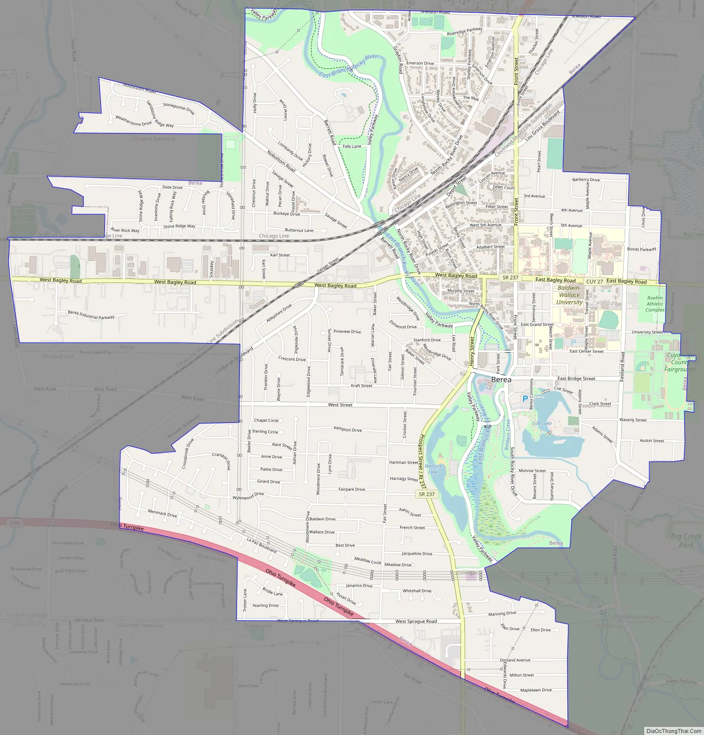
Berea Road Map
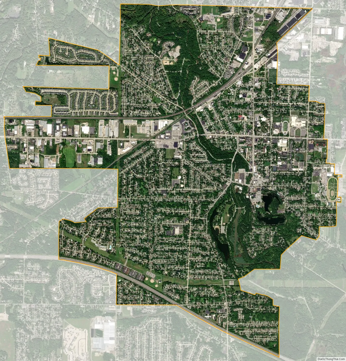
Berea city Satellite Map
Geography
Berea is located at 41°22′12″N 81°51′45″W / 41.37000°N 81.86250°W / 41.37000; -81.86250 (41.369950, -81.862591). It is located south/southwest of Brook Park and west of Middleburg Heights.
According to the 2010 census, the city has a total area of 5.83 square miles (15.1 km), of which 5.72 square miles (14.8 km) (or 98.11%) is land and 0.11 square miles (0.28 km) (or 1.89%) is water.
The east branch of the Rocky River runs through Berea, providing its water supply for most of the year. The Cleveland Metroparks’ Rocky River and Mill Stream Run reservations run through the city.
Congressional district
Since January 3, 2013, Berea has been split between two congressional districts, lying partly in Ohio’s 16th congressional district and partly in Ohio’s 9th congressional district. The 9th district has been called “The Mistake by the Lake” and one of the “Top 5 Ugliest Districts” due to gerrymandering.
See also
Map of Ohio State and its subdivision:- Adams
- Allen
- Ashland
- Ashtabula
- Athens
- Auglaize
- Belmont
- Brown
- Butler
- Carroll
- Champaign
- Clark
- Clermont
- Clinton
- Columbiana
- Coshocton
- Crawford
- Cuyahoga
- Darke
- Defiance
- Delaware
- Erie
- Fairfield
- Fayette
- Franklin
- Fulton
- Gallia
- Geauga
- Greene
- Guernsey
- Hamilton
- Hancock
- Hardin
- Harrison
- Henry
- Highland
- Hocking
- Holmes
- Huron
- Jackson
- Jefferson
- Knox
- Lake
- Lake Erie
- Lawrence
- Licking
- Logan
- Lorain
- Lucas
- Madison
- Mahoning
- Marion
- Medina
- Meigs
- Mercer
- Miami
- Monroe
- Montgomery
- Morgan
- Morrow
- Muskingum
- Noble
- Ottawa
- Paulding
- Perry
- Pickaway
- Pike
- Portage
- Preble
- Putnam
- Richland
- Ross
- Sandusky
- Scioto
- Seneca
- Shelby
- Stark
- Summit
- Trumbull
- Tuscarawas
- Union
- Van Wert
- Vinton
- Warren
- Washington
- Wayne
- Williams
- Wood
- Wyandot
- Alabama
- Alaska
- Arizona
- Arkansas
- California
- Colorado
- Connecticut
- Delaware
- District of Columbia
- Florida
- Georgia
- Hawaii
- Idaho
- Illinois
- Indiana
- Iowa
- Kansas
- Kentucky
- Louisiana
- Maine
- Maryland
- Massachusetts
- Michigan
- Minnesota
- Mississippi
- Missouri
- Montana
- Nebraska
- Nevada
- New Hampshire
- New Jersey
- New Mexico
- New York
- North Carolina
- North Dakota
- Ohio
- Oklahoma
- Oregon
- Pennsylvania
- Rhode Island
- South Carolina
- South Dakota
- Tennessee
- Texas
- Utah
- Vermont
- Virginia
- Washington
- West Virginia
- Wisconsin
- Wyoming


