Bethesda (/bəˈθɛzdə/) is a village in west-central Belmont County, Ohio, United States. The population was 1,211 at the 2020 census. It is part of the Wheeling metropolitan area.
| Name: | Bethesda village |
|---|---|
| LSAD Code: | 47 |
| LSAD Description: | village (suffix) |
| State: | Ohio |
| County: | Belmont County |
| Elevation: | 1,220 ft (372 m) |
| Total Area: | 0.64 sq mi (1.67 km²) |
| Land Area: | 0.62 sq mi (1.62 km²) |
| Water Area: | 0.02 sq mi (0.05 km²) |
| Total Population: | 1,211 |
| Population Density: | 1,940.71/sq mi (749.45/km²) |
| ZIP code: | 43719 |
| Area code: | 740 |
| FIPS code: | 3906138 |
| GNISfeature ID: | 1064431 |
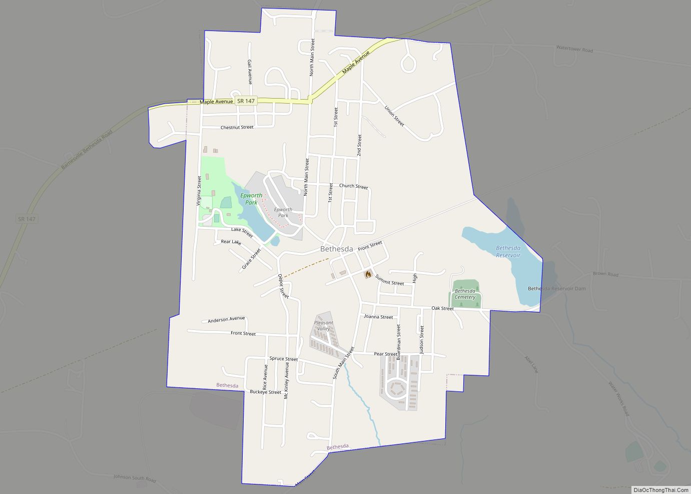
Online Interactive Map
Click on ![]() to view map in "full screen" mode.
to view map in "full screen" mode.
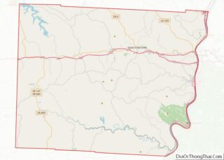
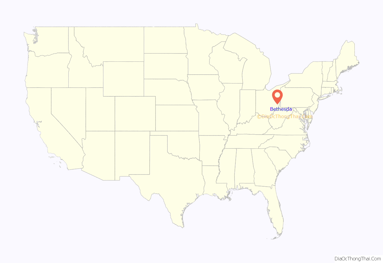
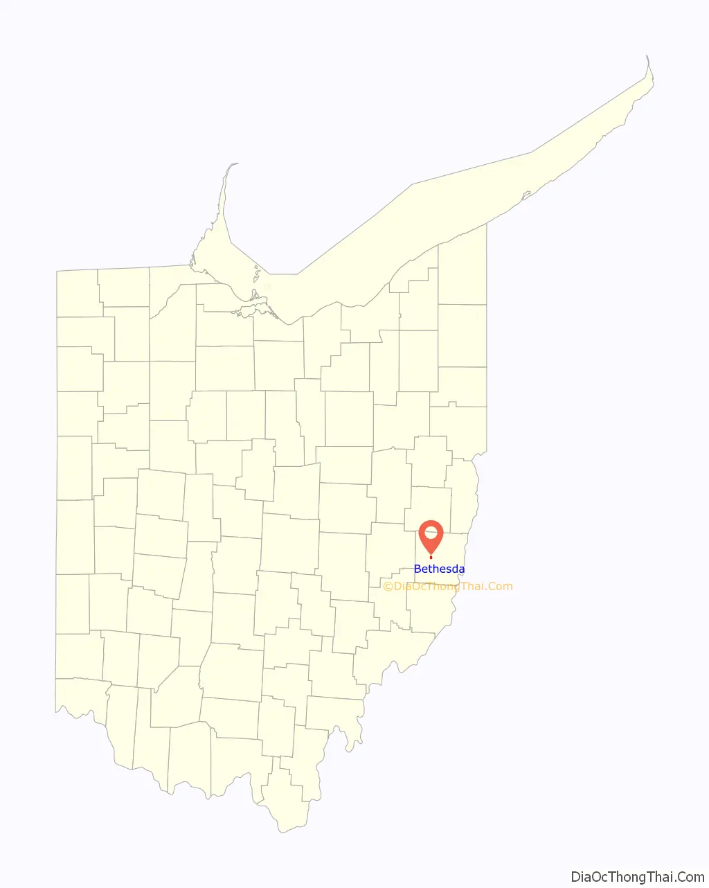
Bethesda location map. Where is Bethesda village?
History
Bethesda has had three names: Burrs Mills, Fairmount, and Bethesda. When the railroad reached the village in 1852, the Central Ohio Railroad built a station and named it Burr’s Mills in honor of Merrick S. Burr, who operated a sawmill in the area. In 1855, Burr laid out a village which he called Fairmount because of its high and beautiful location. Prior to that time, there was a store, the Bethesda Methodist Church, and a post office, all located about 2 miles south of the current town on what now CR 26, and the post office was named after the church. The store proprietor was the postmaster and when he moved his store to the town, the post office also was relocated but retained its name. As a result, the town was called Fairmount while the railroad station was Burr’s Mills and the post office was Bethesda. In the late 1800s, the name of Bethesda was finally chosen for the town. Bethesda was incorporated as a village in 1910. In 1920, the town contracted with the E. Howard Watch & Clock Company to supply a town clock which was dedicated to Bethesda’s World War I veterans, and erected atop the Orrison Cigar Co. building on Main Street. In 2010, the town clock was removed from service and placed in storage. In 2015, a local business owner from Bethesda, Uncle Bob Murray, spearheaded the restoration of the clock and established the Murray Family Memorial Pizza. The facility and the restored clock have been dictated to militia veterans from all services and have been described as the “Times Leader of Bethesda”.
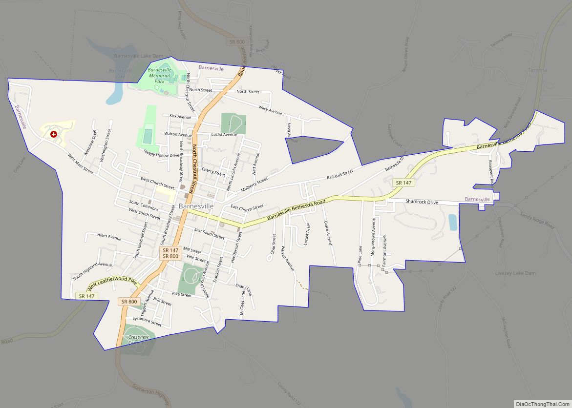
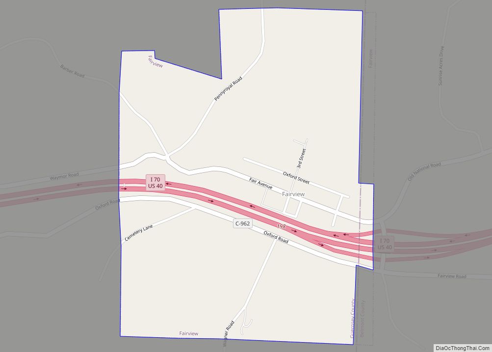
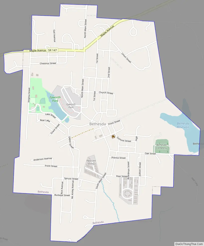
Bethesda Road Map
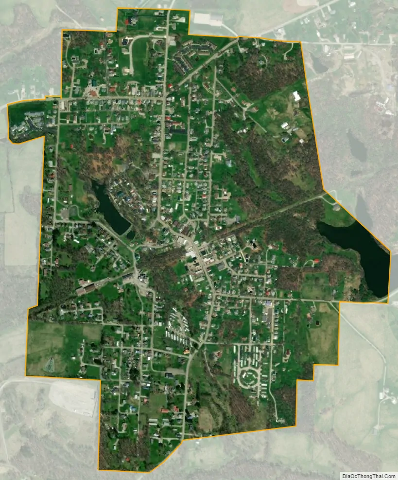
Bethesda city Satellite Map
Geography
According to the United States Census Bureau, the village has a total area of 0.64 square miles (1.66 km), of which 0.62 square miles (1.61 km) is land and 0.02 square miles (0.05 km) is water.
See also
Map of Ohio State and its subdivision:- Adams
- Allen
- Ashland
- Ashtabula
- Athens
- Auglaize
- Belmont
- Brown
- Butler
- Carroll
- Champaign
- Clark
- Clermont
- Clinton
- Columbiana
- Coshocton
- Crawford
- Cuyahoga
- Darke
- Defiance
- Delaware
- Erie
- Fairfield
- Fayette
- Franklin
- Fulton
- Gallia
- Geauga
- Greene
- Guernsey
- Hamilton
- Hancock
- Hardin
- Harrison
- Henry
- Highland
- Hocking
- Holmes
- Huron
- Jackson
- Jefferson
- Knox
- Lake
- Lake Erie
- Lawrence
- Licking
- Logan
- Lorain
- Lucas
- Madison
- Mahoning
- Marion
- Medina
- Meigs
- Mercer
- Miami
- Monroe
- Montgomery
- Morgan
- Morrow
- Muskingum
- Noble
- Ottawa
- Paulding
- Perry
- Pickaway
- Pike
- Portage
- Preble
- Putnam
- Richland
- Ross
- Sandusky
- Scioto
- Seneca
- Shelby
- Stark
- Summit
- Trumbull
- Tuscarawas
- Union
- Van Wert
- Vinton
- Warren
- Washington
- Wayne
- Williams
- Wood
- Wyandot
- Alabama
- Alaska
- Arizona
- Arkansas
- California
- Colorado
- Connecticut
- Delaware
- District of Columbia
- Florida
- Georgia
- Hawaii
- Idaho
- Illinois
- Indiana
- Iowa
- Kansas
- Kentucky
- Louisiana
- Maine
- Maryland
- Massachusetts
- Michigan
- Minnesota
- Mississippi
- Missouri
- Montana
- Nebraska
- Nevada
- New Hampshire
- New Jersey
- New Mexico
- New York
- North Carolina
- North Dakota
- Ohio
- Oklahoma
- Oregon
- Pennsylvania
- Rhode Island
- South Carolina
- South Dakota
- Tennessee
- Texas
- Utah
- Vermont
- Virginia
- Washington
- West Virginia
- Wisconsin
- Wyoming