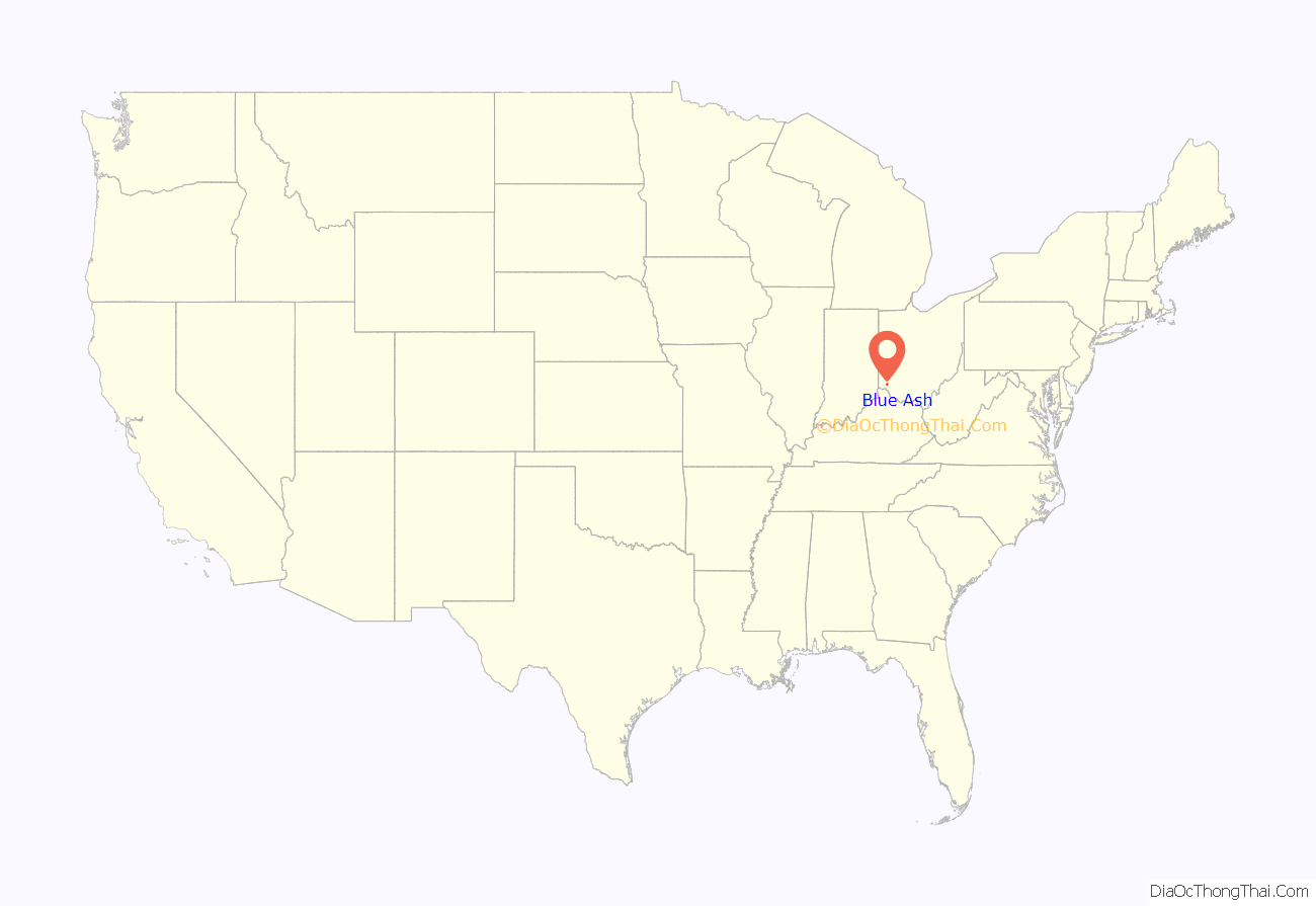
Blue Ash is a city in Hamilton County, Ohio. An inner suburb of Cincinnati, the population was 13,394 at the time of the 2020 census.
| Name: | Blue Ash city |
|---|---|
| LSAD Code: | 25 |
| LSAD Description: | city (suffix) |
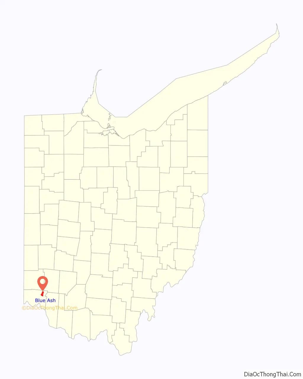
| State: | Ohio |
| County: | Hamilton County |
| Elevation: | 846 ft (258 m) |
| Total Area: | 7.60 sq mi (19.69 km²) |
| Land Area: | 7.58 sq mi (19.64 km²) |
| Water Area: | 0.02 sq mi (0.05 km²) |
| Total Population: | 13,394 |
| Population Density: | 1,766.09/sq mi (681.89/km²) |
| ZIP code: | 45242 |
| Area code: | 513 |
| FIPS code: | 3907300 |
| GNISfeature ID: | 1064458 |
| Website: | www.blueash.com |
Online Interactive Map
Click on ![]() to view map in "full screen" mode.
to view map in "full screen" mode.
Blue Ash location map. Where is Blue Ash city?
History
The area that is now Blue Ash was settled around 1791. In 1797, the first settlers built Carpenter’s Run Baptist Church out of blue ash logs, giving the area its eventual name.
In the late 19th century, the Cincinnati, Lebanon and Northern Railway provided narrow gauge commuter rail service to Blue Ash.
Blue Ash was the site of Cincinnati–Blue Ash Airport from 1921 to 2012. Originally a private airfield called Grisard Field, it was sold to the City of Cincinnati in 1946, becoming Ohio’s first municipal airport. Cincinnati desired to expand the airport for major commercial service through the 1950s, but Blue Ash fought the city by incorporating first as a village in 1955 and then as a city in 1961. Eventually, through Reed Hartman’s Community Improvement Corporation, Cincinnati developed the surrounding area as an industrial park and golf course. The airport closed on August 29, 2012, and the property was sold to the City of Blue Ash, which opened Summit Park on the property.
In 1998, the Southwest Ohio Regional Transit Authority proposed a MetroMoves light rail system with a Green Line that would initially run 19-mile (31 km) from Blue Ash to Covington, Kentucky. A future phase would have extended the line further north to Kings Island and south to the Cincinnati/Northern Kentucky International Airport. However, MetroMoves was rejected by Hamilton County voters.
On April 9, 1999, Blue Ash experienced an F4 tornado that caused four deaths.
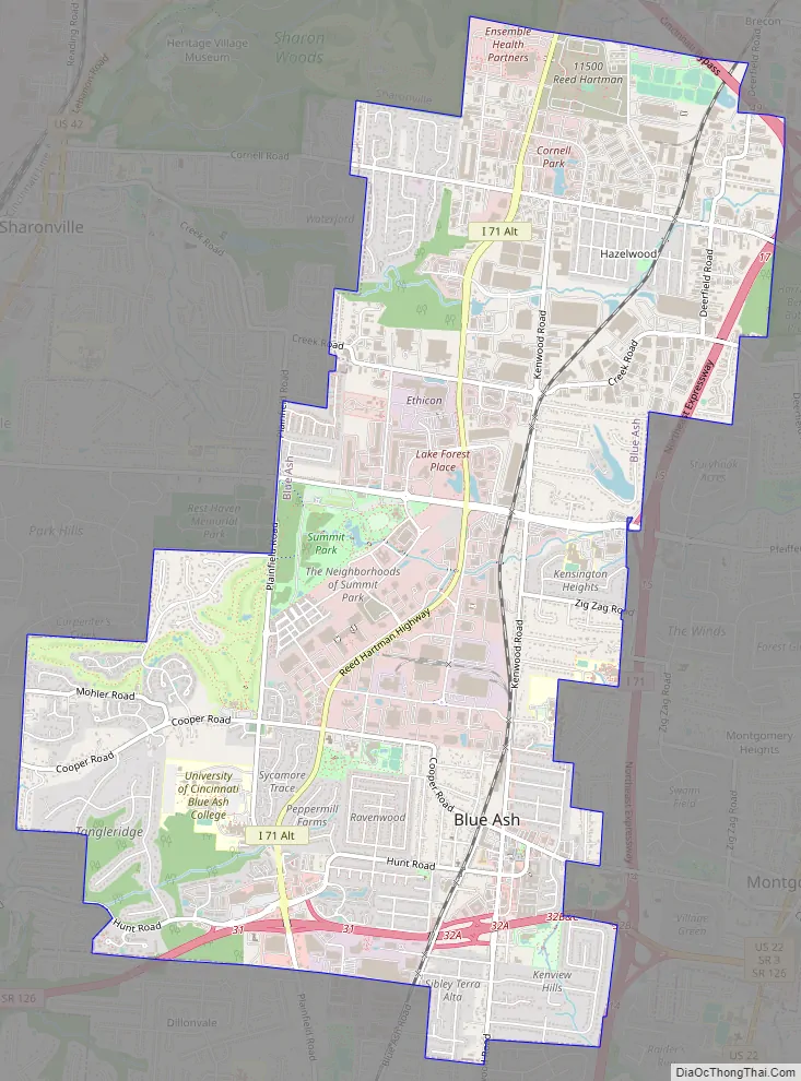
Blue Ash Road Map
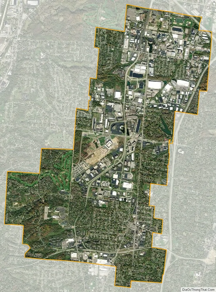
Blue Ash city Satellite Map
Geography
Blue Ash is located at 39°14′50″N 84°22′34″W / 39.24722°N 84.37611°W / 39.24722; -84.37611 (39.247109, -84.376038).
According to the 2010 census, the city has a total area of 7.59 square miles (19.7 km), of which 7.58 square miles (19.6 km) (or 99.87%) is land and 0.01 square miles (0.026 km) (or 0.13%) is water.
Blue Ash can be reached by Interstate 71 to the east, Interstate 275 to the north, and Ronald Reagan Cross County Highway to the south.
See also
Map of Ohio State and its subdivision:- Adams
- Allen
- Ashland
- Ashtabula
- Athens
- Auglaize
- Belmont
- Brown
- Butler
- Carroll
- Champaign
- Clark
- Clermont
- Clinton
- Columbiana
- Coshocton
- Crawford
- Cuyahoga
- Darke
- Defiance
- Delaware
- Erie
- Fairfield
- Fayette
- Franklin
- Fulton
- Gallia
- Geauga
- Greene
- Guernsey
- Hamilton
- Hancock
- Hardin
- Harrison
- Henry
- Highland
- Hocking
- Holmes
- Huron
- Jackson
- Jefferson
- Knox
- Lake
- Lake Erie
- Lawrence
- Licking
- Logan
- Lorain
- Lucas
- Madison
- Mahoning
- Marion
- Medina
- Meigs
- Mercer
- Miami
- Monroe
- Montgomery
- Morgan
- Morrow
- Muskingum
- Noble
- Ottawa
- Paulding
- Perry
- Pickaway
- Pike
- Portage
- Preble
- Putnam
- Richland
- Ross
- Sandusky
- Scioto
- Seneca
- Shelby
- Stark
- Summit
- Trumbull
- Tuscarawas
- Union
- Van Wert
- Vinton
- Warren
- Washington
- Wayne
- Williams
- Wood
- Wyandot
- Alabama
- Alaska
- Arizona
- Arkansas
- California
- Colorado
- Connecticut
- Delaware
- District of Columbia
- Florida
- Georgia
- Hawaii
- Idaho
- Illinois
- Indiana
- Iowa
- Kansas
- Kentucky
- Louisiana
- Maine
- Maryland
- Massachusetts
- Michigan
- Minnesota
- Mississippi
- Missouri
- Montana
- Nebraska
- Nevada
- New Hampshire
- New Jersey
- New Mexico
- New York
- North Carolina
- North Dakota
- Ohio
- Oklahoma
- Oregon
- Pennsylvania
- Rhode Island
- South Carolina
- South Dakota
- Tennessee
- Texas
- Utah
- Vermont
- Virginia
- Washington
- West Virginia
- Wisconsin
- Wyoming


