Bridgetown is a census-designated place (CDP) in Green Township, Hamilton County, Ohio, United States. The population was 14,731 at the 2020 census. In earlier censuses it was listed as the slightly smaller Bridgetown North CDP.
| Name: | Bridgetown CDP |
|---|---|
| LSAD Code: | 57 |
| LSAD Description: | CDP (suffix) |
| State: | Ohio |
| County: | Hamilton County |
| Elevation: | 900 ft (300 m) |
| Total Area: | 4.31 sq mi (11.17 km²) |
| Land Area: | 4.31 sq mi (11.17 km²) |
| Water Area: | 0.00 sq mi (0.00 km²) |
| Total Population: | 14,731 |
| Population Density: | 3,416.28/sq mi (1,319.15/km²) |
| FIPS code: | 3908602 |
| GNISfeature ID: | 1048549 |
Online Interactive Map
Click on ![]() to view map in "full screen" mode.
to view map in "full screen" mode.
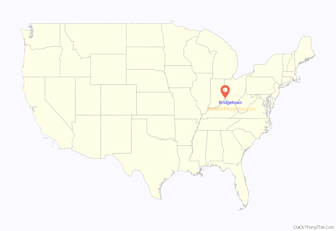
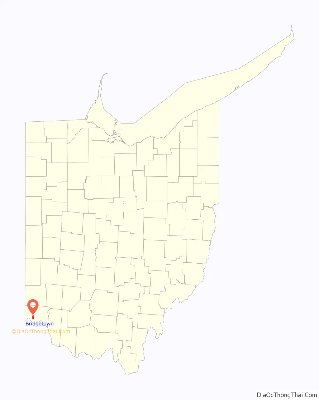
Bridgetown location map. Where is Bridgetown CDP?
History
Bridgetown was settled circa 1820, and named after Bridgeton, New Jersey, the native home of a share of the first settlers.
Bridgetown was home to The Western Hills Airport (Also called “Frank Airport” and “Cheviot Airport”) and was the first airport in western Hamilton County, Ohio. Airport operations began in 1929, shutdown during World War II, then reopened after the end of the war, slowly declining until the corporation ceased services in 1949 as aircraft outgrew the facilities.
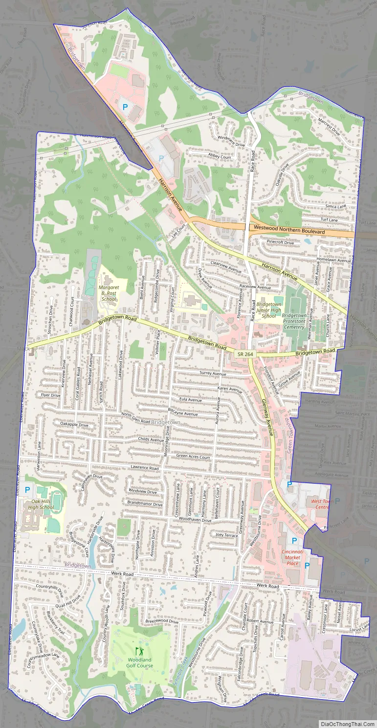
Bridgetown Road Map
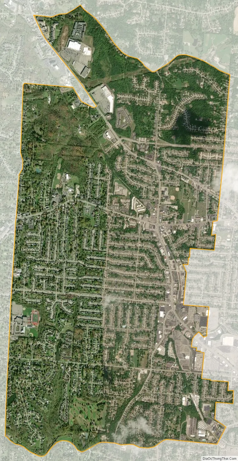
Bridgetown city Satellite Map
Geography
Bridgetown is located at 39°9′29″N 84°38′8″W / 39.15806°N 84.63556°W / 39.15806; -84.63556, just west of the city of Cheviot and 9 miles (14 km) northwest of downtown Cincinnati. Ohio State Route 264, Bridgetown Road, runs through the center of the community.
According to the United States Census Bureau, the CDP has a total area of 4.3 square miles (11.2 km), all land.
See also
Map of Ohio State and its subdivision:- Adams
- Allen
- Ashland
- Ashtabula
- Athens
- Auglaize
- Belmont
- Brown
- Butler
- Carroll
- Champaign
- Clark
- Clermont
- Clinton
- Columbiana
- Coshocton
- Crawford
- Cuyahoga
- Darke
- Defiance
- Delaware
- Erie
- Fairfield
- Fayette
- Franklin
- Fulton
- Gallia
- Geauga
- Greene
- Guernsey
- Hamilton
- Hancock
- Hardin
- Harrison
- Henry
- Highland
- Hocking
- Holmes
- Huron
- Jackson
- Jefferson
- Knox
- Lake
- Lake Erie
- Lawrence
- Licking
- Logan
- Lorain
- Lucas
- Madison
- Mahoning
- Marion
- Medina
- Meigs
- Mercer
- Miami
- Monroe
- Montgomery
- Morgan
- Morrow
- Muskingum
- Noble
- Ottawa
- Paulding
- Perry
- Pickaway
- Pike
- Portage
- Preble
- Putnam
- Richland
- Ross
- Sandusky
- Scioto
- Seneca
- Shelby
- Stark
- Summit
- Trumbull
- Tuscarawas
- Union
- Van Wert
- Vinton
- Warren
- Washington
- Wayne
- Williams
- Wood
- Wyandot
- Alabama
- Alaska
- Arizona
- Arkansas
- California
- Colorado
- Connecticut
- Delaware
- District of Columbia
- Florida
- Georgia
- Hawaii
- Idaho
- Illinois
- Indiana
- Iowa
- Kansas
- Kentucky
- Louisiana
- Maine
- Maryland
- Massachusetts
- Michigan
- Minnesota
- Mississippi
- Missouri
- Montana
- Nebraska
- Nevada
- New Hampshire
- New Jersey
- New Mexico
- New York
- North Carolina
- North Dakota
- Ohio
- Oklahoma
- Oregon
- Pennsylvania
- Rhode Island
- South Carolina
- South Dakota
- Tennessee
- Texas
- Utah
- Vermont
- Virginia
- Washington
- West Virginia
- Wisconsin
- Wyoming


