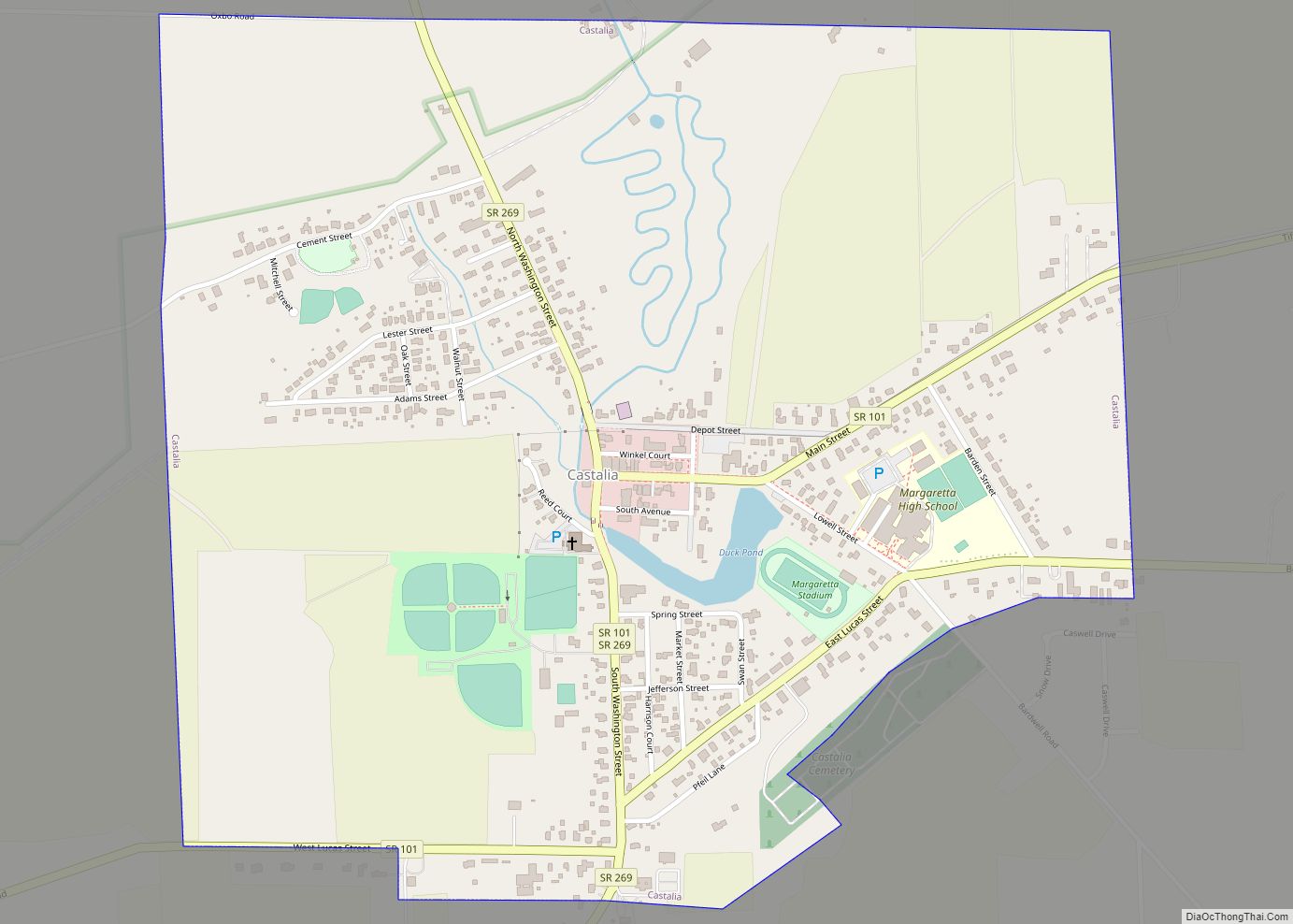
Castalia is a village in Erie County, Ohio, United States. The population was 852 at the 2010 census, down from 935 at the 2000 census. It is part of the Sandusky, Ohio Metropolitan Statistical Area.
| Name: | Castalia village |
|---|---|
| LSAD Code: | 47 |
| LSAD Description: | village (suffix) |
| State: | Ohio |
| County: | Erie County |
| Elevation: | 633 ft (193 m) |
| Total Area: | 1.03 sq mi (2.67 km²) |
| Land Area: | 1.02 sq mi (2.65 km²) |
| Water Area: | 0.01 sq mi (0.02 km²) |
| Total Population: | 774 |
| Population Density: | 757.34/sq mi (292.35/km²) |
| ZIP code: | 44824 |
| Area code: | 419 |
| FIPS code: | 3912476 |
| GNISfeature ID: | 1056773 |
| Website: | https://www.villageofcastalia.com |
Online Interactive Map
Click on ![]() to view map in "full screen" mode.
to view map in "full screen" mode.
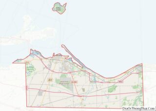
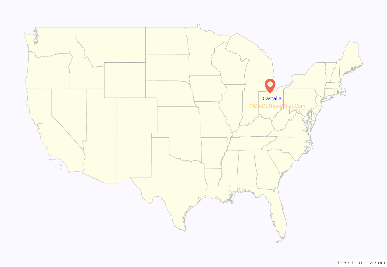
Castalia location map. Where is Castalia village?
History
By 1738 there was a Wyandot settlement at what is now Castalia under the leadership of Nicholas Orontony. Due to growing disputes with the French and closer trade relations with Pennsylvania-based merchants, the Wyandot burned their village and relocated to the mouth of the Cuyahoga River in what is today Cleveland in 1748.
Castalia was laid out in 1836. The village was named after Castalia, a figure in Greek mythology.
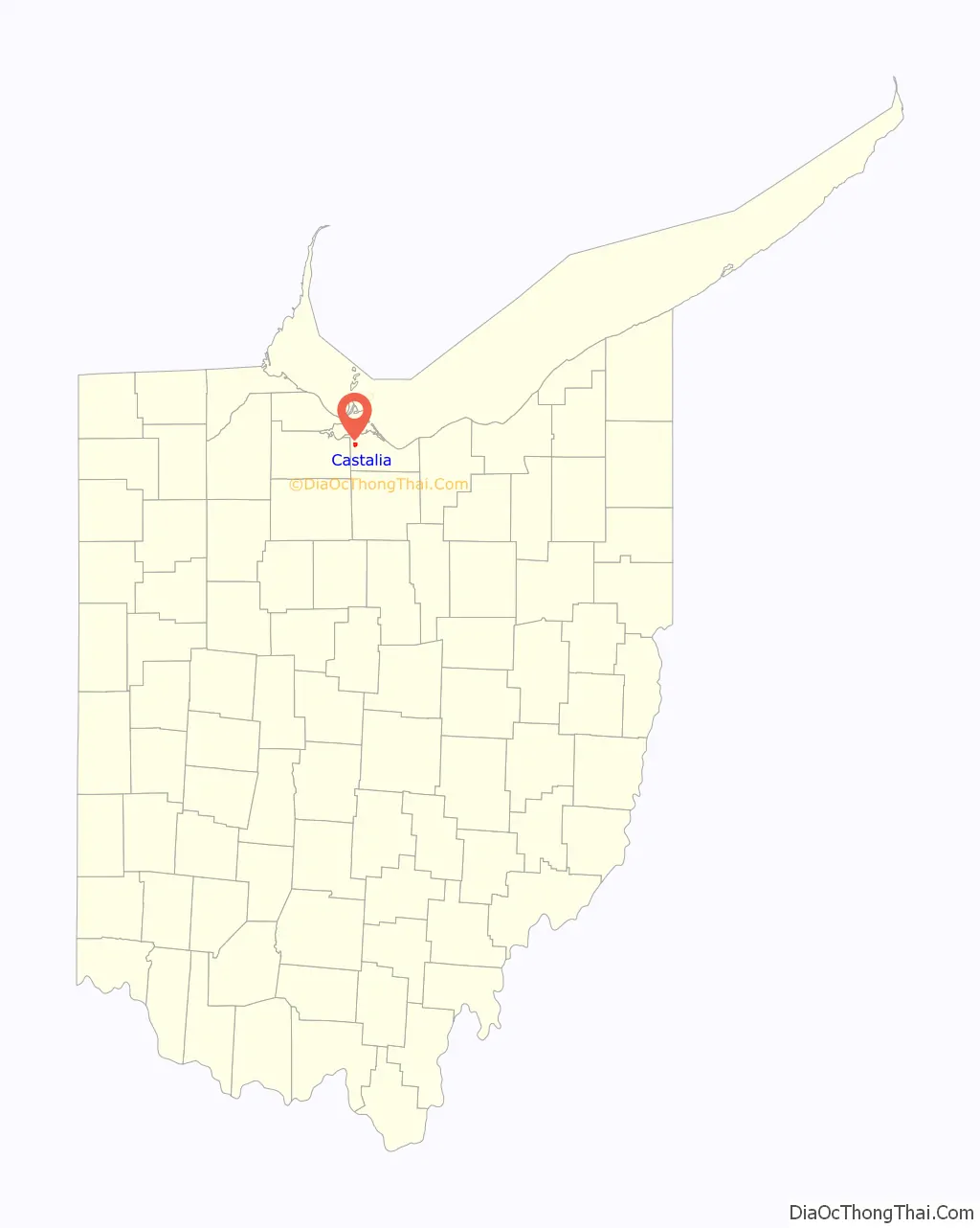
Castalia Road Map
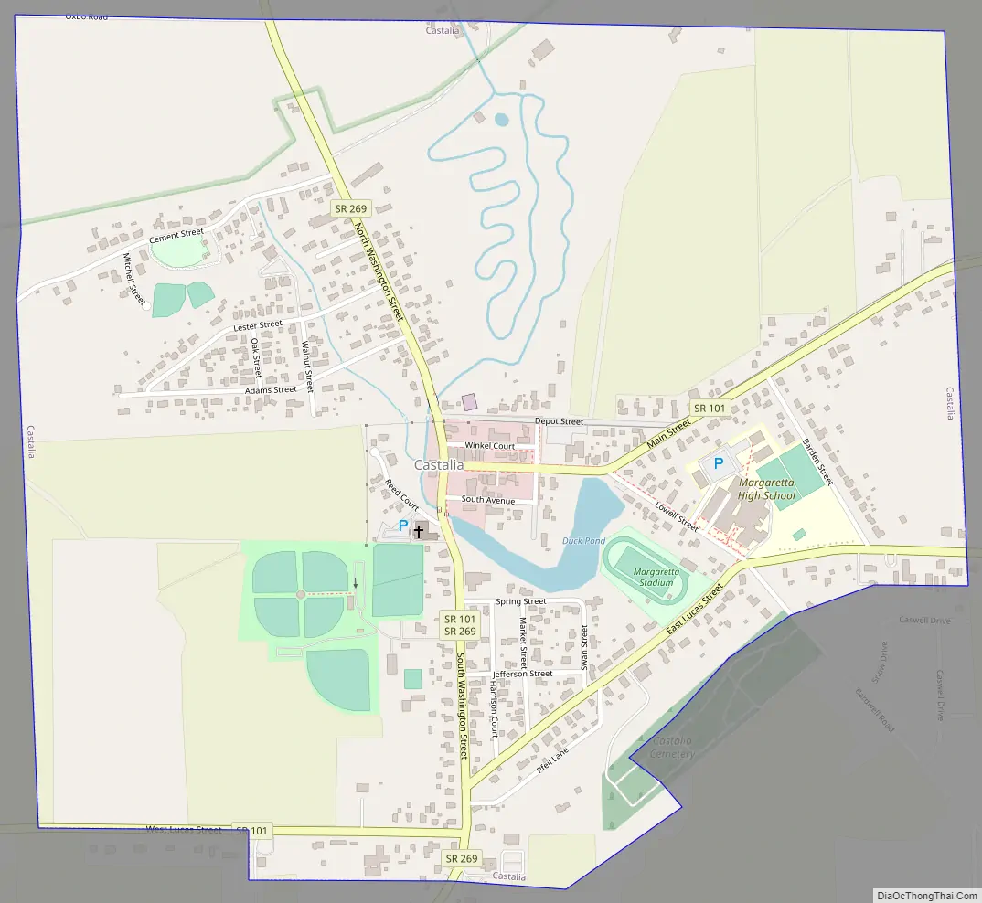
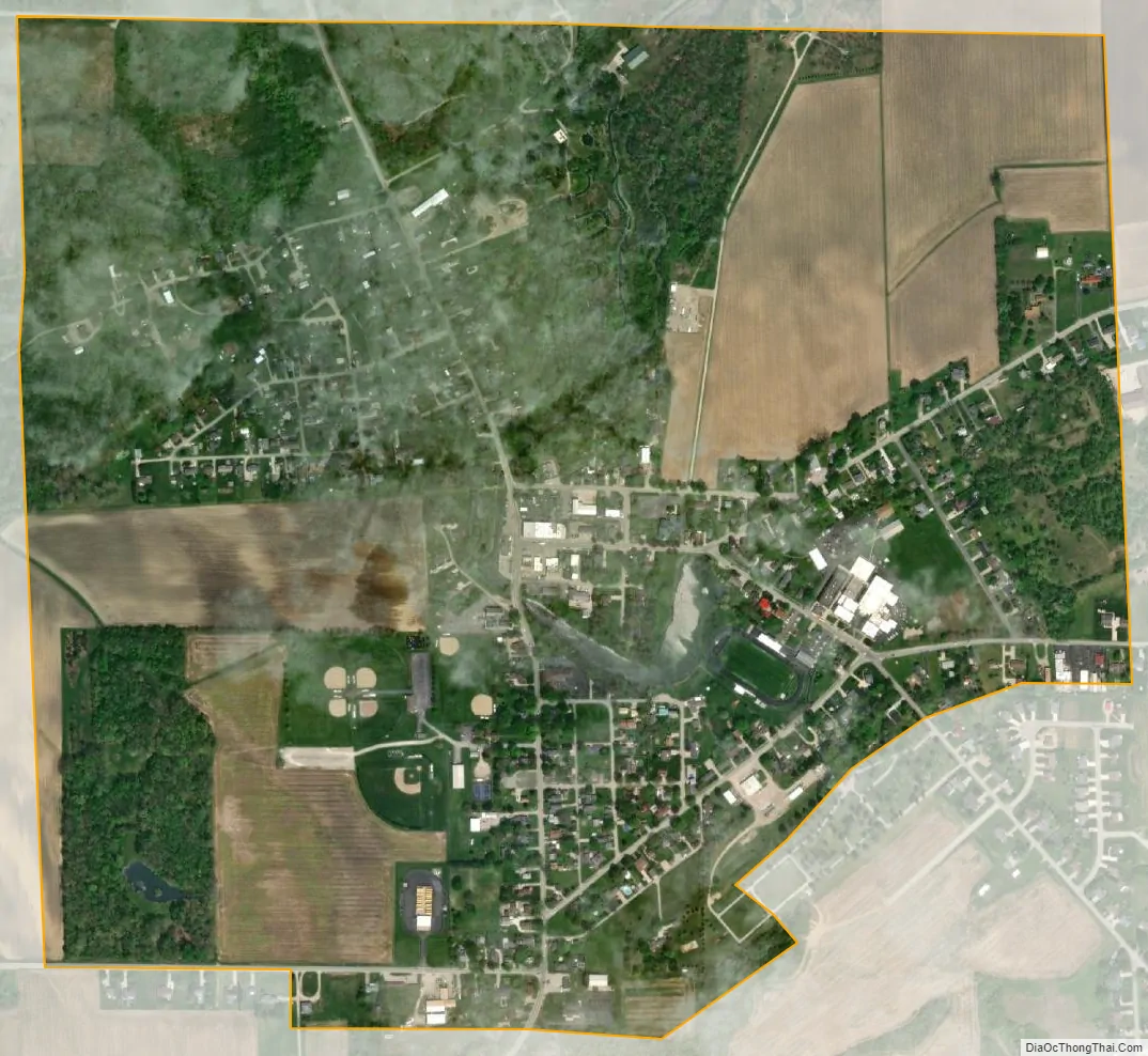
Castalia city Satellite Map
Geography
Castalia is located in western Erie County at 41°23′59″N 82°48′26″W / 41.39972°N 82.80722°W / 41.39972; -82.80722 (41.399805, -82.807176).
According to the United States Census Bureau, the village has a total area of 1.05 square miles (2.72 km), of which 1.04 square miles (2.69 km) is land and 0.01 square miles (0.03 km) is water.
See also
Map of Ohio State and its subdivision:- Adams
- Allen
- Ashland
- Ashtabula
- Athens
- Auglaize
- Belmont
- Brown
- Butler
- Carroll
- Champaign
- Clark
- Clermont
- Clinton
- Columbiana
- Coshocton
- Crawford
- Cuyahoga
- Darke
- Defiance
- Delaware
- Erie
- Fairfield
- Fayette
- Franklin
- Fulton
- Gallia
- Geauga
- Greene
- Guernsey
- Hamilton
- Hancock
- Hardin
- Harrison
- Henry
- Highland
- Hocking
- Holmes
- Huron
- Jackson
- Jefferson
- Knox
- Lake
- Lake Erie
- Lawrence
- Licking
- Logan
- Lorain
- Lucas
- Madison
- Mahoning
- Marion
- Medina
- Meigs
- Mercer
- Miami
- Monroe
- Montgomery
- Morgan
- Morrow
- Muskingum
- Noble
- Ottawa
- Paulding
- Perry
- Pickaway
- Pike
- Portage
- Preble
- Putnam
- Richland
- Ross
- Sandusky
- Scioto
- Seneca
- Shelby
- Stark
- Summit
- Trumbull
- Tuscarawas
- Union
- Van Wert
- Vinton
- Warren
- Washington
- Wayne
- Williams
- Wood
- Wyandot
- Alabama
- Alaska
- Arizona
- Arkansas
- California
- Colorado
- Connecticut
- Delaware
- District of Columbia
- Florida
- Georgia
- Hawaii
- Idaho
- Illinois
- Indiana
- Iowa
- Kansas
- Kentucky
- Louisiana
- Maine
- Maryland
- Massachusetts
- Michigan
- Minnesota
- Mississippi
- Missouri
- Montana
- Nebraska
- Nevada
- New Hampshire
- New Jersey
- New Mexico
- New York
- North Carolina
- North Dakota
- Ohio
- Oklahoma
- Oregon
- Pennsylvania
- Rhode Island
- South Carolina
- South Dakota
- Tennessee
- Texas
- Utah
- Vermont
- Virginia
- Washington
- West Virginia
- Wisconsin
- Wyoming