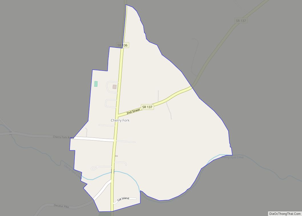
Cherry Fork is an unincorporated community and former village in Wayne Township, Adams County, Ohio, United States. The population was 170 at the 2020 census. In 2014, voters chose to disincorporate the village.
| Name: | Cherry Fork CDP |
|---|---|
| LSAD Code: | 57 |
| LSAD Description: | CDP (suffix) |
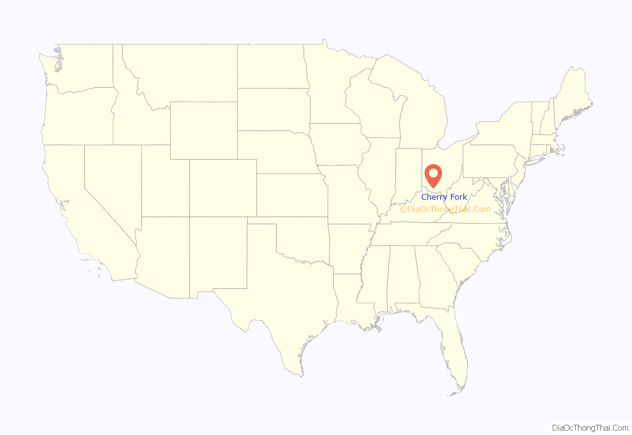
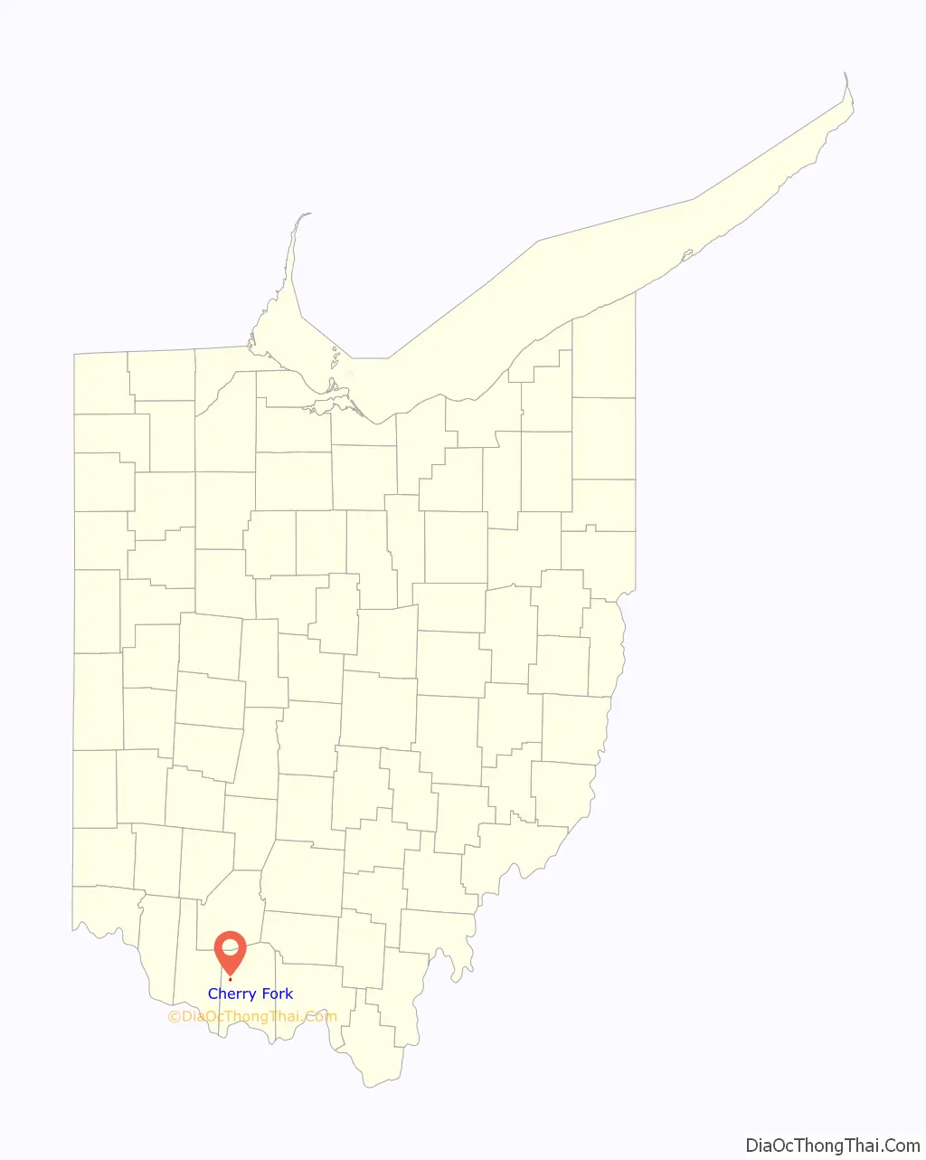
| State: | Ohio |
| County: | Adams County |
| Elevation: | 899 ft (274 m) |
| Total Area: | 0.30 sq mi (0.78 km²) |
| Land Area: | 0.30 sq mi (0.78 km²) |
| Water Area: | 0.00 sq mi (0.00 km²) |
| Total Population: | 170 |
| Population Density: | 562.91/sq mi (217.36/km²) |
| ZIP code: | 45618 |
| Area code: | 937, 326 |
| FIPS code: | 3913834 |
| GNISfeature ID: | 1060952 |
Online Interactive Map
Click on ![]() to view map in "full screen" mode.
to view map in "full screen" mode.
Cherry Fork location map. Where is Cherry Fork CDP?
History
Cherry Fork was originally called North Liberty, and under the latter name was laid out in 1848. The present name comes from Cherry Fork, a stream near the town site.
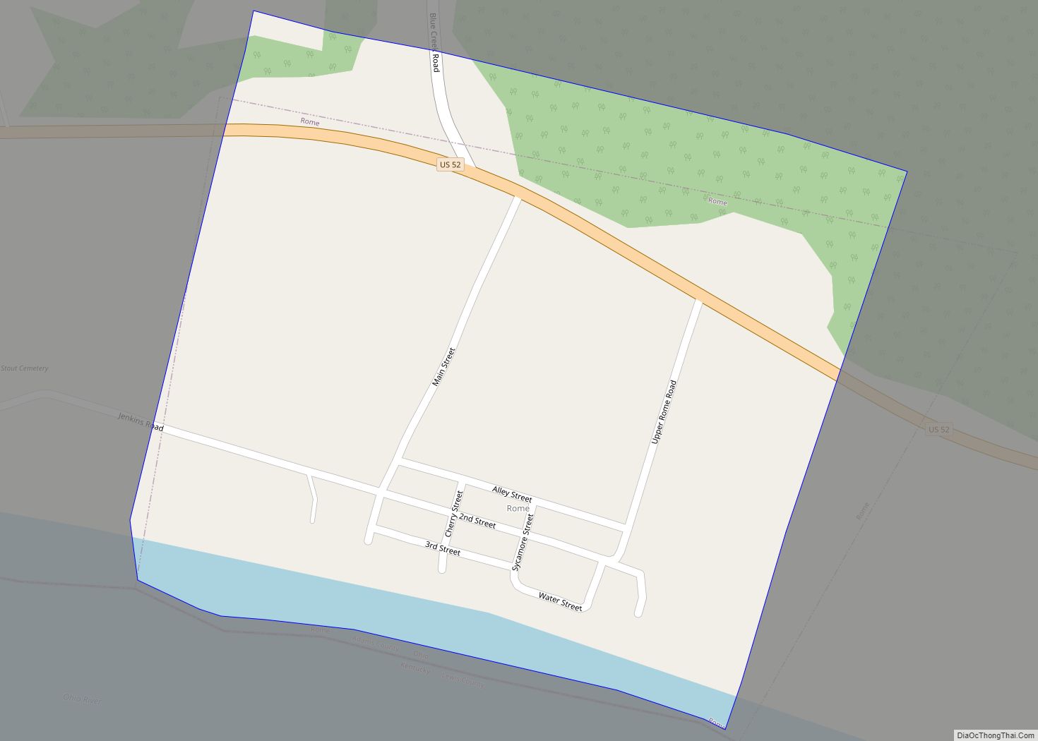
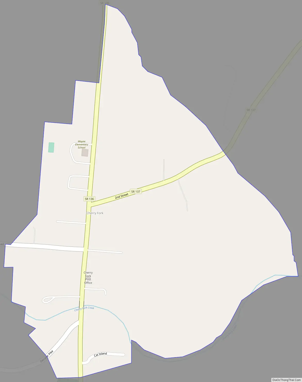
Cherry Fork Road Map
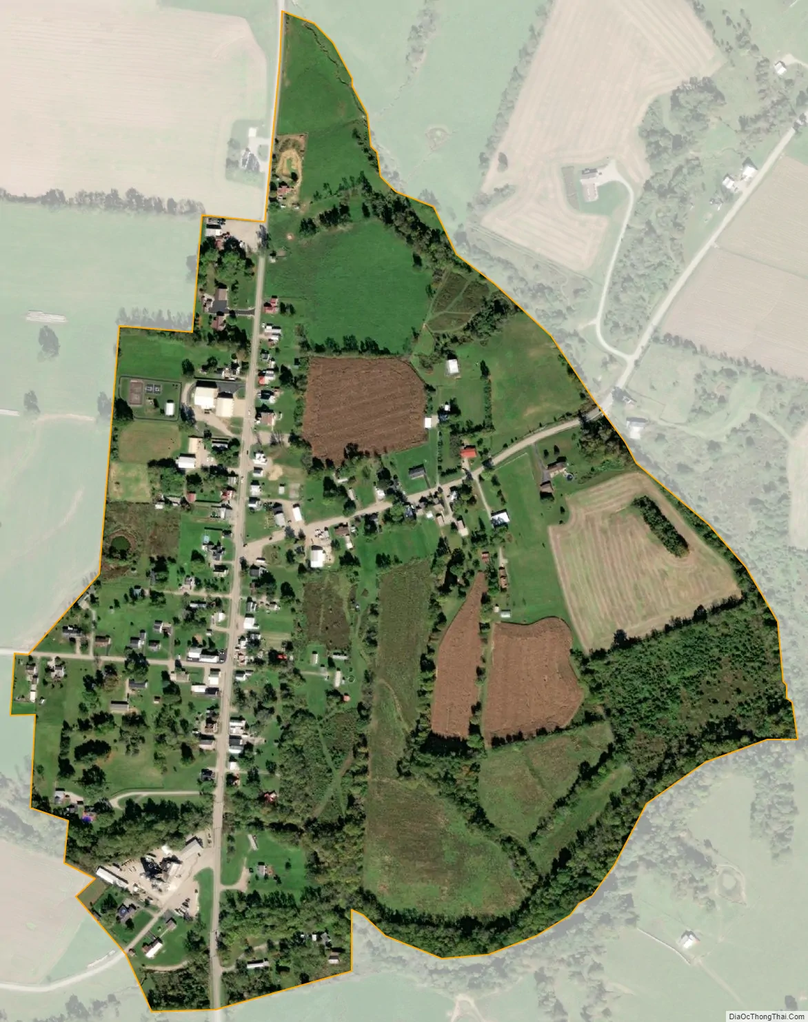
Cherry Fork city Satellite Map
Geography
Cherry Fork is at 38°53′17″N 83°36′46″W / 38.88806°N 83.61278°W / 38.88806; -83.61278 (38.888012, -83.612640).
According to the United States Census Bureau, the village has an area of 0.12 square miles (0.31 km), all land.
See also
Map of Ohio State and its subdivision:- Adams
- Allen
- Ashland
- Ashtabula
- Athens
- Auglaize
- Belmont
- Brown
- Butler
- Carroll
- Champaign
- Clark
- Clermont
- Clinton
- Columbiana
- Coshocton
- Crawford
- Cuyahoga
- Darke
- Defiance
- Delaware
- Erie
- Fairfield
- Fayette
- Franklin
- Fulton
- Gallia
- Geauga
- Greene
- Guernsey
- Hamilton
- Hancock
- Hardin
- Harrison
- Henry
- Highland
- Hocking
- Holmes
- Huron
- Jackson
- Jefferson
- Knox
- Lake
- Lake Erie
- Lawrence
- Licking
- Logan
- Lorain
- Lucas
- Madison
- Mahoning
- Marion
- Medina
- Meigs
- Mercer
- Miami
- Monroe
- Montgomery
- Morgan
- Morrow
- Muskingum
- Noble
- Ottawa
- Paulding
- Perry
- Pickaway
- Pike
- Portage
- Preble
- Putnam
- Richland
- Ross
- Sandusky
- Scioto
- Seneca
- Shelby
- Stark
- Summit
- Trumbull
- Tuscarawas
- Union
- Van Wert
- Vinton
- Warren
- Washington
- Wayne
- Williams
- Wood
- Wyandot
- Alabama
- Alaska
- Arizona
- Arkansas
- California
- Colorado
- Connecticut
- Delaware
- District of Columbia
- Florida
- Georgia
- Hawaii
- Idaho
- Illinois
- Indiana
- Iowa
- Kansas
- Kentucky
- Louisiana
- Maine
- Maryland
- Massachusetts
- Michigan
- Minnesota
- Mississippi
- Missouri
- Montana
- Nebraska
- Nevada
- New Hampshire
- New Jersey
- New Mexico
- New York
- North Carolina
- North Dakota
- Ohio
- Oklahoma
- Oregon
- Pennsylvania
- Rhode Island
- South Carolina
- South Dakota
- Tennessee
- Texas
- Utah
- Vermont
- Virginia
- Washington
- West Virginia
- Wisconsin
- Wyoming