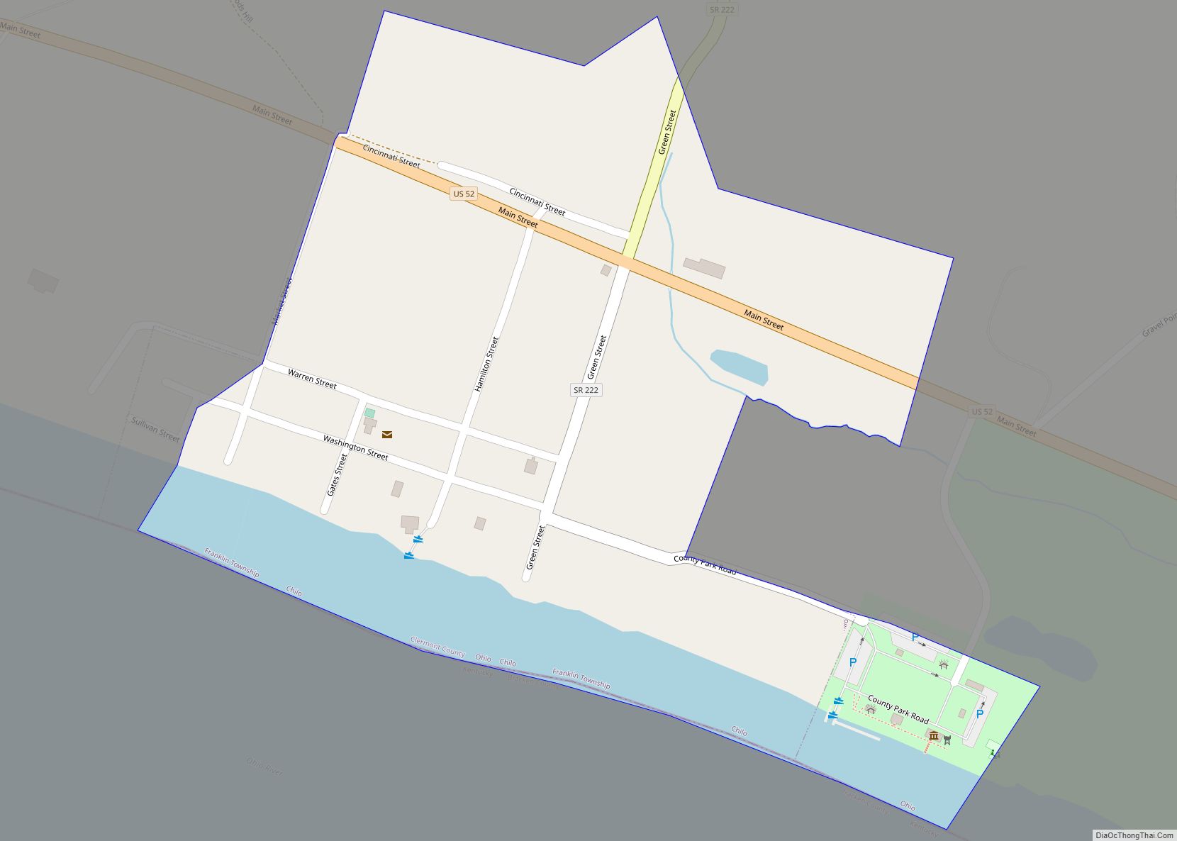
Chilo /ˈʃaɪloʊ/ or /ˈtʃaɪloʊ/ is a village in Clermont County, Ohio, United States, along the Ohio River. The population was 71 at the 2020 census.
| Name: | Chilo village |
|---|---|
| LSAD Code: | 47 |
| LSAD Description: | village (suffix) |
| State: | Ohio |
| County: | Clermont County |
| Elevation: | 499 ft (152 m) |
| Total Area: | 0.24 sq mi (0.63 km²) |
| Land Area: | 0.20 sq mi (0.52 km²) |
| Water Area: | 0.04 sq mi (0.11 km²) |
| Total Population: | 71 |
| Population Density: | 351.49/sq mi (135.43/km²) |
| ZIP code: | 45112 |
| Area code: | 513 |
| FIPS code: | 3914226 |
| GNISfeature ID: | 1056800 |
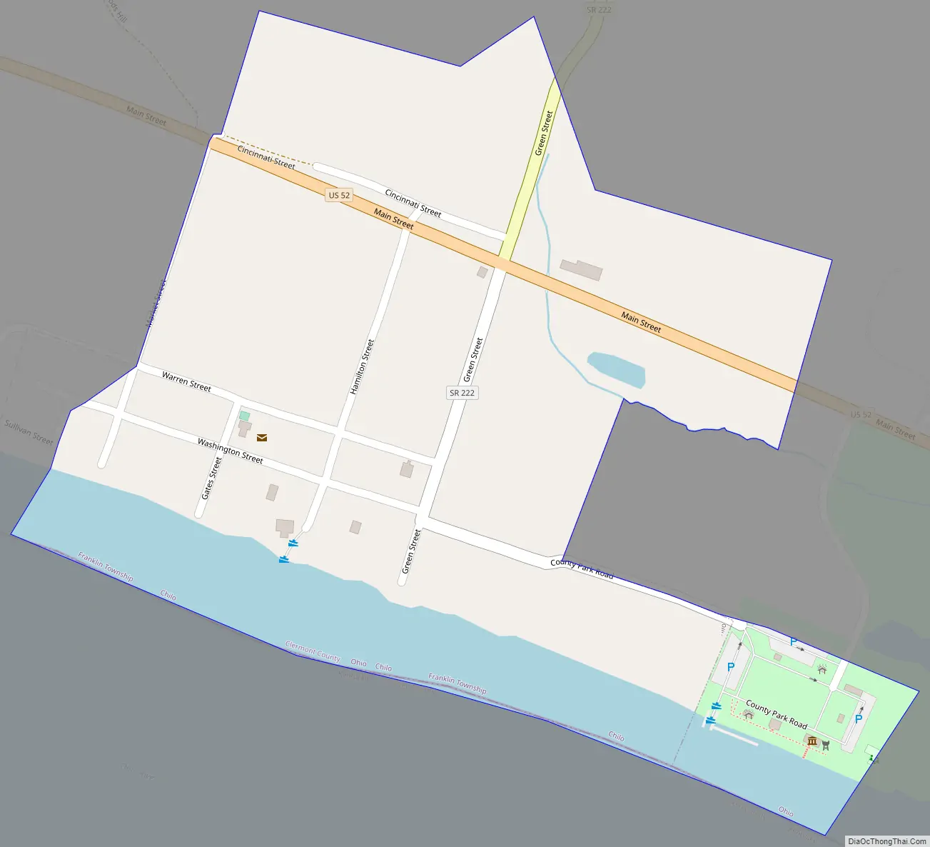
Online Interactive Map
Click on ![]() to view map in "full screen" mode.
to view map in "full screen" mode.
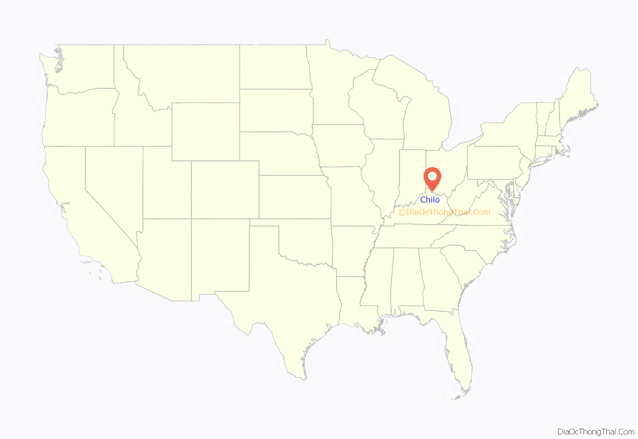
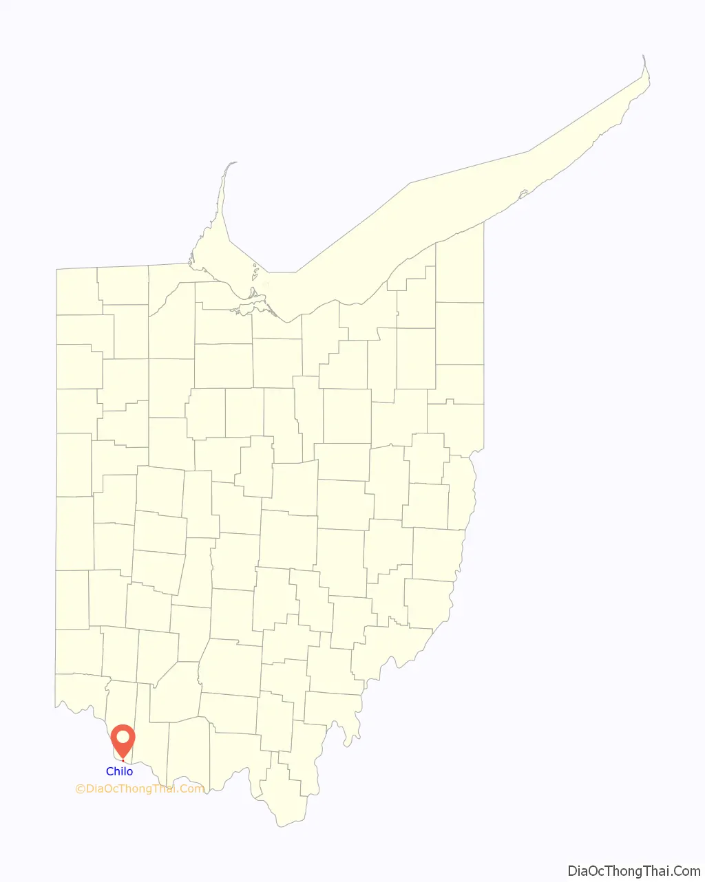
Chilo location map. Where is Chilo village?
History
Chilo was originally called Mechanicsburgh, and under the latter name was platted in 1816. A post office called Mechanicsburg was established in 1819. The village’s name was changed to Chilo in 1820 by an act of the Ohio Legislature. By the 1830s, was home of boat building businesses, which swelled the population to several hundred. Chilo had more than thirty houses and two stores. The town was the site of Lock #34 on the Ohio River up until the 1960s, when nearby Meldahl Dam was built. The original lock building is home to the Ohio River Museum, operated by the Clermont County Parks Department.
Chilo Road Map
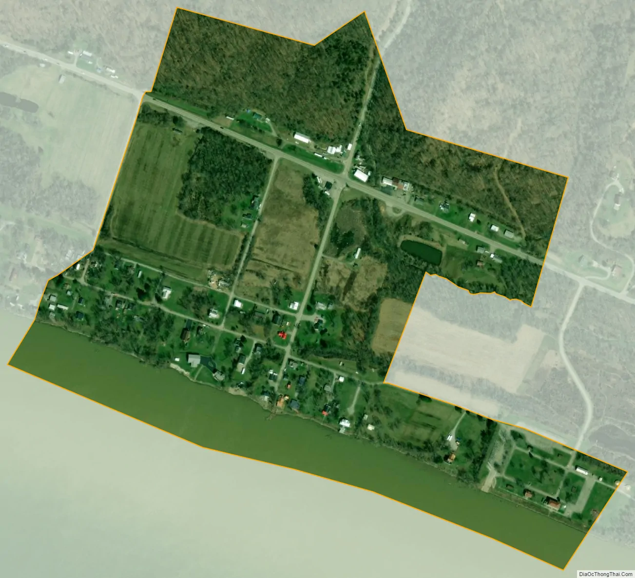
Chilo city Satellite Map
Geography
Chilo is located at 38°47′40″N 84°8′16″W / 38.79444°N 84.13778°W / 38.79444; -84.13778 (38.794447, -84.137813).
According to the United States Census Bureau, the village has a total area of 0.24 square miles (0.62 km), of which 0.20 square miles (0.52 km) is land and 0.04 square miles (0.10 km) is water.
See also
Map of Ohio State and its subdivision:- Adams
- Allen
- Ashland
- Ashtabula
- Athens
- Auglaize
- Belmont
- Brown
- Butler
- Carroll
- Champaign
- Clark
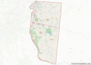
- Clermont
- Clinton
- Columbiana
- Coshocton
- Crawford
- Cuyahoga
- Darke
- Defiance
- Delaware
- Erie
- Fairfield
- Fayette
- Franklin
- Fulton
- Gallia
- Geauga
- Greene
- Guernsey
- Hamilton
- Hancock
- Hardin
- Harrison
- Henry
- Highland
- Hocking
- Holmes
- Huron
- Jackson
- Jefferson
- Knox
- Lake
- Lake Erie
- Lawrence
- Licking
- Logan
- Lorain
- Lucas
- Madison
- Mahoning
- Marion
- Medina
- Meigs
- Mercer
- Miami
- Monroe
- Montgomery
- Morgan
- Morrow
- Muskingum
- Noble
- Ottawa
- Paulding
- Perry
- Pickaway
- Pike
- Portage
- Preble
- Putnam
- Richland
- Ross
- Sandusky
- Scioto
- Seneca
- Shelby
- Stark
- Summit
- Trumbull
- Tuscarawas
- Union
- Van Wert
- Vinton
- Warren
- Washington
- Wayne
- Williams
- Wood
- Wyandot
- Alabama
- Alaska
- Arizona
- Arkansas
- California
- Colorado
- Connecticut
- Delaware
- District of Columbia
- Florida
- Georgia
- Hawaii
- Idaho
- Illinois
- Indiana
- Iowa
- Kansas
- Kentucky
- Louisiana
- Maine
- Maryland
- Massachusetts
- Michigan
- Minnesota
- Mississippi
- Missouri
- Montana
- Nebraska
- Nevada
- New Hampshire
- New Jersey
- New Mexico
- New York
- North Carolina
- North Dakota
- Ohio
- Oklahoma
- Oregon
- Pennsylvania
- Rhode Island
- South Carolina
- South Dakota
- Tennessee
- Texas
- Utah
- Vermont
- Virginia
- Washington
- West Virginia
- Wisconsin
- Wyoming